tiraram a gente pra merda mesmo (mas tá certo essa galera que eh mais tchonga caiu no brasil já era)
The entire period meme of video over satellite (the BIG DISH), the tapes, the lo-fi and the noise. Videodrome was 1983, maybe a bit early for the peak of the video-on-tape era, but it holds enough of it for the feel. #movienight
satellite mata qualquer um..vc nao esta sozinha raja
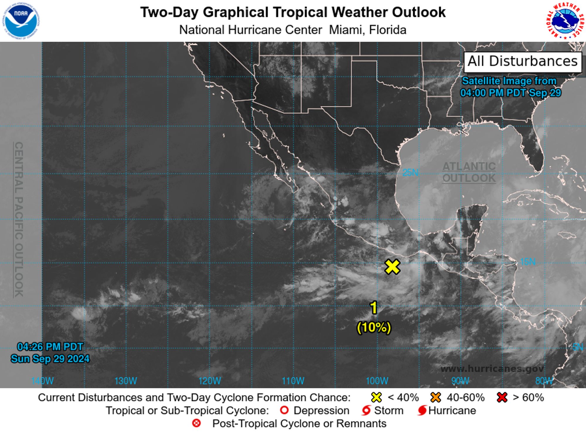
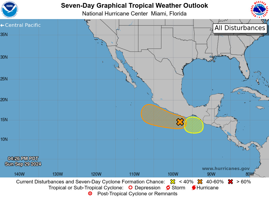
NWS National Hurricane Center Miami FL 500 PM PDT Sun Sep 29 2024 For the eastern North Pacific...east of 140 degrees west longitude:
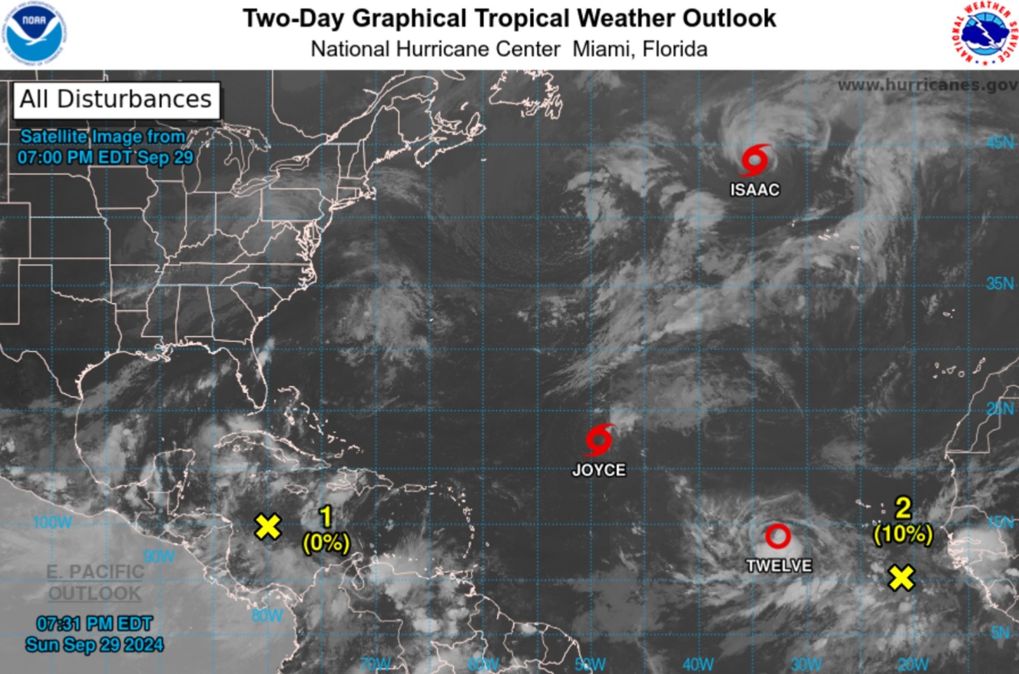
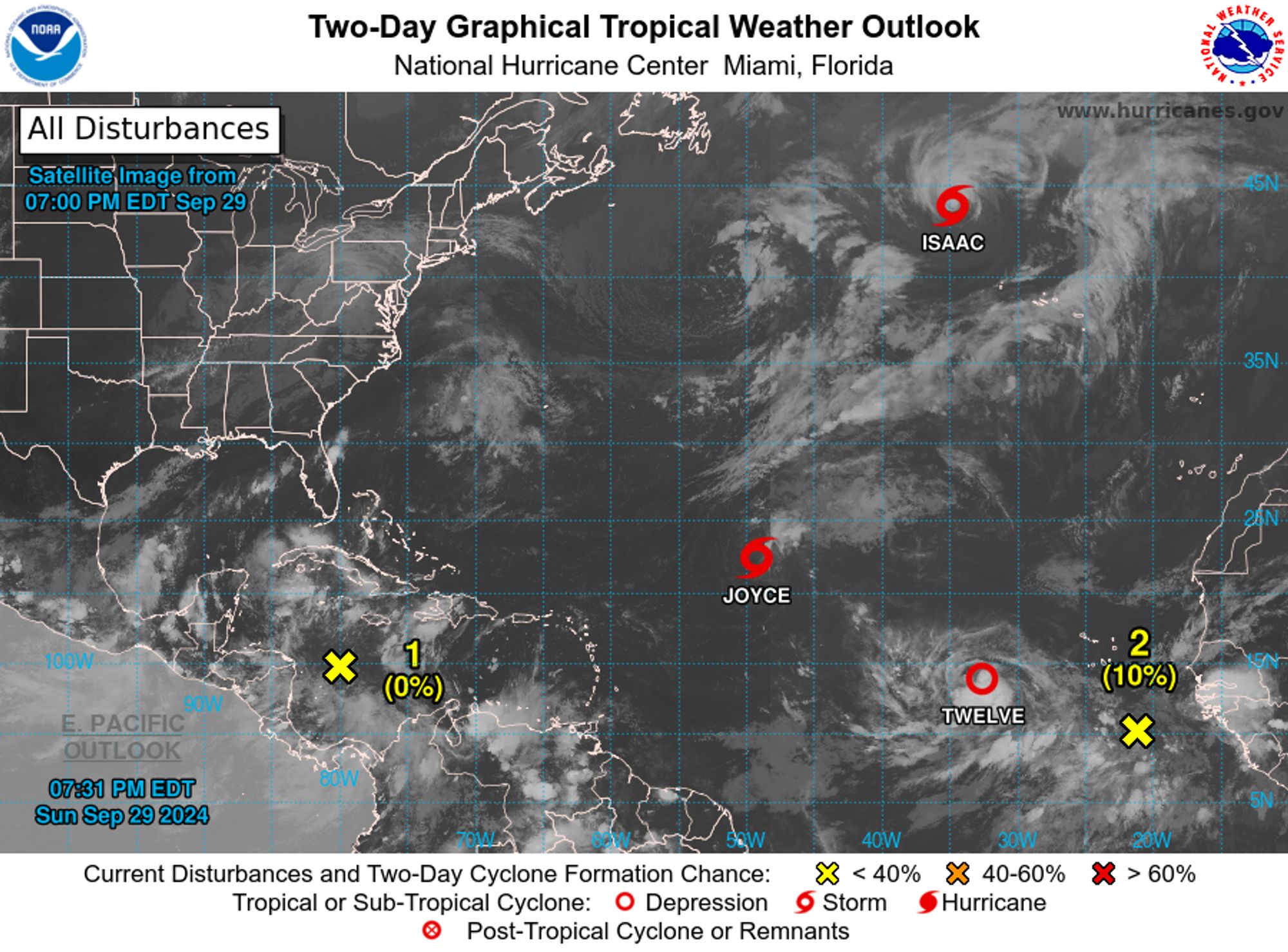
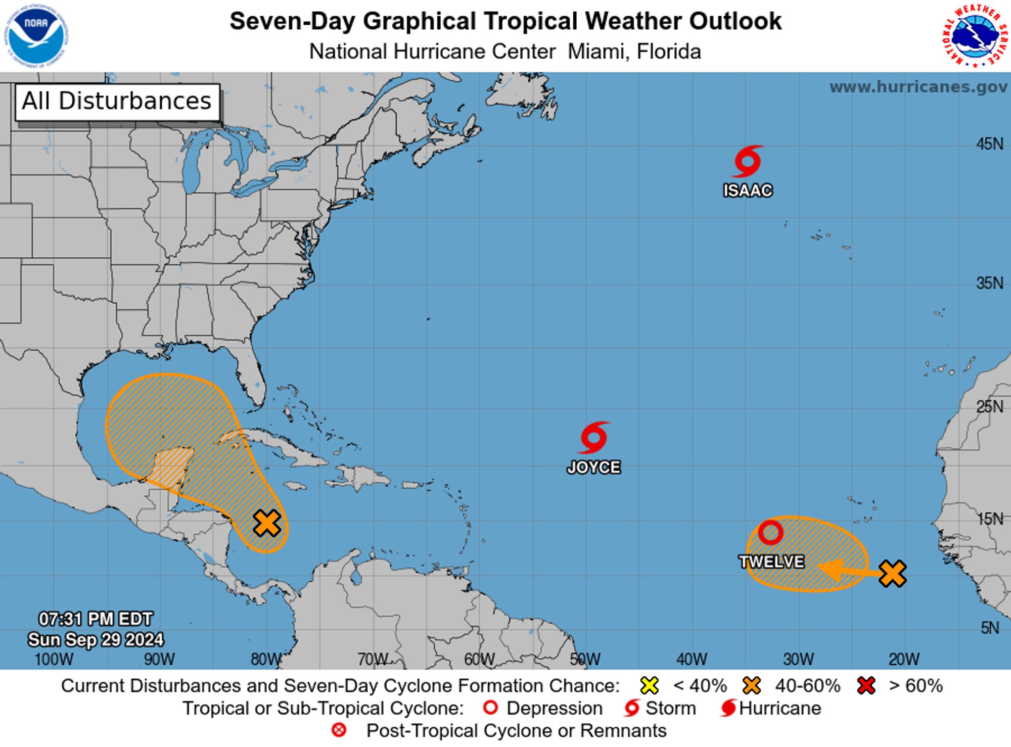
NWS National Hurricane Center Miami FL 800 PM EDT Sun Sep 29 2024 For the North Atlantic...Caribbean Sea and the Gulf of Mexico: Active Systems: The National Hurricane Center is issuing advisories on Tropical Storm Isaac, located several hundred miles northwest of the Azores, on Tropical Storm J
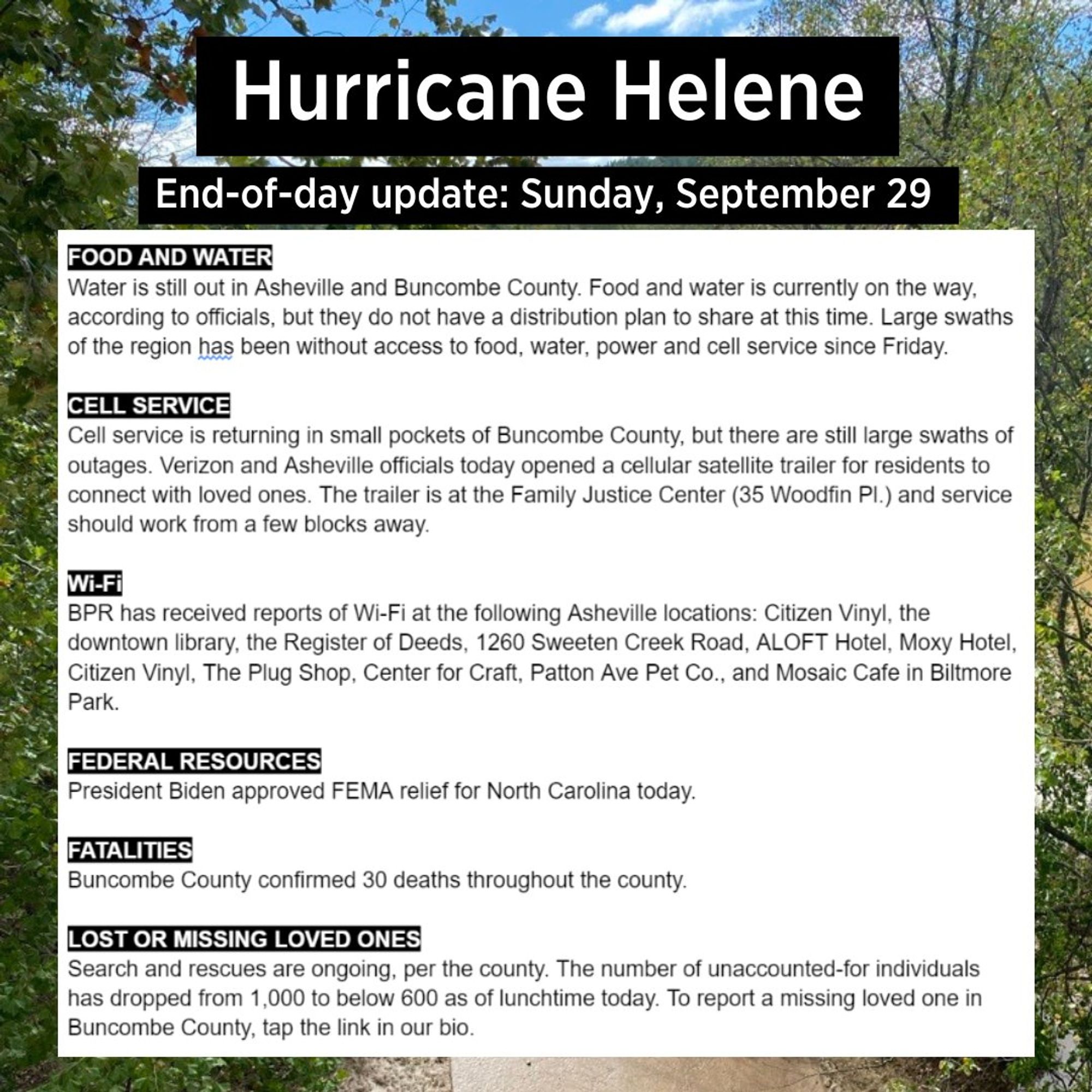
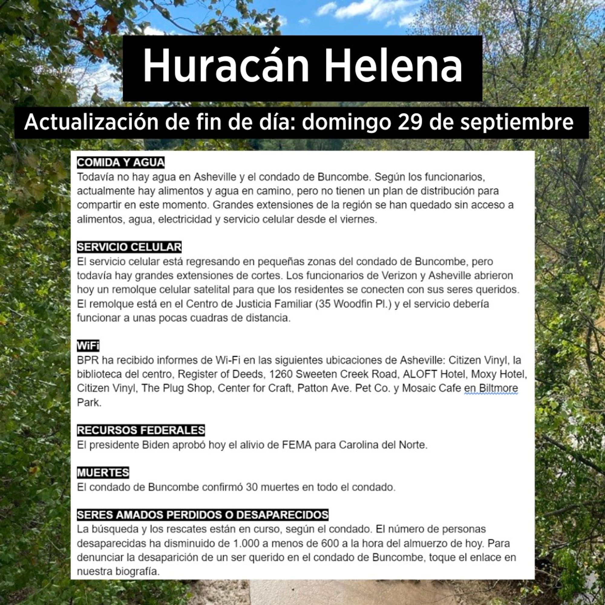
Sunday afternoon update from Blue Ridge Public Radio (serving western North Carolina), based on info from 4 p.m. Buncombe County press briefing
Low Orbit Satellite Companies Respond To Scientists’ Concerns About Light And Environmental Pollution With Even Bigger, Brighter Satellites www.techdirt.com/2024/09/27/l...

Scientists say that low earth orbit (LEO) satellite constellations being built by Amazon, Starlink, and AT&T pose a dire threat to astronomy and scientific research, and that too little is bein…