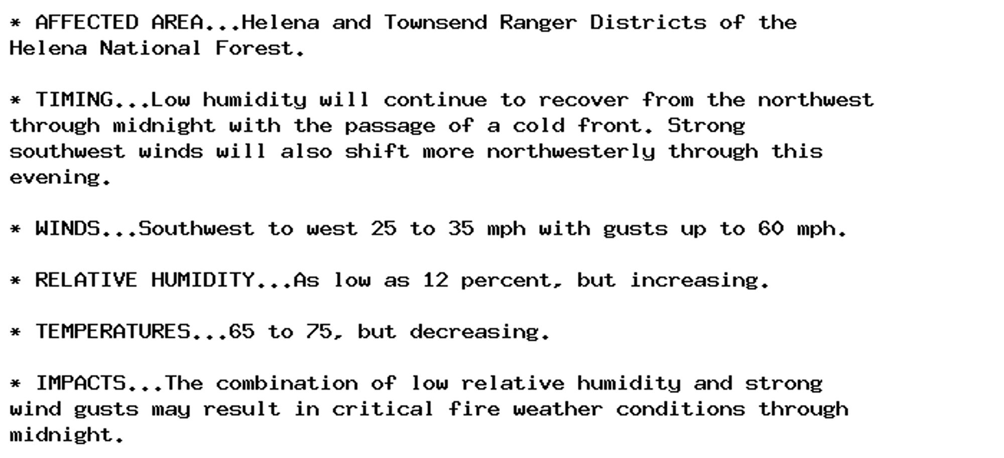
🚨 Red Flag Warning issued October 4 at 9:52PM MDT until October 5 at 3:00AM MDT by NWS Great Falls MT 🚨 Additional Details Here.
Special Weather Statement issued October 4 at 10:28PM CDT by NWS Twin Cities/Chanhassen MN Additional Details Here.

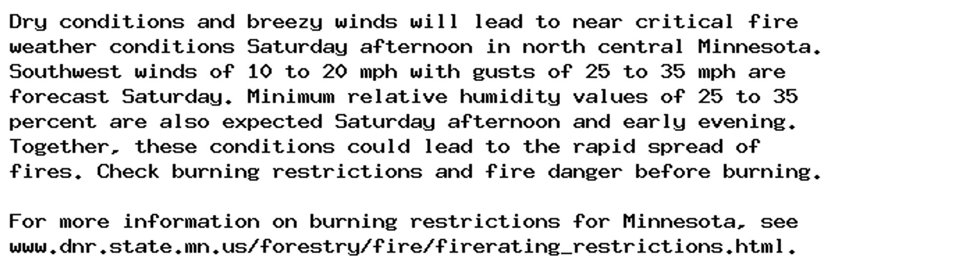
NEW WEATHER ADVISORY: Special Weather Statement Dry conditions and breezy winds will lead to near critical fire weather conditions Saturday afternoon in north central Minnesota. Southwest winds of 10 to 20 mph with gusts of 25 to 35 mph are forecast... See more: watchedsky.social/app/alerts/...
You live in the southwest! Anywhere colder has to be better. ;)
Special Weather Statement issued October 4 at 10:02PM CDT by NWS Duluth MN Additional Details Here.
Watching Oregon v. Mich St on fox broadcast TV (channel 17 southwest michigan) and the commercials are *insane*

NEW WEATHER ADVISORY: Special Weather Statement Dry conditions and breezy winds will lead to near critical fire weather conditions Saturday afternoon in north central Minnesota. Southwest winds of 10 to 20 mph with gusts of 25 to 35 mph are forecast... See more: watchedsky.social/app/alerts/...
🚨 High Wind Warning issued October 4 at 8:41PM MDT until October 5 at 6:00AM MDT by NWS Great Falls MT 🚨 Additional Details Here.
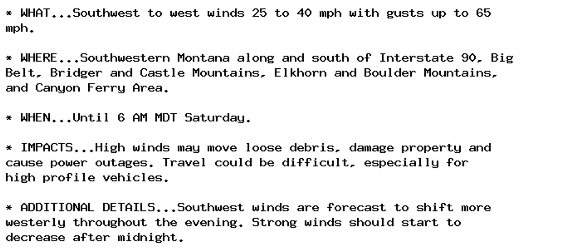
NEW WEATHER ADVISORY: High Wind Warning * WHAT...Southwest to west winds 25 to 40 mph with gusts up to 65 mph. * WHERE...Southwestern Montana along and south of Interstate 90, Big Belt, Bridger and Castle Mountains, Elkhorn and Boulder Mountains, and... See more: watchedsky.social/app/alerts/...