I know the need is endless but I can tell you that a donation here would help make sure that 8 people at least have a tent to sleep in for a while instead of the streets.
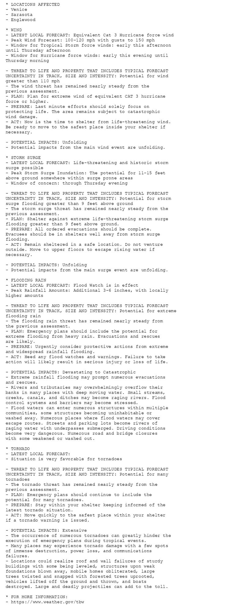
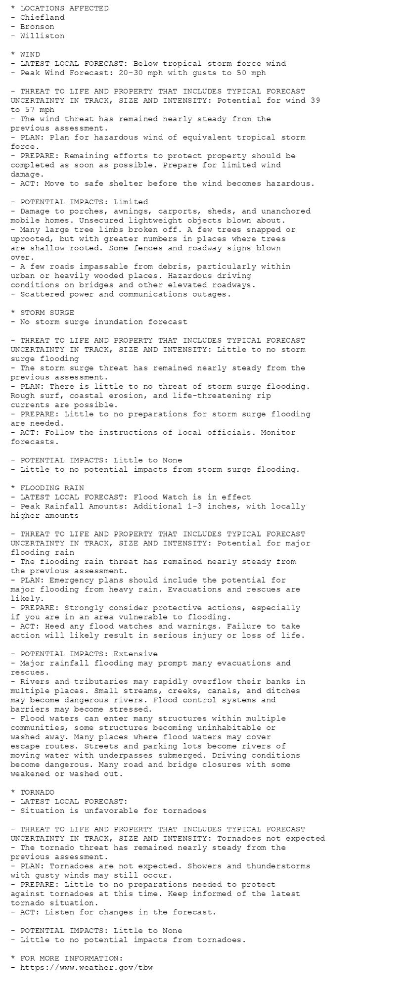
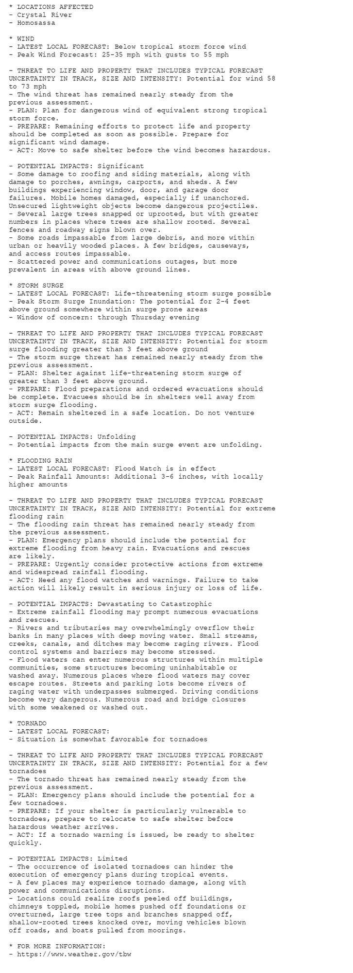
🚨🚨🚨 Hurricane Warning issued October 9 at 8:09AM EDT by NWS Tampa Bay Ruskin FL 🚨🚨🚨 Additional Details Here.(9/9)
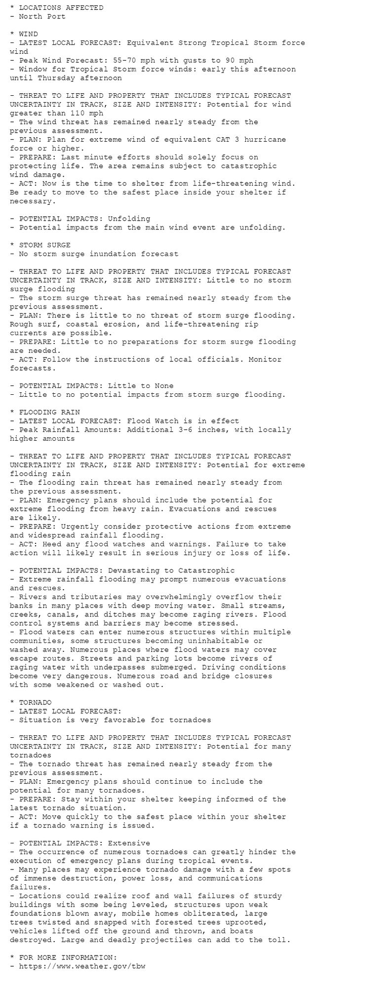
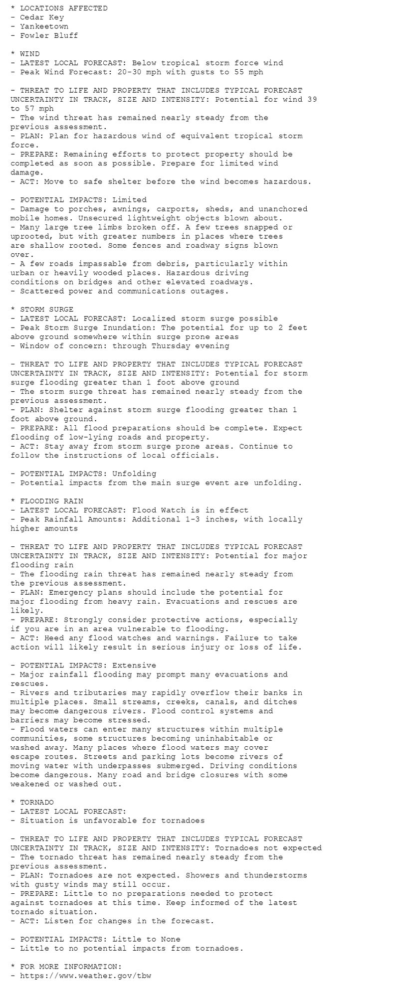
🚨🚨🚨 Hurricane Warning issued October 9 at 8:09AM EDT by NWS Tampa Bay Ruskin FL 🚨🚨🚨 Additional Details Here. (8/9)
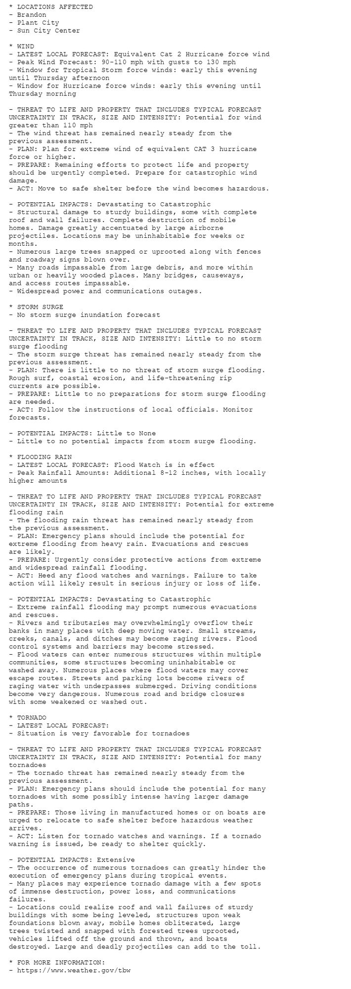
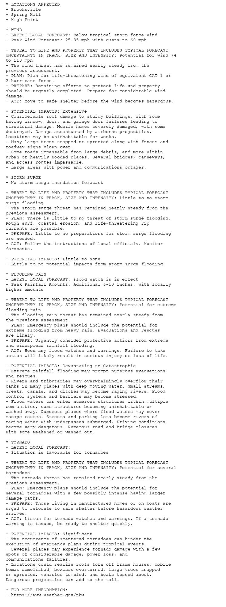
🚨🚨🚨 Hurricane Warning issued October 9 at 8:09AM EDT by NWS Tampa Bay Ruskin FL 🚨🚨🚨 Additional Details Here. (7/9)
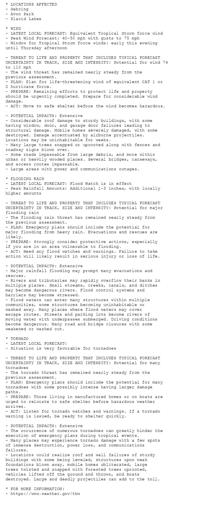
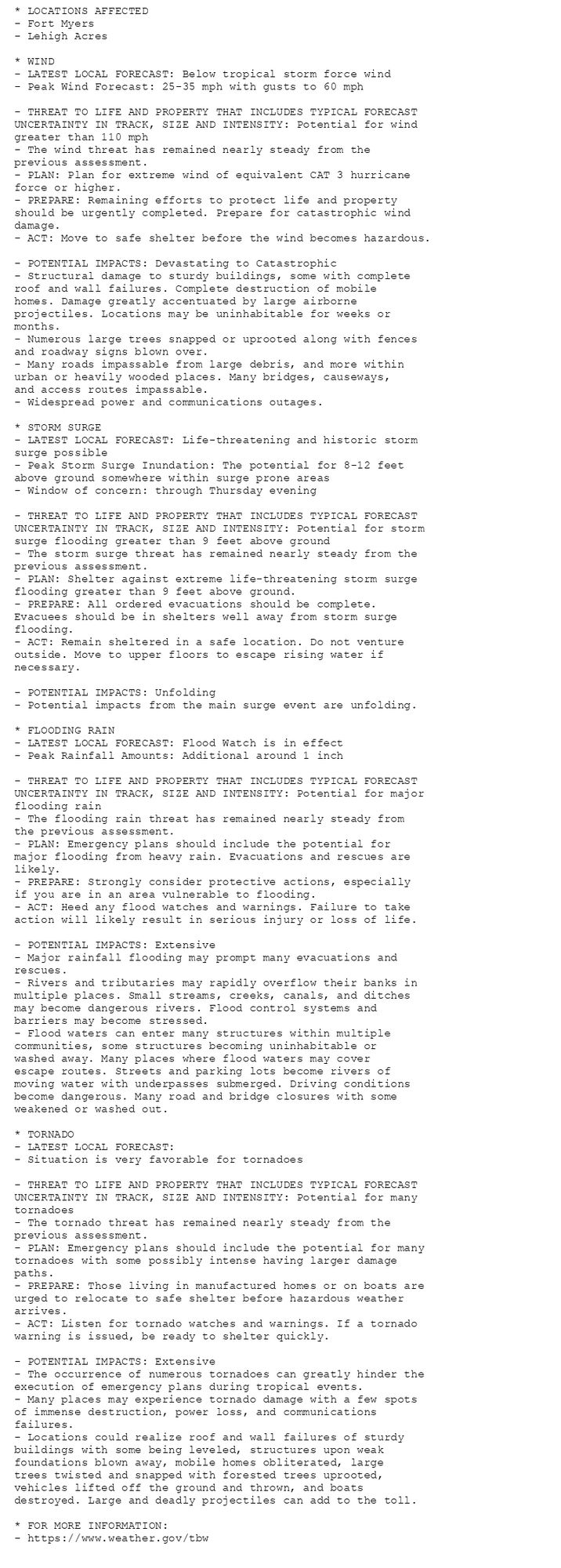
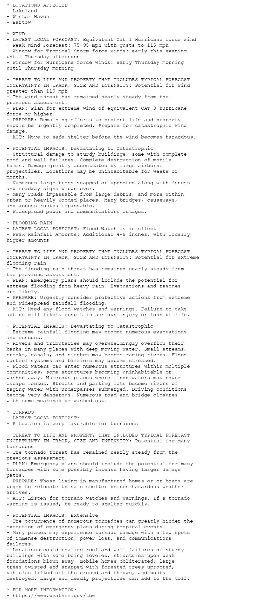
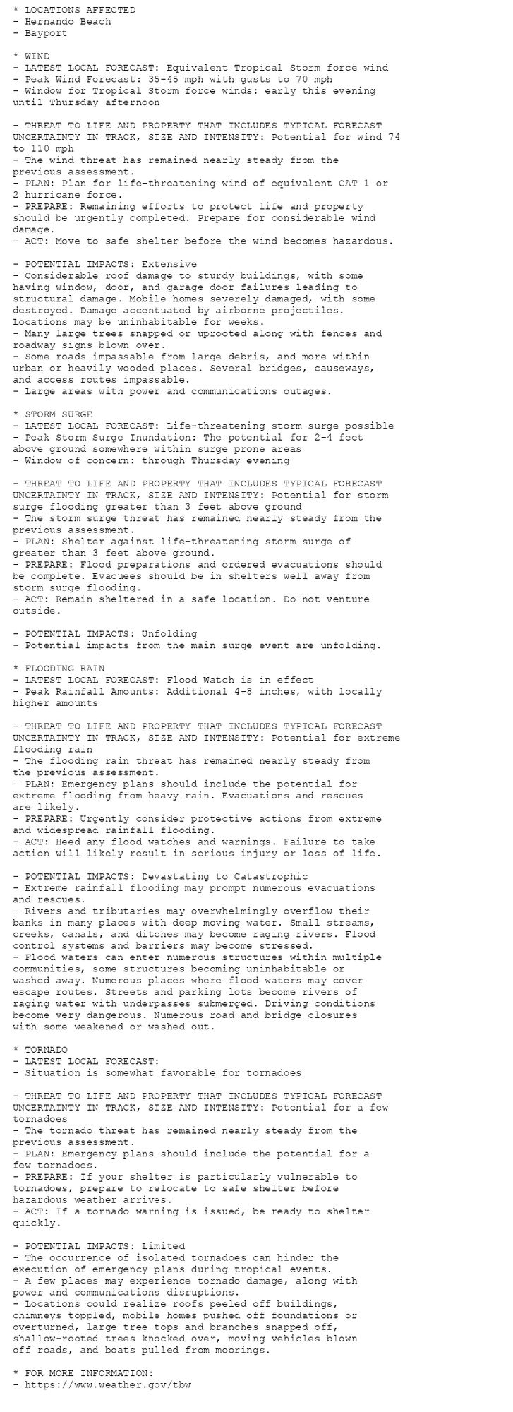
🚨🚨🚨 Hurricane Warning issued October 9 at 8:09AM EDT by NWS Tampa Bay Ruskin FL 🚨🚨🚨 Additional Details Here. (6/9)
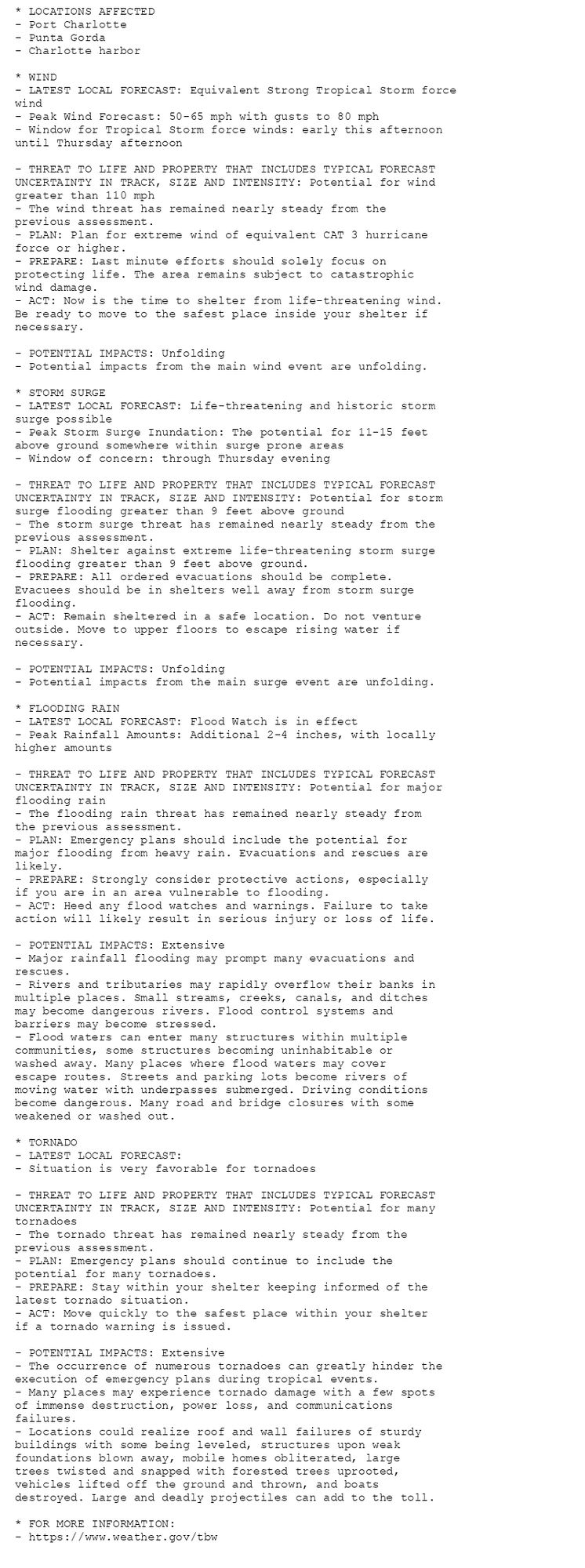
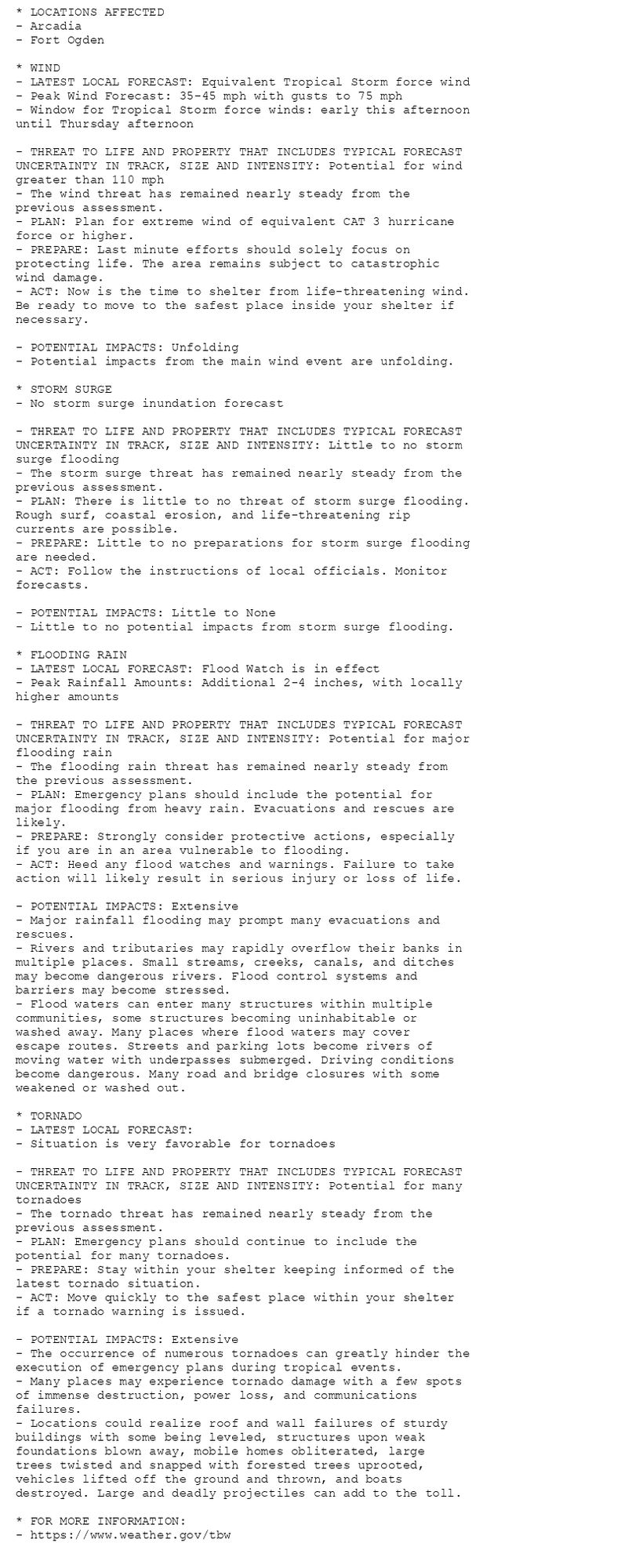
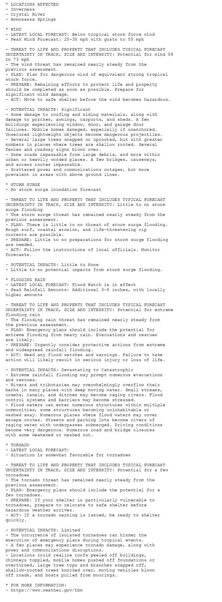
🚨🚨🚨 Hurricane Warning issued October 9 at 8:09AM EDT by NWS Tampa Bay Ruskin FL 🚨🚨🚨 Additional Details Here. (5/9)
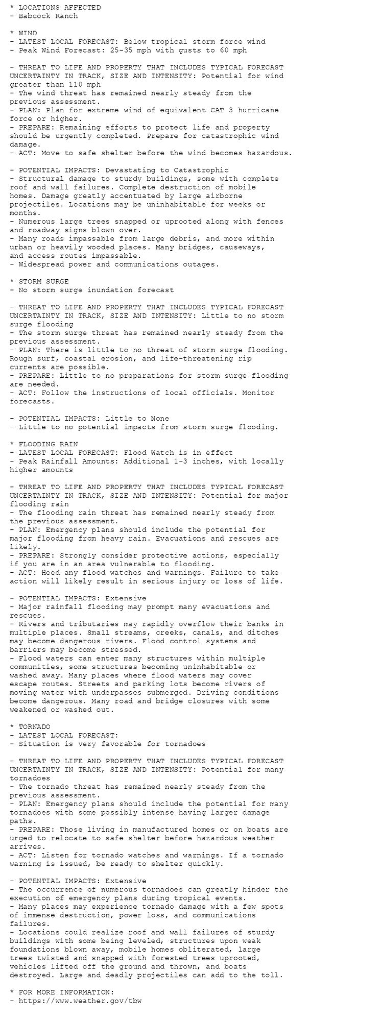
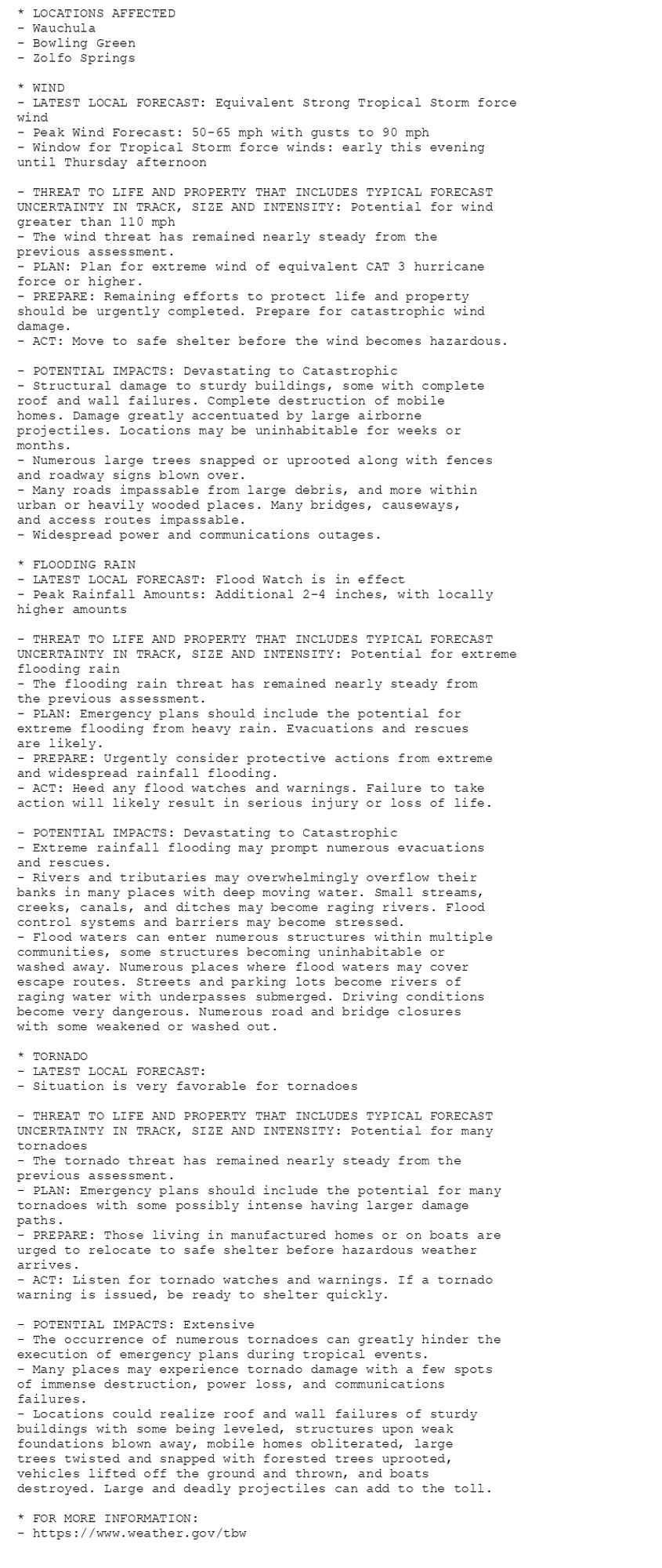
🚨🚨🚨 Hurricane Warning issued October 9 at 8:09AM EDT by NWS Tampa Bay Ruskin FL 🚨🚨🚨 Additional Details Here. (3/9)
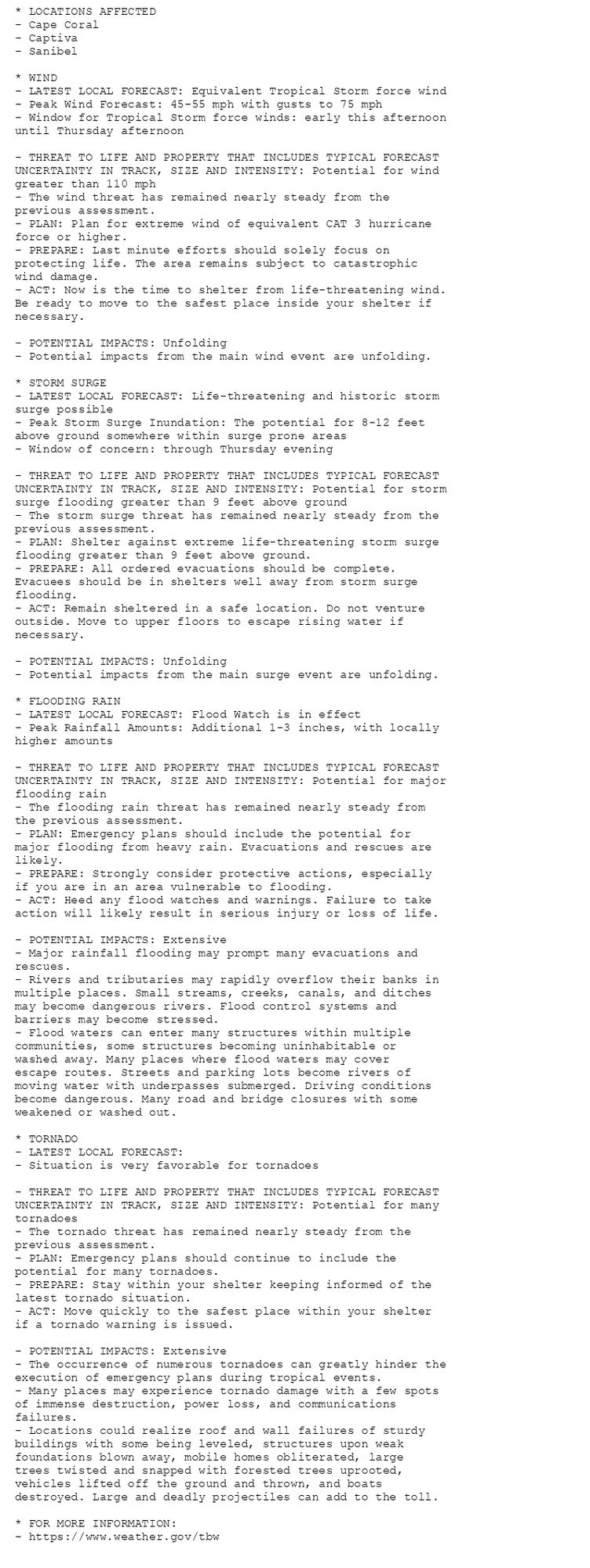
🚨🚨🚨 Hurricane Warning issued October 9 at 8:09AM EDT by NWS Tampa Bay Ruskin FL 🚨🚨🚨 Additional Details Here. (2/9)
🚨🚨🚨 Hurricane Warning issued October 9 at 8:09AM EDT by NWS Tampa Bay Ruskin FL 🚨🚨🚨 Additional Details Here. (1/9)
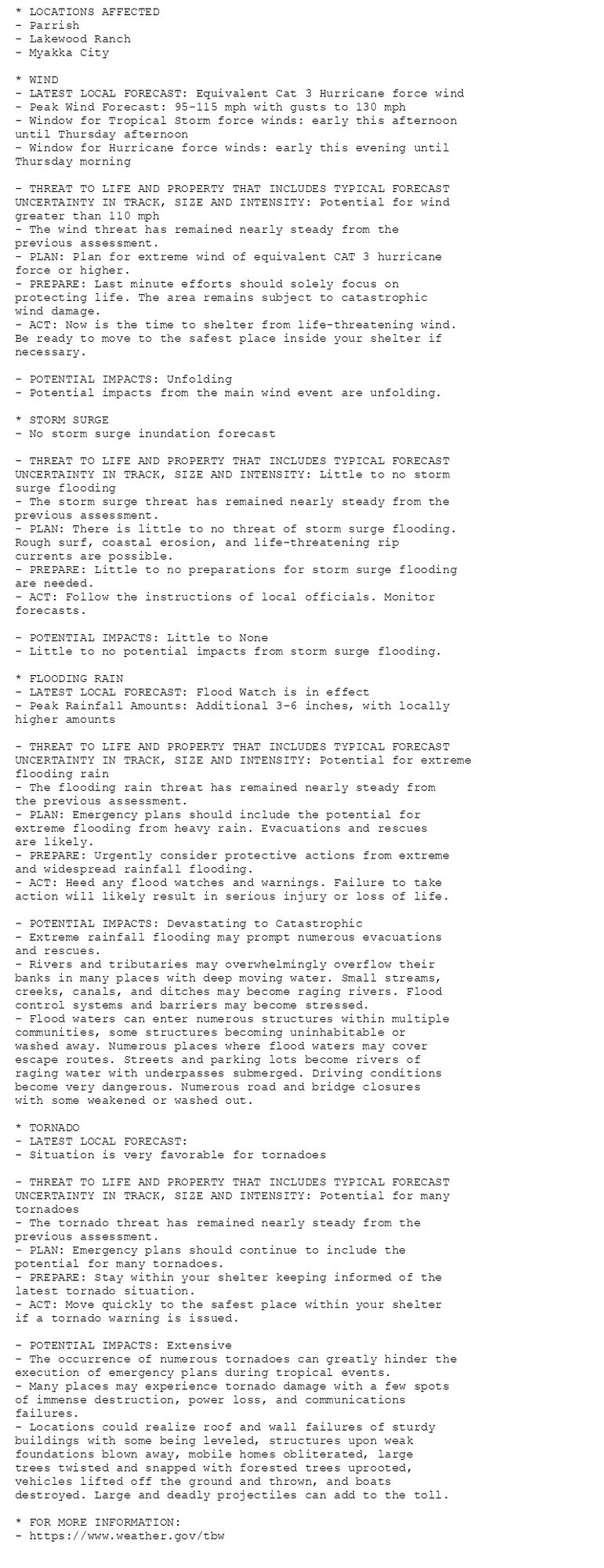
Bradenton, south of the Tampa Bay inlet, is extremely heavily populated. There are hundreds of tightly packed residential streets, many on waterways or interspersed with retention ponds. The level of destruction in that area, if the track stays as predicted, will be shocking.