« … thousands attended the protest and march in NYC to flood the streets in solidarity with Gaza… » 🔗 · www.youtube.com/watch?v=GoJd...#Palestine#ceasefire#FreePalestine 🕊️ 🇵🇸 🍉 🙏🏻 ✌️ ☮️
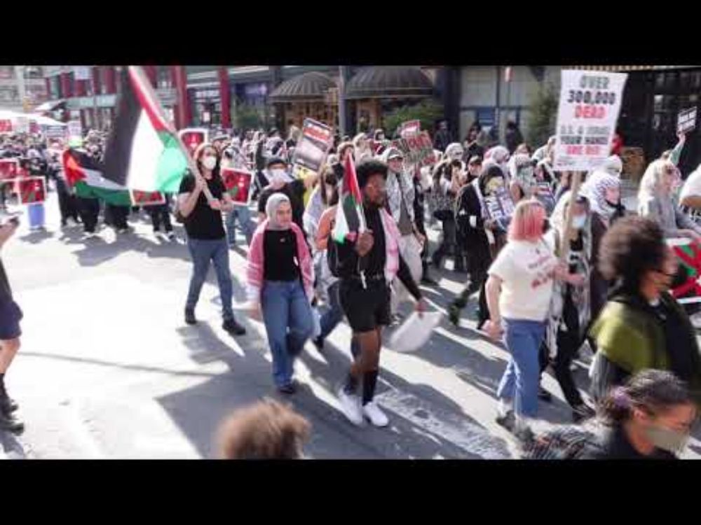
YouTube video by Neturei Karta
“Ryan Gosling deserves an Oscar nomination for his performance in this film. I swear on all that is holy, if he isn't nominated, I will run through the streets calling down fire on the Academy." NAILED IT.
For me, one of the great findings of ICOS Cities project has been, that cities want to invest in climate actions as response to the demonstrations they have seen on their streets. But how? We host "Science meets City" meeting in Barcelona 19 Nov - register by 18 Oct. www.icos-cp.eu/programme-sp...

I don't think it's *too* bad. Some effort at, e.g., London stock brick. What's even weirder is when they use the New York street set, which looks less like London again, but put red phone boxes, black cabs and Routemasters on the streets. Presumably because the other one is booked.

There will be some who leave of course & the press will bang on about them. A bit rich given most of the press is owned by tax exiles But others will take their place provided UK is a nice place to live as a wealthy person That requires a lively cultural scene, clean and orderly streets, low crime
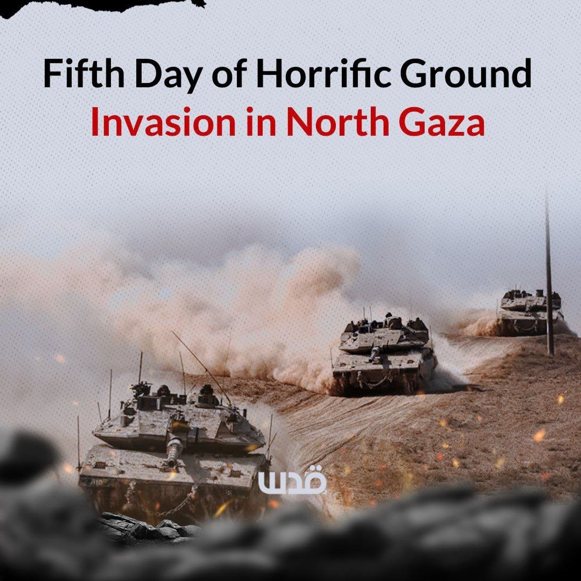
Israeli occupation forces are besieging the Jabalia refugee camp from multiple directions, advancing in various areas of northern Gaza for the third time during this ongoing genocide. This unprecedented military assault is marked by indiscriminate shelling and gunfire targeting anyone on the streets
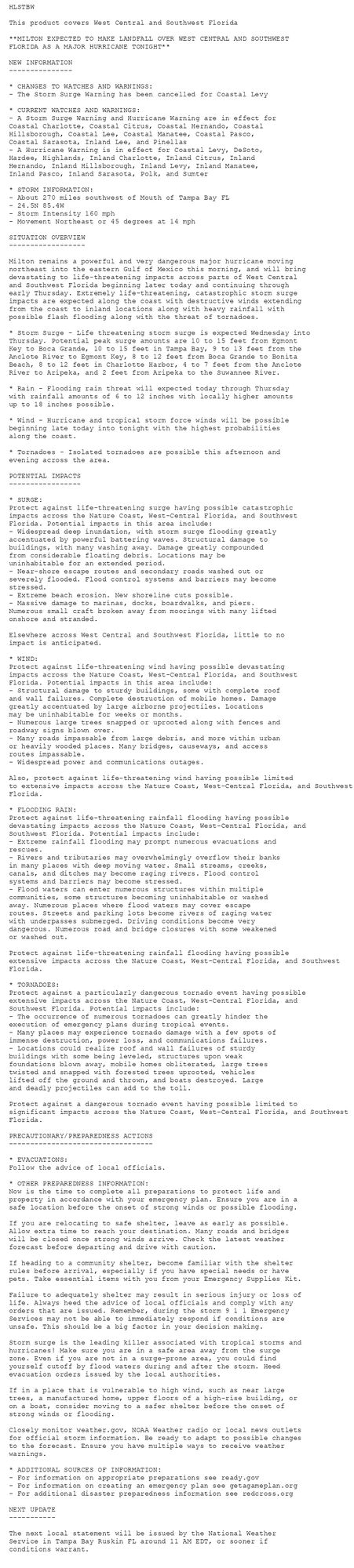
Tropical Cyclone Statement issued October 9 at 5:15AM EDT by NWS Tampa Bay Ruskin FL Additional Details Here.
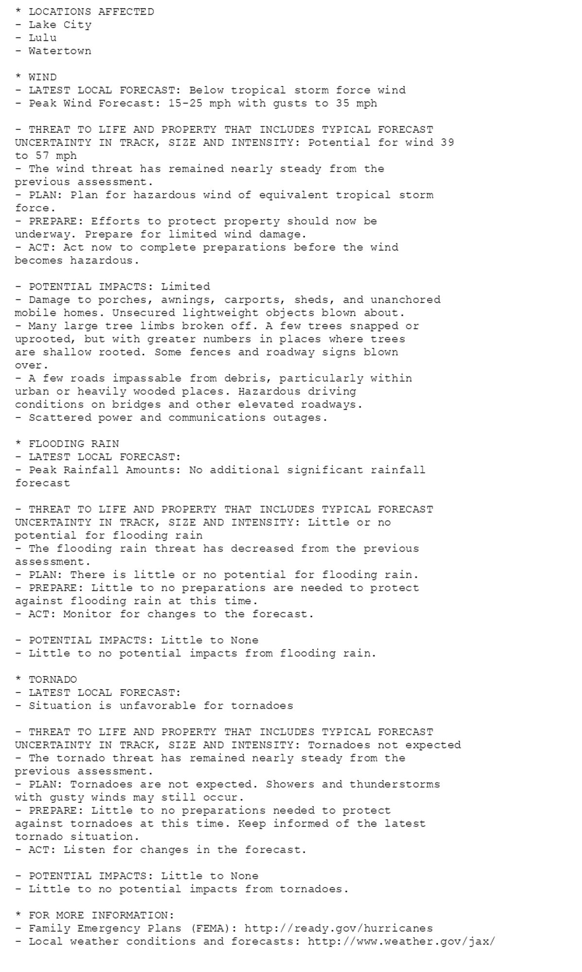
🚨🚨🚨 Hurricane Watch issued October 9 at 5:17AM EDT by NWS Jacksonville FL 🚨🚨🚨 Additional Details Here. (12/14)
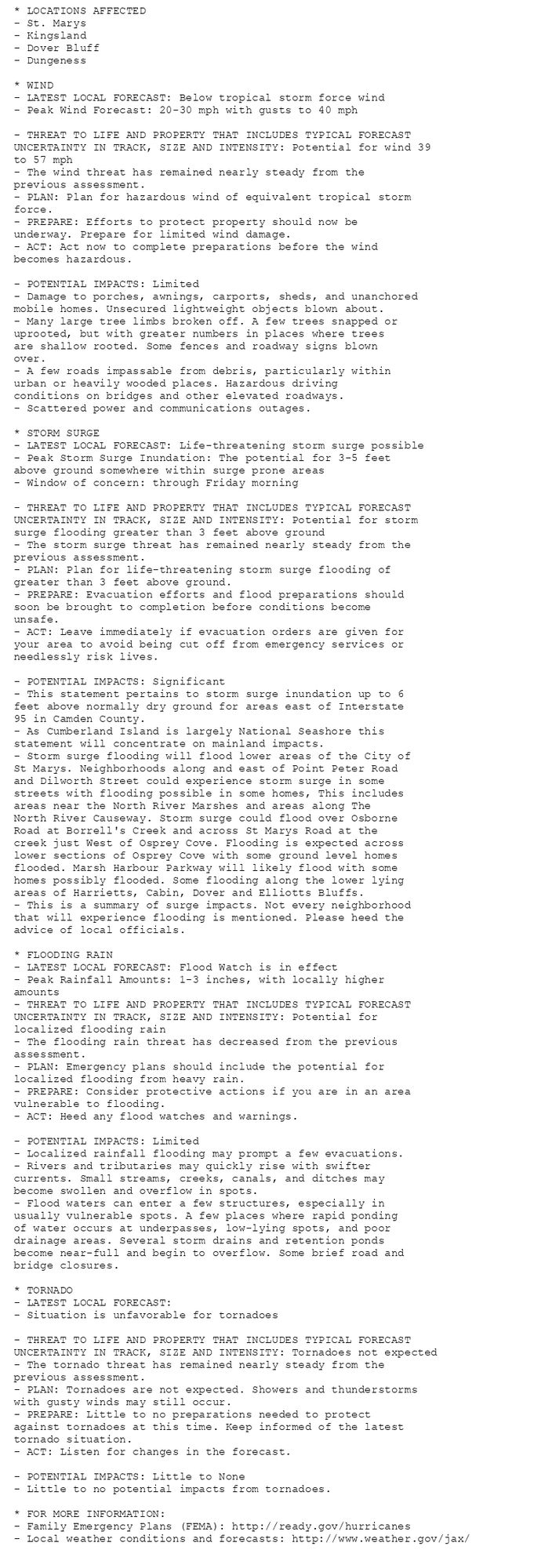
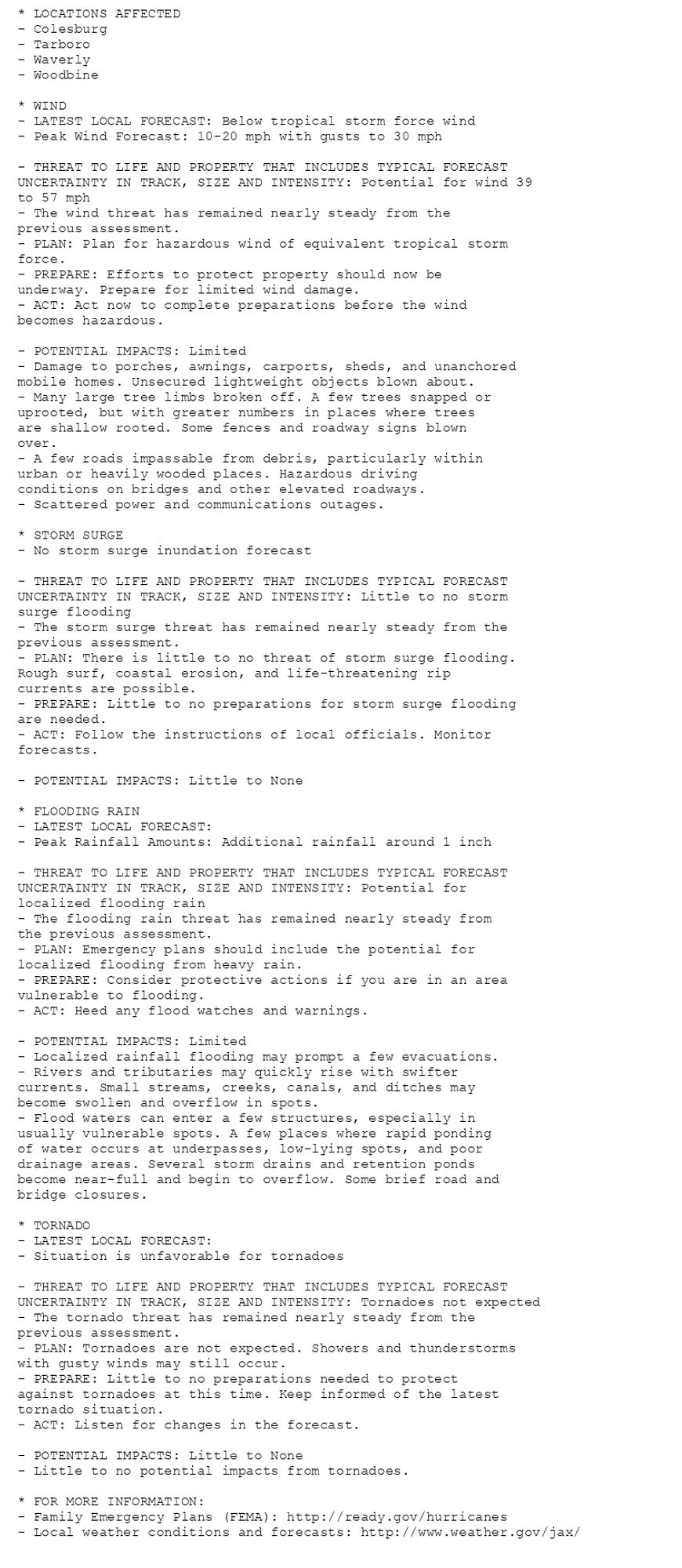
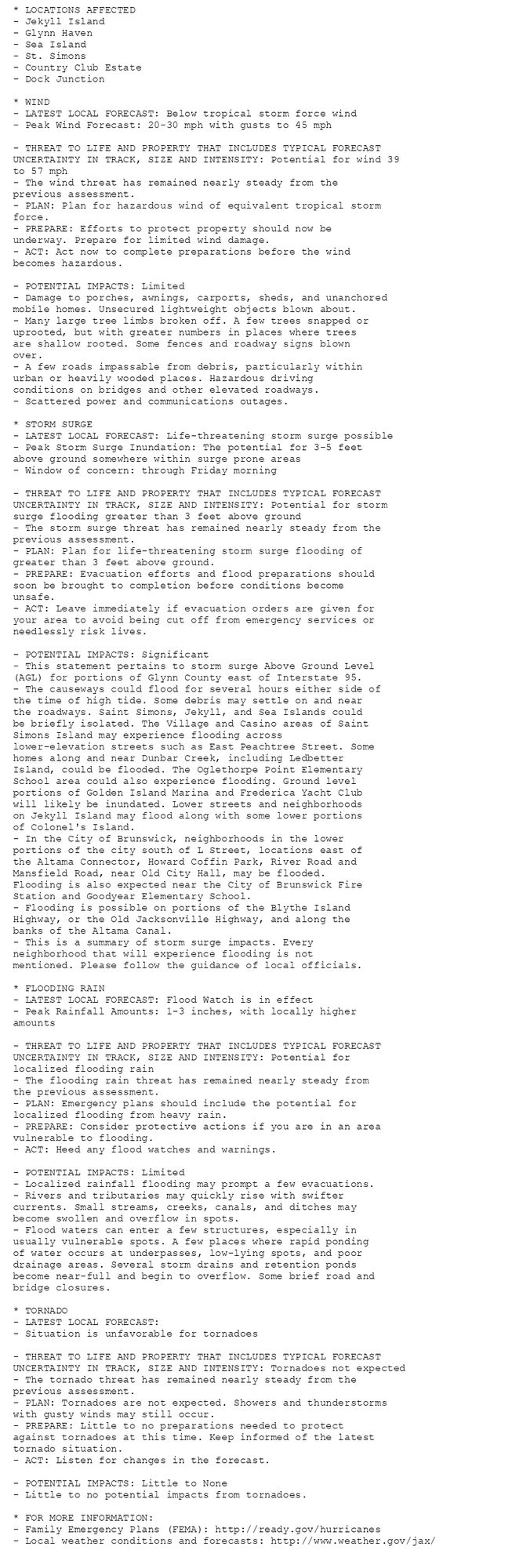
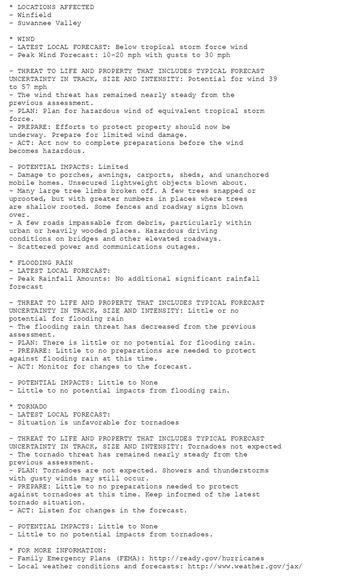
🚨🚨🚨 Hurricane Watch issued October 9 at 5:17AM EDT by NWS Jacksonville FL 🚨🚨🚨 Additional Details Here. (11/14)