New #WMOfreshwaterblog.net/2024/10/08/g...

Image: WMO 2023 was the driest year for global rivers in 33 years, according to a major new report released this week. The World Meteorological Organisation’s (WMO) State of Global Water Resources …
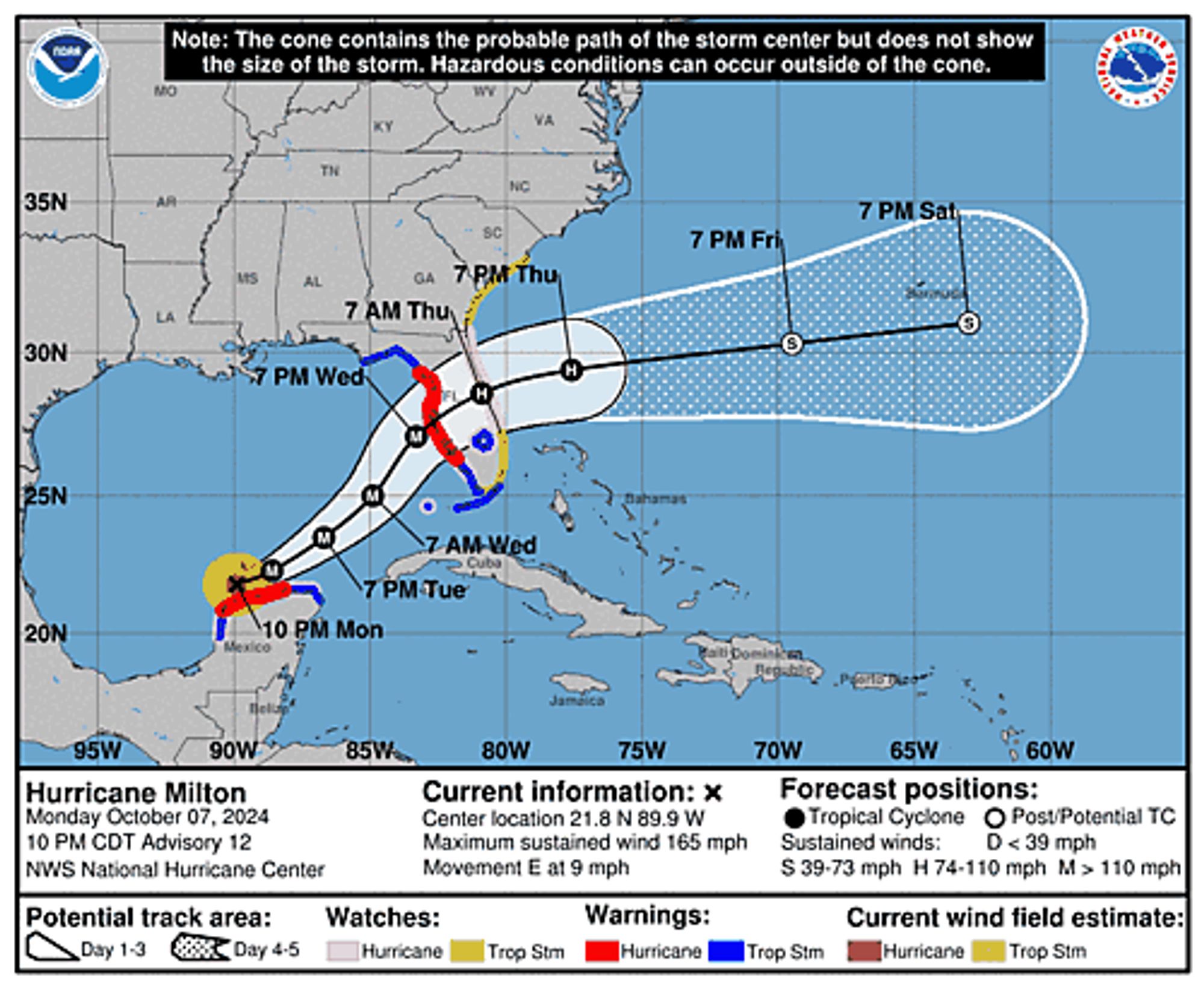
Atlantic Hurricane Milton Intermediate Advisory Number 13A ...HURRICANE AND STORM SURGE WARNINGS ISSUED FOR PORTIONS OF THE EAST COAST OF FLORIDA... ...RESIDENTS IN FLORIDA ARE URGED TO USE TODAY TO PREPARE FOR MILTON'S ARRIVAL AND EVACUATE IF TOLD TO DO SO BY ... Additional Details Here.
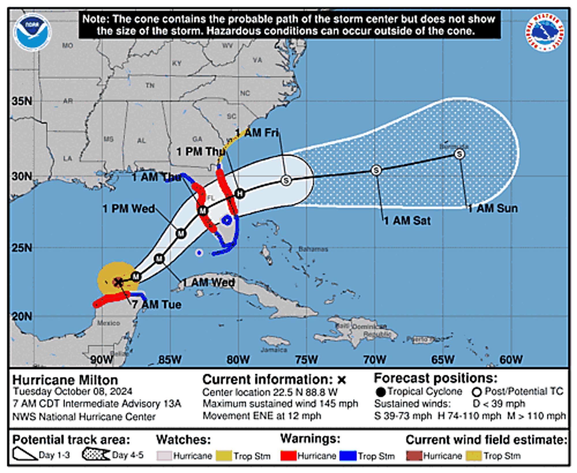
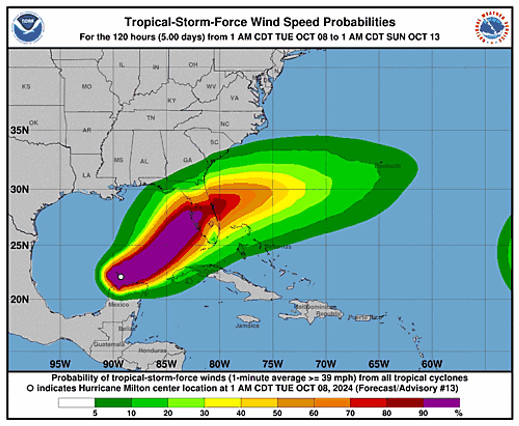
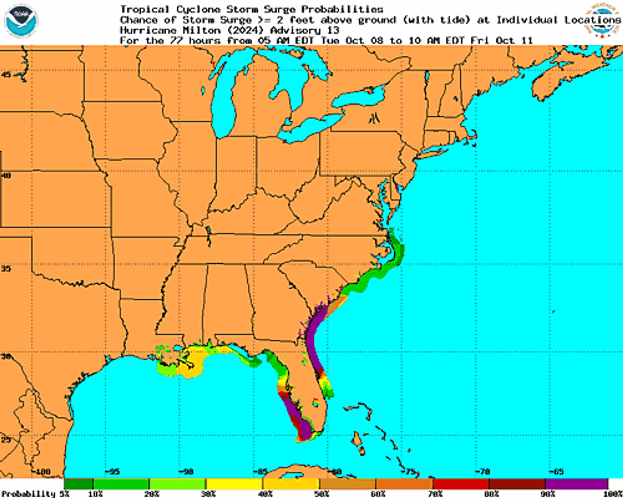
Atlantic Hurricane Milton Intermediate Advisory Number 13A ...HURRICANE AND STORM SURGE WARNINGS ISSUED FOR PORTIONS OF THE EAST COAST OF FLORIDA... ...RESIDENTS IN FLORIDA ARE URGED TO USE TODAY TO PREPARE FOR MILTON'S ARRIVAL AND EVACUATE IF TOLD TO DO SO BY ... Additional Details Here.
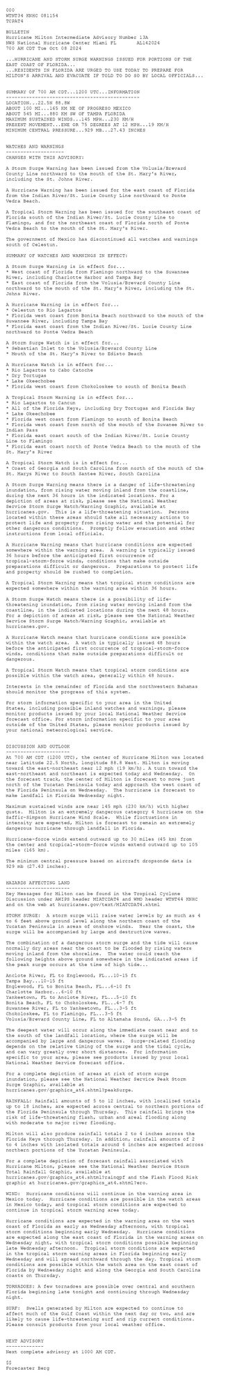
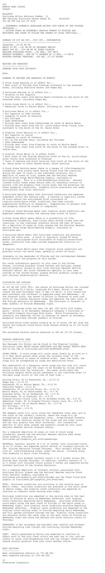
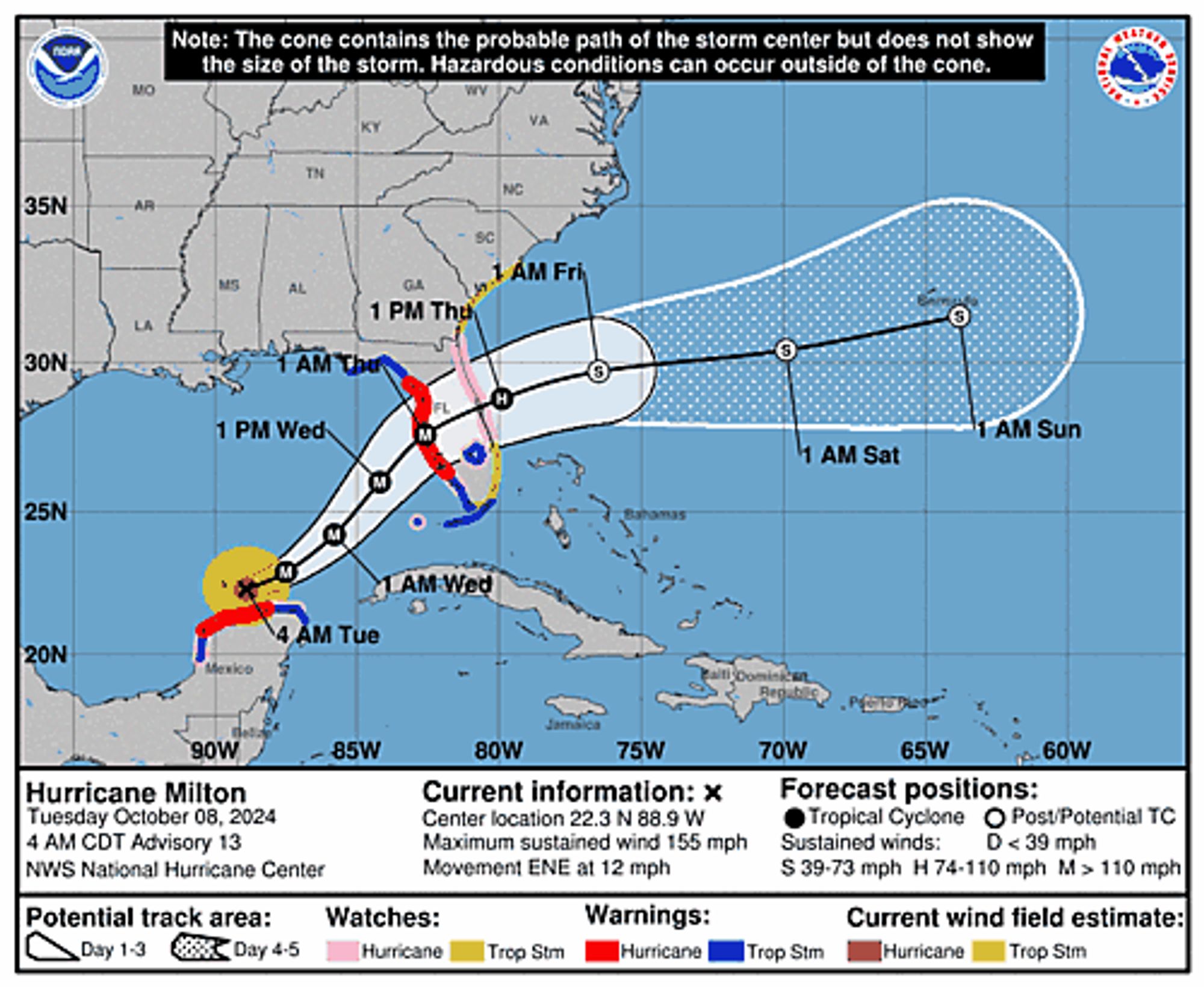
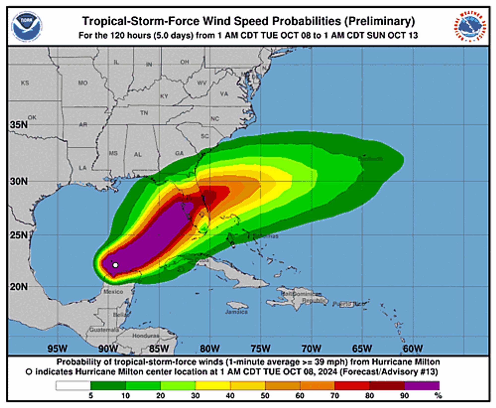
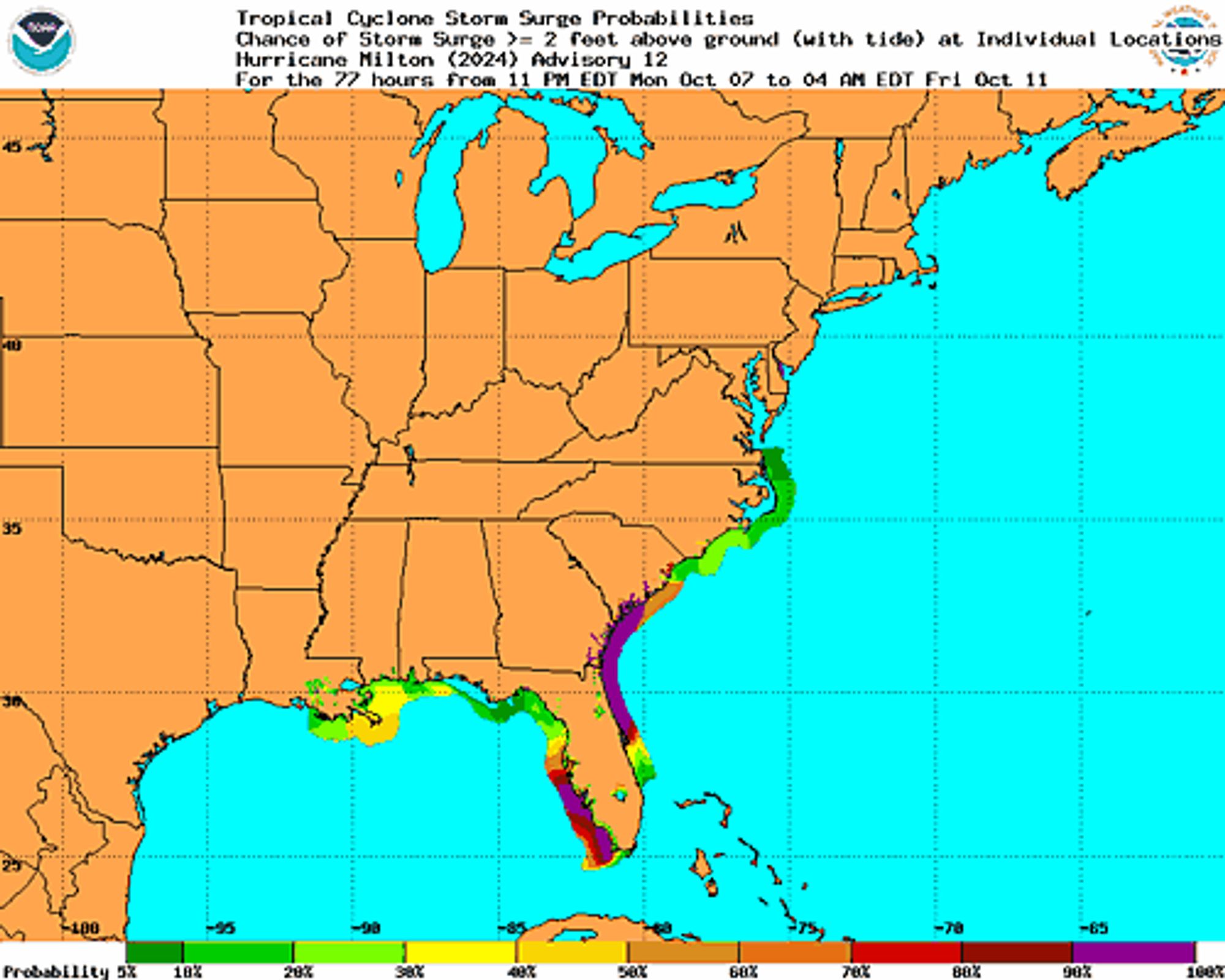
Atlantic Hurricane Milton Advisory Number 13 issued at Tue, 08 Oct 2024 08:32:24 +0000 ...EXTREMELY POWERFUL HURRICANE MILTON JUST NORTH OF THE YUCATAN PENINSULA... ...MILTON POSES AN EXTREMELY SERIOUS THREAT TO FLORIDA AND RESIDENTS ARE URGED TO FOLLOW THE ORDER... Additional Details Here.
Global Water Woes the 'Canary in the Coal Mine' for Climate Calamity: WMO www.commondreams.org/news/wmo-wat...

"As a result of rising temperatures, the hydrological cycle has accelerated. It has also become more erratic and unpredictable, and we are facing growing problems of either too much or too little wate...
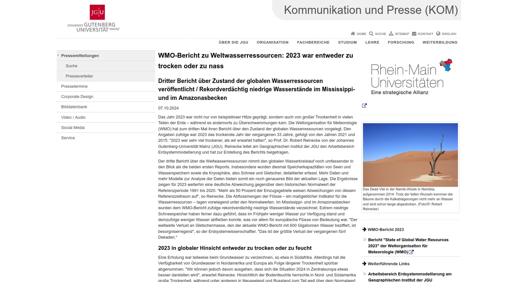
"Extrem niedrige Schneespeicher haben ferner dazu geführt, dass im Frühjahr weniger Wasser zur Verfügung stand und demzufolge weniger Wasser abfließen konnte, was vor allem für europäische Flüsse von Bedeutung war" presse.uni-mainz.de/wmo-bericht-...
Atlantic Hurricane Milton Intermediate Advisory Number 12A ...EXTREMELY POWERFUL HURRICANE MILTON JUST NORTH OF THE YUCATAN PENINSULA... ...MILTON POSES AN EXTREMELY SERIOUS THREAT TO FLORIDA AND RESIDENTS ARE URGED TO FOLLOW THE ORDERS OF LOCAL OFFICIALS... Additional Details Here.
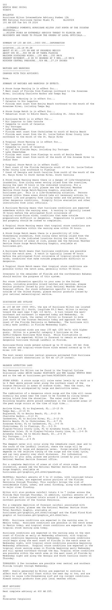
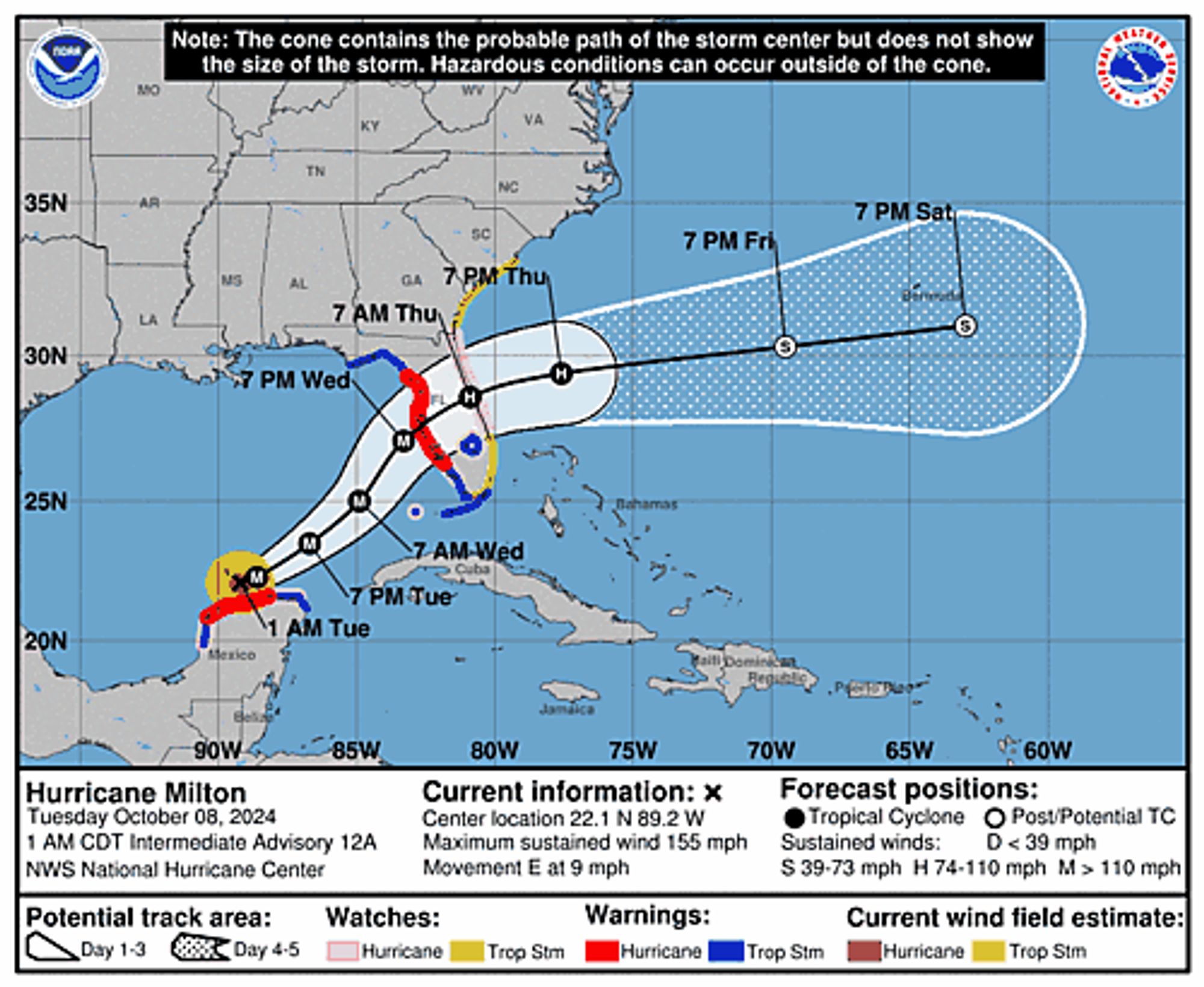
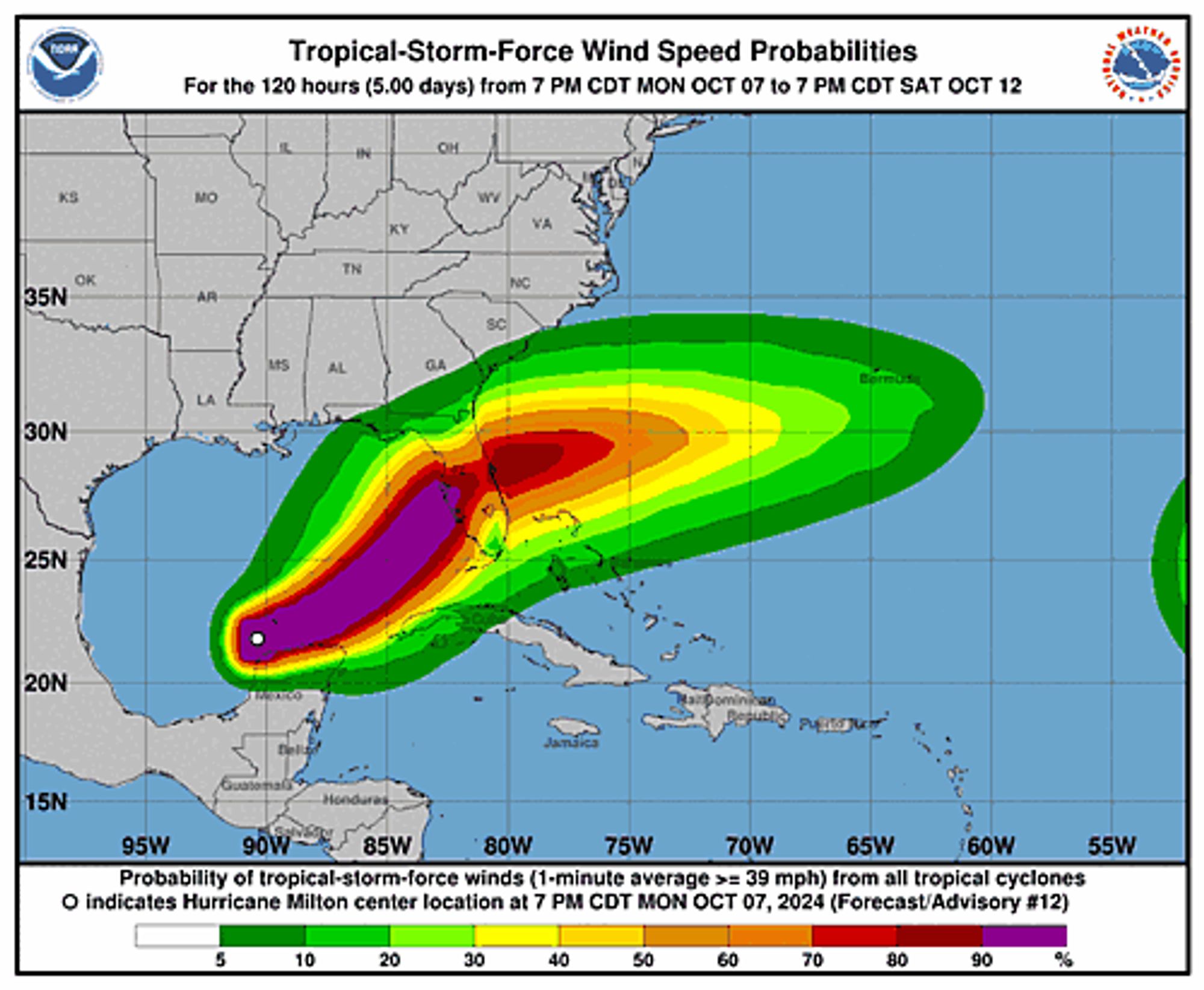

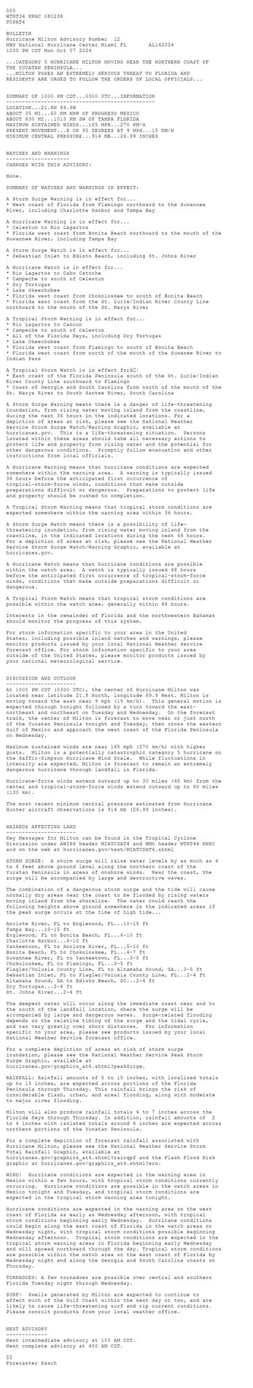
Atlantic Hurricane Milton Advisory Number 12 ...CATEGORY 5 HURRICANE MILTON MOVING NEAR THE NORTHERN COAST OF THE YUCATAN PENINSULA... ...MILTON POSES AN EXTREMELY SERIOUS THREAT TO FLORIDA AND RESIDENTS ARE URGED TO FOLLOW THE ORDERS OF LOCAL OFFICIALS...Additional Details Here.