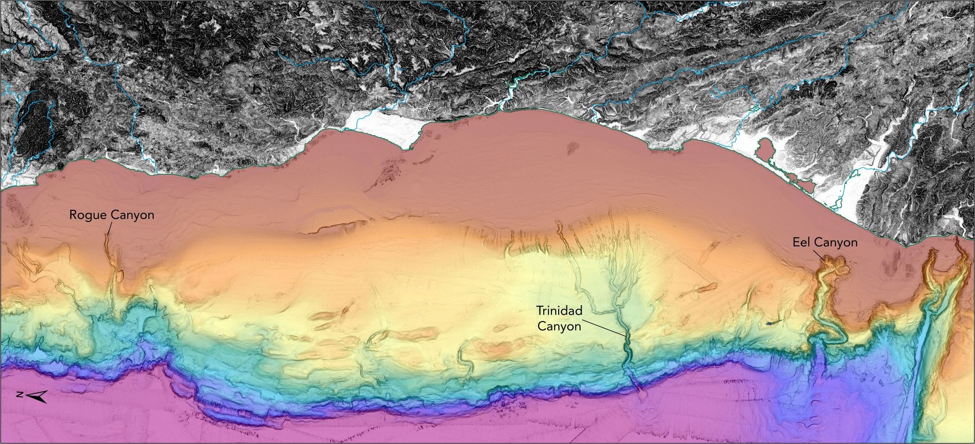
An elevation and bathymetry map using #USGS#QGISen.wikipedia.org/wiki/Carolin...@timdemko.xyz for help in identifying these interesting features!

[OC] Eine Karte🗺️, die das Relief des afrikanischen Kontinents zeigt. Der Datensatz stammt von Natural Earth und GEBCO Bathymetry https://www.bytesde.com/522441/ [OC] Eine Karte🗺️, die das Relief des afrikanischen Kontinents zeigt. Der Datensatz stammt von Natural Earth und GEBCO Bathymetry Von …

Eine Karte🗺️, die das Relief des afrikanischen Kontinents zeigt. Der Datensatz stammt von Natural Earth und GEBCO BathymetryVon hemedlungo_725
I was once watching a surfing competition on the web, and the colour commentator, who had the classic accent, used the word "bathymetry" and now whenever I encounter it while reading, it's his voice in my head.
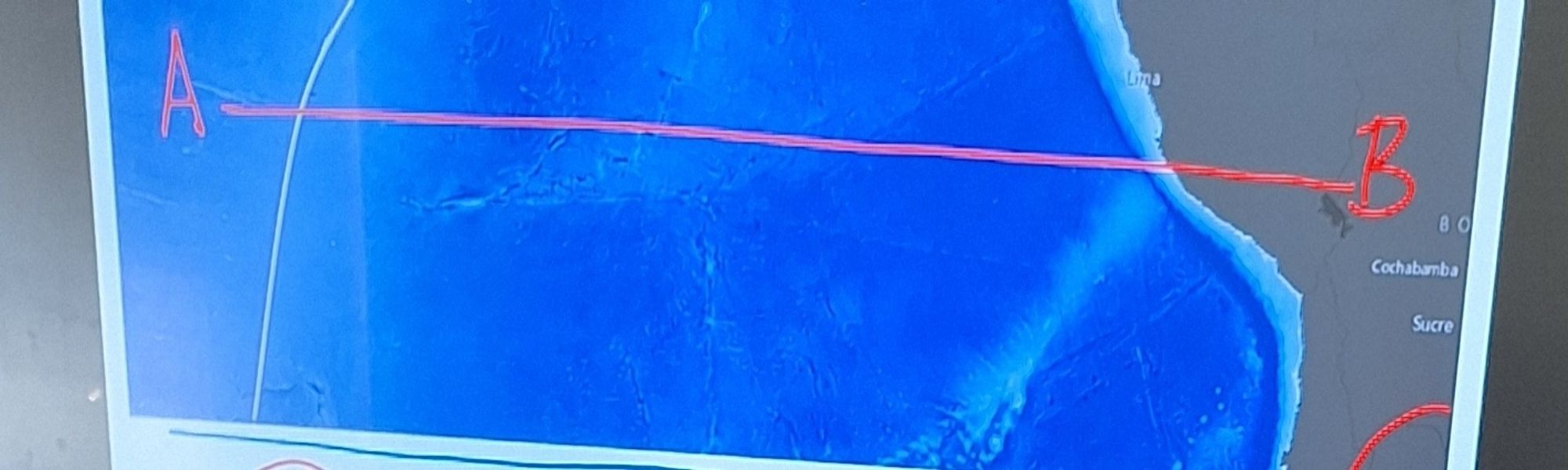
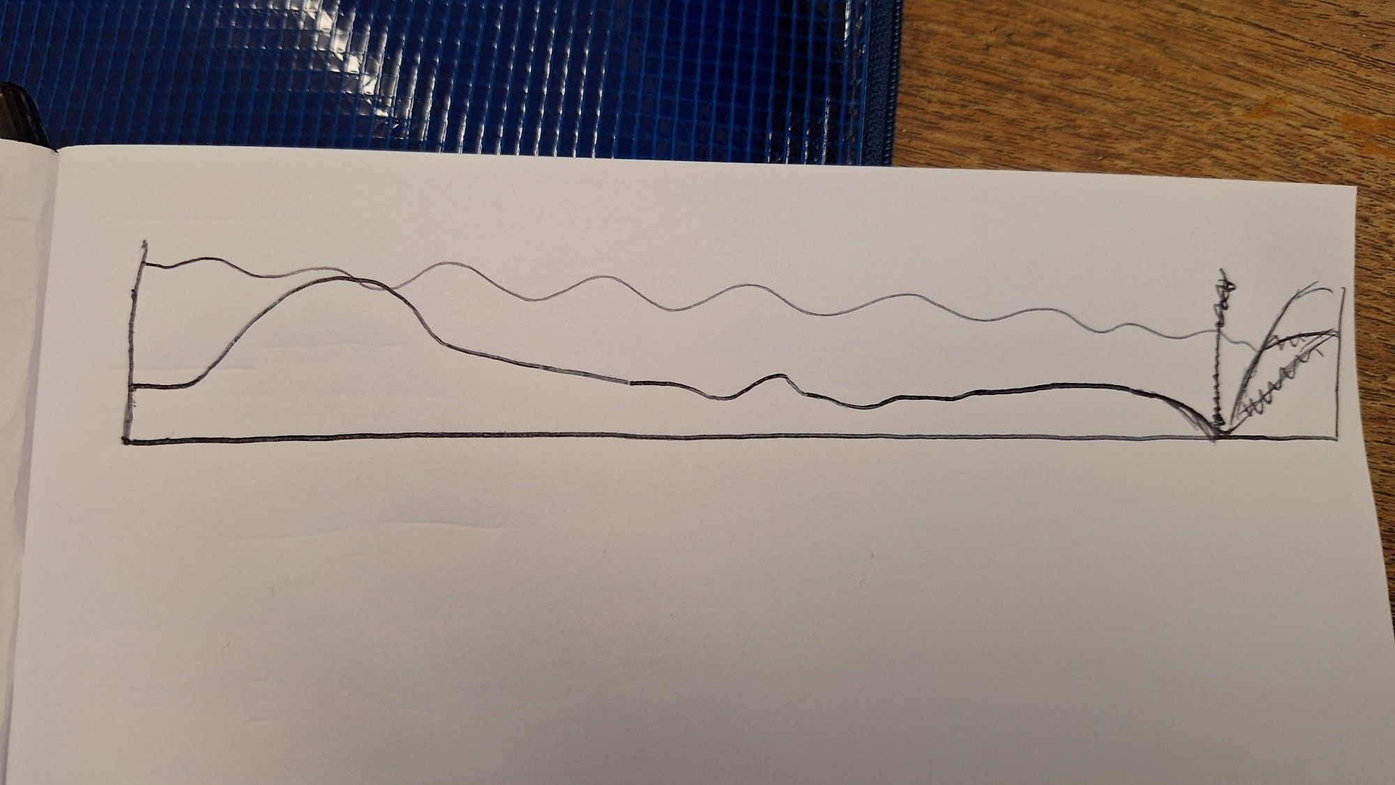
#HowIUsedGISToday 1/ We were exploring seafloor topography as evidence for seafloor spreading. I gave the pupils a plan view map of the bathymetry of SE Pacific & asked them to draw a cross section transect along AB.
Influences of meteorological conditions, runoff, and bathymetry on summer thermal regime of a #GreatLakeswww.sciencedirect.com/science/arti...
To better understand the primary drivers of the thermal regime in a Great Lakes estuary, and their implications for local biota, water temperature var…
Luckily, high resolution bathymetry data came in during the revision process, making some extremely high resolution tsunami/wave modeling possible. This made for more accurate modeling and showed that yep, a seiche could carry on for so long! Who knew? (apparently nobody!)
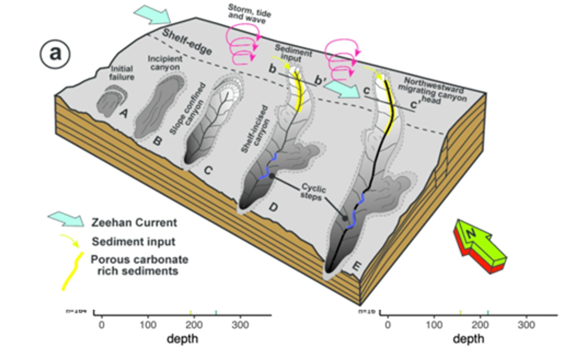
🌊 New research on submarine canyon development in the southeastern Australian margin! Harishidayat et al. reveal insights into canyon formation using high-res bathymetry & 3D seismic data, with global implications for understanding continental margins. 👉 https://buff.ly/4dIV3p1