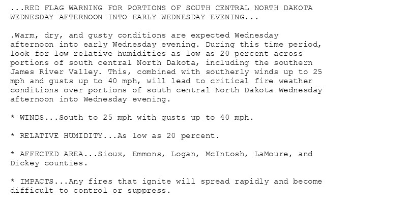
🚨 Red Flag Warning issued October 15 at 9:47PM CDT until October 16 at 7:00PM CDT by NWS Bismarck ND 🚨 Additional Details Here.
Like a lot of the best country and western songs that aren't "Sink the Bismarck", the lyrics communicate some very twisty psychology beneath the relatively cheerful instrumentals and rhythm.
Se eles tivessem seguido o conselho de Bismark não estariam na merda que estão necessitando de um genocídio para ter energia alheia né Bismarck?

Wildfire activity could pick up again in #NorthDakotabismarcktribune.com/news/state-r...#NDFire#NDwx
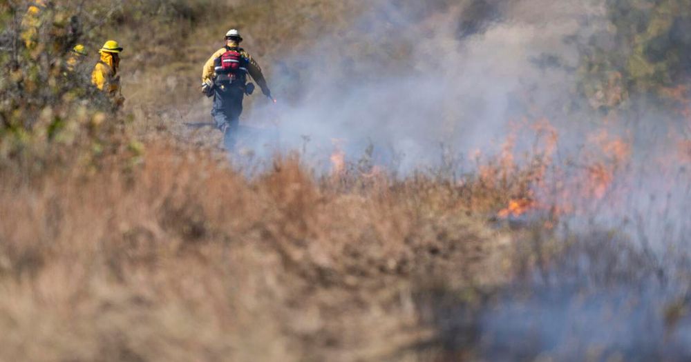
Wildfire concerns are mounting in North Dakota again, with breezy conditions and little rain in the forecast this week.
🚨 Red Flag Warning issued October 15 at 2:03PM CDT until October 16 at 7:00PM CDT by NWS Bismarck ND 🚨 Additional Details Here.
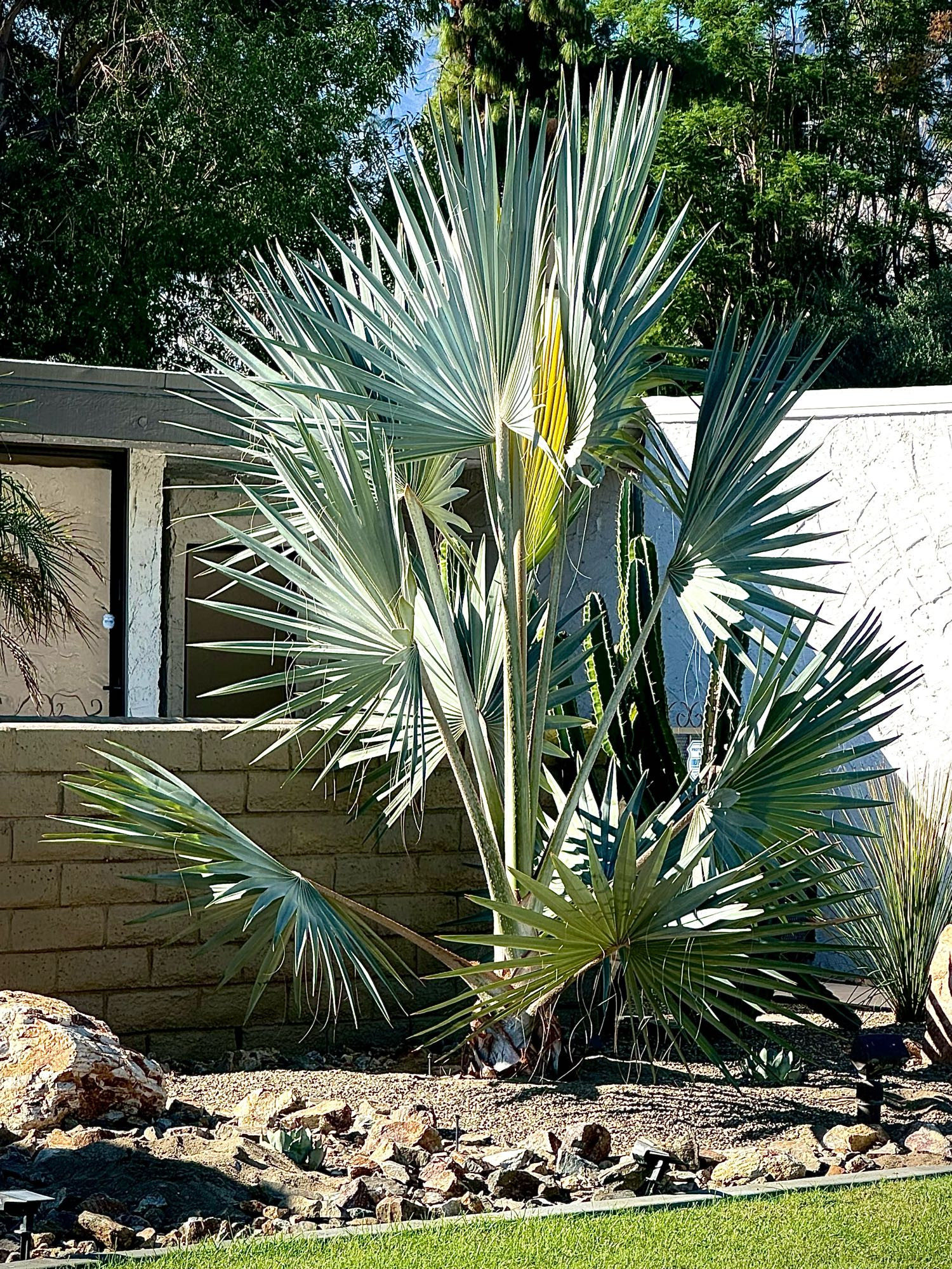
This Silver Bismarck Palm in the neighborhood is unique to me and stands about 10’ tall. It reminds me of a firework exploding. I’m making the call now for #TallTreeTuesday 🤪
"Es wird niemals so viel gelogen wie vor der Wahl, während des Krieges und nach der Jagd." ~ Otto von Bismarck ~
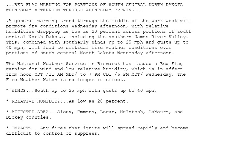
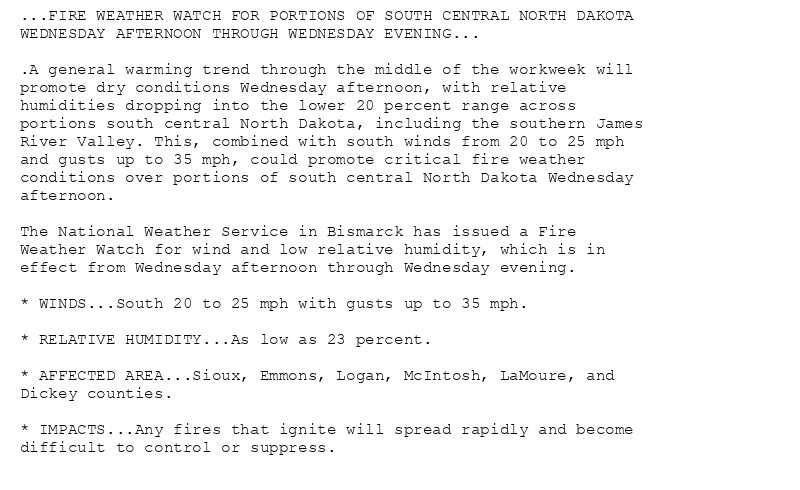
🚨 Fire Weather Watch issued October 15 at 2:08AM CDT until October 16 at 7:00PM CDT by NWS Bismarck ND 🚨 Additional Details Here.
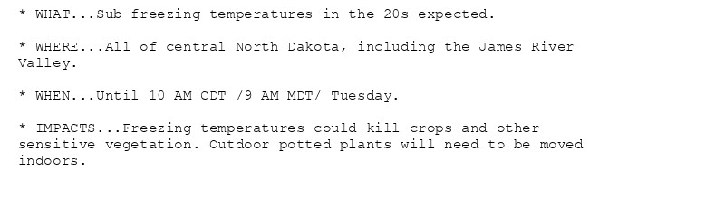
Freeze Warning issued October 15 at 1:48AM CDT until October 15 at 10:00AM CDT by NWS Bismarck ND Additional Details Here.

Freeze Warning issued October 14 at 8:46PM CDT until October 15 at 10:00AM CDT by NWS Bismarck ND Additional Details Here.