🚨 High Wind Watch issued October 2 at 4:45AM MDT until October 5 at 12:00PM MDT by NWS Great Falls MT 🚨 Additional Details Here.
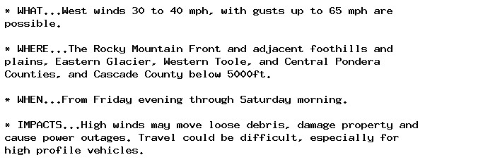
NEW WEATHER ADVISORY: High Wind Watch * WHAT...West winds 30 to 40 mph, with gusts up to 65 mph are possible. * WHERE...The Rocky Mountain Front and adjacent foothills and plains, Eastern Glacier, Western Toole, and Central Pondera Counties, and... See more: watchedsky.social/app/alerts/...
this is so confusing lol like why don't i control the counties in my duchies outright! why is there some lady in the capital seat of croatia claiming to be countess!
🚨 Flood Warning issued October 2 at 6:09AM EDT until October 4 at 12:30PM EDT by NWS Wakefield VA 🚨 Additional Details Here.
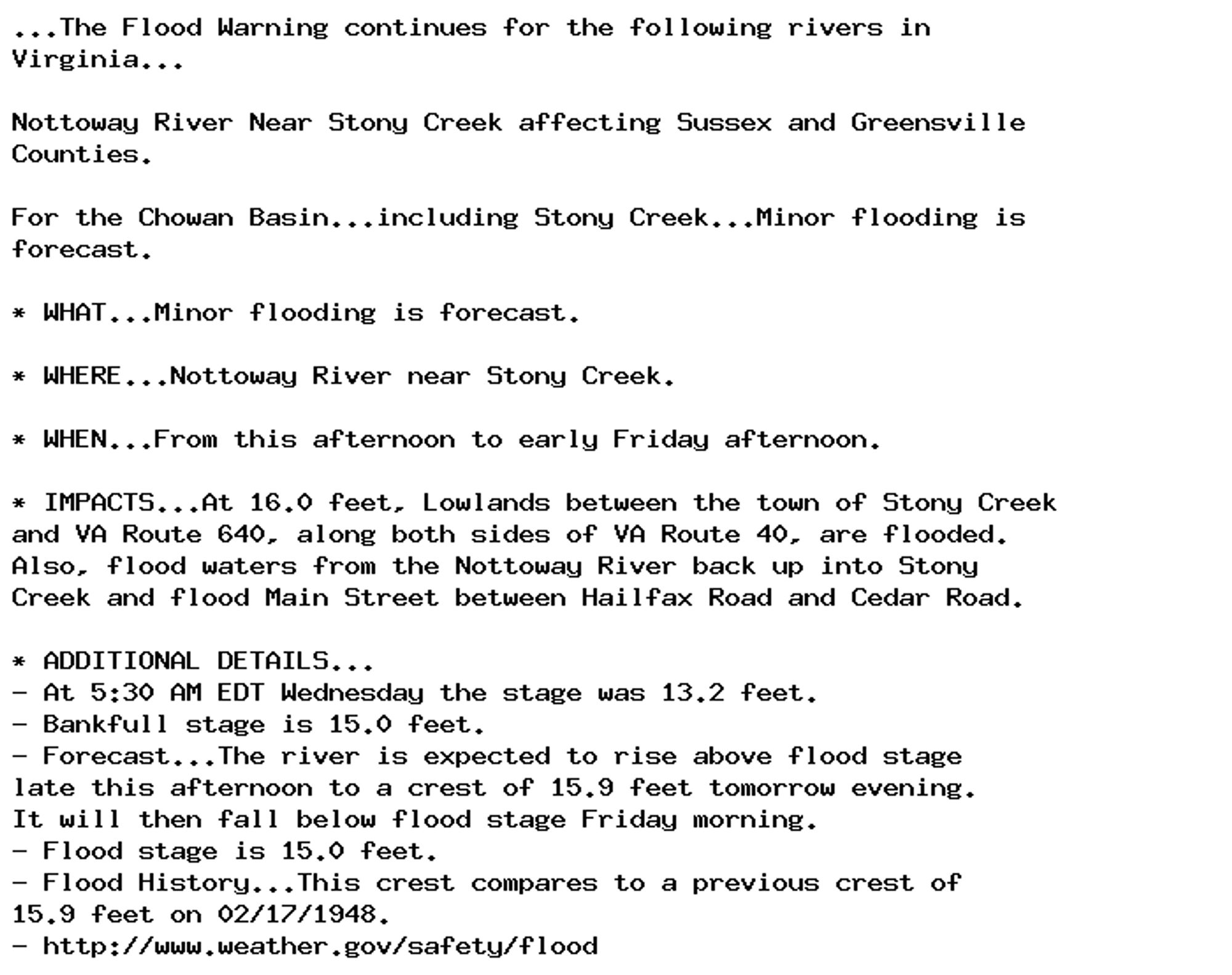
NEW WEATHER ADVISORY: Flood Warning ...The Flood Warning continues for the following rivers in Virginia... Nottoway River Near Stony Creek affecting Sussex and Greensville Counties. For the Chowan Basin...including Stony Creek...Minor flooding is... See more: watchedsky.social/app/alerts/...
Dense Fog Advisory issued October 2 at 5:48AM EDT until October 2 at 9:00AM EDT by NWS Peachtree City GA Additional Details Here.
...the remainder. Remember that if your heir ends up having too many vassals he may also face rebellions and have a hard time, so if he has lots of duchies he'll need a solid domain (counties held in his own hands) to face off this problem.
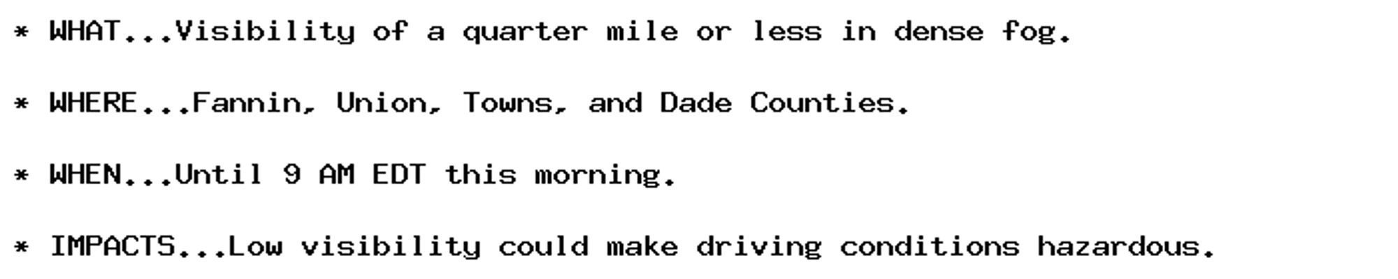
NEW WEATHER ADVISORY: Dense Fog Advisory * WHAT...Visibility of a quarter mile or less in dense fog. * WHERE...Fannin, Union, Towns, and Dade Counties. * WHEN...Until 9 AM EDT this morning. * IMPACTS...Low visibility could make driving conditions... See more: watchedsky.social/app/alerts/...
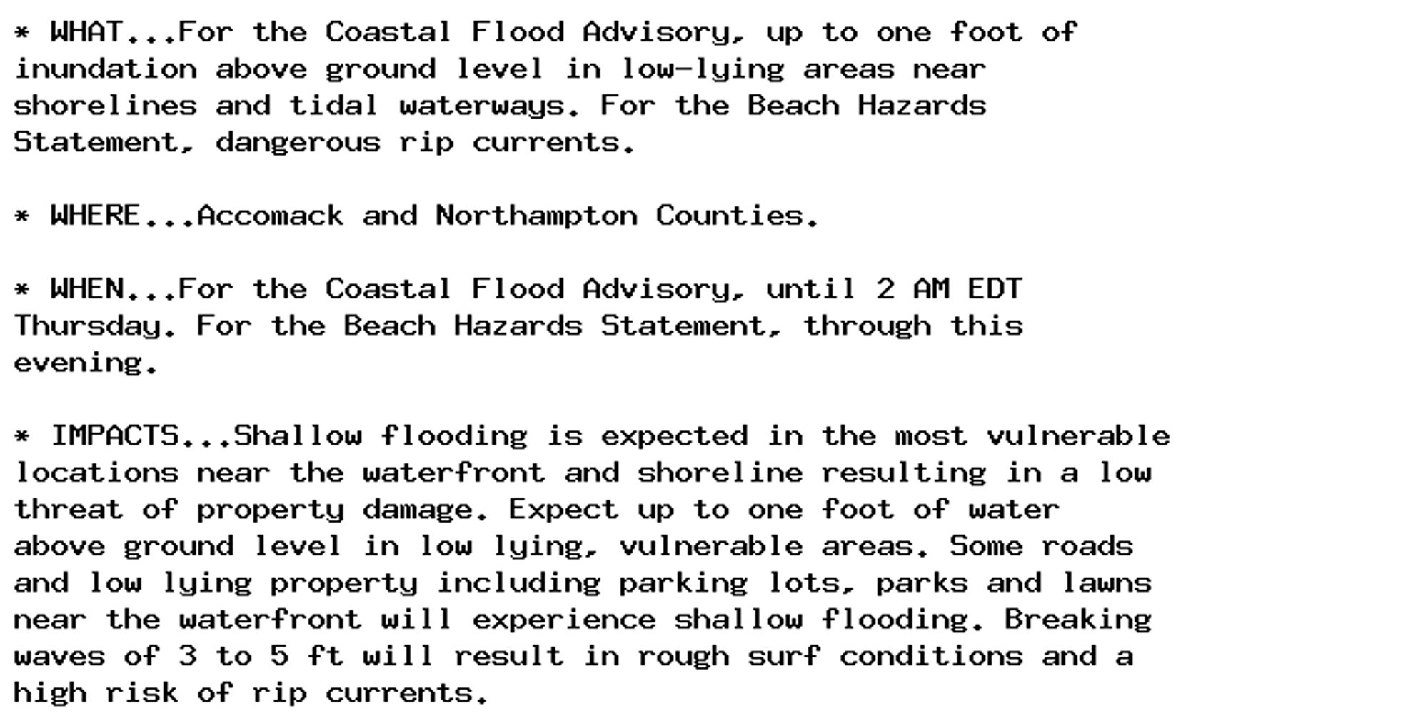
Coastal Flood Advisory issued October 2 at 5:42AM EDT until October 3 at 2:00AM EDT by NWS Wakefield VA Additional Details Here.
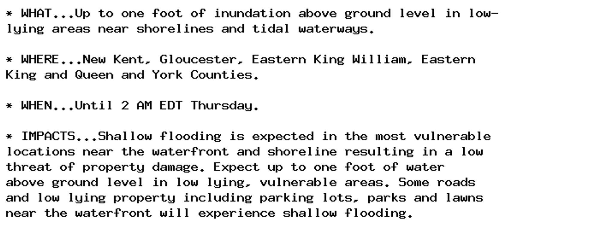
Coastal Flood Advisory issued October 2 at 5:42AM EDT until October 3 at 2:00AM EDT by NWS Wakefield VA Additional Details Here.