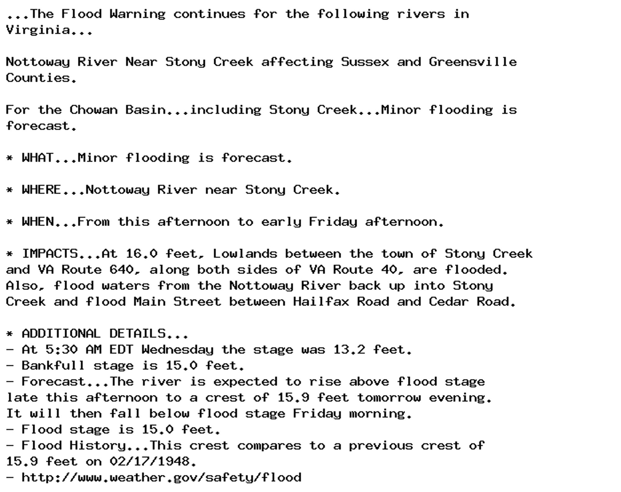
🚨 Flood Warning issued October 2 at 6:09AM EDT until October 4 at 12:30PM EDT by NWS Wakefield VA 🚨 Additional Details Here.
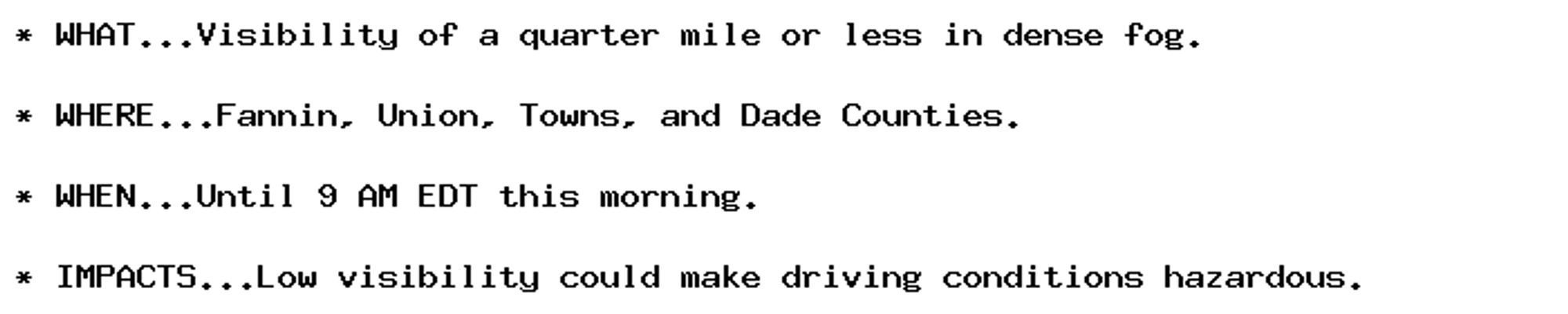
Dense Fog Advisory issued October 2 at 5:48AM EDT until October 2 at 9:00AM EDT by NWS Peachtree City GA Additional Details Here.
...the remainder. Remember that if your heir ends up having too many vassals he may also face rebellions and have a hard time, so if he has lots of duchies he'll need a solid domain (counties held in his own hands) to face off this problem.
NEW WEATHER ADVISORY: Dense Fog Advisory * WHAT...Visibility of a quarter mile or less in dense fog. * WHERE...Fannin, Union, Towns, and Dade Counties. * WHEN...Until 9 AM EDT this morning. * IMPACTS...Low visibility could make driving conditions... See more: watchedsky.social/app/alerts/...
Coastal Flood Advisory issued October 2 at 5:42AM EDT until October 3 at 2:00AM EDT by NWS Wakefield VA Additional Details Here.
Coastal Flood Advisory issued October 2 at 5:42AM EDT until October 3 at 2:00AM EDT by NWS Wakefield VA Additional Details Here.
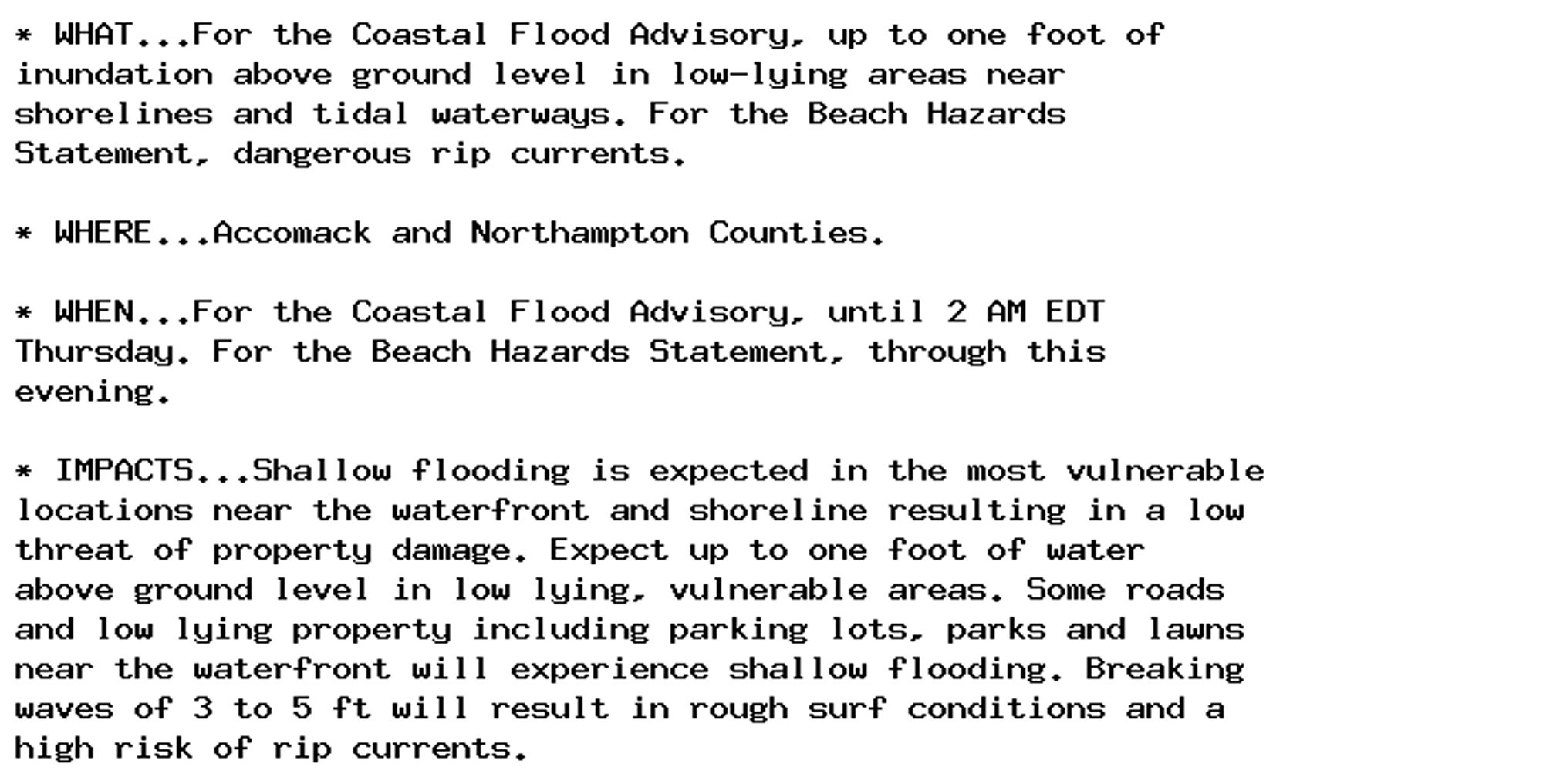
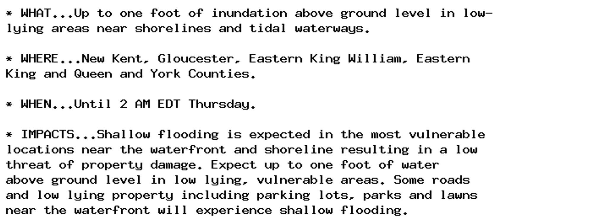
Coastal Flood Advisory issued October 2 at 5:42AM EDT until October 3 at 8:00AM EDT by NWS Wakefield VA Additional Details Here.

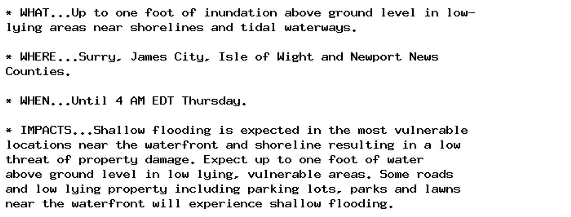
Coastal Flood Advisory issued October 2 at 5:42AM EDT until October 3 at 4:00AM EDT by NWS Wakefield VA Additional Details Here.
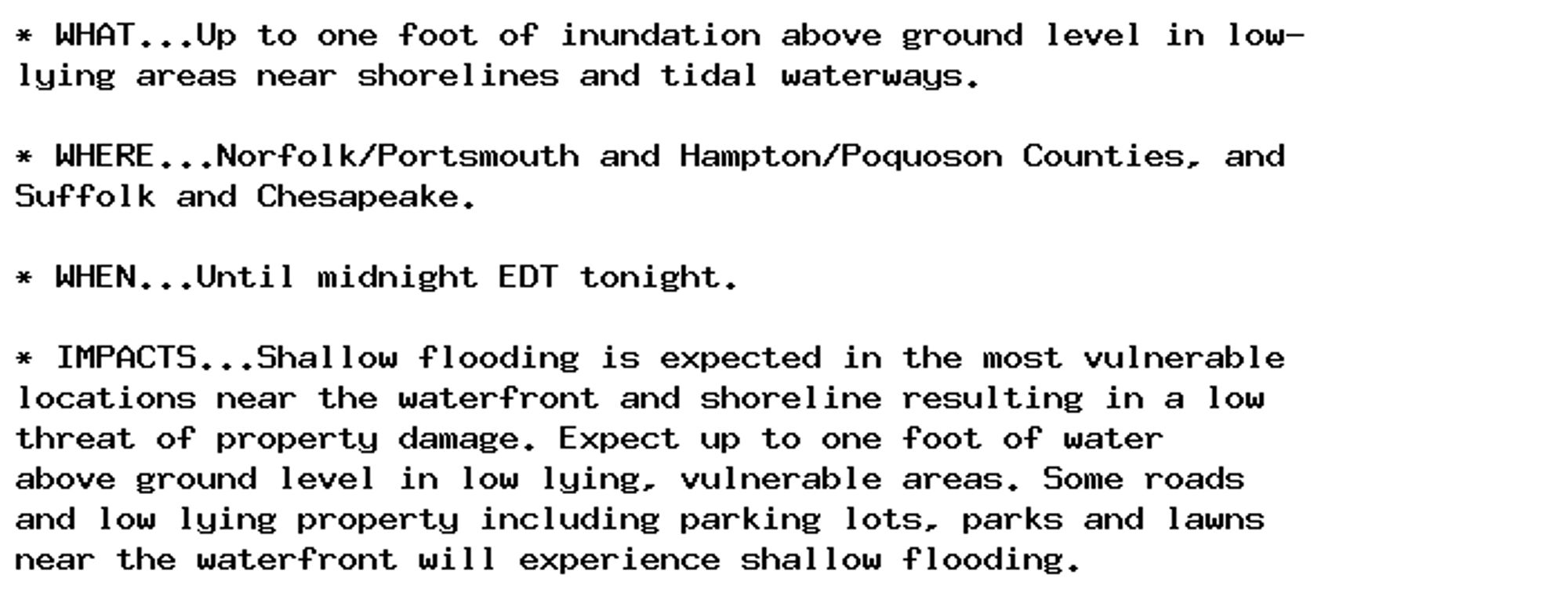
Coastal Flood Advisory issued October 2 at 5:42AM EDT until October 3 at 12:00AM EDT by NWS Wakefield VA Additional Details Here.
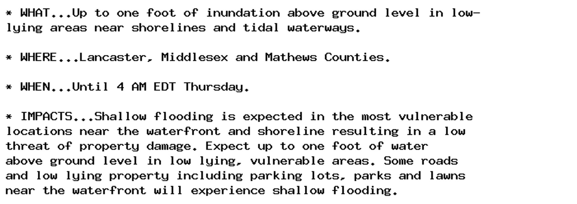
Coastal Flood Advisory issued October 2 at 5:42AM EDT until October 3 at 4:00AM EDT by NWS Wakefield VA Additional Details Here.