yeah, but low dewpoint, so basically winter 😀
Data for nerds: Current Readings (3:42 PM) 81°F Vis: 10 miles Wind: NNE @ 17mph Humidity: 72% Barometer: 29.758" hg Tendency: Falling E 10 Minute Gust: 23mph Anemometer: 18mph Dewpoint: 75.2°F Hygrometer: 81.9% Rain: Accum last 24 hr: 0.35" Solar Radiation Sensor: 408 W/m^2 UV Radiation Sensor: 2.9
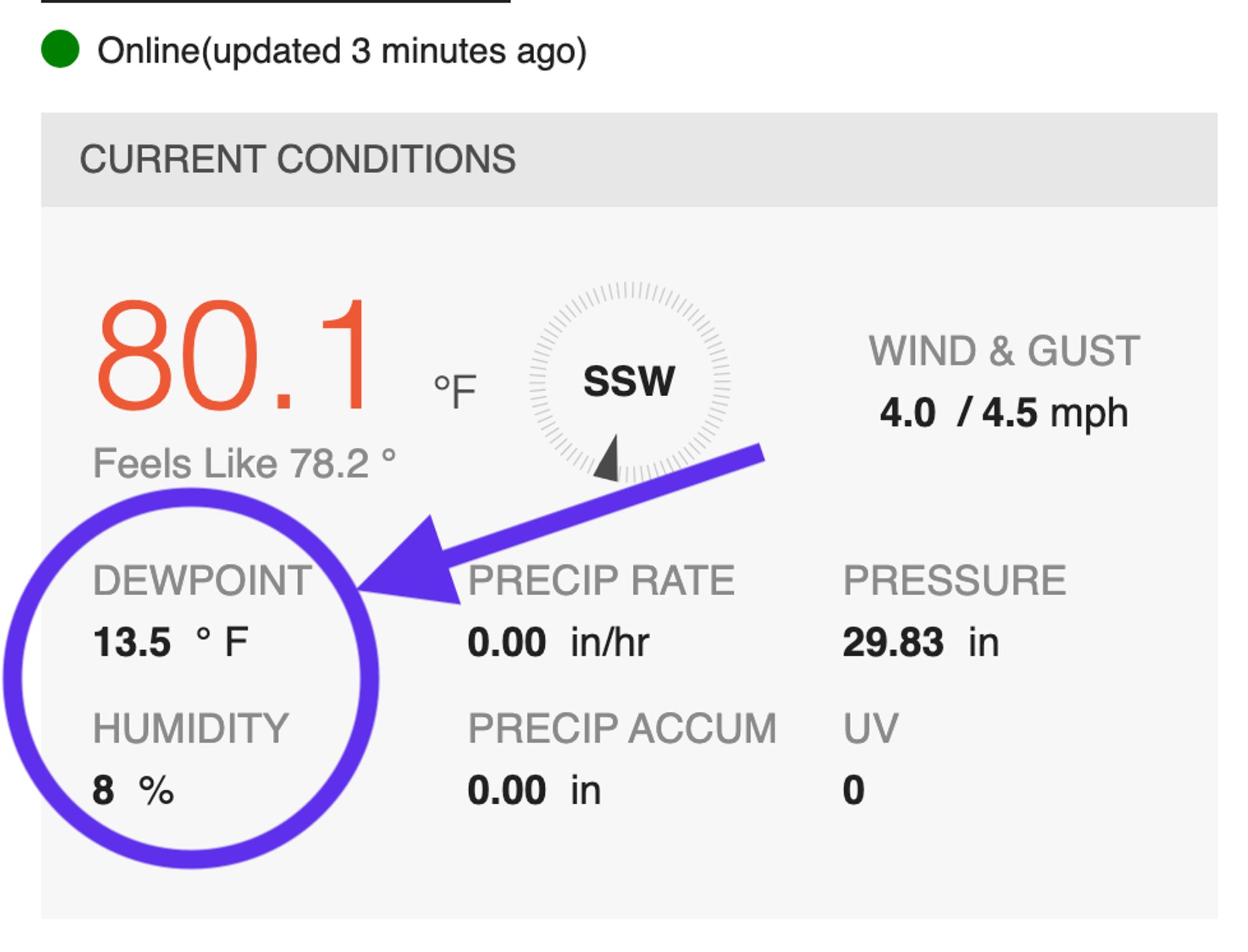
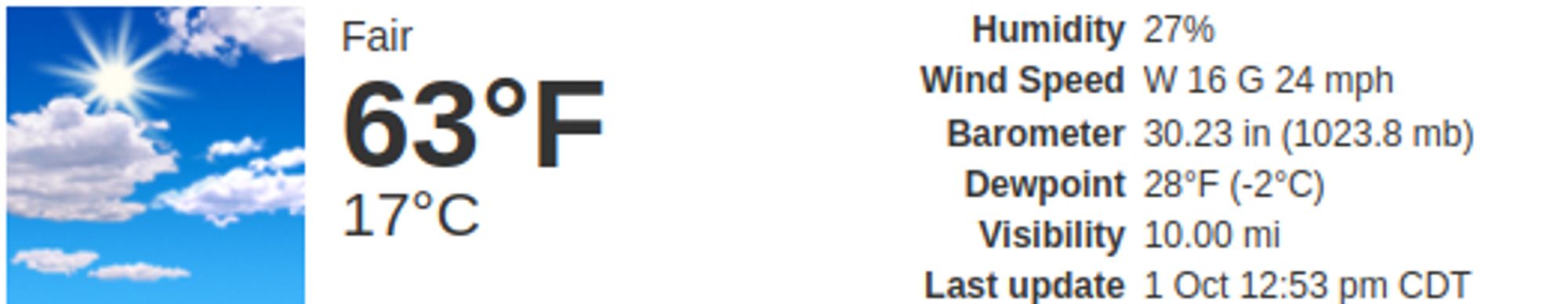
wow - this is just wild. humidity down to 8% and the dewpoint is 13.5F. just breathing could mean a spark. do. not. like.
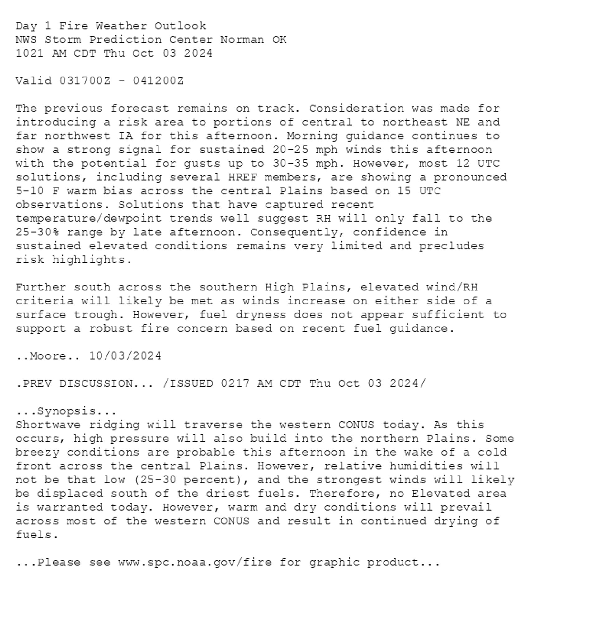
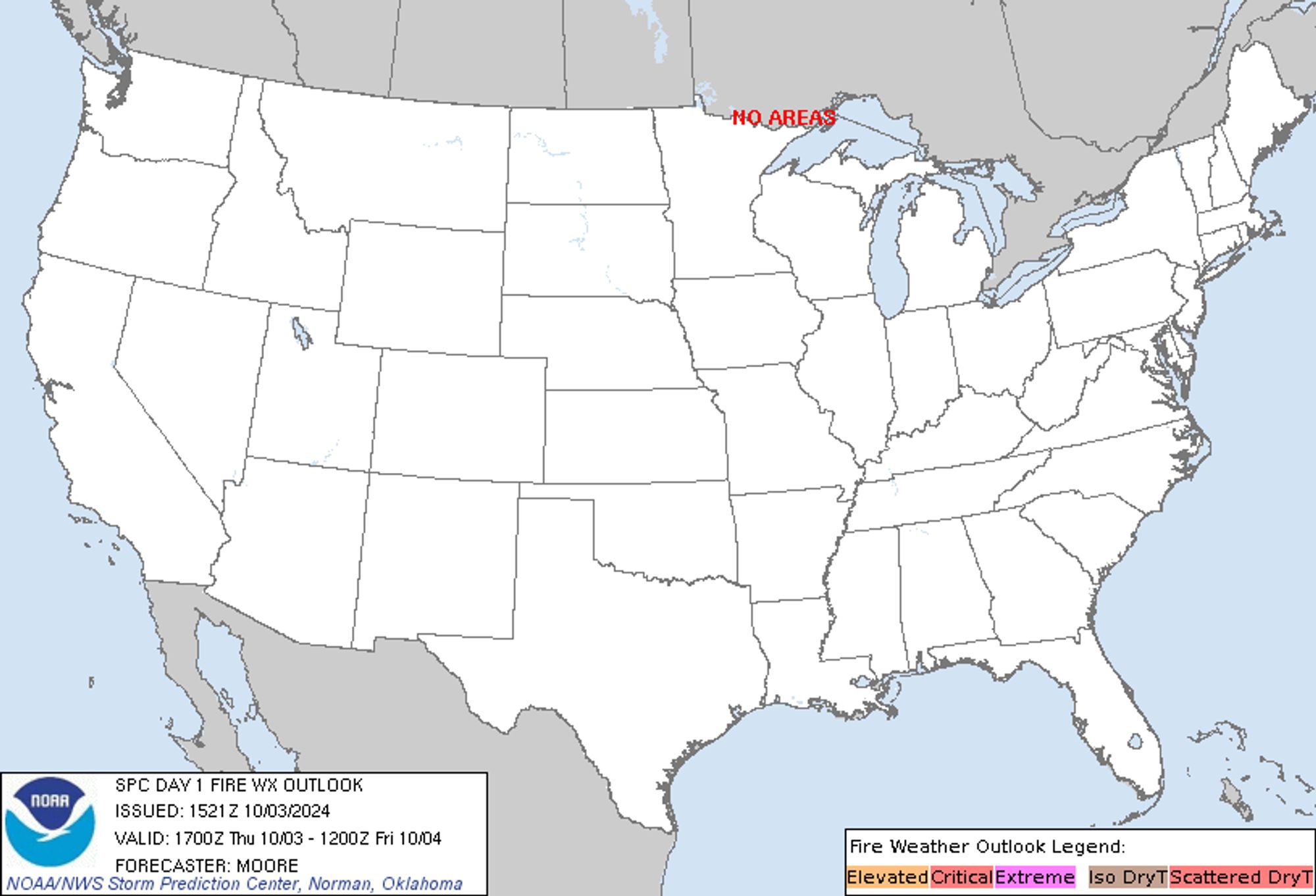
SPC Day 1 Fire Weather Outlook posted at Thu, 03 Oct 2024 15:22:28 +0000 🔥 /ISSUED 0217 AM CDT Thu Oct 03 2024/ 🔥 Additional Details Here.
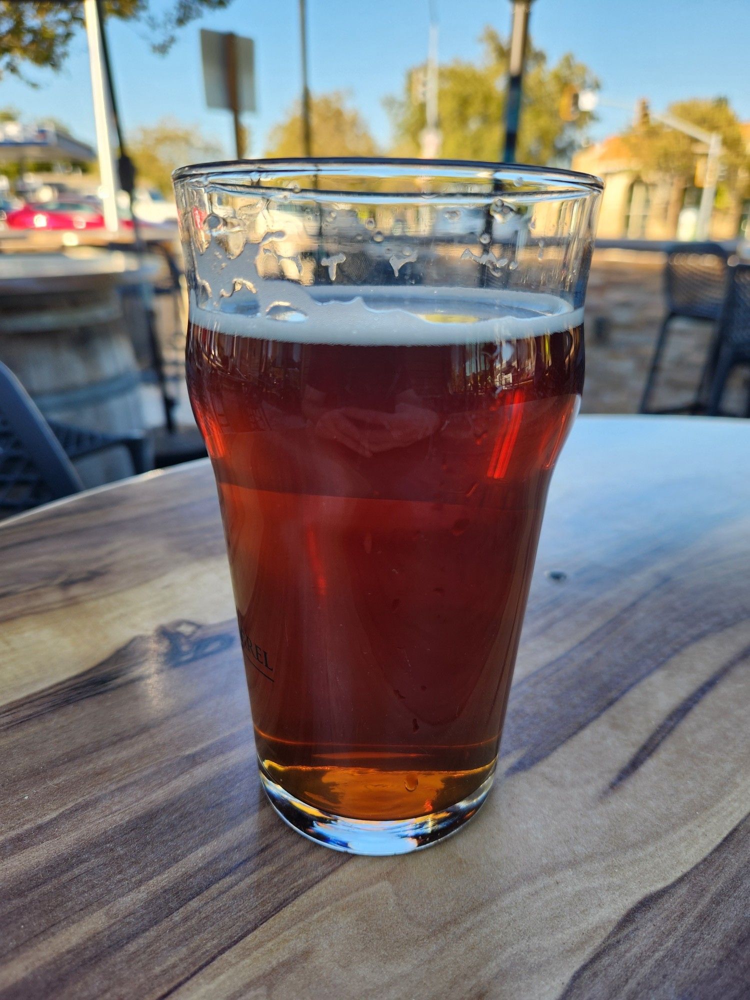
I shouldn't complain though, the dewpoint is only 46. Siitting in the shade and neither my beer nor I am sweating.
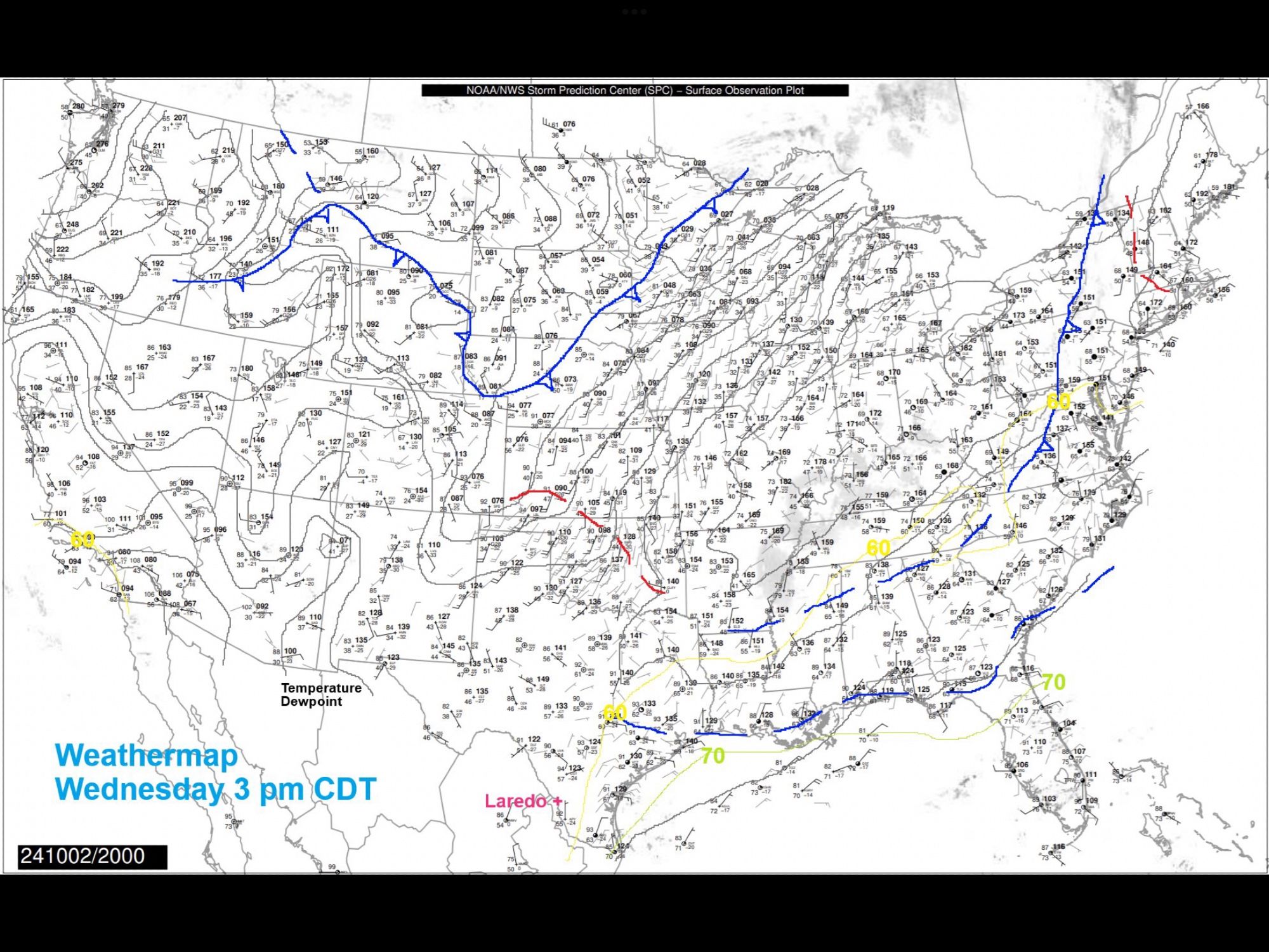
Wednesday 3:50 pm: Big Picture Weathermap: A dry airmass remains in control of our weather. A few small cumulus in our skies. Near 70F dawn Thursday, dewpoint in the 60's, sunshine, dry air will stir in with dewpoints <60F pm, mid 90's.
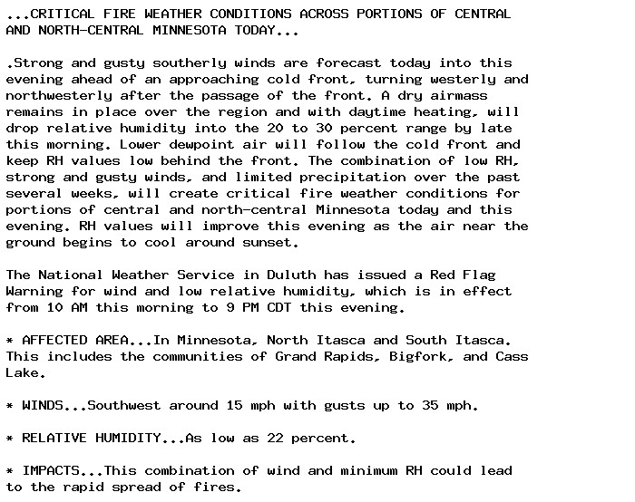
🚨 Red Flag Warning issued September 30 at 2:26PM CDT until September 30 at 9:00PM CDT by NWS Duluth MN 🚨 Additional Details Here.
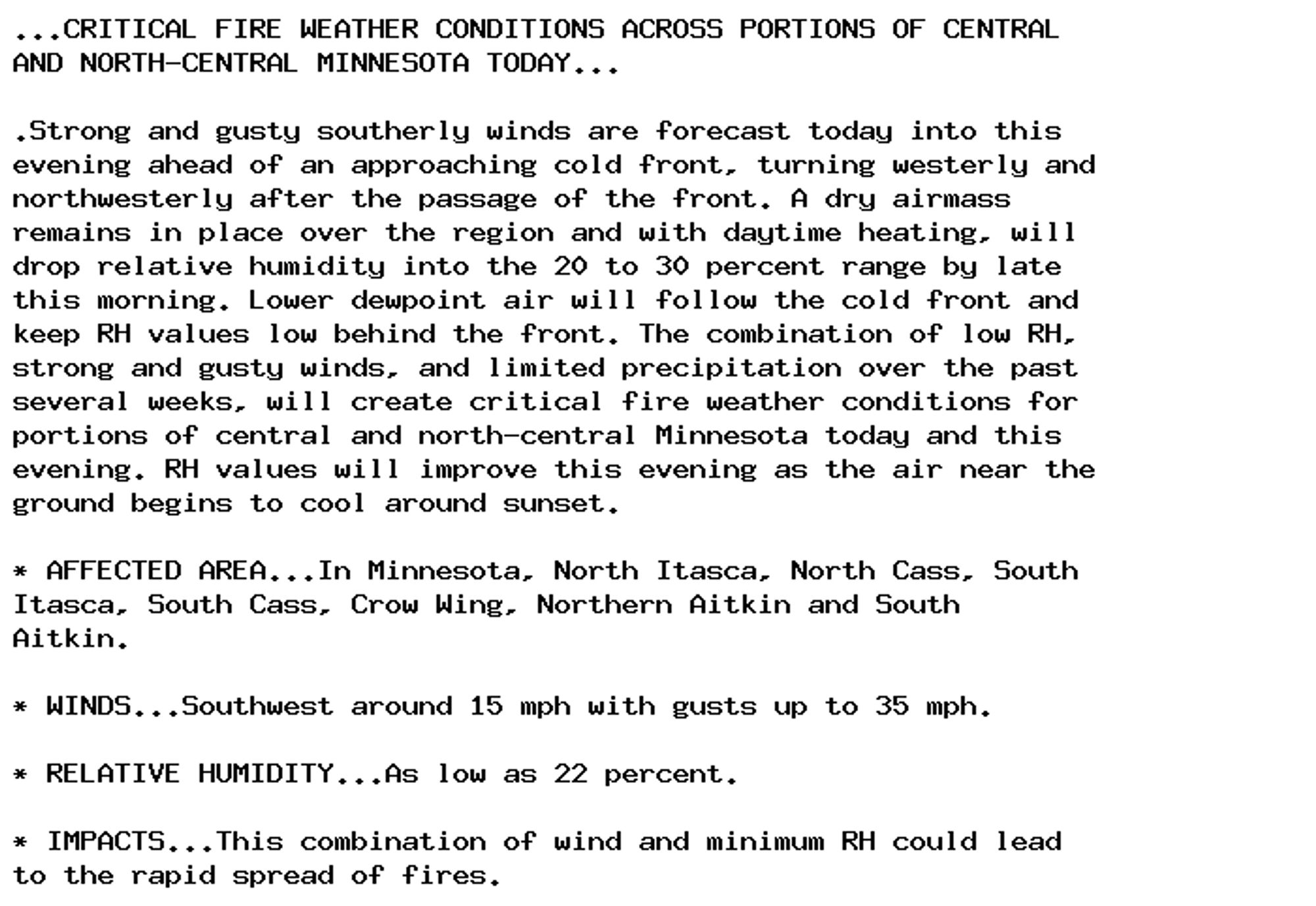
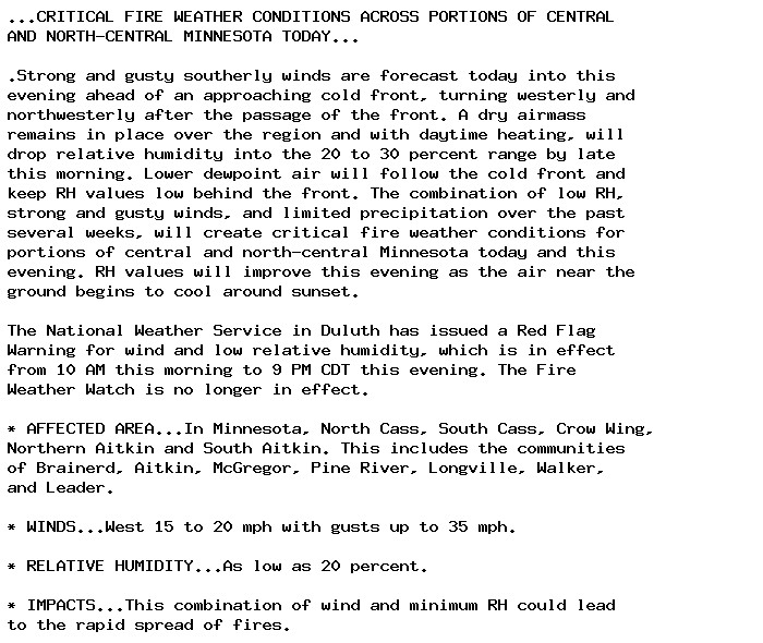
🚨 Red Flag Warning issued September 30 at 3:40AM CDT until September 30 at 9:00PM CDT by NWS Duluth MN 🚨 Additional Details Here.
🚨 Red Flag Warning issued September 30 at 3:40AM CDT until September 30 at 9:00PM CDT by NWS Duluth MN 🚨 Additional Details Here.