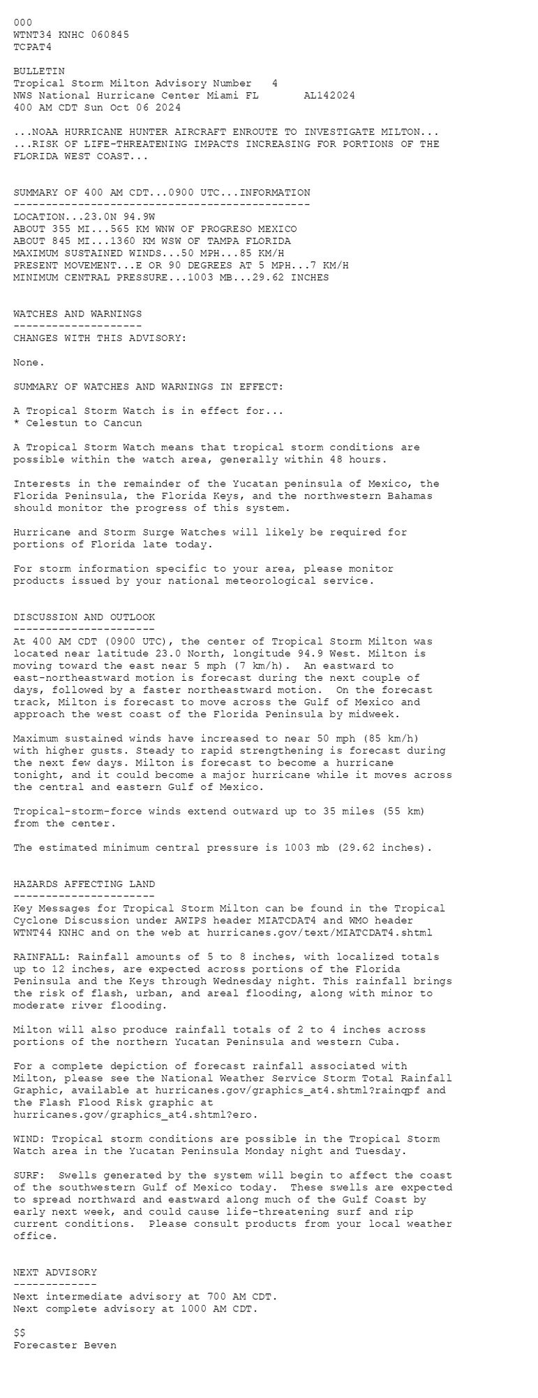
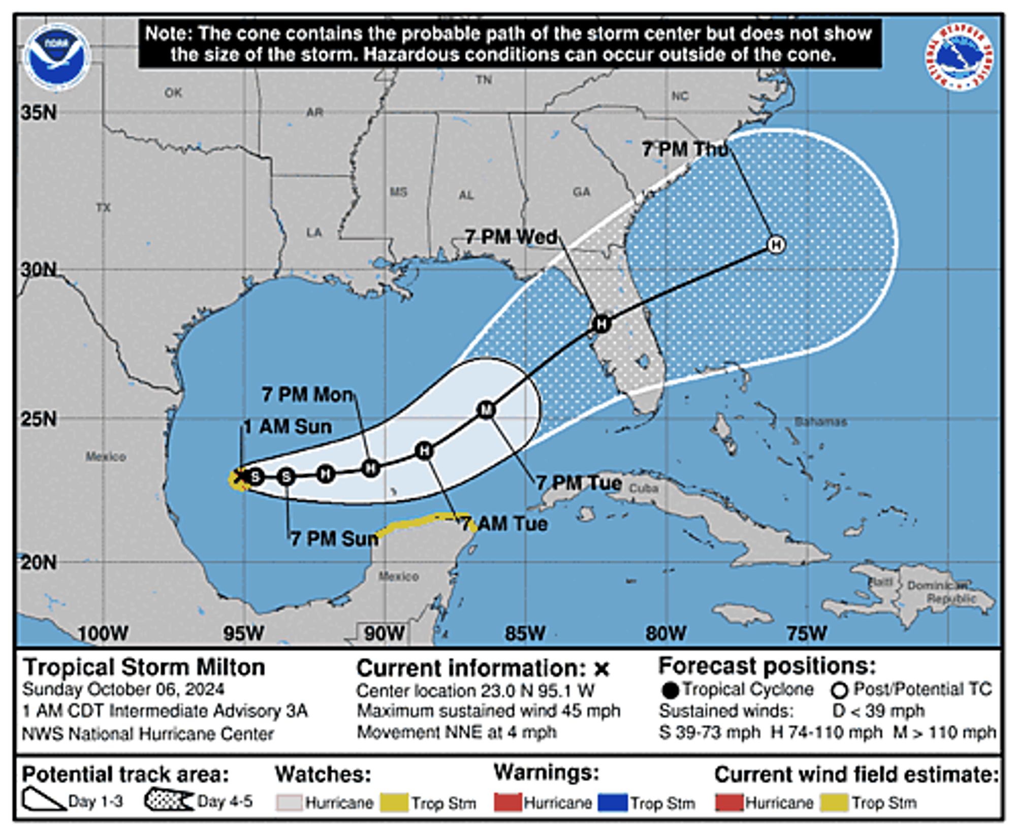
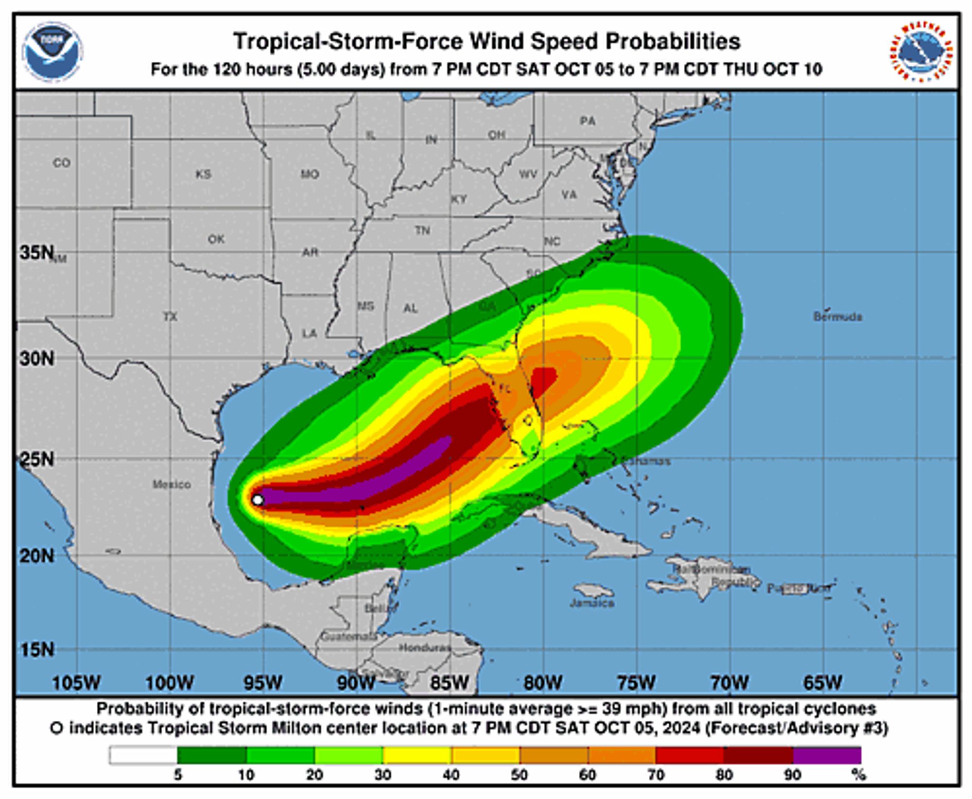
Atlantic Tropical Storm Milton Advisory Number 4 issued at Sun, 06 Oct 2024 08:45:25 +0000 ...NOAA HURRICANE HUNTER AIRCRAFT ENROUTE TO INVESTIGATE MILTON... ...RISK OF LIFE-THREATENING IMPACTS INCREASING FOR PORTIONS OF THE FLORIDA WEST COAST... Additional Details Here.
Tropical Storm #Miltonhttps://t.co/tW4KeGe9uJ
We need to stop by! @pqkate.bsky.social is enroute
Enroute to New Hampshire to share the great science of JWST with folks at the New England Fall Astronomy Festival! 🔭❤️🪐

There are 4 main enroute secondary radar sites (remote from aerodromes) so some degree of co-location with pthese is perhaps to be expected. Mt Gabriel - Co Cork; Dooncarton - Co Mayo; Woodcock Hill - Co Clare; and Malin Head - Co Donegal.
#Hurricane#Helene#NorthCarolina#GlobalWarming#Climate#Nature#Environment#Politics#Asheville at the historic Grove Park Inn to break up the drive. The famous hotel is closed until further notice. 😢
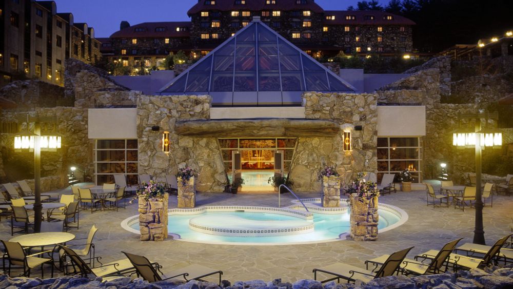
Historic hotels and attractions in Asheville are closed due to devastating floods bought on by Tropical Storm Helene.
Book is still enroute but the pages you photoed were very helpful!
Milo was enroute to a Love Sucks party that his bro's had set him up for; when a bat divebombed him. His estranged twin brother, Wylie, appeared before him. "What do you want? I'm on my way to a party", Milo asked "We need to talk about THAT' Wylie replied They reconnected at the old Haunted Deco.

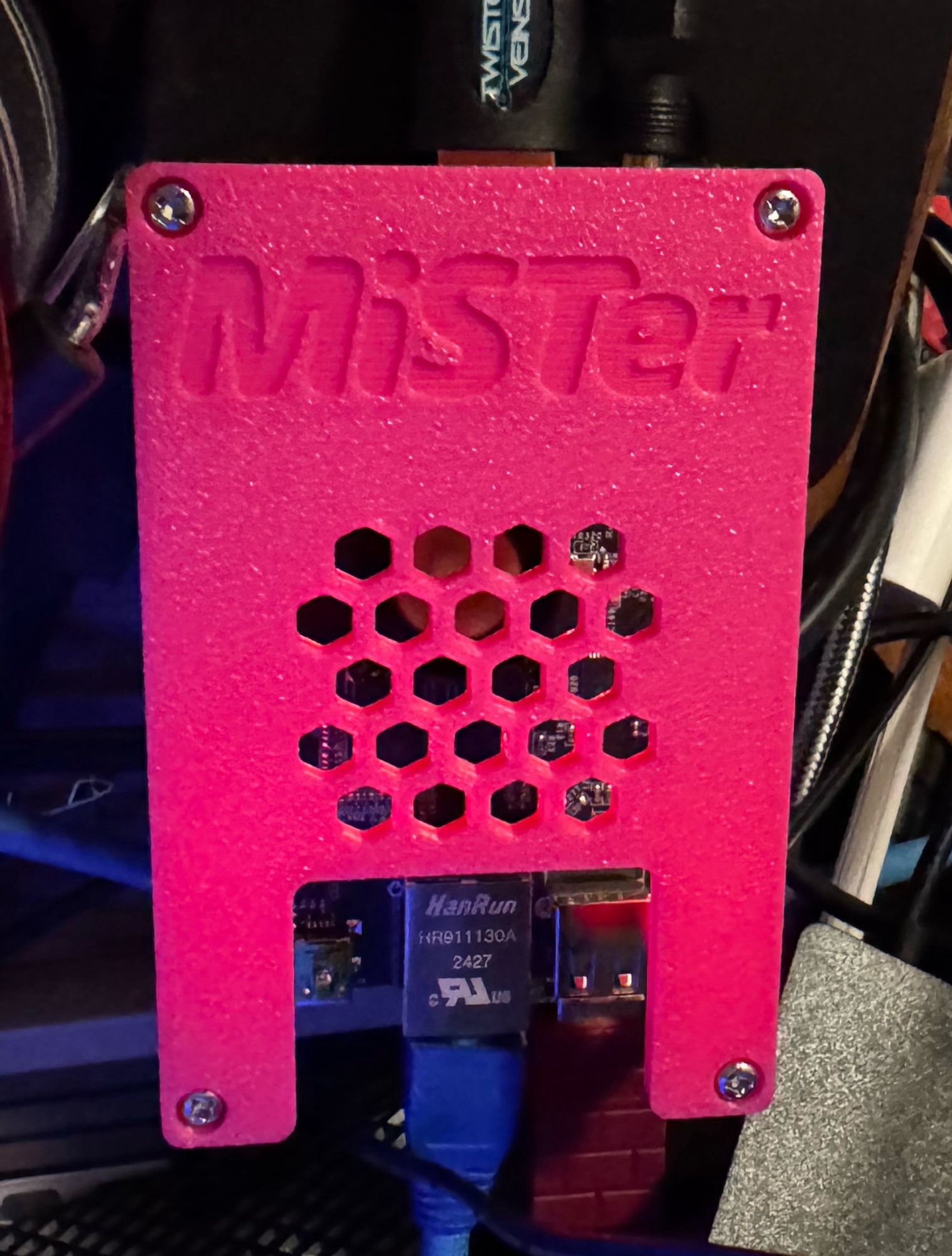
Got my DE10 Nano clone QMtech board and I’m running tests on it now. Technically, it’s a fully usable MISTer now but I have the IO board enroute now. Honestly, this is all so I can have frame-accurate Neo-Geo Arcade play.