All of this came about because of the lack of evacuations for Katrina.
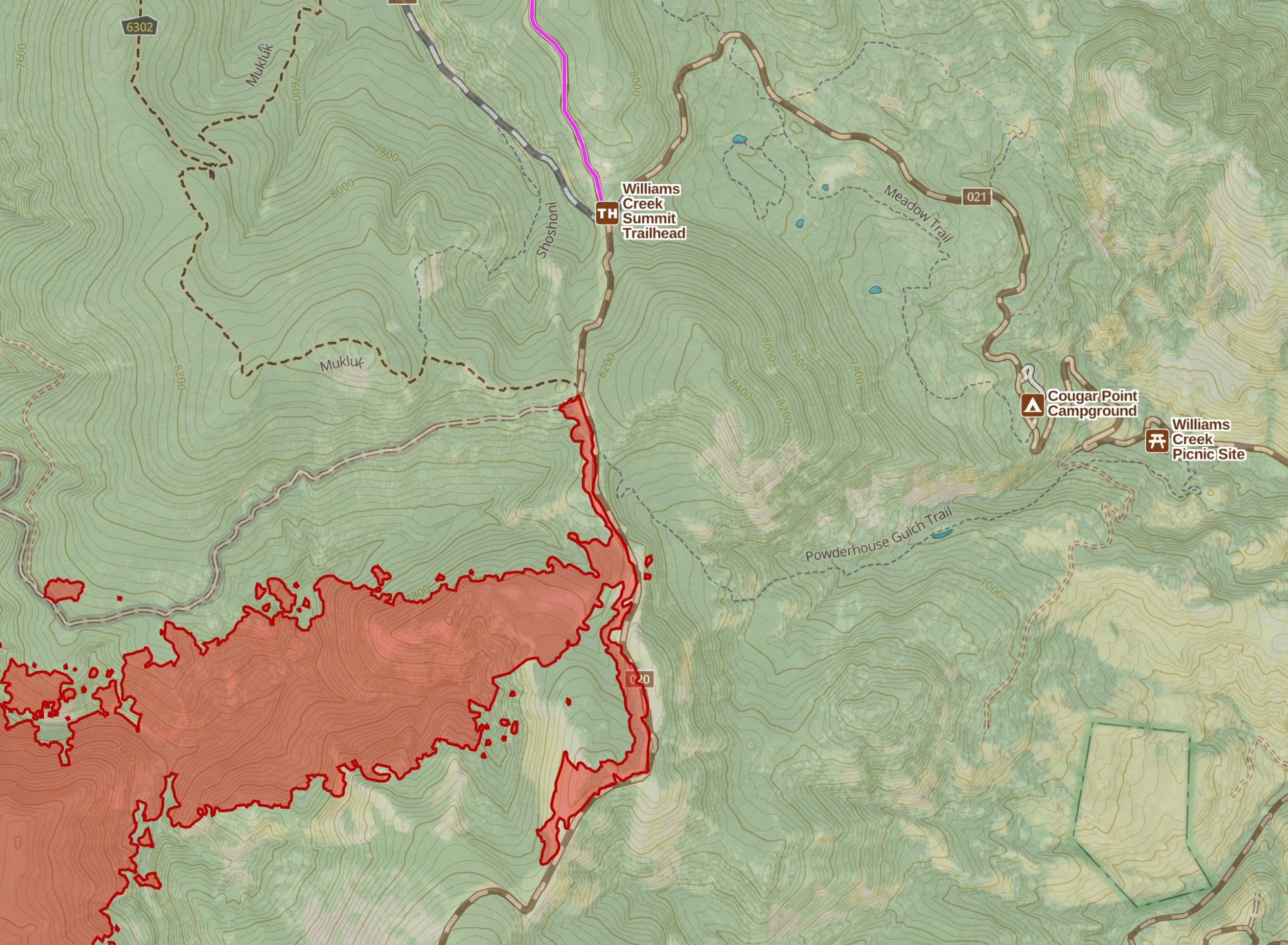
Crews on the Red Rock Fire completed a burnout operation along the Ridge Road. This *greatly* reduces the threat of the fire getting established across the Ridge Road which would result in evacuations for Williams Creek and Williams Lake residents. #IdahoFire#Idaho
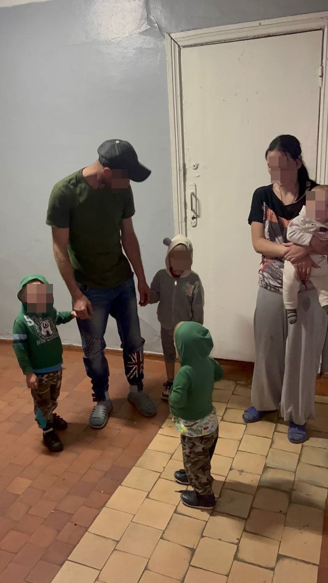
Thanks to you, we were recently able to evacuate an entire family again. Thank you so much for supporting us and helping make these moments possible. Your donation allows us to fund the evacuations we carry out. Donate & Support us here: helppeople.org.ua/en/help
📰 More than half of required armored vehicles available for medical evacuations – AFU Medical Command 🔗 https://www.ukrinform.net/rubric-ato/3915206-more-than-half-of-required-armored-vehicles-available-for-medical-evacuations-afu-medical-command.html#News#RussianInvasion#RussianWar
@France24_en: 🇺🇳 The report accused #Israel of deliberately killing, detaining and torturing #Palestinian medical staff and restricting permits for medical evacuations from #Gaza. It said these actions amount to war crimes and crimes against humanity. 🔗 Full story: https:
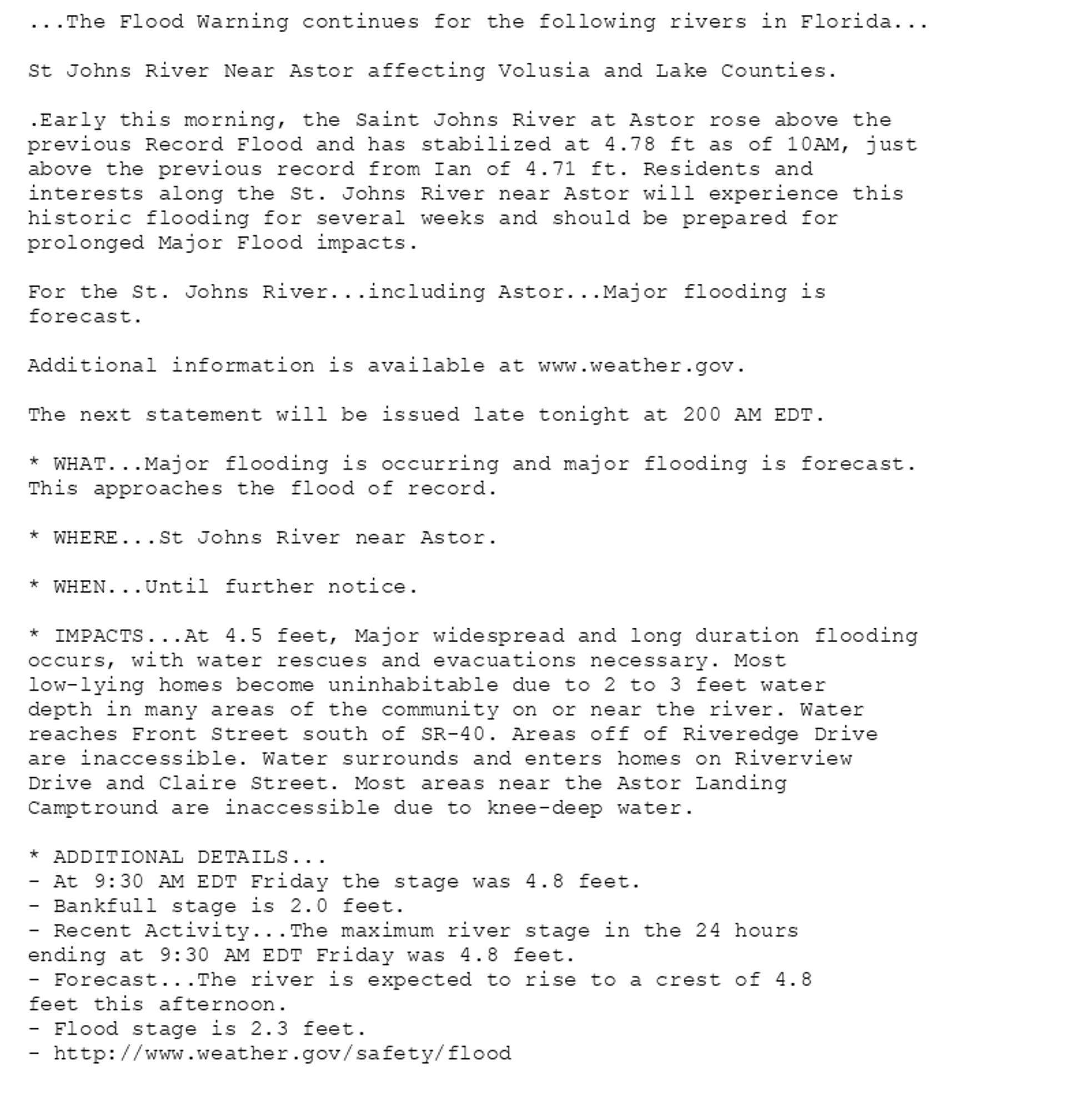
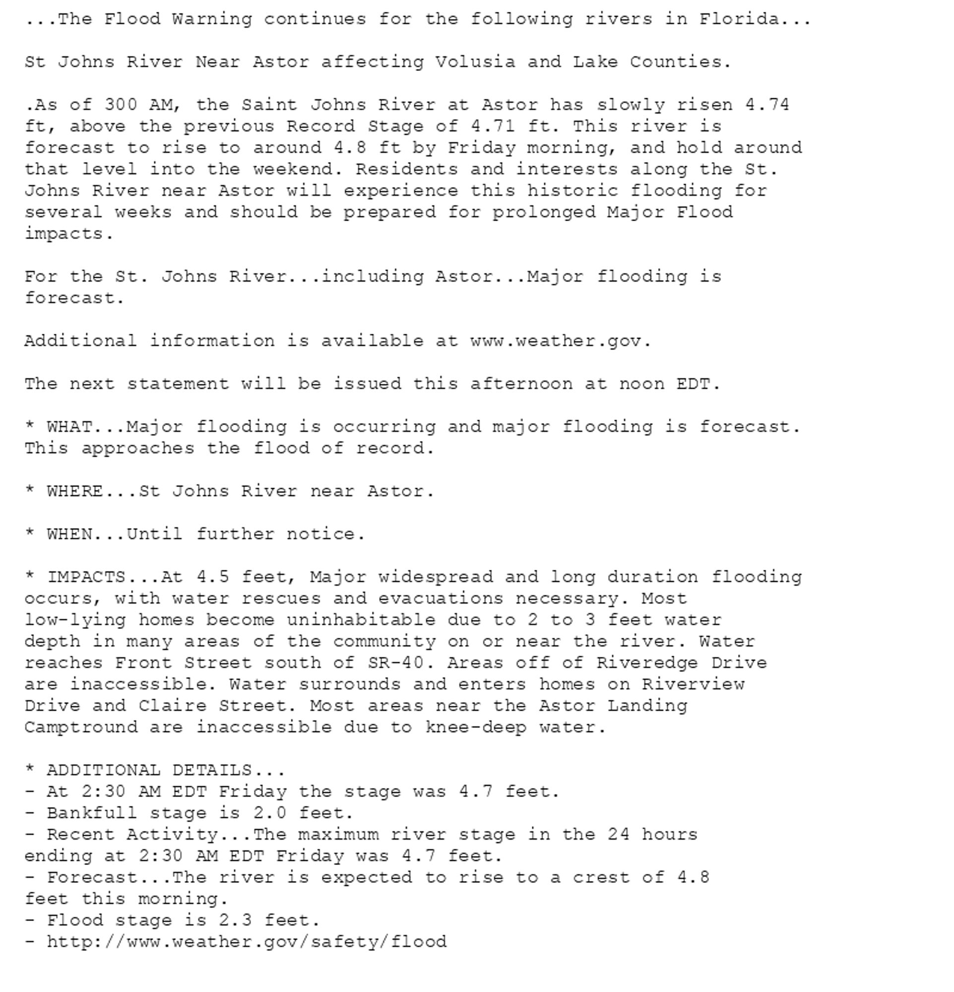
Our home was located in a Zone D, and only Zones A, B and C had mandatory evacuations. There were nasty floods just 5 miles away from our home.
🔴 Dépression Kirk : des évacuations dans le sud de l'Eure-et-Loir, un pic de crue attendu à 14 heures, des routes bloquées, le préfet à la rencontre des sinistrés www.lechorepublicain.fr/chartres-280...
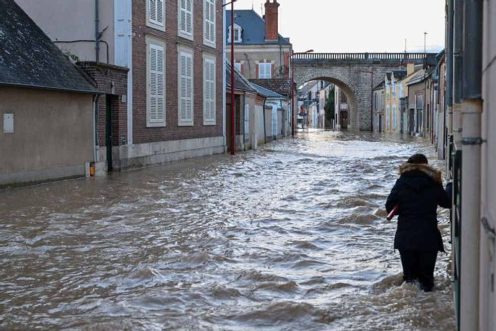
Le point sur le front des crues dans le sud de l'Eure-et-Loir, ce vendredi matin 11 octobre 2024.
Where are civilians in #Gaza#Israel#Palestine#IHL#intLawwww.ejiltalk.org/evacuations-...
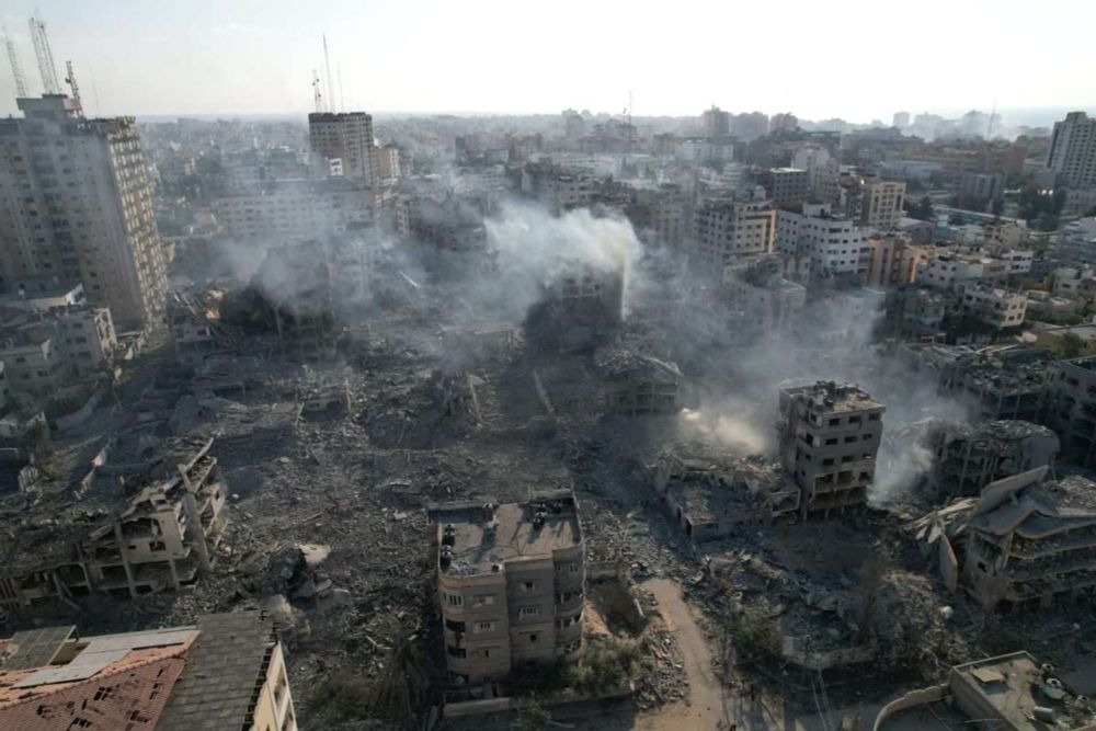
According to media reports, Israeli Prime Minister Benjamin Netanyahu is proposing to force Palestinian civilians out of northern Gaza and declare a ‘closed military zone’. Likud MP Avichai Boaron …