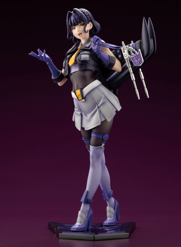
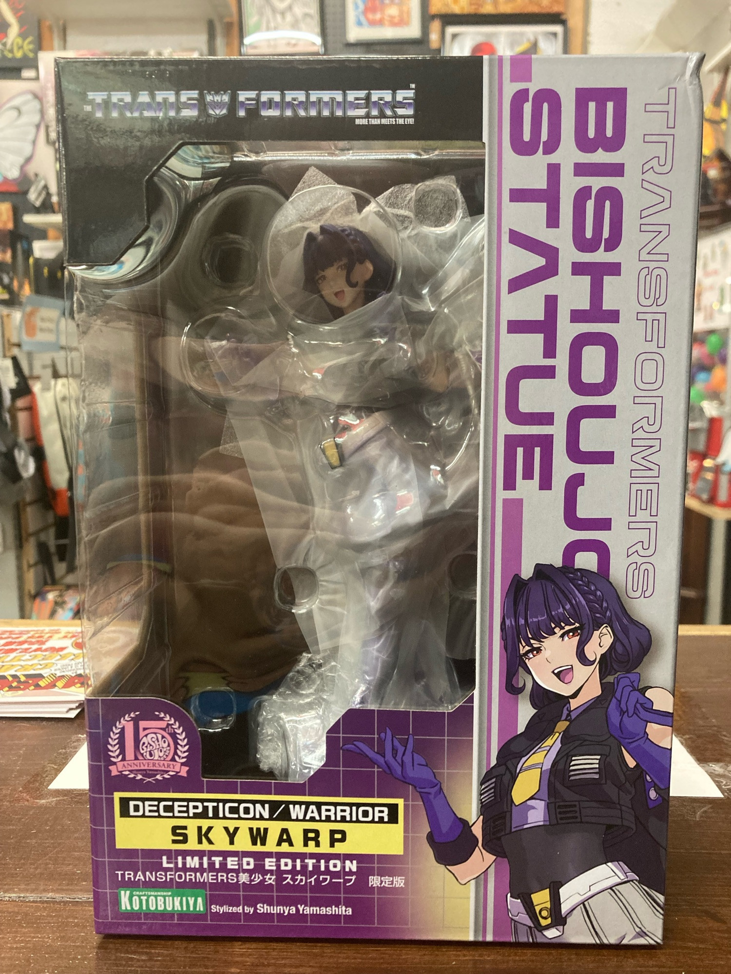
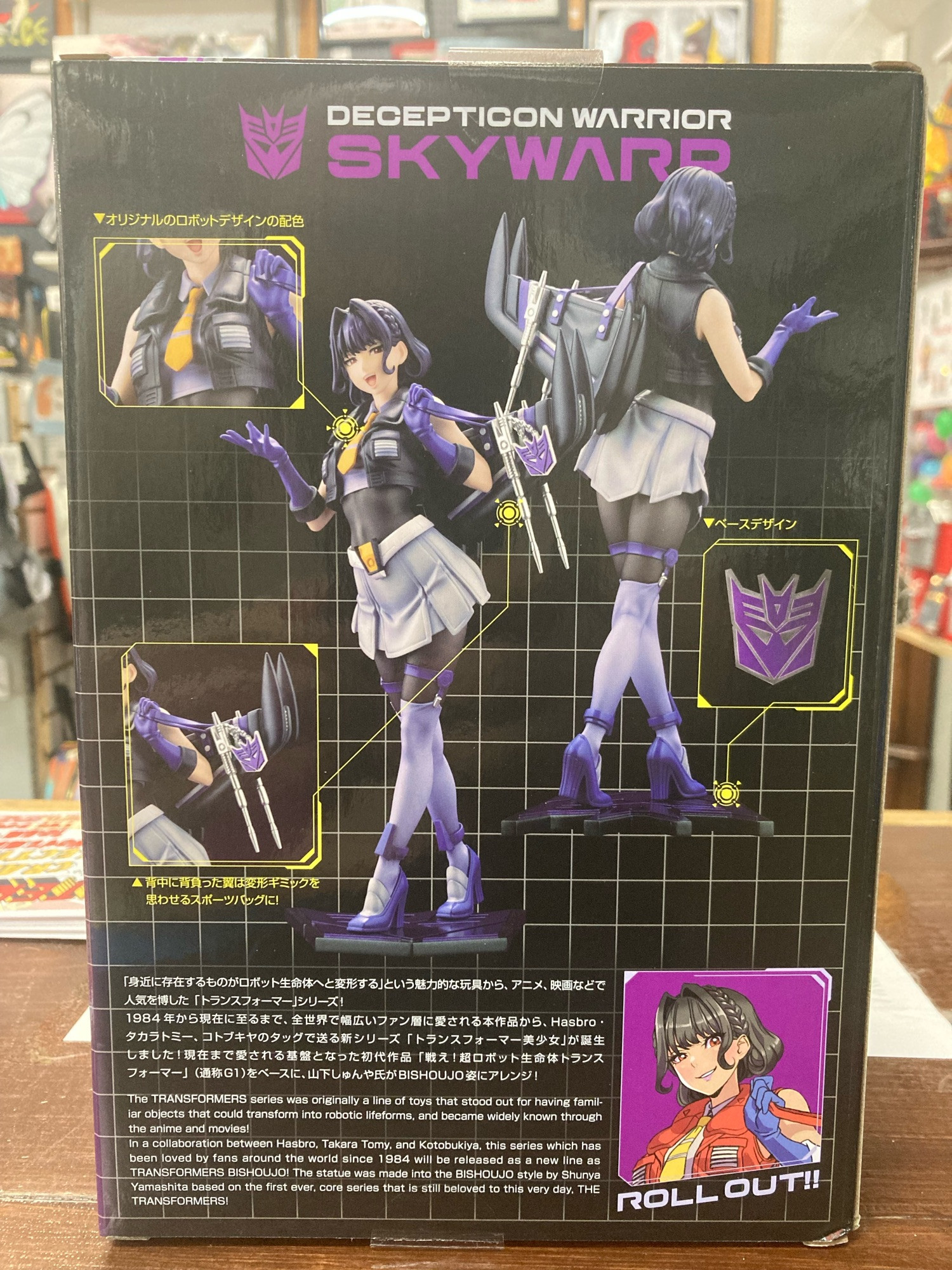
E&A Collectables has the Limited Edition Skywarp Statue from Bishoujo/Kotobukiya! We are a Collectable shop in Farmington Missouri that offers Comics, Manga, Funko, and so much more!
Indie wrestling in the greater St. Louis area tonight: Dynamo Pro Wrestling in Farmington MO, SICW in East St. Louis IL, and New Genesis Wrestling in Highland IL!
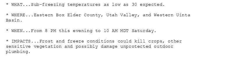
🚨 Freeze Warning issued October 18 at 2:13PM MDT until October 19 at 10:00AM MDT by NWS Salt Lake City UT 🚨 Additional Details Here.(1/2)
Special Weather Statement issued October 18 at 2:13PM MDT by NWS Albuquerque NM Additional Details Here.
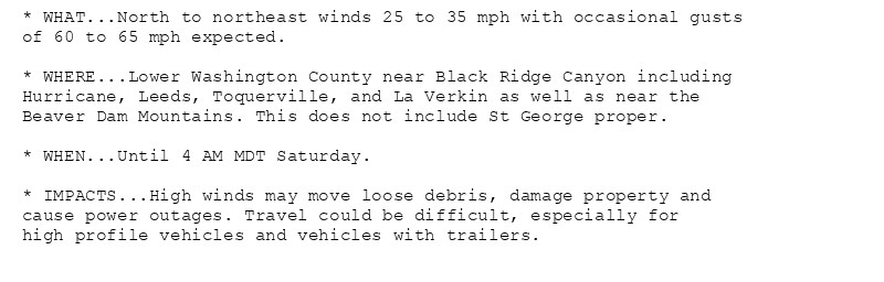
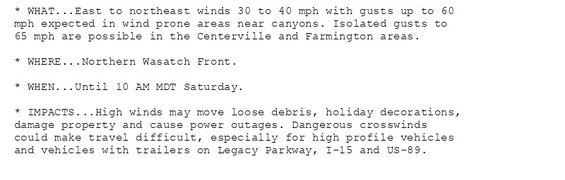
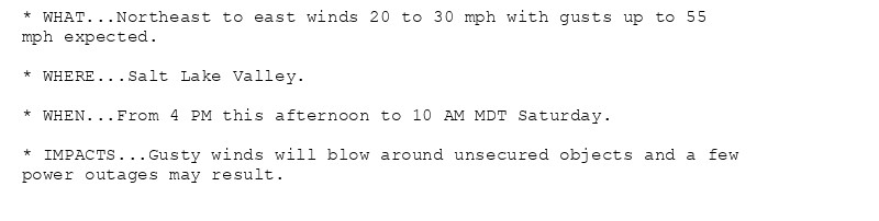
NEW WEATHER ADVISORY: High Wind Warning * WHAT...East to northeast winds 30 to 40 mph with gusts up to 60 mph expected in wind prone areas near canyons. Isolated gusts to 65 mph are possible in the Centerville and Farmington areas. * WHERE...Northern... See more: watchedsky.social/app/alerts/...
🚨 Freeze Warning issued October 18 at 9:10AM MDT until October 19 at 10:00AM MDT by NWS Salt Lake City UT 🚨 Additional Details Here.(1/2)
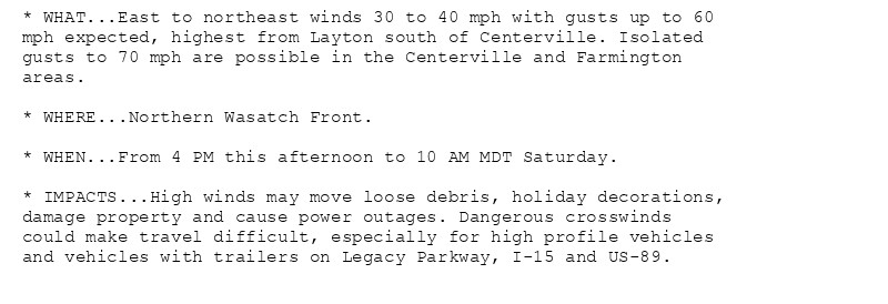
NEW WEATHER ADVISORY: High Wind Warning * WHAT...East to northeast winds 30 to 40 mph with gusts up to 60 mph expected, highest from Layton south of Centerville. Isolated gusts to 70 mph are possible in the Centerville and Farmington areas. *... See more: watchedsky.social/app/alerts/...
really miss the fresh air of Maine, used to live in Farmington years back. thank you for the memories :)
🚨 Freeze Warning issued October 18 at 1:58AM MDT until October 19 at 10:00AM MDT by NWS Salt Lake City UT 🚨 Additional Details Here. (1/2)