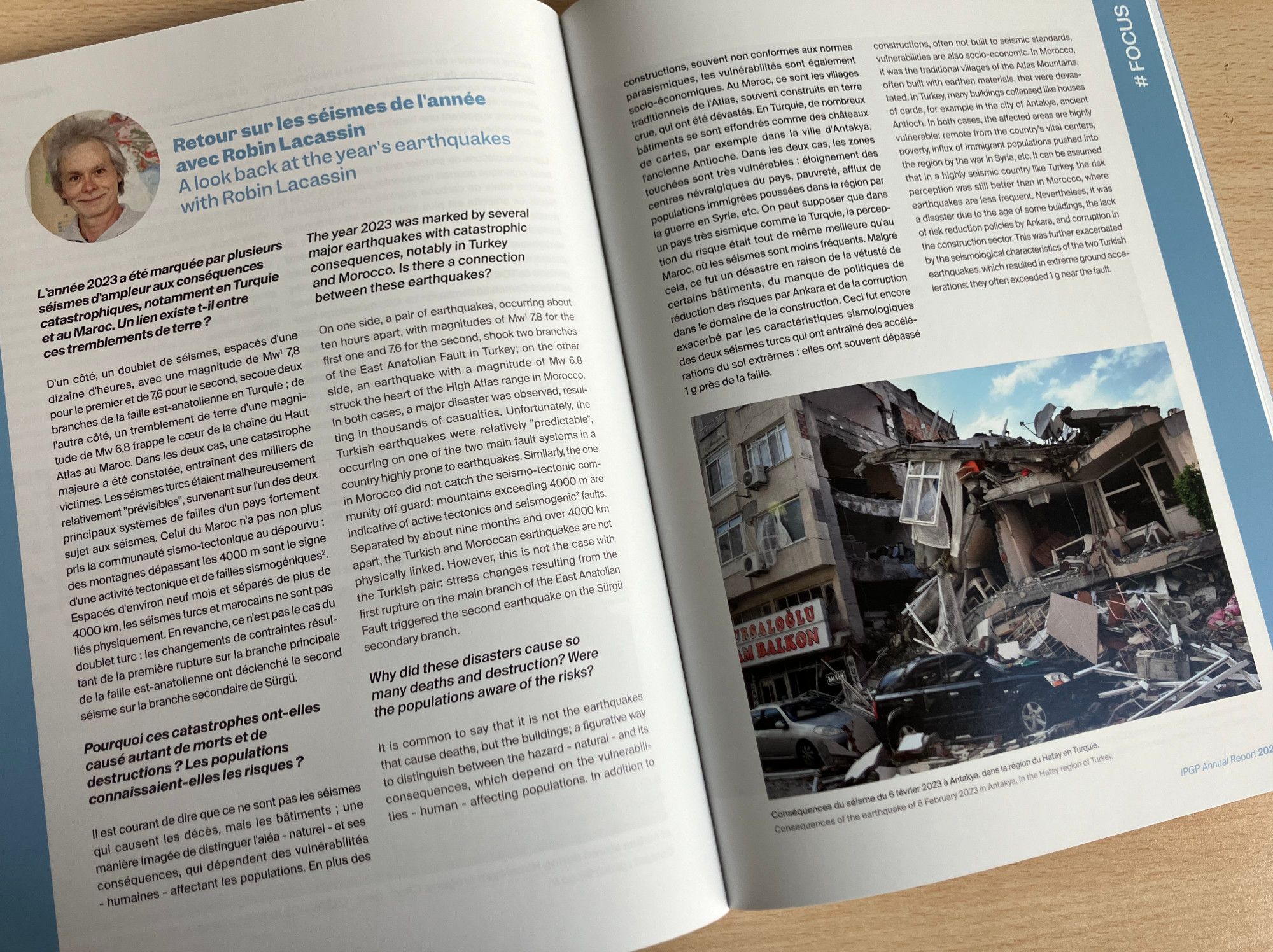
🆕 the IPGP annual report for 2023 is here ! Read it in French and English: www.ipgp.fr/wp-content/u... On pages 82 to 85, I briefly look back on several earthquakes in 2023: Morocco (Mw 6.8), Turkey (Mw 7.8 and 7.6), Western France (Mw 4.8). ⚒️
Will miss MoLA this spring, but hope to see you all at INSAR!
Save the Date! The next MoLA will be held March 12-14th, 2026 in Atlanta, GA. To encourage MoLA representation at INSAR this spring, we're hosting an abstract workshop. Tues, 10/8 at 12pm ET. Registration: duke.qualtrics.com/jfe/form/SV_...molautism.org/listserv/
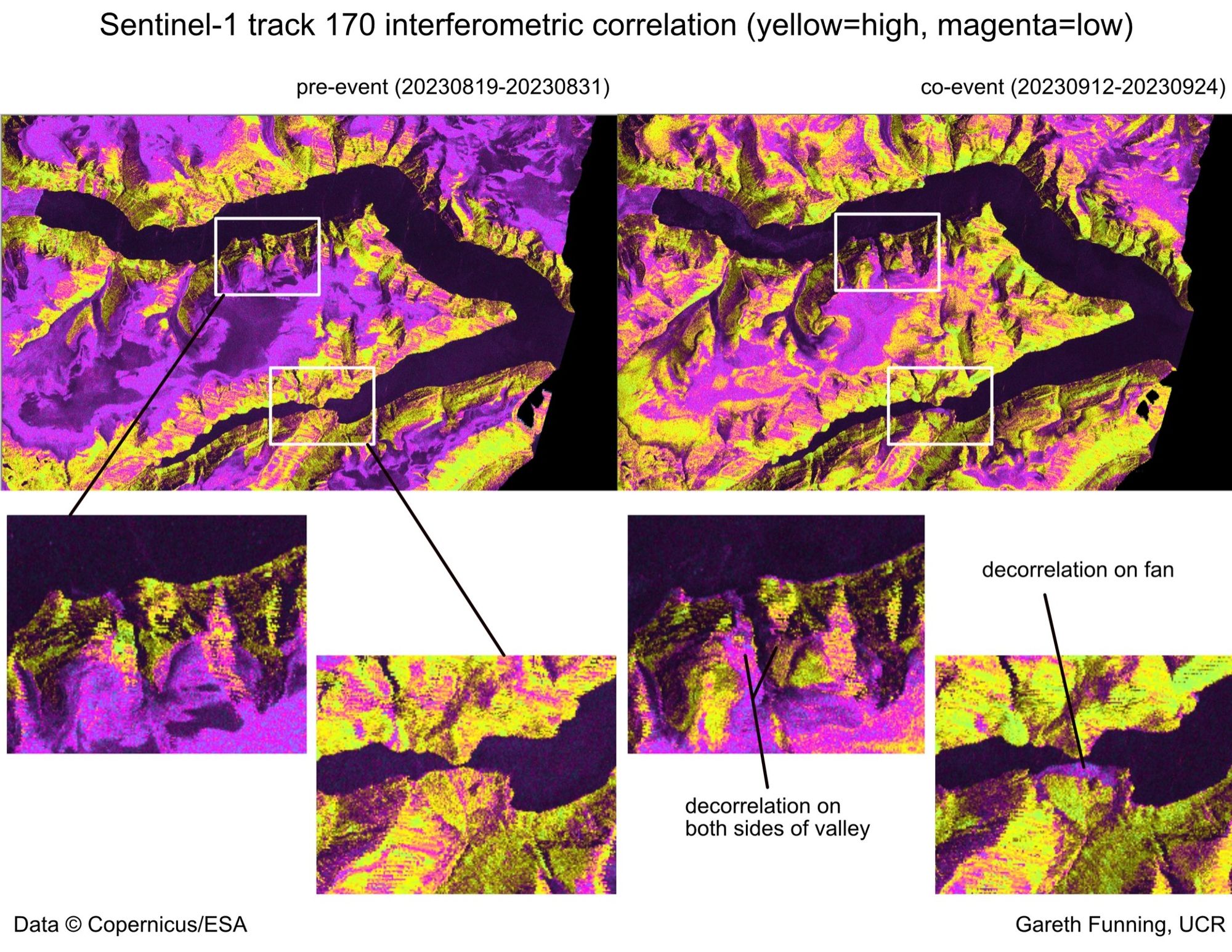
(For my part, I processed InSAR data over Dickson Fjord and was able to independently detect decorrelation consistent with the expected tsunami run-up around the edges of the fjord. I did not find any obvious pre-event signal on the rocky peak, but it certainly did decorrelate after it fell.)
Abstract submissions for presentation at the #INSAR2025insar.confex.com/insar/2025/c...
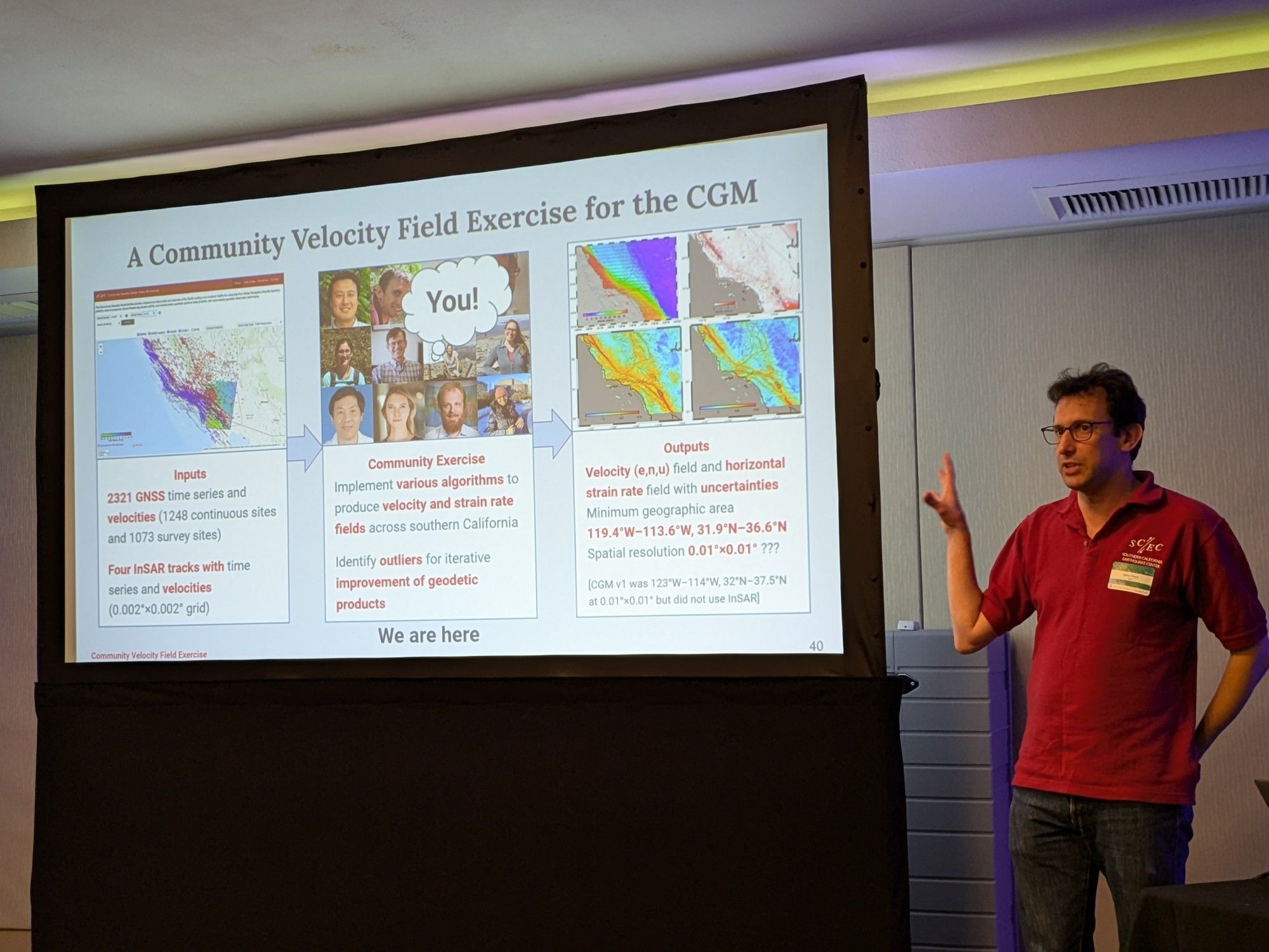
Mike Floyd again: We would like to engage the community (anyone who is interested!) in a velocity field exercise. We supply the CGM InSAR and GNSS data, and participants would produce a combined east/north/up velocity dataset on the same grid. We can then compare strategies and results!
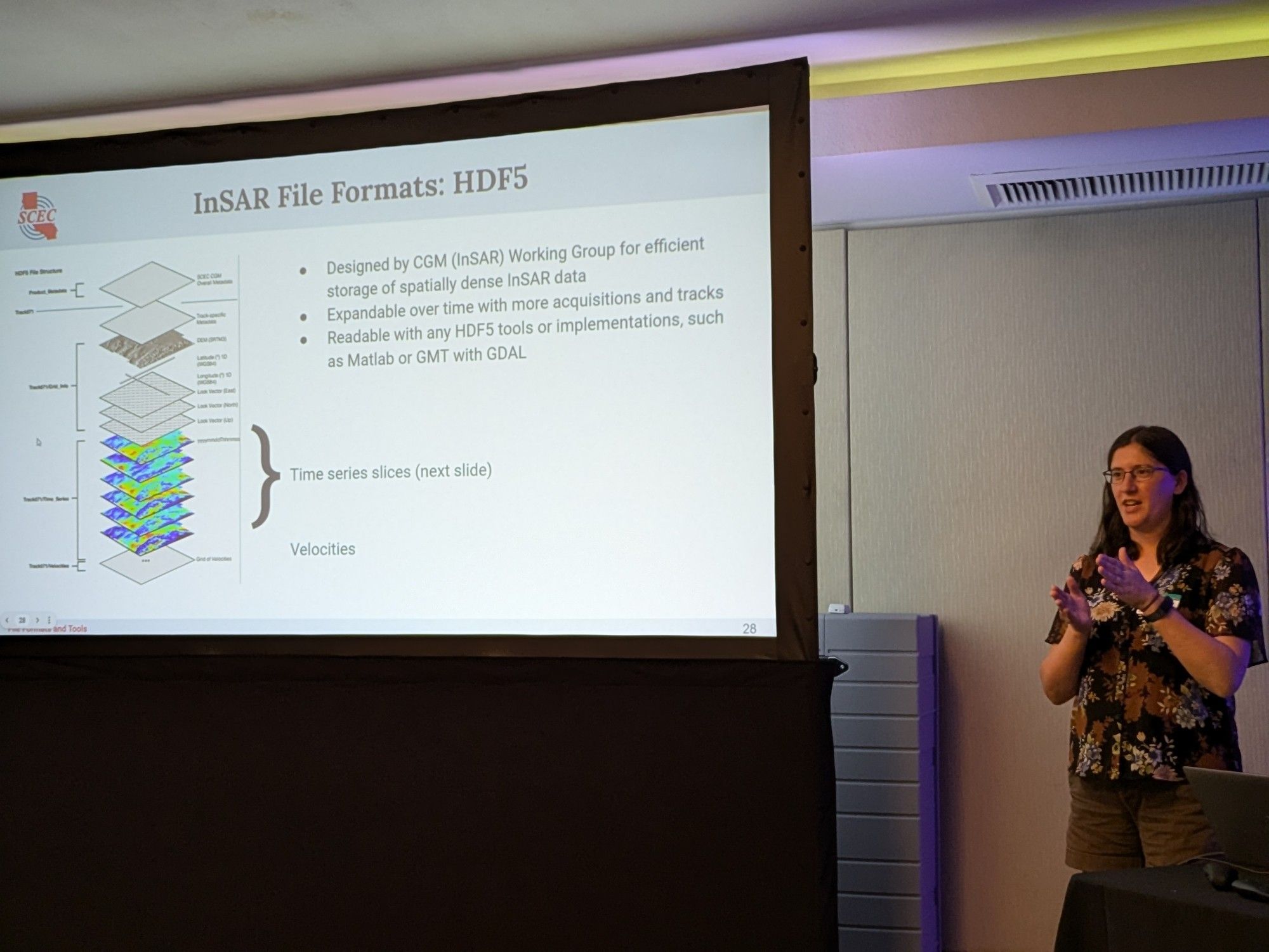
Now, Kathryn Materna is showing the HDF5 format that the CGM InSAR data are supplied in, and the tools she has developed to read those files (which are part of the back end of the web viewer). Extremely important to supply tools along with the data!
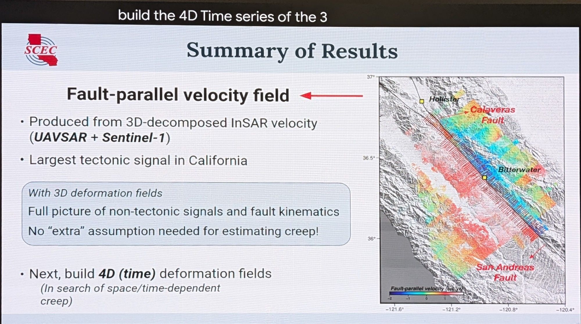
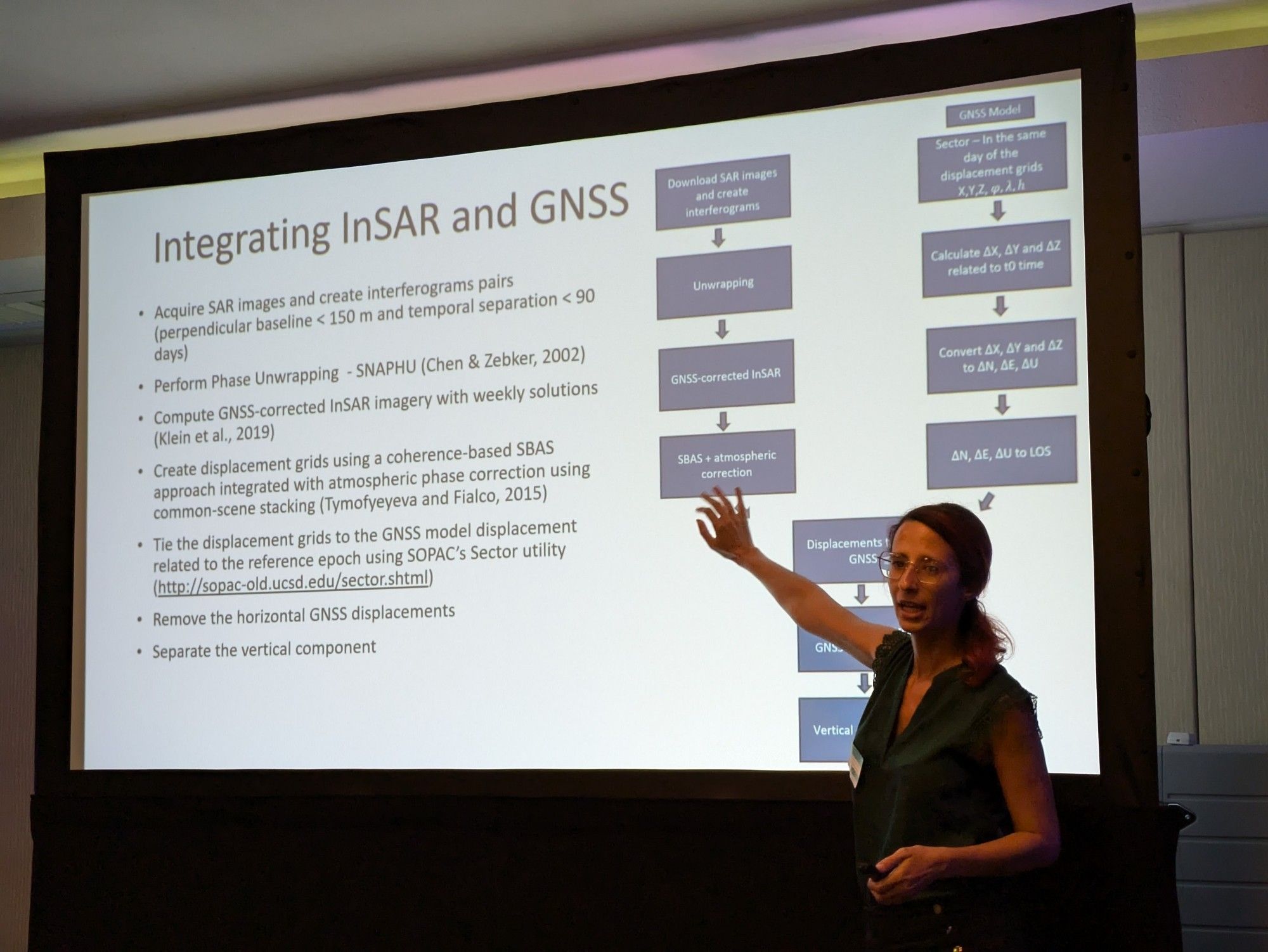
Lavoisiane Ferreira: The Scripps approach for InSAR-GNSS combination uses a dynamic datum model (integrating secular rates and transients, fitting a parametric model at each GNSS station), to generate predicted horizontal motions, and then removing them from the InSAR, leaving just the verticals.
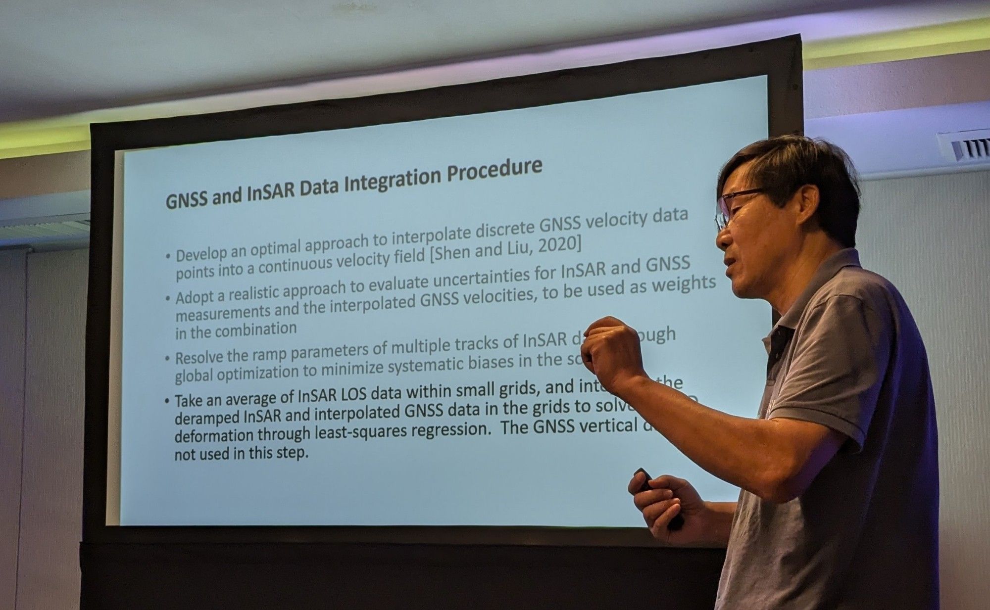
Zheng-Kang Shen: To combine InSAR and GNSS velocities requires interpolating GNSS (using distance weighting and not crossing creeping faults), estimating uncertainties for both datasets and ramps in the InSAR, and then aligning InSAR with the horizontal GNSS.