BLUE

In Central Kentucky, showery weather, with a few storms possible, can be expected through tomorrow. Storm chances will continue into next week with rising temperatures. #lmkwx#kywx

0

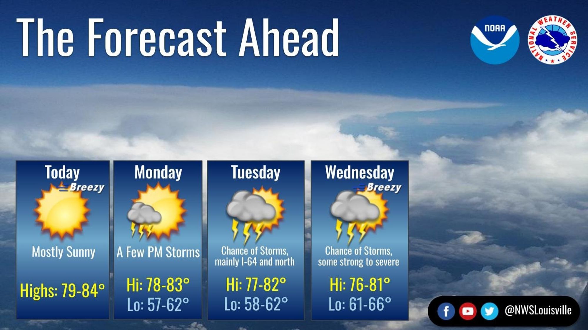
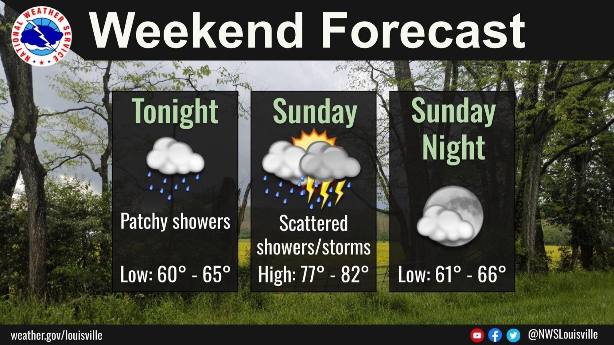
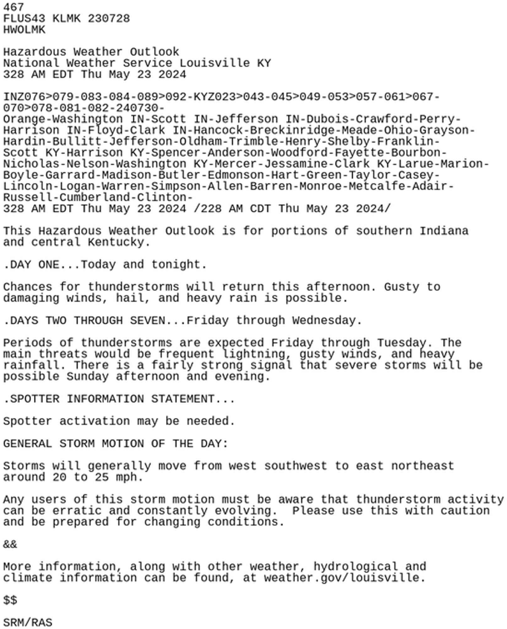
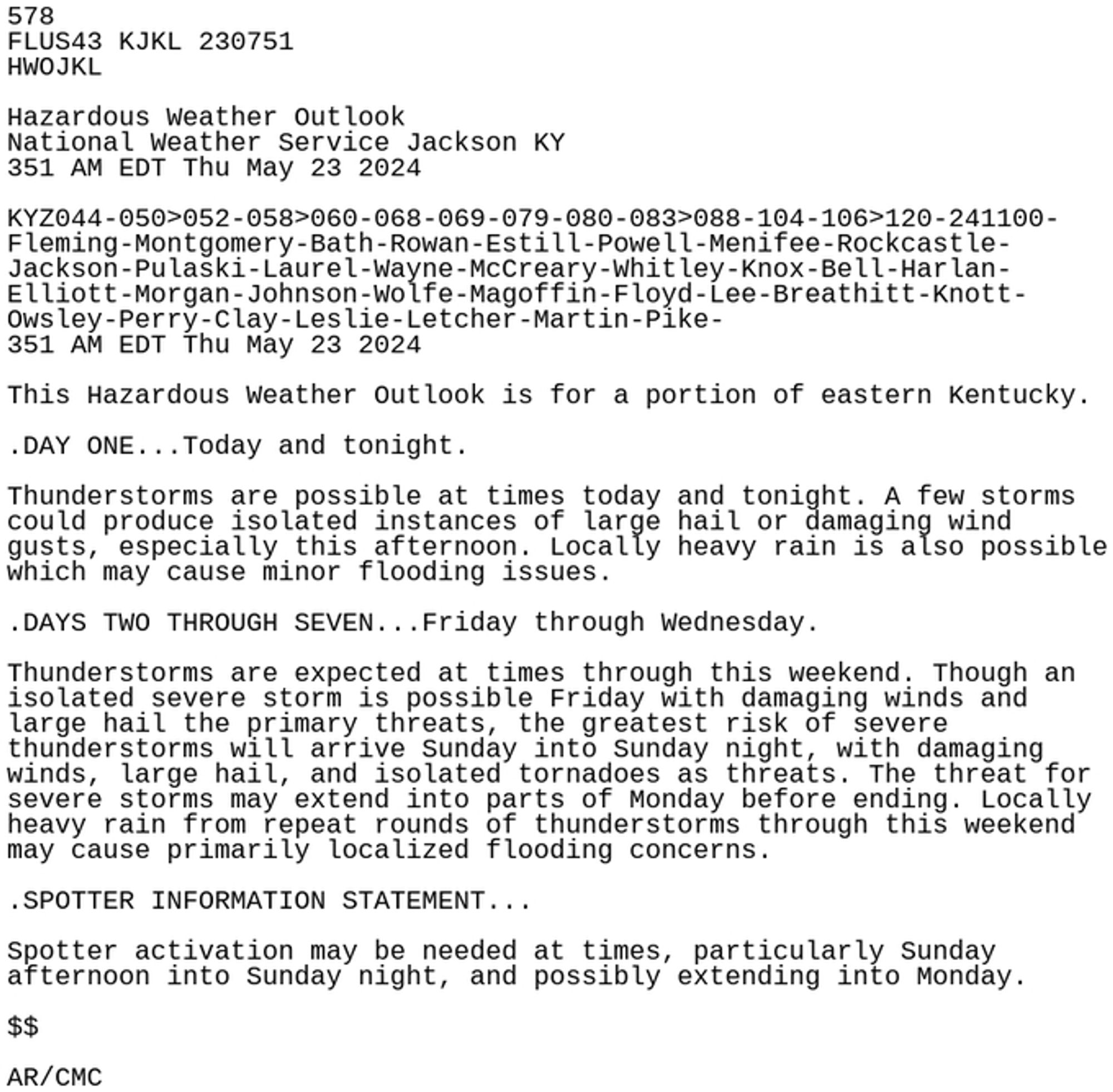
Here are the 23 May 2024 morning Hazardous Weather Outlook statements for Central and Eastern Kentucky. #kywx#ekywx#lmkwx#jklwx#BePrepared#StayWeatherAware

0

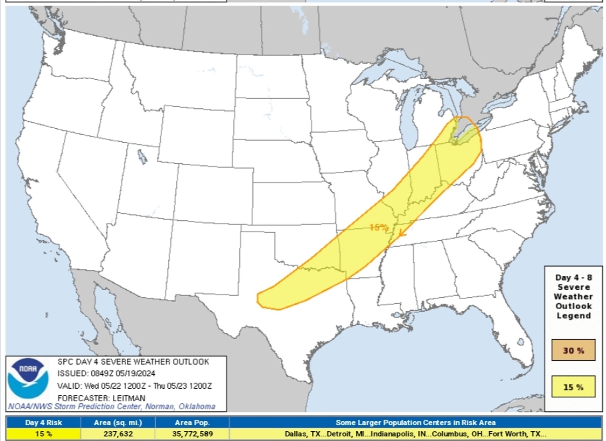
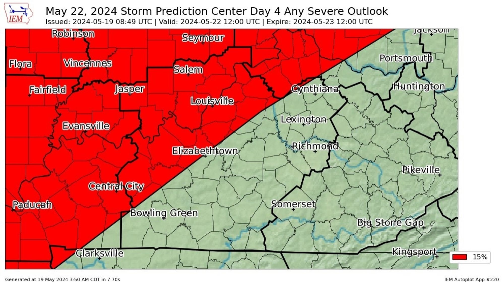
The NWS Storm Prediction Center (SPC) issues Day 4 15% Any Severe Convective Risk at May 19, 8:49 UTC for Central Kentucky www.spc.noaa.gov/products/exp...#kywx#lmkwx

0

In Central Kentucky and Southern Indiana, it will be mostly dry and mild this weekend! #lmkwx#kywx#inwx

0

Watch out for patches of fog early this morning in Central Kentucky, some which are locally dense. If encountering fog, leave plenty of room between you and other vehicles, and use your low beam headlights. #lmkwx#kywx#inwx

0

In Central Kentucky, watch out for patches of fog early this morning, some which are locally dense. If encountering fog, leave plenty of room between you and other vehicles, and use your low beam headlights. #lmkwx#kywx#inwx

0

Highlights this week in Central Kentucky include the possibility of frost tonight, scattered showers Tuesday afternoon and night, and scattered thunderstorms possible Friday and Saturday. #lmkwx#kywx#inwx

0

Isolated severe storms remain possible this afternoon in Central Kentucky but confidence is low. However, any storms that do occur could become strong to severe. There's medium confidence of another strong to severe storm threat taking place on Thursday evening and night. #lmkwx#kywx#inwx

0

Enjoy the nice but breezy weather for Central Kentucky and Southern Indiana today, because rain chances, though slight, return on Monday and then increase steadily Tuesday into Wednesday. We could see strong to severe storms late Tuesday night through Wednesday. #lmkwx#kywx#inwx

0