TORNADO WATCH 315 IS IN EFFECT UNTIL 4 PM EDT / 3 PM CDT THIS AFTERNOON 26 May 2024 for all of Central Kentucky and parts of Eastern Kentucky, including most of the Cumberland River Valley basin (Harlan County not included at this time). #hamradio#GetPrepared#StayWeatherAware#kywx#ekywx#tnwx
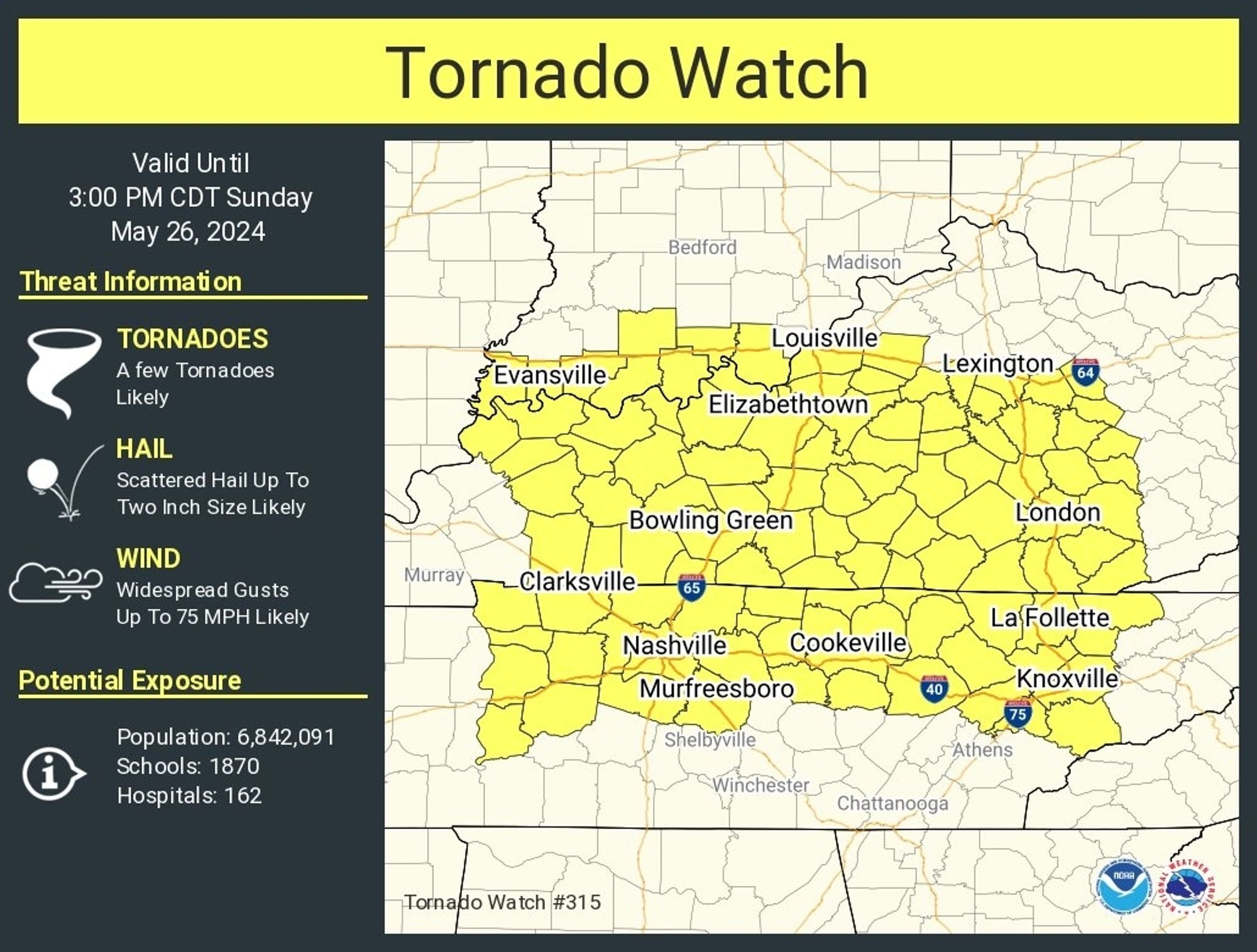
Storms tonight could produce widespread damaging winds and flash flooding. In addition, tornadoes and large hail cannot be ruled out either. #BePrepared#StayWeatherAware#TurnaroundDontdrown#kywx (2/2)
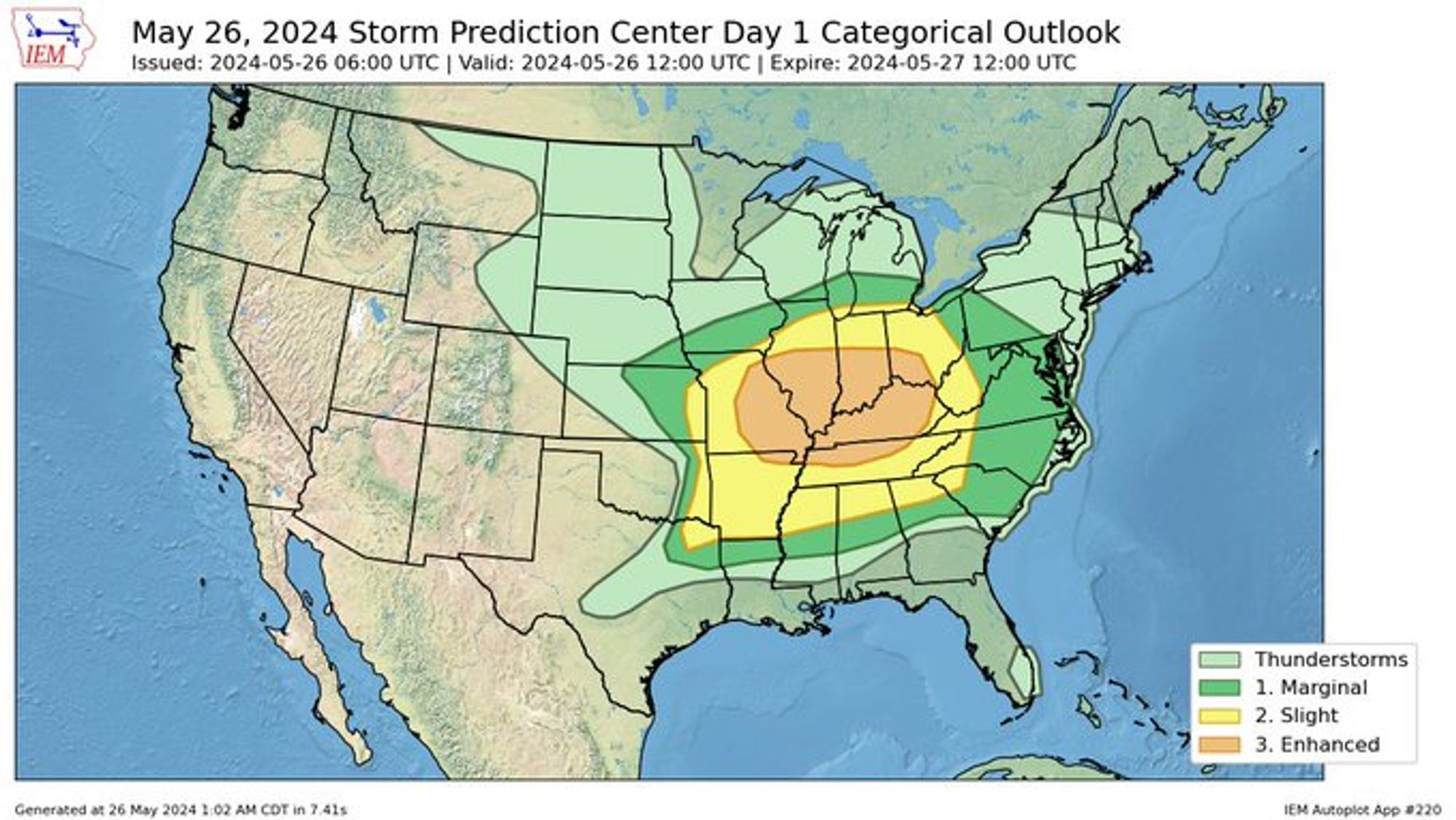
The Storm Prediction Center issued the Day 1 Convective Outlook at 6:00 UTC or 2:00 AM EDT for Sunday, 26 May 2024. An Enhanced Risk for all severe weather hazards is in play for KY, OH, IN, IL, MO, AR, and TN. #BePrepared#StayWeatherAware#kywx#ohwx#inwx#ilwx#mowx#arwx#tnwx
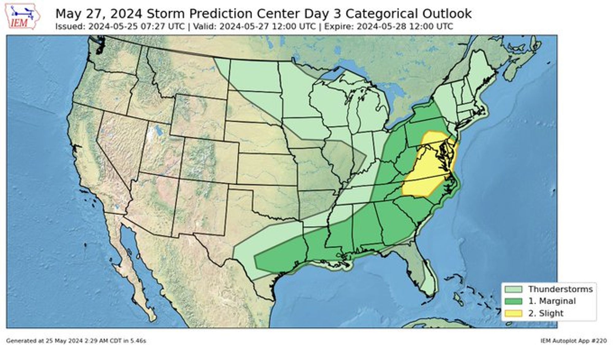
By Memorial Day Monday, the severe weather threat shifts east to the Atlantic and Gulf coastal regions of the US, with slight risks (2/5) in NJ, PA, MD, DC, VA, and NC and marginal risks (1/5) in NY, PA, NJ, OH, WV, KY, TN, VA, NC, SC, GA, FL, AL, MS, LA, and TX. #BePrepared#StayWeatherAware#usawx
Storms in western KY and TN are lifting northeast with a warm front. Storms will be possible here from late afternoon into the evening hours; some could be strong to severe. #kywx#ekywx#BePrepared#StayWeatherAwarex.com/i/status/179...
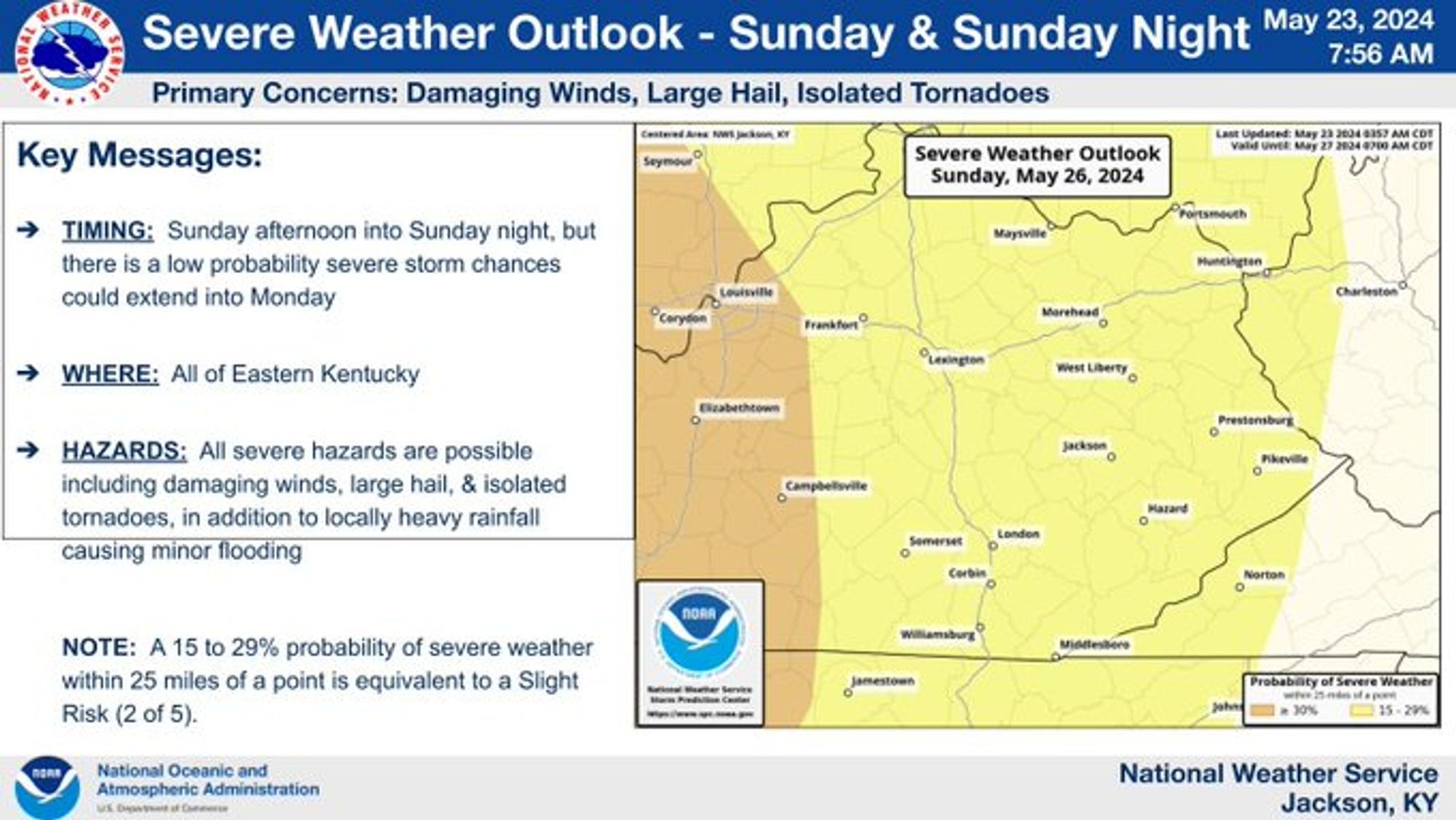
A possibly significant severe weather event is expected in western and central Kentucky on Sunday. This system may move into East Kentucky later Sunday afternoon into Sunday night and there is a low probability that severe storm chances will linger into Monday. #ekywx#BePrepared#StayWeatherAware
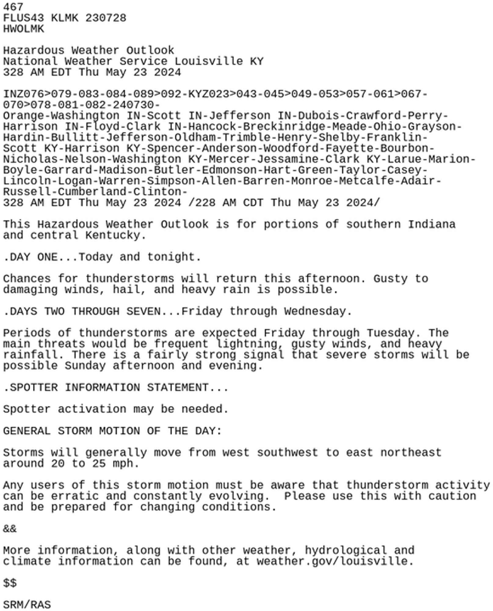
Here are the 23 May 2024 morning Hazardous Weather Outlook statements for Central and Eastern Kentucky. #kywx#ekywx#lmkwx#jklwx#BePrepared#StayWeatherAware
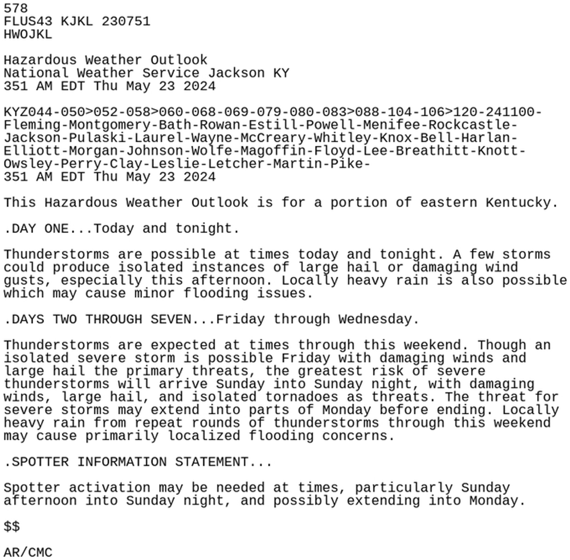
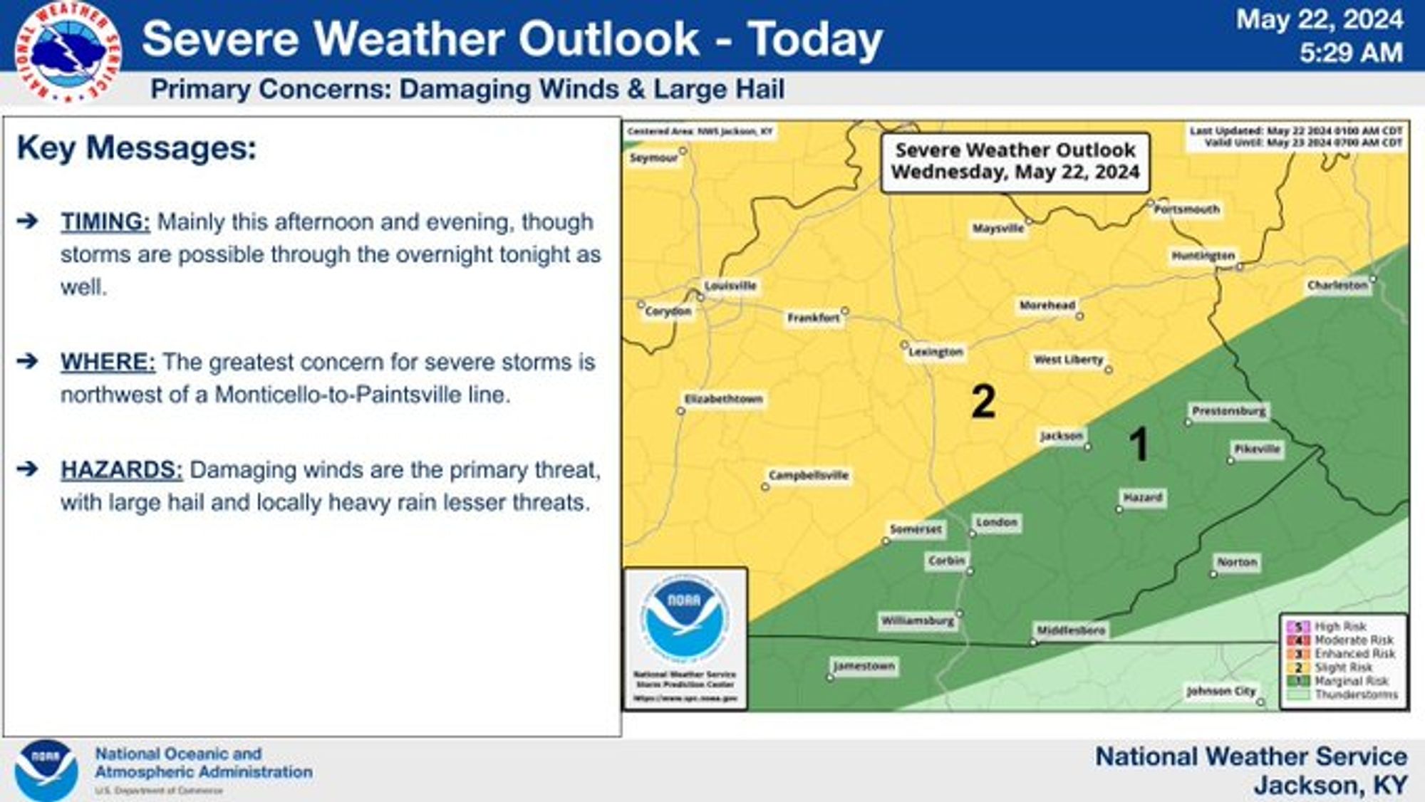
Isolated to scattered severe thunderstorms are possible today in Eastern Kentucky, mainly this afternoon and evening. Storms may persist into the early morning hours on Thursday. Damaging winds are the primary threat, with large hail a lesser threat. #kywx#ekywx#BePrepared#StayWeatherAware
Strong Midweek Storm System. Briefing from the Jackson KY NWS Office can be found at www.weather.gov/media/jkl/Ds...#BePrepared#StayWeatherAware#ekywx#kywx
The Jackson (KY) NWS will be hosting 2 Weather Preparedness Events in May - come join them!!! It's free and lasts ~1 hour!! www.weather.gov/jkl/WxPrepCl...#BePrepared#StayWeatherAware#ekywx#kywx