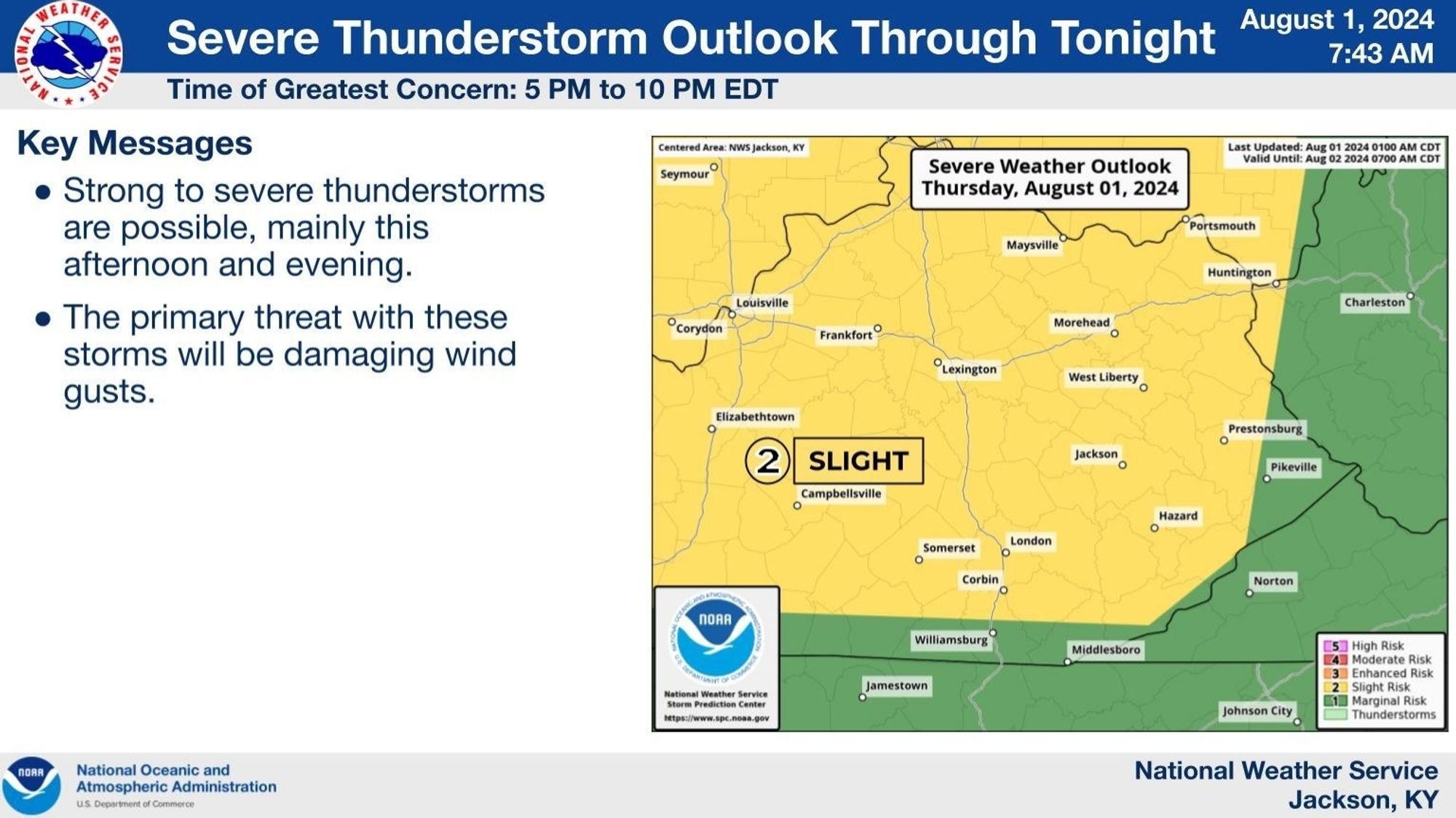
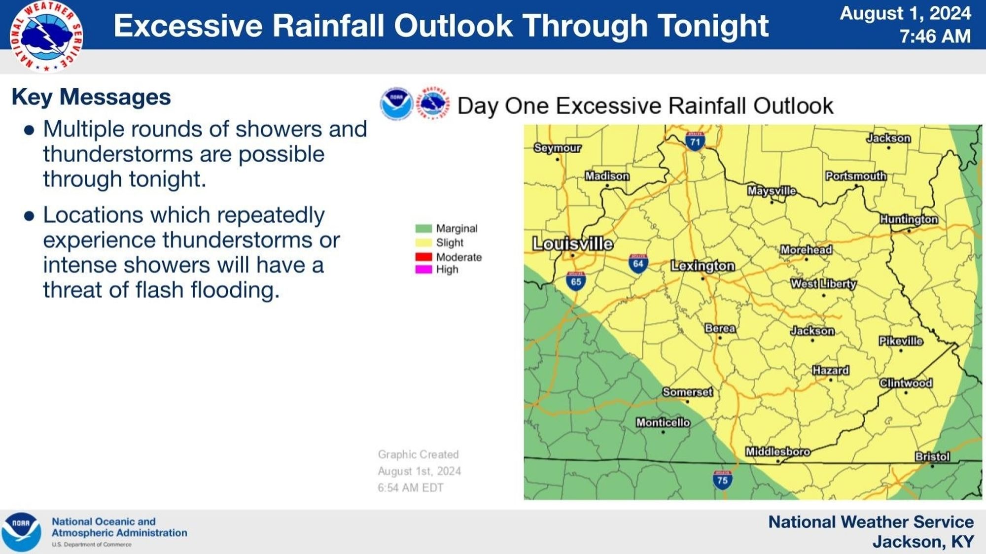
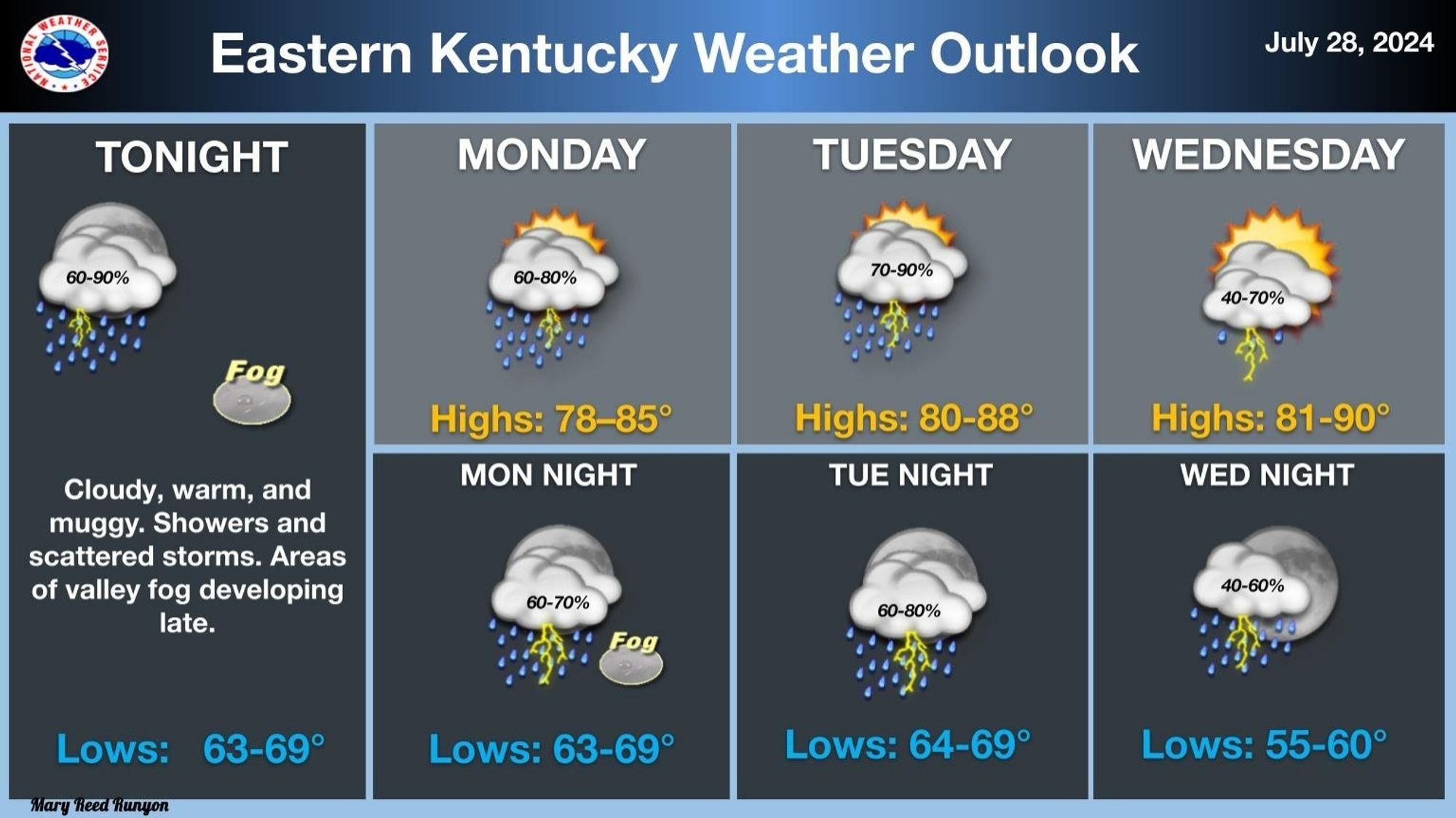
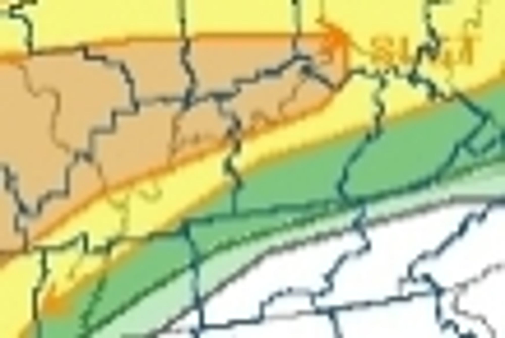
There is a slight risk of severe thunderstorms over most of eastern Kentucky late today into tonight and most of eastern Kentucky has a slight risk of excessive rainfall leading to flash flooding today and tonight. A Flood Watch is in effect. #kywx#ekywx#BeWeatherAware#TurnAroundDontDrown
Warm and muggy conditions, along with repeated rounds of showers and storms, will plague eastern Kentucky through mid-week, as a series of disturbances aloft move through the area. Rain could be locally heavy at times, with isolated instances of flooding possible. #kywx#ekywx#turnarounddontdrown
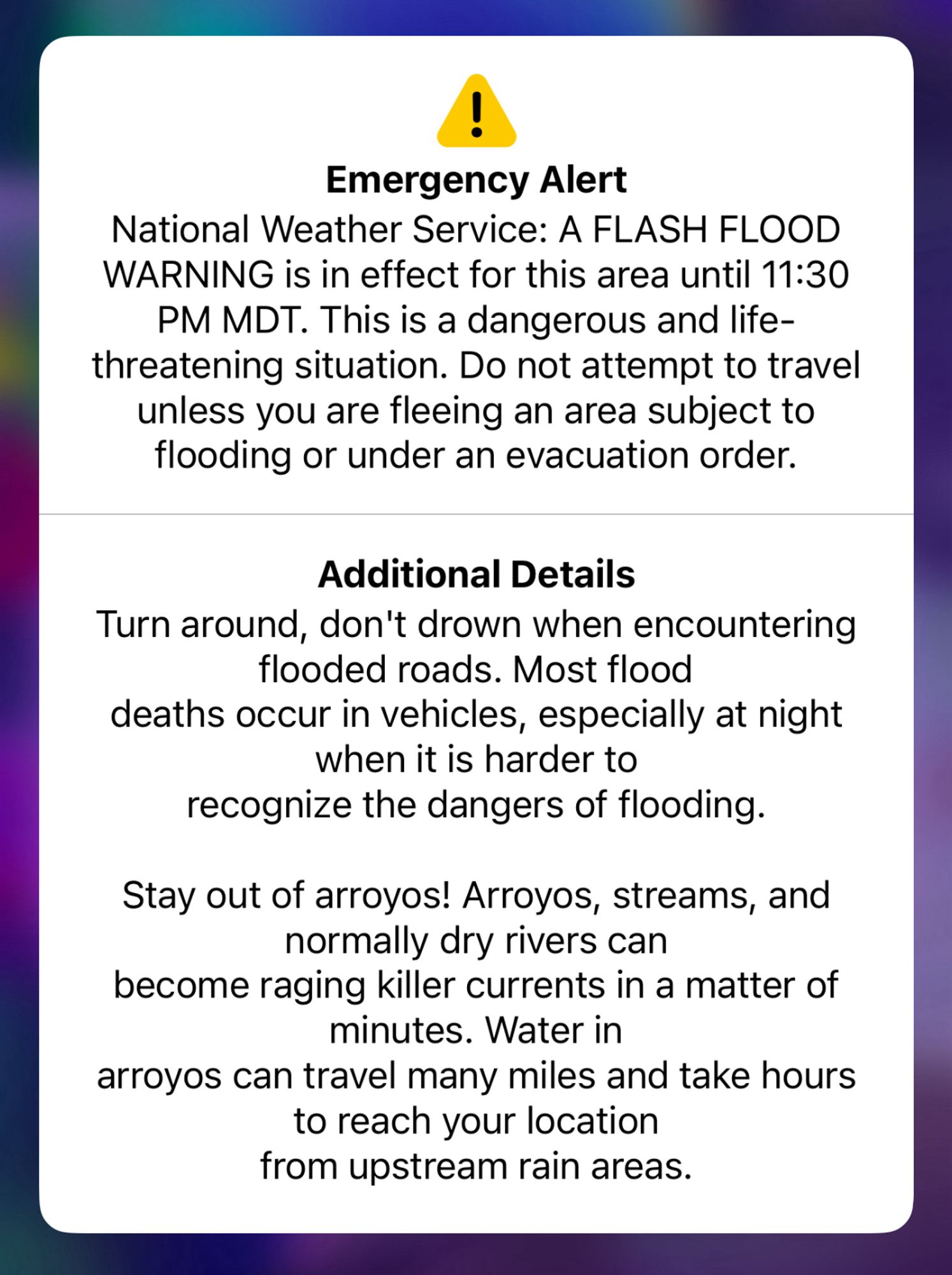
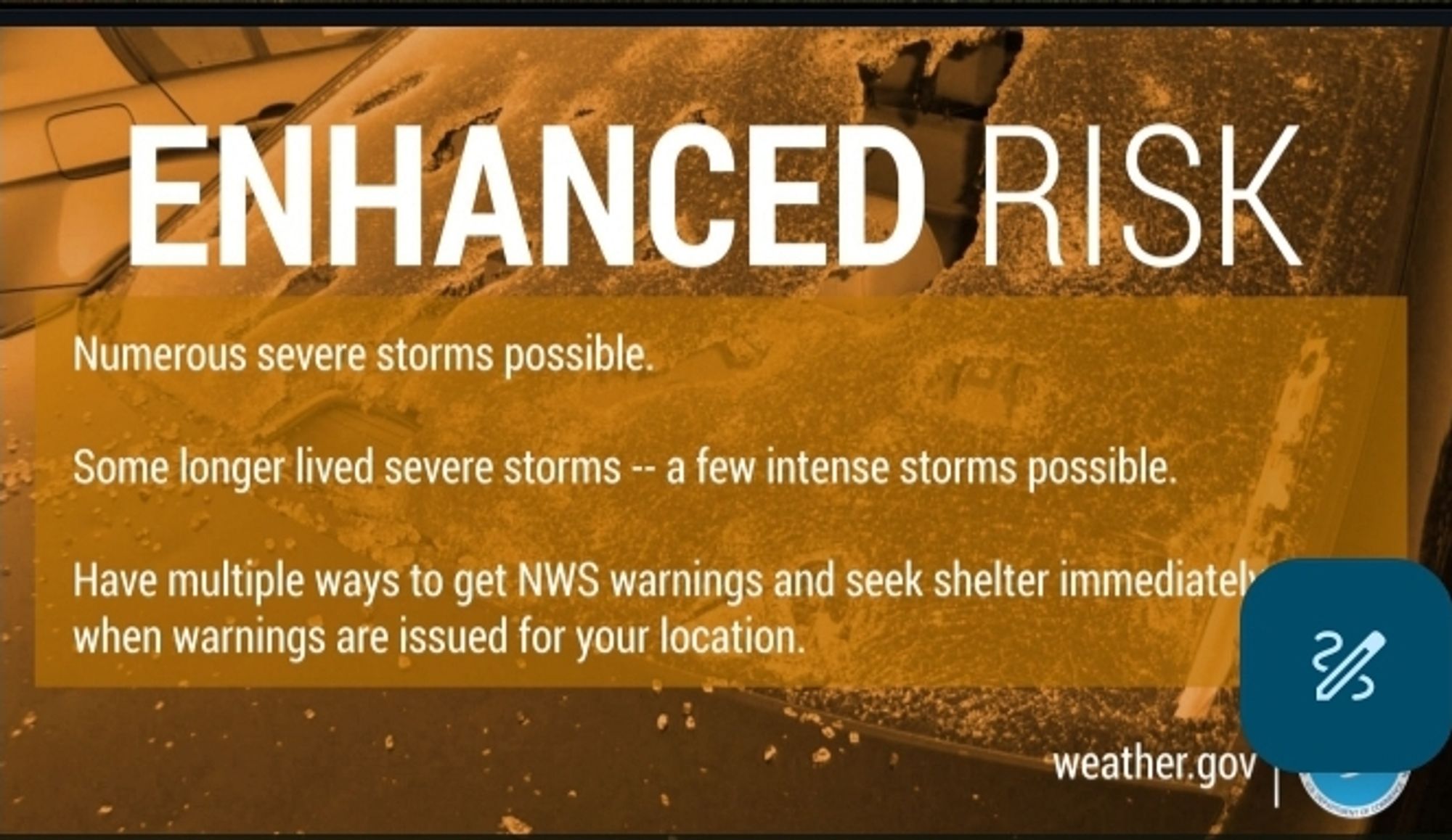
Storms tonight could produce widespread damaging winds and flash flooding. In addition, tornadoes and large hail cannot be ruled out either. #BePrepared#StayWeatherAware#TurnaroundDontdrown#kywx (2/2)
Even with the threat for #Tornadoes#CentralOhio#Flooding#TurnAroundDontDrown#10TV#Doppler10#OHwx#Ohiowww.10tv.com/article/weat...
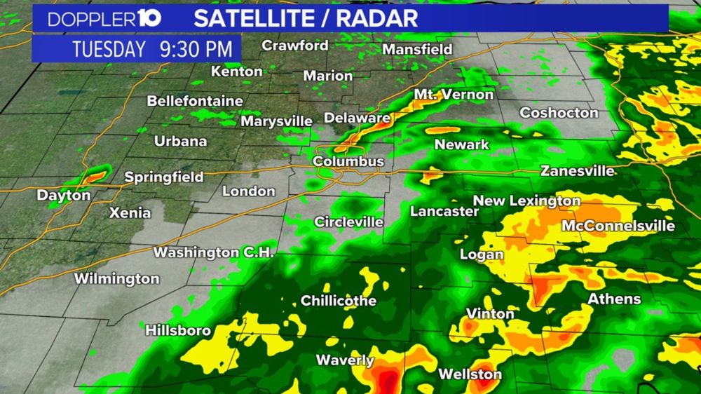
Areas of central Ohio could see strong winds, large hail, tornadoes and flash flooding as severe storms move through the area Tuesday.

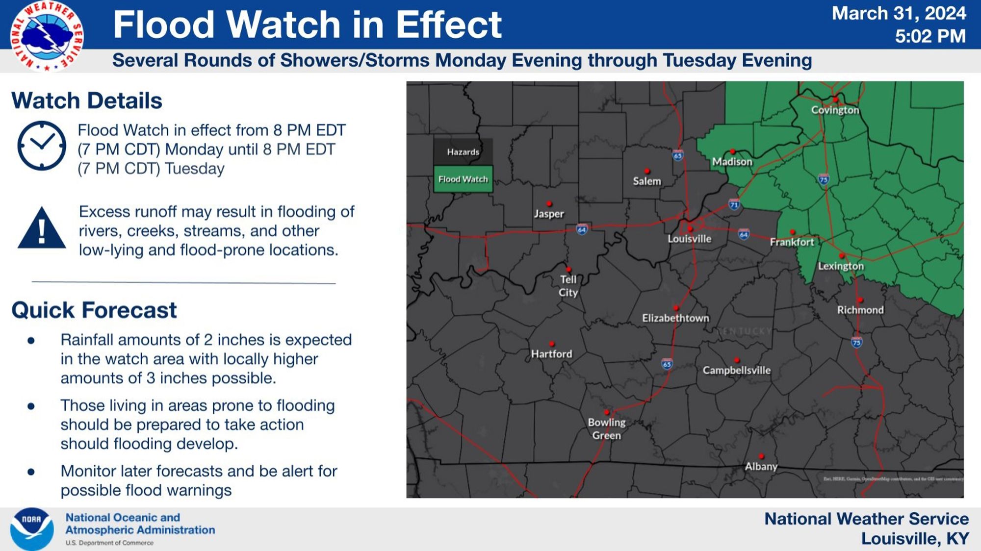
Rainfall amounts of 1.5 to 2 inches are expected within the watch area through Tuesday evening across portions of North Central Kentucky and Southern Indiana, with locally higher amounts of 3 inches possible. #lmkwx#kywx#inwx#BeWeatherAware#TurnAroundDontDrown
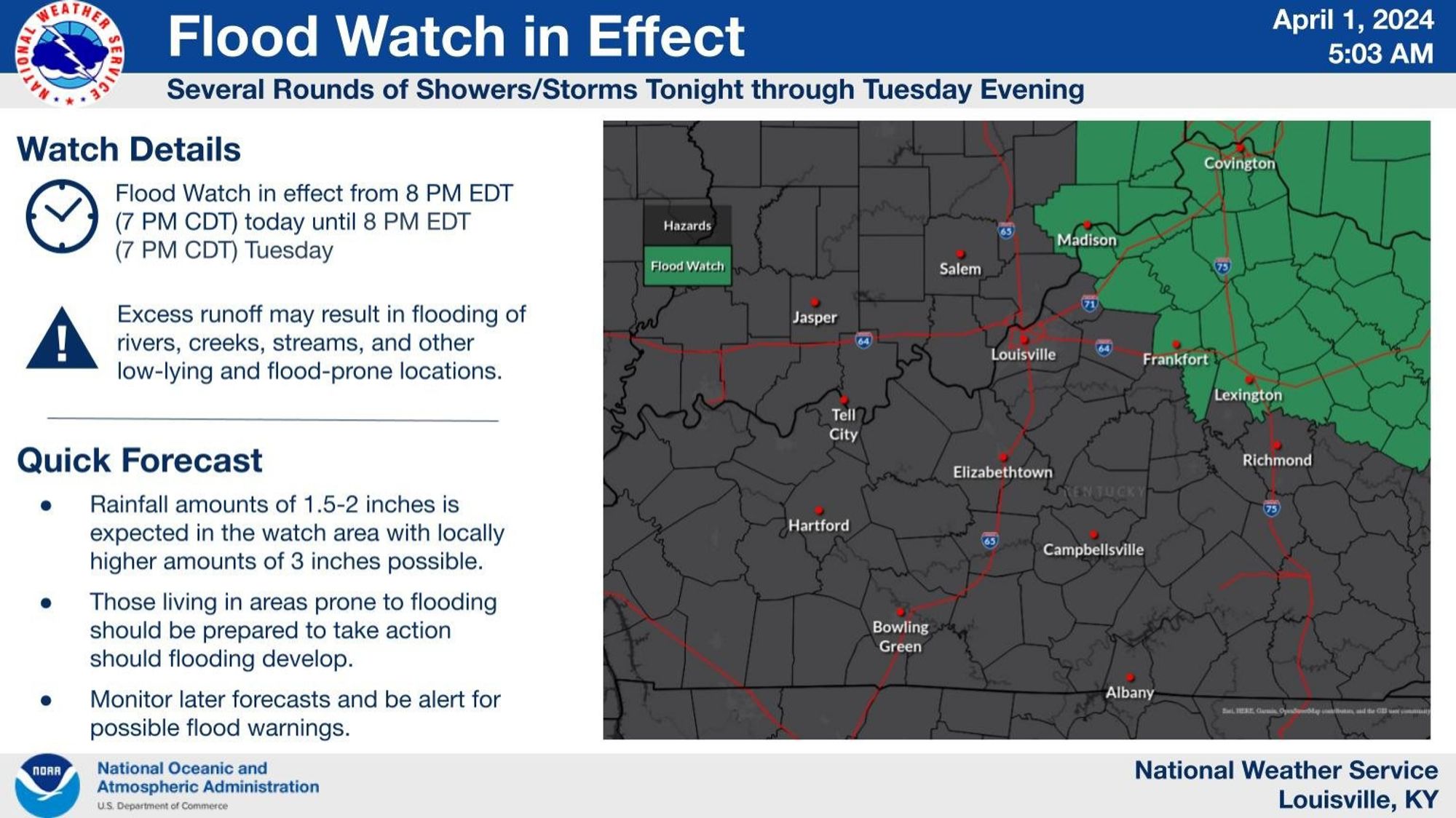
Along with the severe threat through Tuesday, some of these showers/storms could produce 2 inches of rain with locally up to 3 inches. Flood watch in effect Monday evening until Tuesday evening. #KYwx#INwx#TurnAroundDontDrown#BePrepared#StayWeatherAware