BLUE
DGdeannag.bsky.social

Meteorologist here. Is bad. If that thing hits just north of Tampa, the amount of destruction in the Bay is going to be horrendous.

0
BDbritculpsapp.bsky.social

and now for weather, let’s go to our meteorologist, dr. hustlebitch

HustleBitch
@HustleBitch_• 1h
* #BREAKING: These are NOT
Asperitas Clouds forming.
...
The Gulf of Mexico along the Florida Coast is possibly the MOST geo-engineered weather modification area on the entire planet.
#HurricaneMilton #Milton #FLwx
#HAARP #Darpa #DEW

photo of clouds that are now a conspiracy theory
2

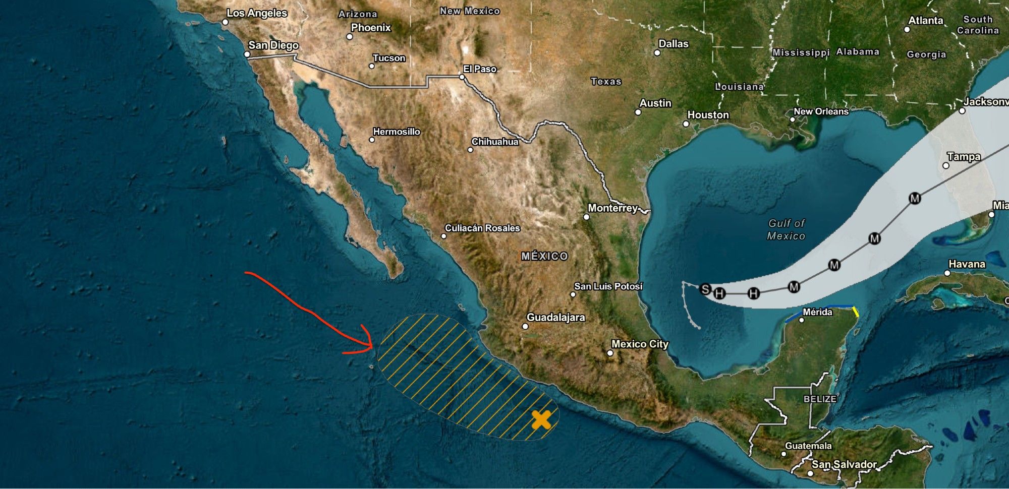
Hey hurricane/meteorologist folks, what are your thoughts on this little fella on the Pacific side of things? Do we have another Hilary brewing? #hurricane

0
AFeyw.nws-bot.us

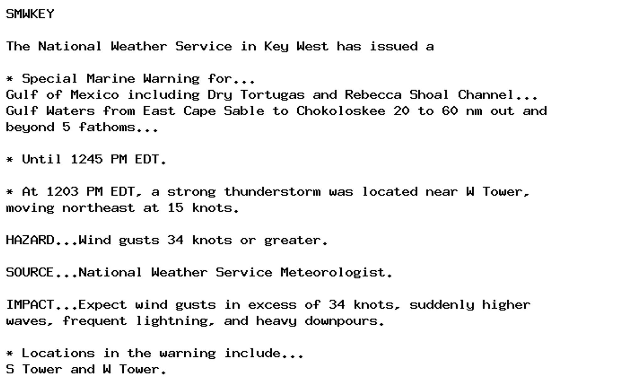
🚨 Special Marine Warning issued October 6 at 12:03PM EDT until October 6 at 12:45PM EDT by NWS Key West FL 🚨 Additional Details Here.

SMWKEY

The National Weather Service in Key West has issued a

* Special Marine Warning for...
Gulf of Mexico including Dry Tortugas and Rebecca Shoal Channel...
Gulf Waters from East Cape Sable to Chokoloskee 20 to 60 nm out and
beyond 5 fathoms...

* Until 1245 PM EDT.

* At 1203 PM EDT, a strong thunderstorm was located near W Tower,
moving northeast at 15 knots.

HAZARD...Wind gusts 34 knots or greater.

SOURCE...National Weather Service Meteorologist.

IMPACT...Expect wind gusts in excess of 34 knots, suddenly higher
waves, frequent lightning, and heavy downpours.

* Locations in the warning include...
S Tower and W Tower.
0
AFeyw.nws-bot.us

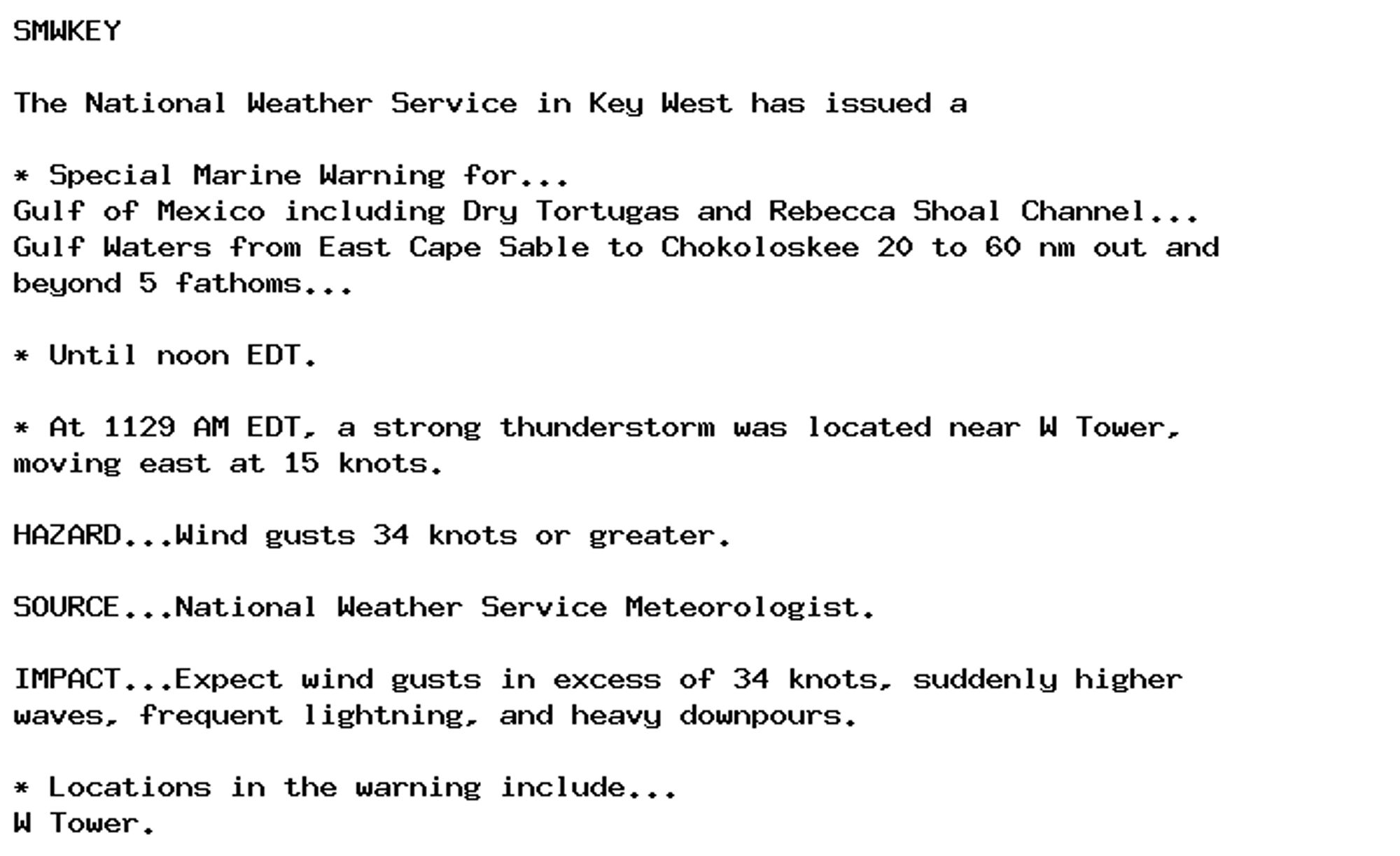
🚨 Special Marine Warning issued October 6 at 11:29AM EDT until October 6 at 12:00PM EDT by NWS Key West FL 🚨 Additional Details Here.

SMWKEY

The National Weather Service in Key West has issued a

* Special Marine Warning for...
Gulf of Mexico including Dry Tortugas and Rebecca Shoal Channel...
Gulf Waters from East Cape Sable to Chokoloskee 20 to 60 nm out and
beyond 5 fathoms...

* Until noon EDT.

* At 1129 AM EDT, a strong thunderstorm was located near W Tower,
moving east at 15 knots.

HAZARD...Wind gusts 34 knots or greater.

SOURCE...National Weather Service Meteorologist.

IMPACT...Expect wind gusts in excess of 34 knots, suddenly higher
waves, frequent lightning, and heavy downpours.

* Locations in the warning include...
W Tower.
0
AFeyw.nws-bot.us

🚨 Special Marine Warning issued October 6 at 10:46AM EDT until October 6 at 11:15AM EDT by NWS Key West FL 🚨 Additional Details Here.

SMWKEY

The National Weather Service in Key West has issued a

* Special Marine Warning for...
Gulf Waters from East Cape Sable to Chokoloskee 20 to 60 nm out and
beyond 5 fathoms...

* Until 1115 AM EDT.

* At 1046 AM EDT, a strong thunderstorm with possible waterspouts was
located 10 nm northwest of P Tower, moving east at 10 knots.

HAZARD...Waterspouts and wind gusts 34 knots or greater.

SOURCE...National Weather Service Meteorologist.

IMPACT...Waterspouts can quickly form and capsize boats, cause
considerable damage to vessels and create suddenly higher
waves. Expect wind gusts in excess of 34 knots, suddenly
higher waves, frequent lightning, and heavy downpours.

* Locations in the warning include...
P Tower.
0
AFeyw.nws-bot.us

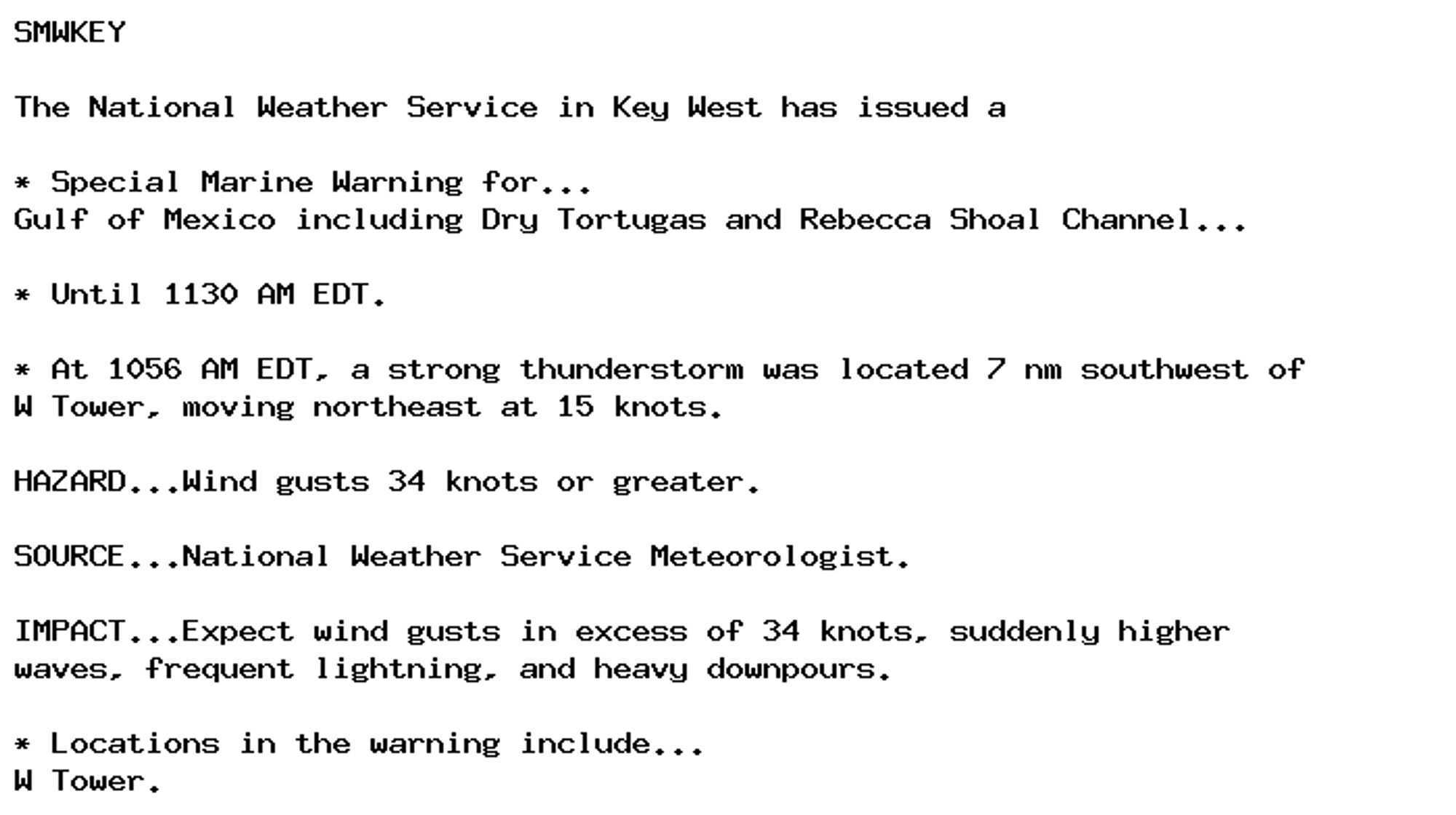
🚨 Special Marine Warning issued October 6 at 10:56AM EDT until October 6 at 11:30AM EDT by NWS Key West FL 🚨 Additional Details Here.

SMWKEY

The National Weather Service in Key West has issued a

* Special Marine Warning for...
Gulf of Mexico including Dry Tortugas and Rebecca Shoal Channel...

* Until 1130 AM EDT.

* At 1056 AM EDT, a strong thunderstorm was located 7 nm southwest of
W Tower, moving northeast at 15 knots.

HAZARD...Wind gusts 34 knots or greater.

SOURCE...National Weather Service Meteorologist.

IMPACT...Expect wind gusts in excess of 34 knots, suddenly higher
waves, frequent lightning, and heavy downpours.

* Locations in the warning include...
W Tower.
0
AFeyw.nws-bot.us

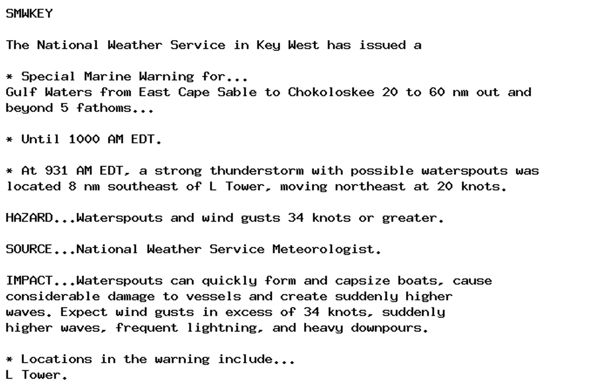
🚨 Special Marine Warning issued October 6 at 9:32AM EDT until October 6 at 10:00AM EDT by NWS Key West FL 🚨 Additional Details Here.

SMWKEY

The National Weather Service in Key West has issued a

* Special Marine Warning for...
Gulf Waters from East Cape Sable to Chokoloskee 20 to 60 nm out and
beyond 5 fathoms...

* Until 1000 AM EDT.

* At 931 AM EDT, a strong thunderstorm with possible waterspouts was
located 8 nm southeast of L Tower, moving northeast at 20 knots.

HAZARD...Waterspouts and wind gusts 34 knots or greater.

SOURCE...National Weather Service Meteorologist.

IMPACT...Waterspouts can quickly form and capsize boats, cause
considerable damage to vessels and create suddenly higher
waves. Expect wind gusts in excess of 34 knots, suddenly
higher waves, frequent lightning, and heavy downpours.

* Locations in the warning include...
L Tower.
0
DKdkrappe.bsky.social

Hasn't the greatest meteorologist of all already promised to change Milton's route with his sharpie?

0
EDdoeposting.bsky.social

Our local meteorologist has Rule #7 of hurricanes— don’t panic until he does. Might get a lil silly and break Rule #7 as a treat 🤪🤪

0