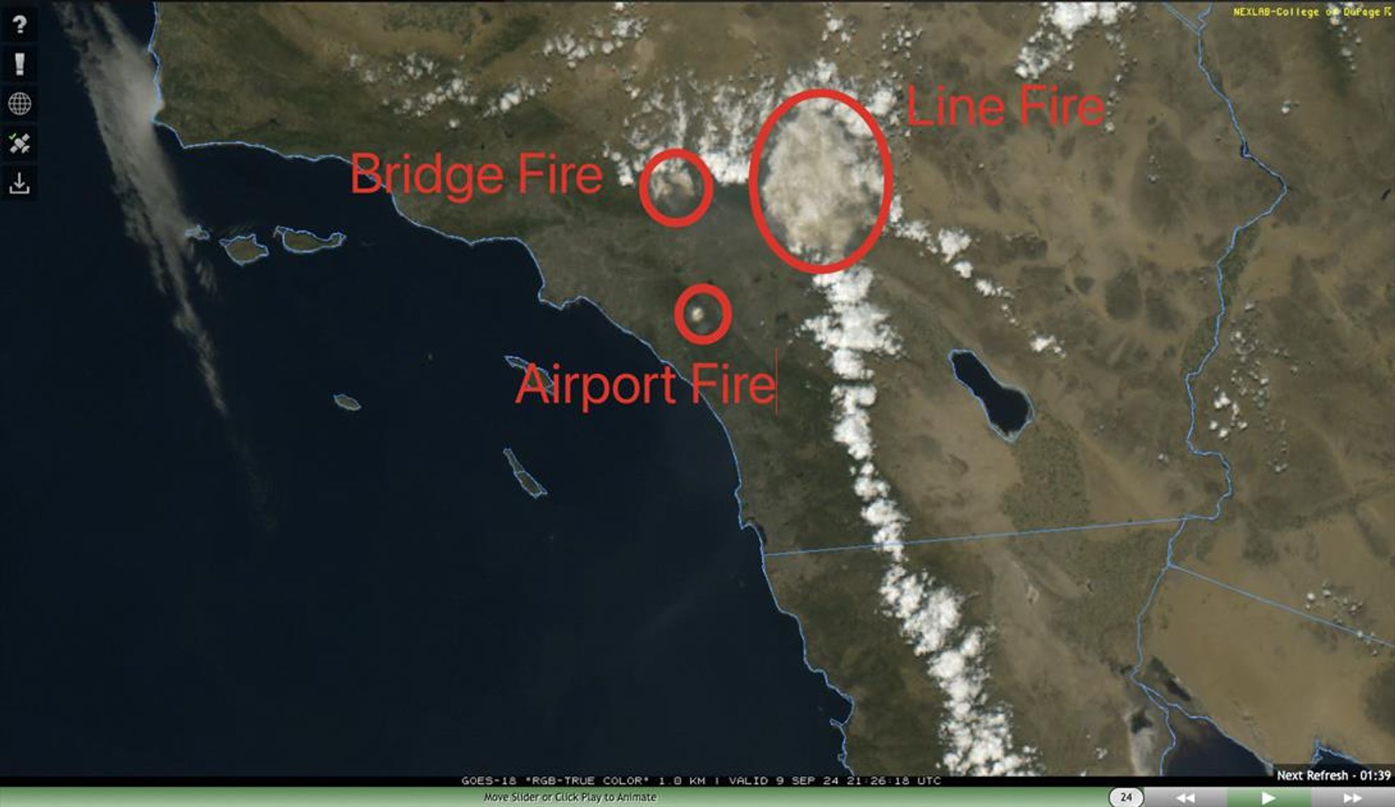
Notable PyroCu plumes already on three significant SoCal fires this afternoon, as labeled, including #LineFire,#BridgeFire,#AirportFire.#CAwx#CAfire
Wow, it’s quite a long way up to the upper troposphere there - are there any previous papers on MLS data related to smoke from South America? Could be a good case to put to the pyrocb mailing list…
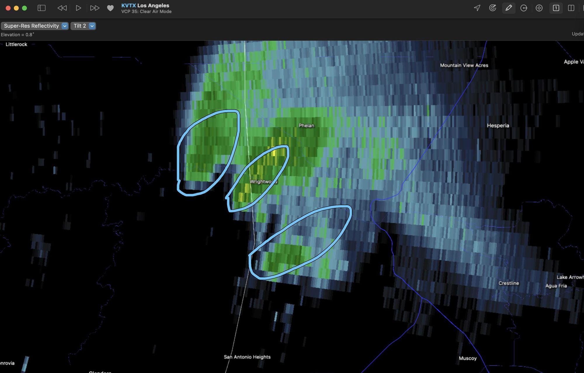
Flannigan recognizing the wind-driven ground spread models aren't great on pyroCb fires maps well with CA experiences as a leading indicator for Canada's future in southern forests. Taylor's point appears to be on full stand replacement and long returns for Northern boreal forests (not suppressed).
Das Park Fire in #Kalifornien#Rauchgewitterwolken#Blitze#Hitze#Brennstoff und verstärken […]
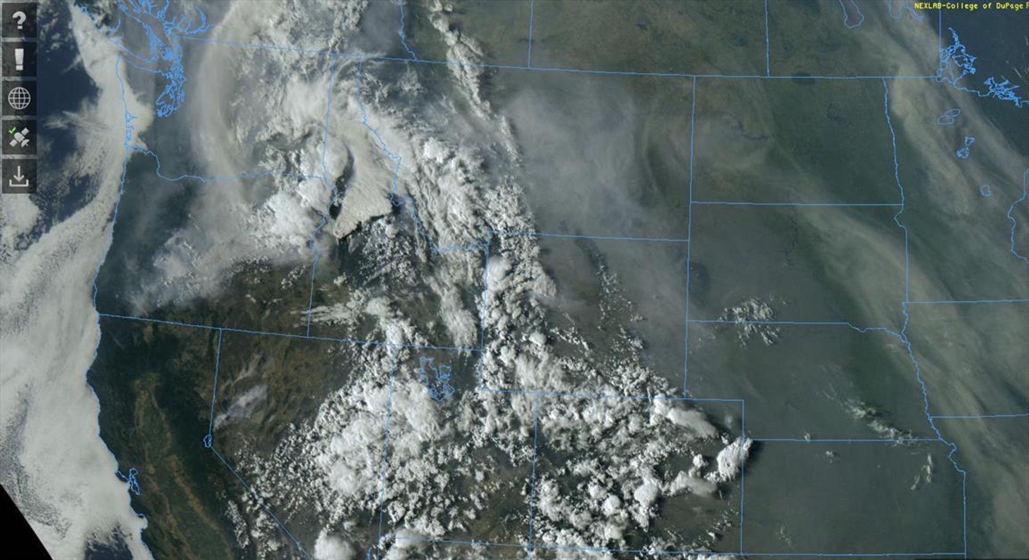
More aggressive plume-dominated fire behavior on #ParkFire#BorelFire#CAwx#CAfire [3/3]
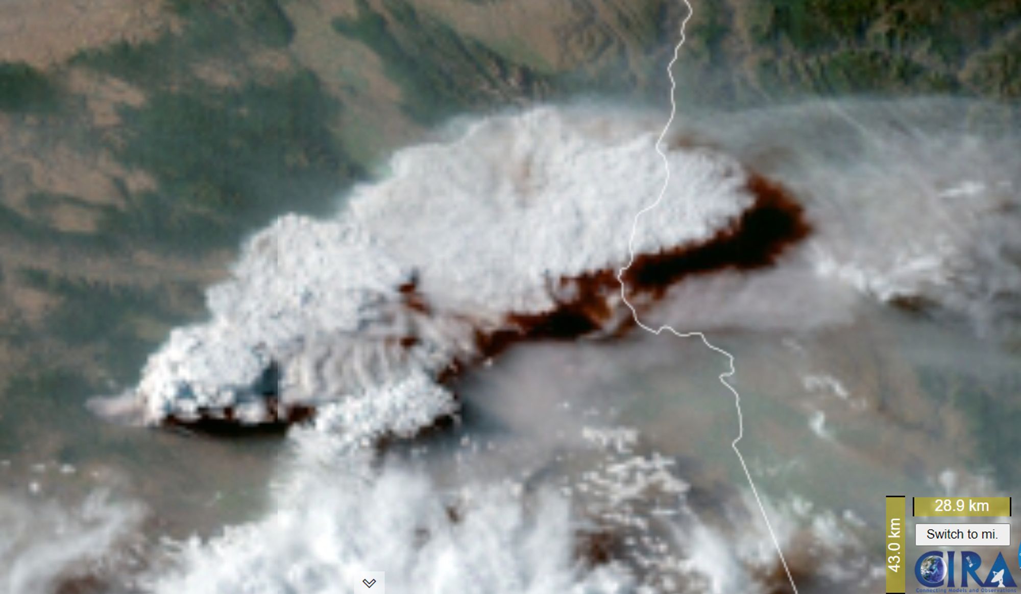
Satellite images showing the development of a pyroCb cloud from the Falls Fire in Oregon, USA. Animation created from #GOES#satellite#CIRA#pyrocumulonimbus#cloud#pyroCb#wildfire#smoke#FallsFire#OrWildFire#orwx
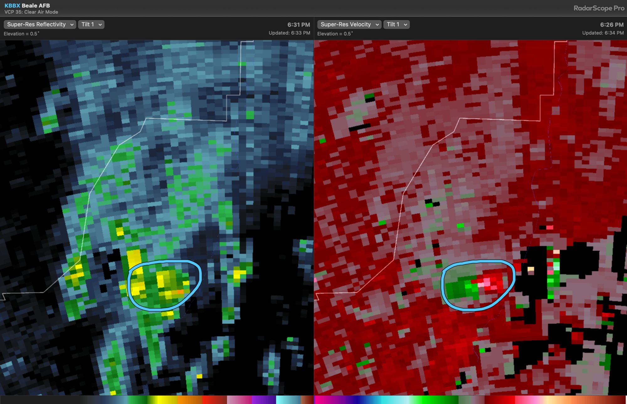
did not have pyrocb on my tuesday bingo card so i guess ill just stamp the free space for that