Tropical Cyclone Statement issued October 10 at 5:38AM EDT by NWS Melbourne FL Additional Details Here.
mourning an age when there could be multiple video games based on an anthropomorphised red dot from the 7-up label


Time for a Halloween themed pyp auction! It ends oct 14th and has two spots ;D! www.furaffinity.net/view/58412280/ <—- bid here!

this is before I find out all my drawing pens have dried out, my ink has hardened and all my nibs have scattered themselves to the several thousand hiding spots there are in my tiny studio.
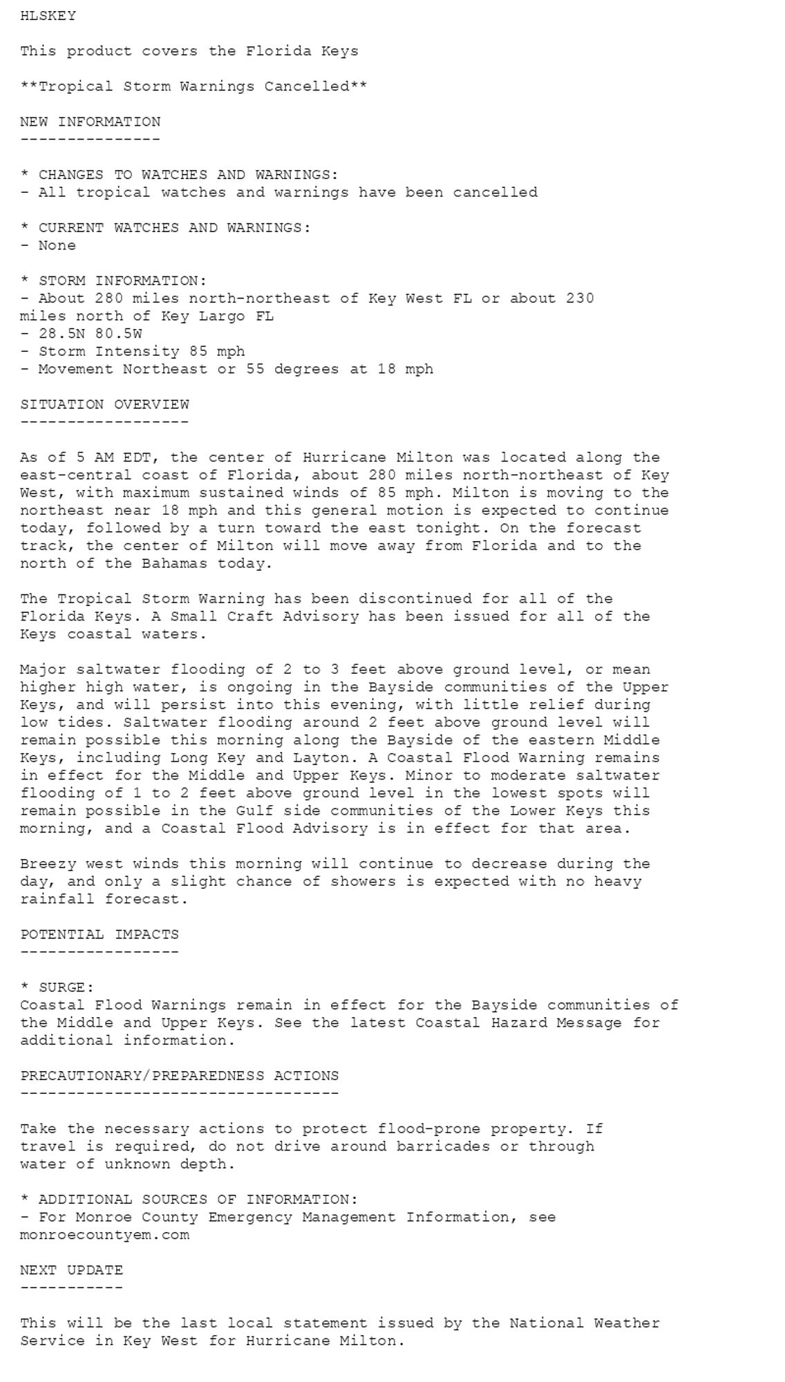
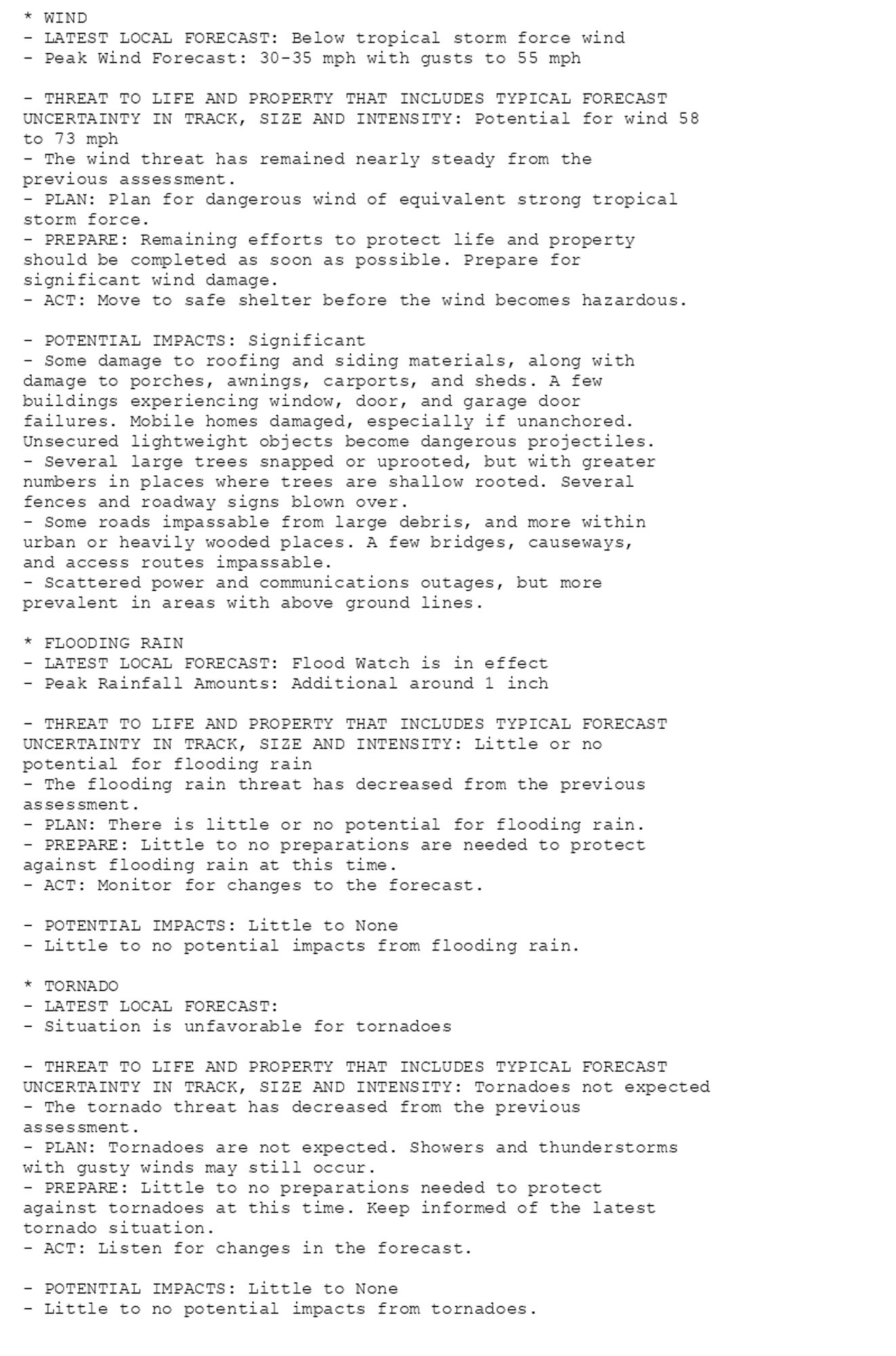
Tropical Cyclone Statement issued October 10 at 5:08AM EDT by NWS Key West FL Additional Details Here.
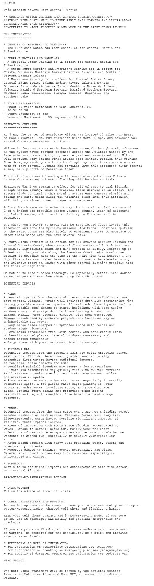
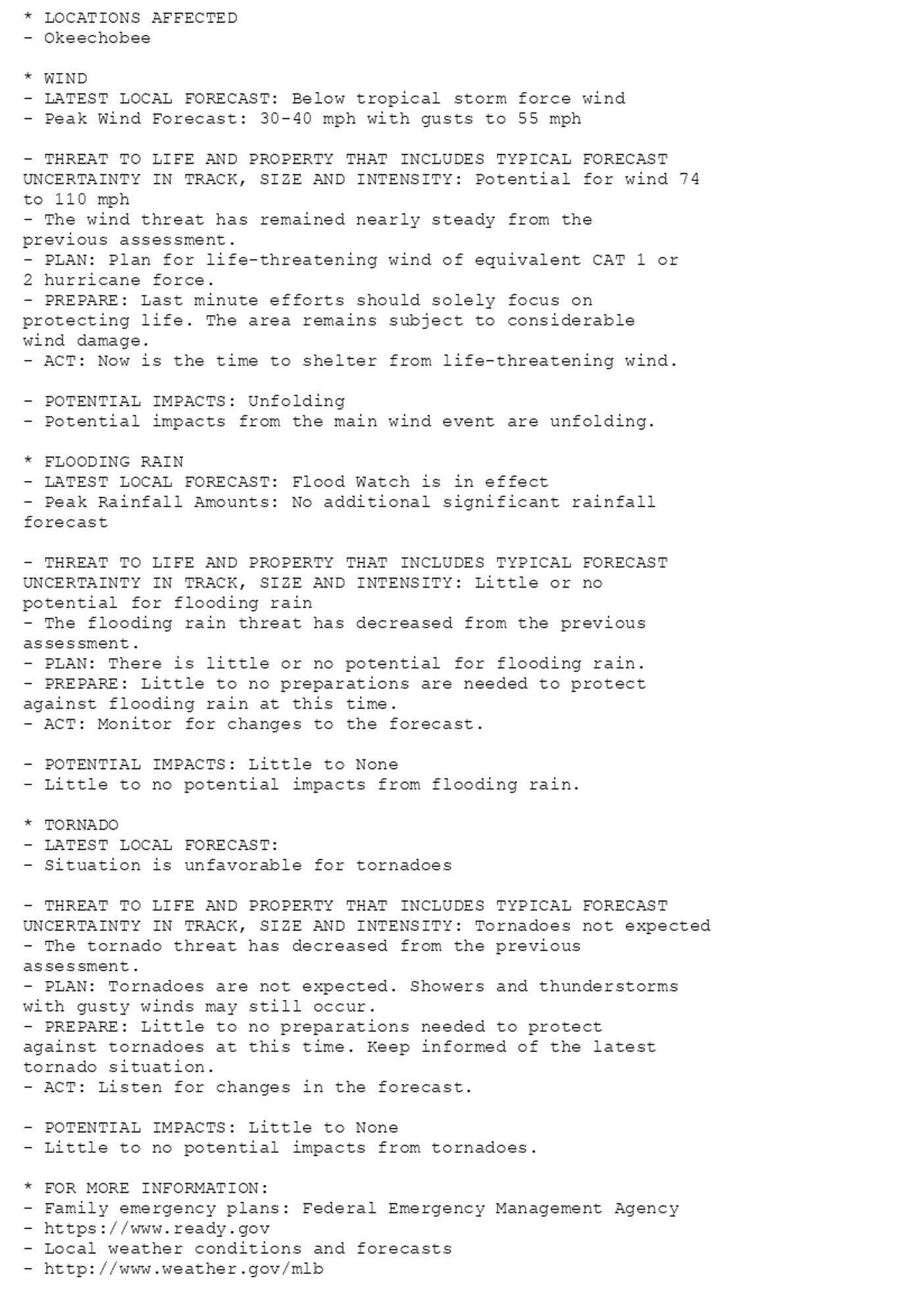
🚨🚨🚨 Hurricane Warning issued October 10 at 5:18AM EDT by NWS Melbourne FL 🚨🚨🚨 Additional Details Here.(6/6)
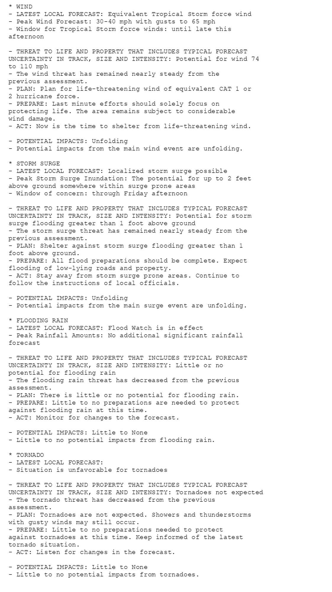
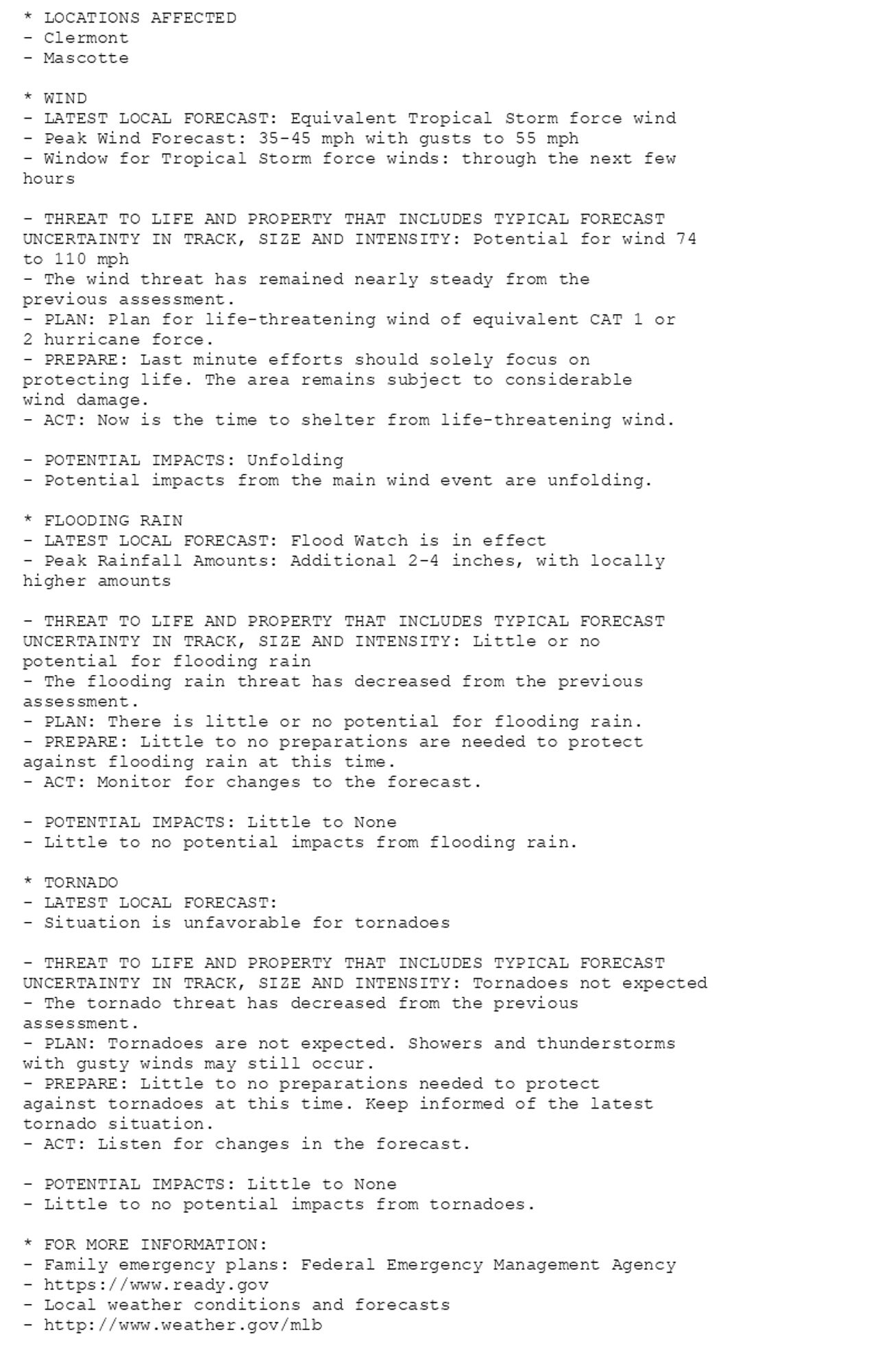
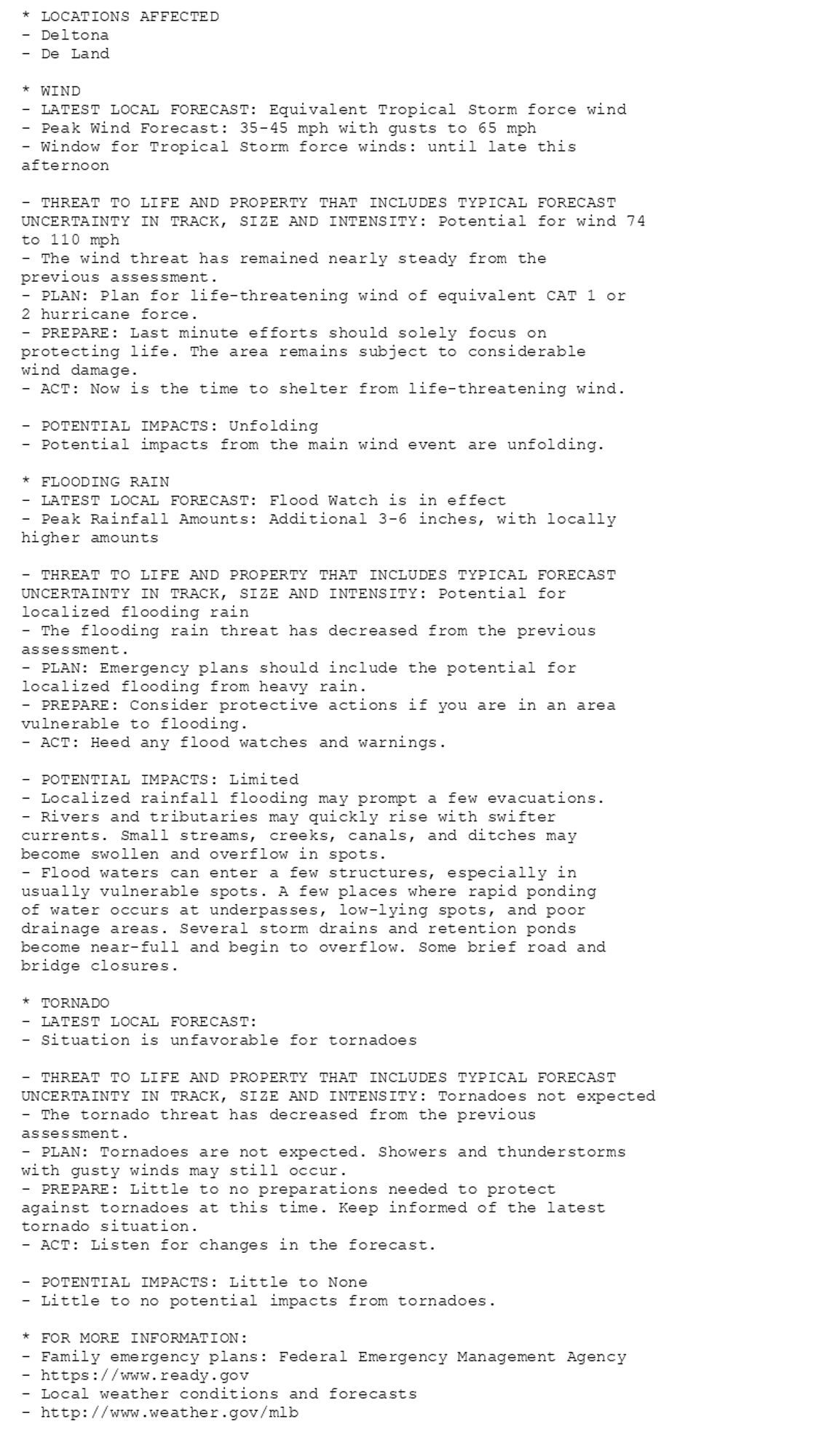
🚨🚨🚨 Hurricane Warning issued October 10 at 5:18AM EDT by NWS Melbourne FL 🚨🚨🚨 Additional Details Here. (5/6)
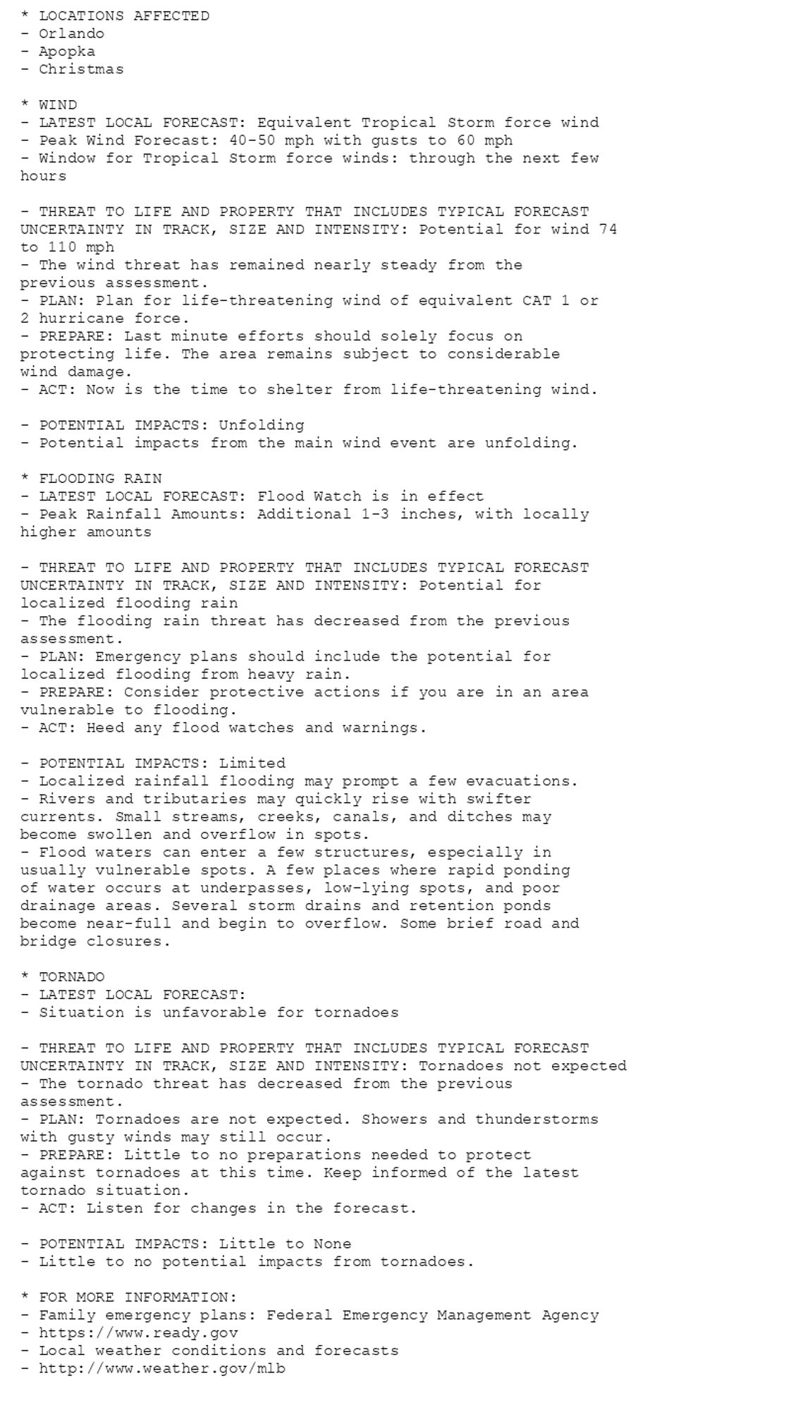
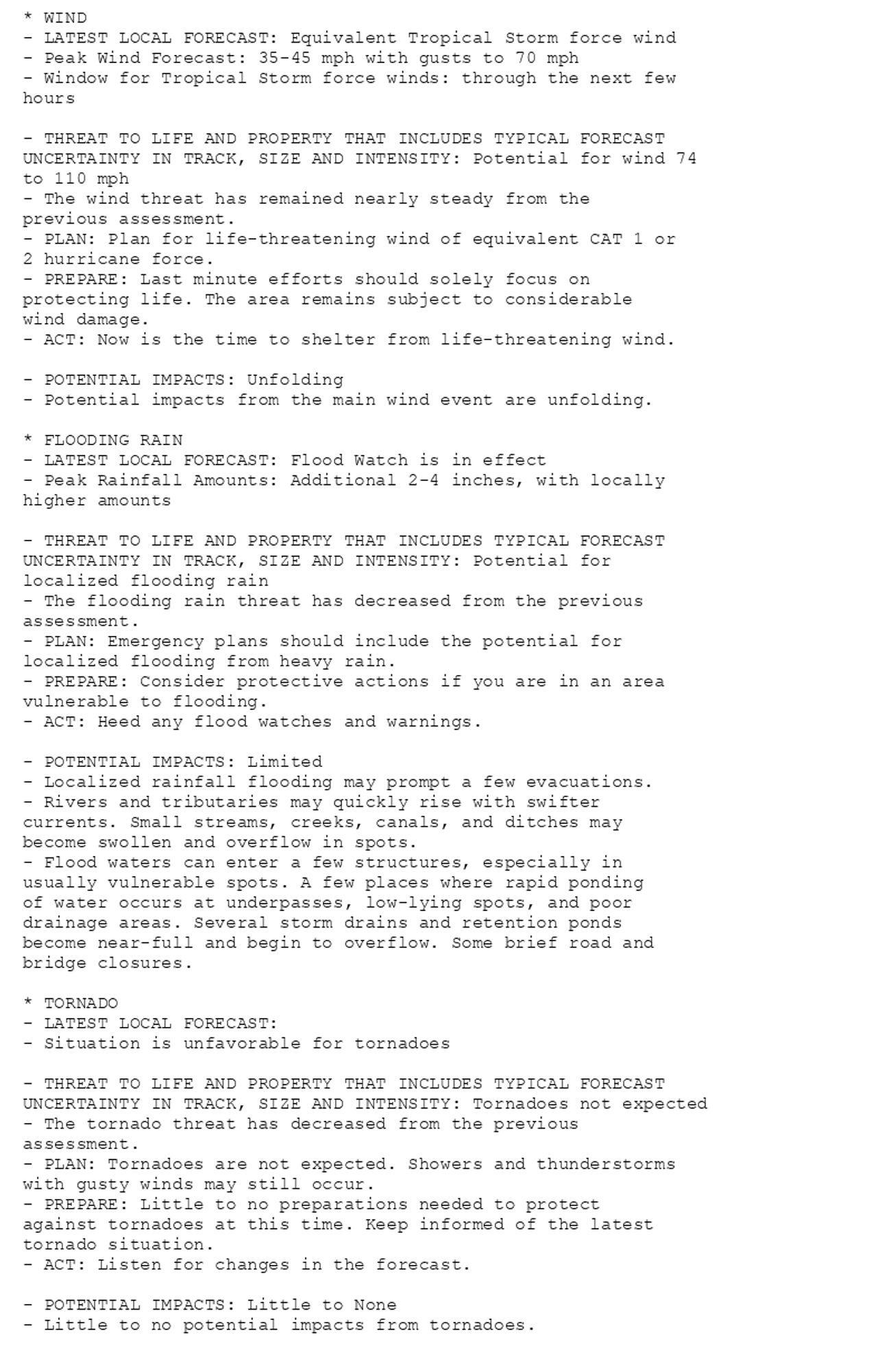
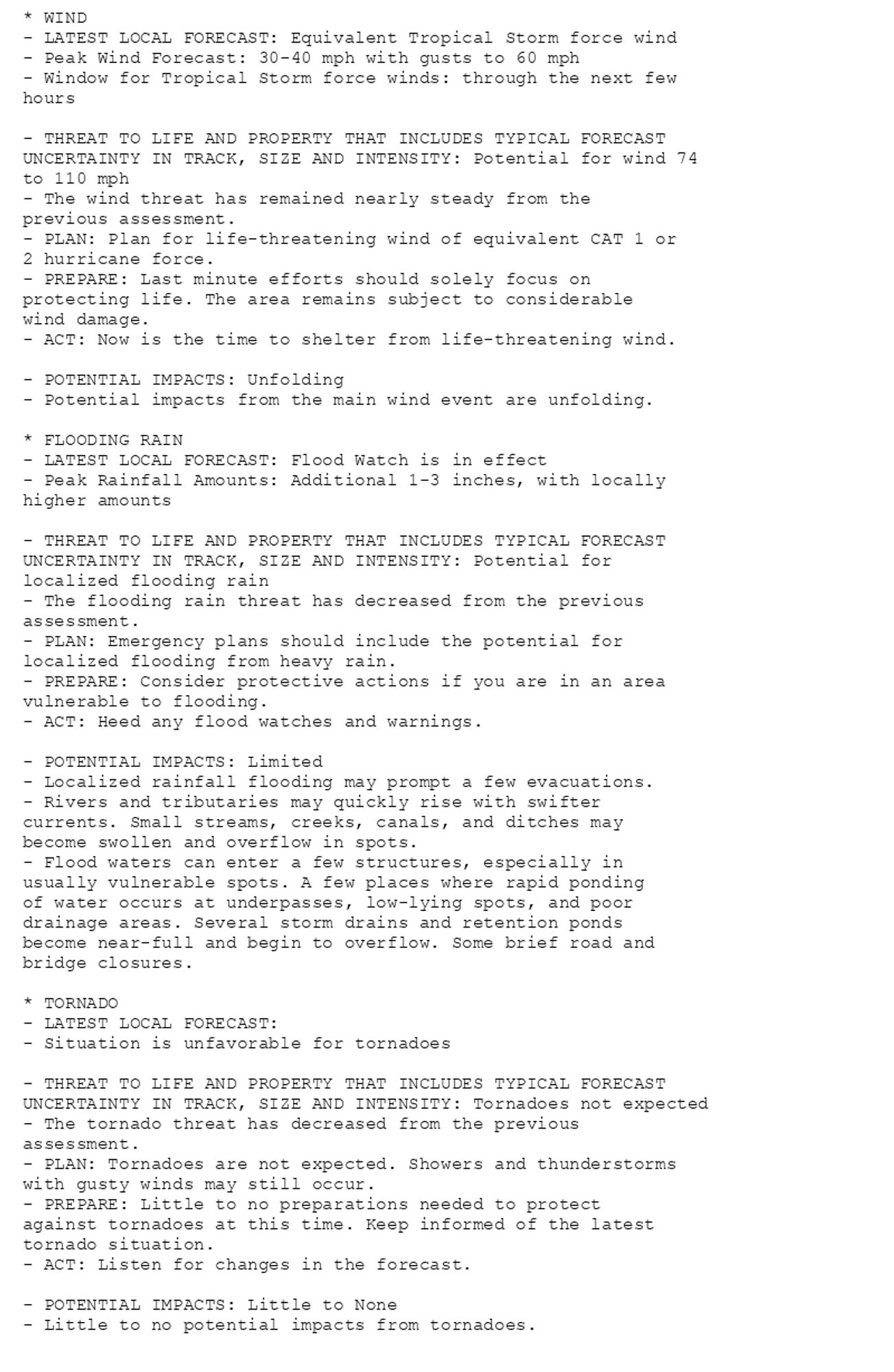
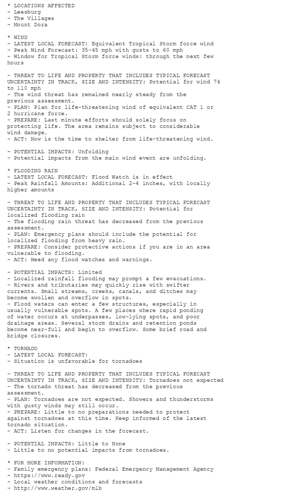
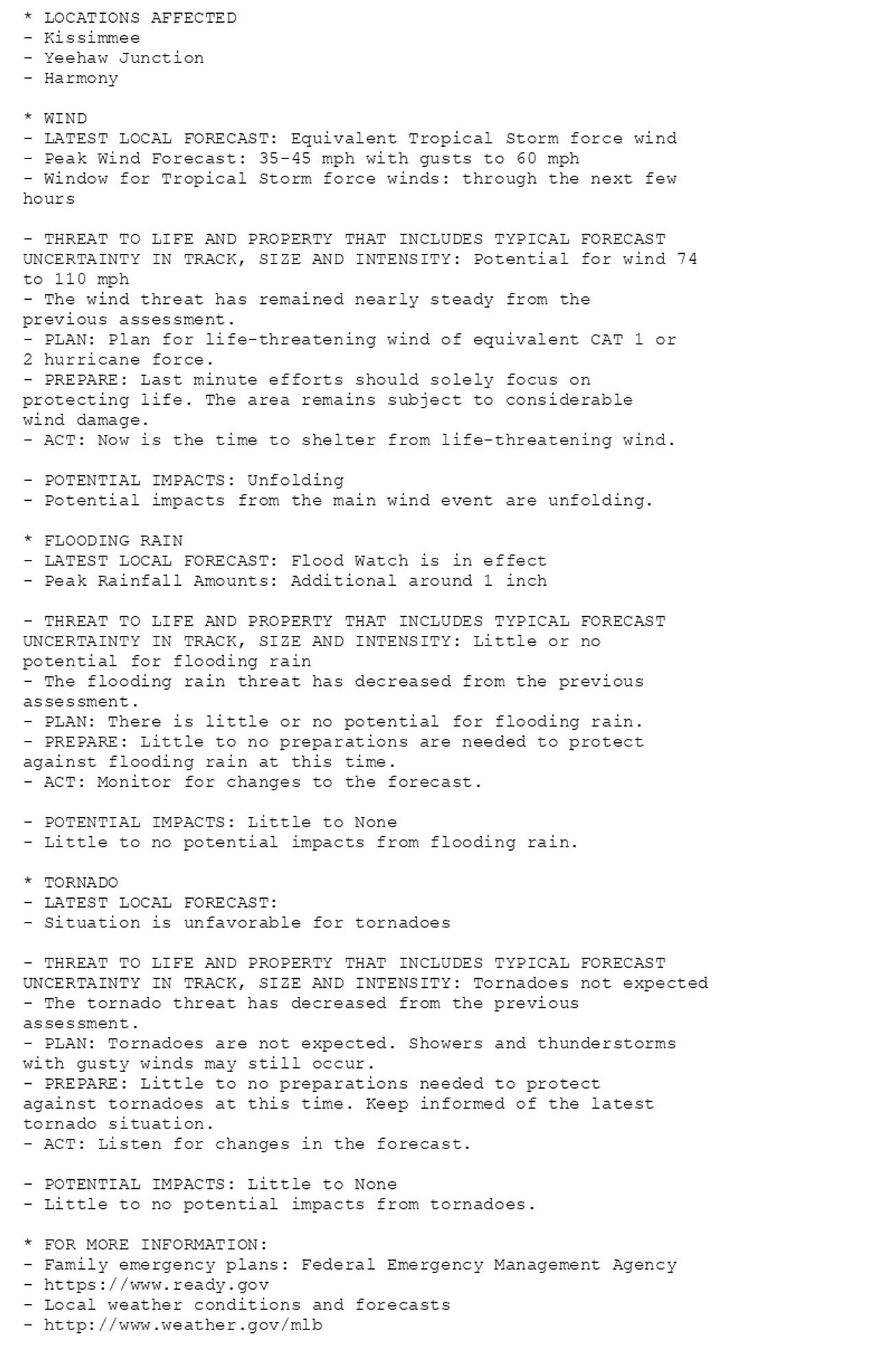
🚨🚨🚨 Hurricane Warning issued October 10 at 5:18AM EDT by NWS Melbourne FL 🚨🚨🚨 Additional Details Here. (4/6)
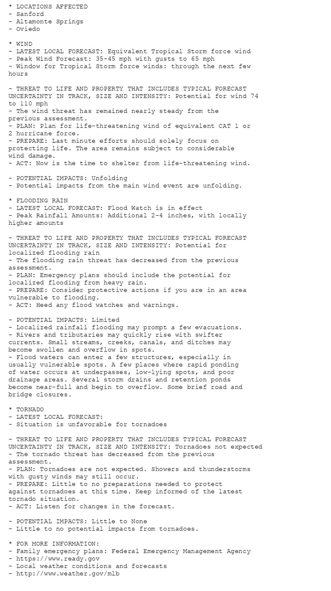
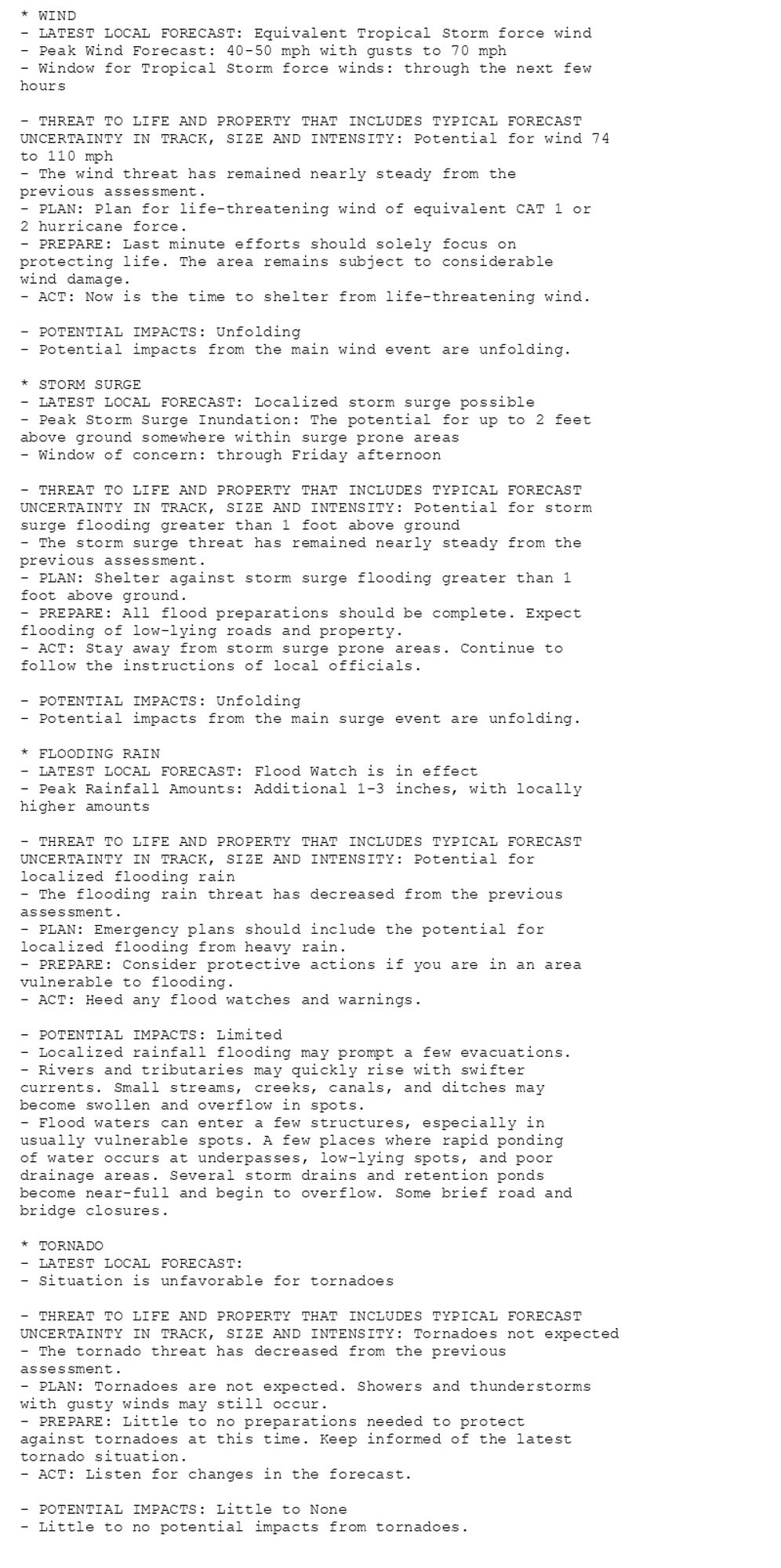
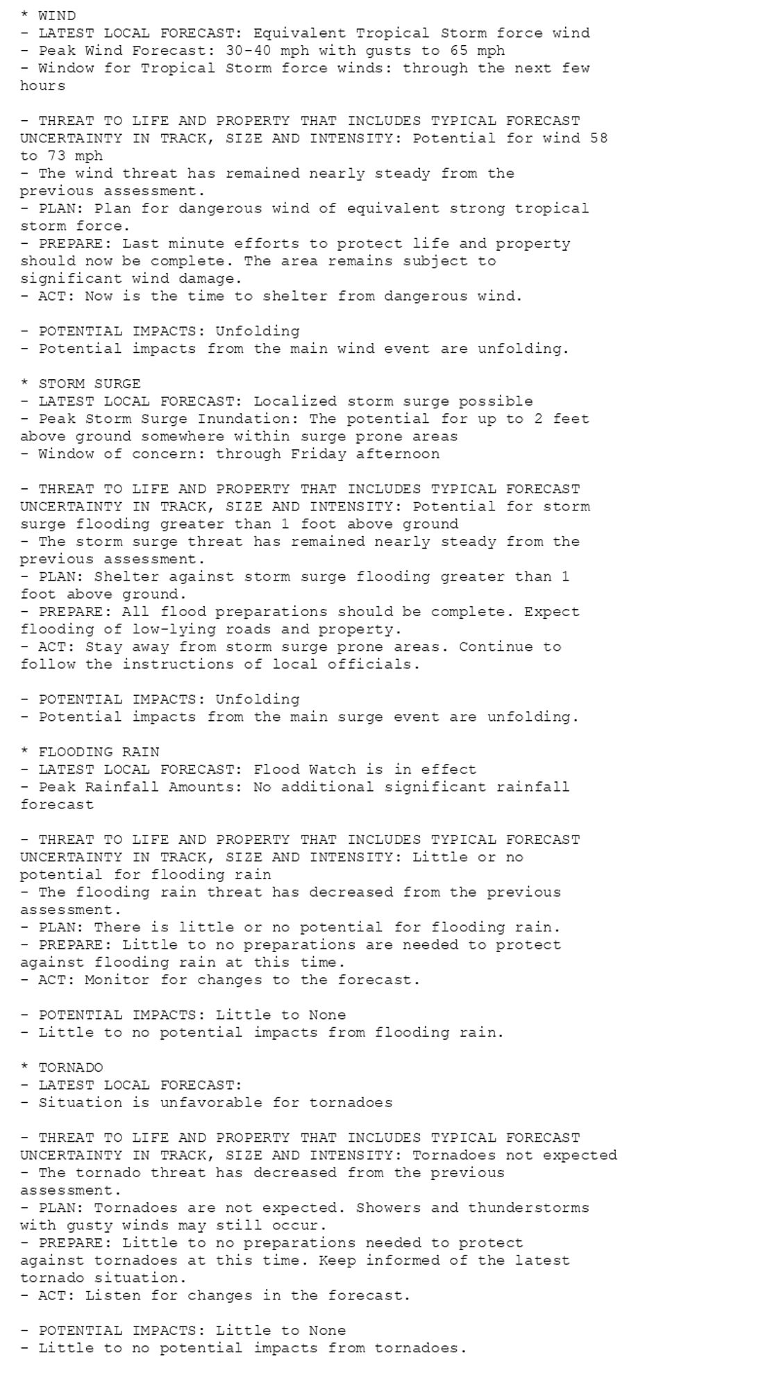
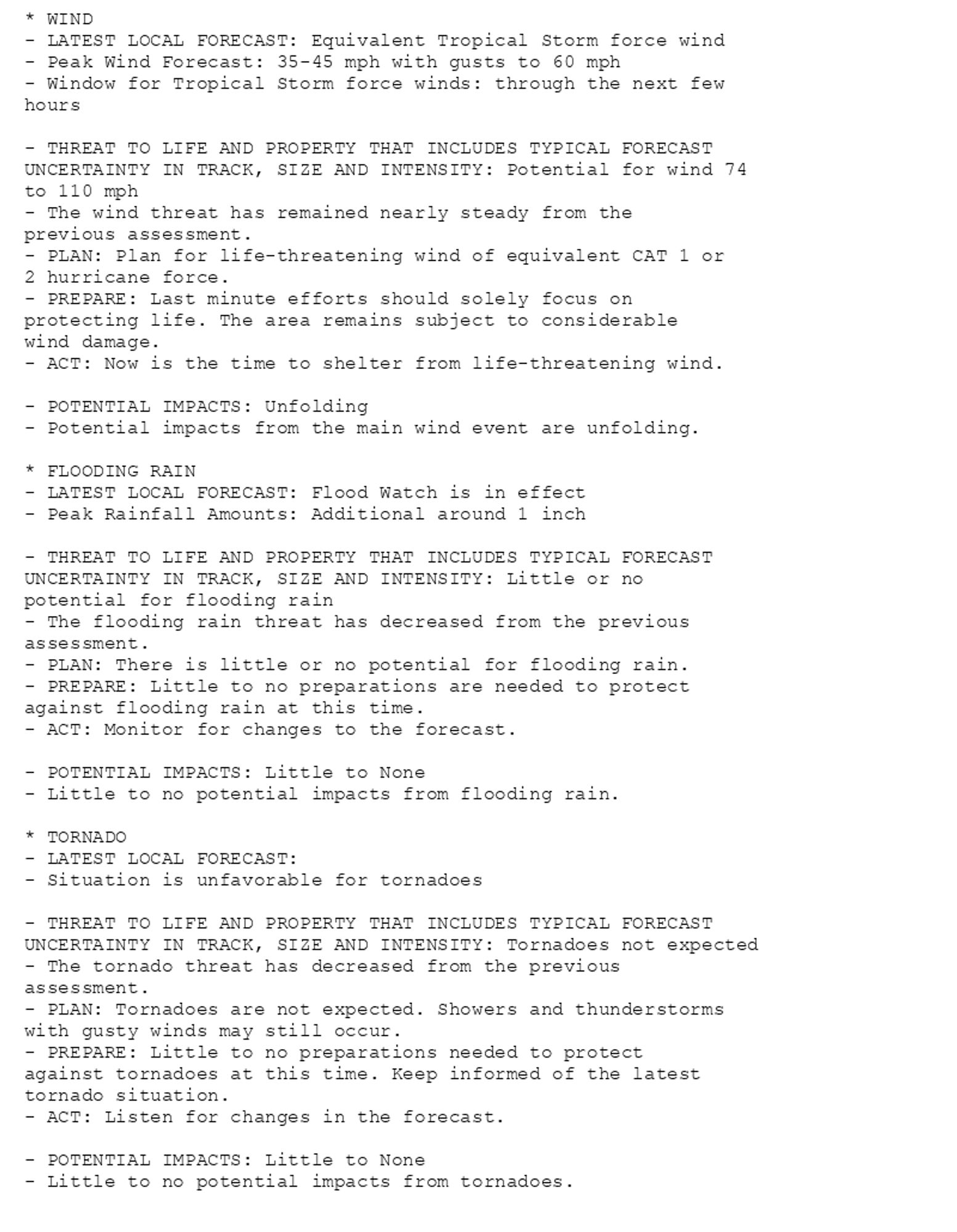
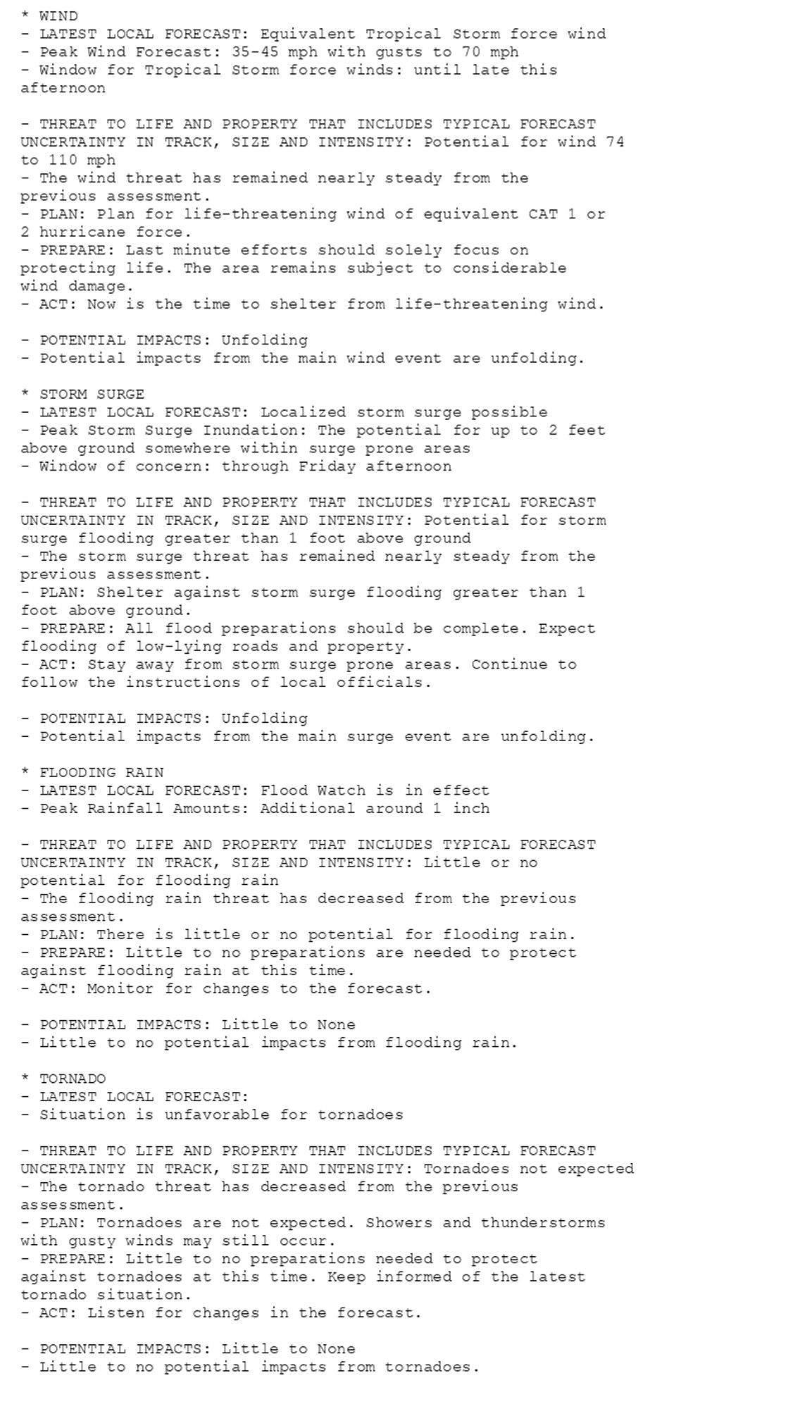
🚨🚨🚨 Hurricane Warning issued October 10 at 5:18AM EDT by NWS Melbourne FL 🚨🚨🚨 Additional Details Here. (3/6)