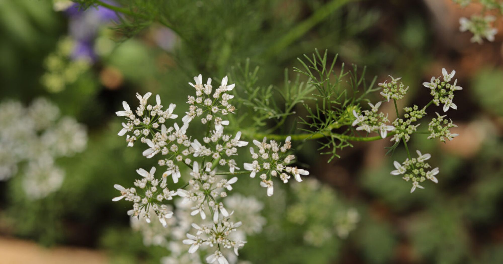
Yucatan | In Chacsinkín they create a House of Health to heal with plants noticaribe.com.mx/2024/10/05/y...
Yucatán | En Chacsinkín crean Casa de la Salud para sanar con plantas noticaribe.com.mx/2024/10/05/y...


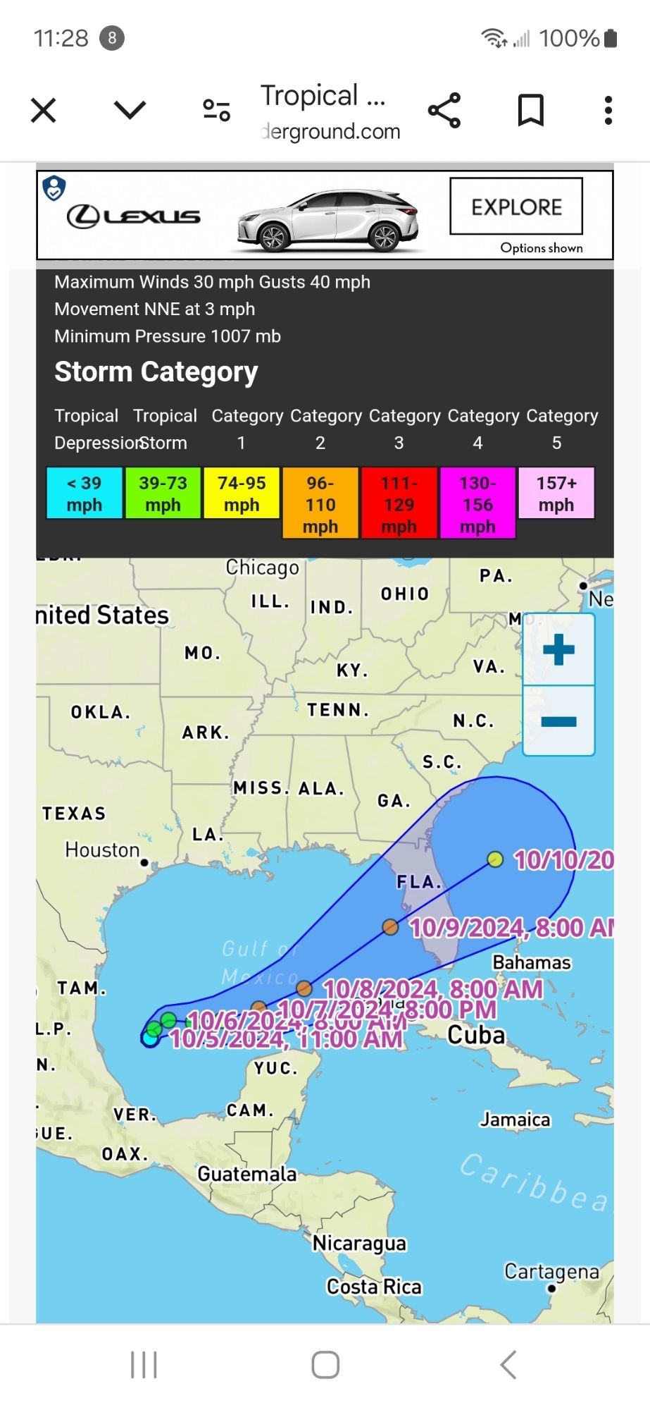
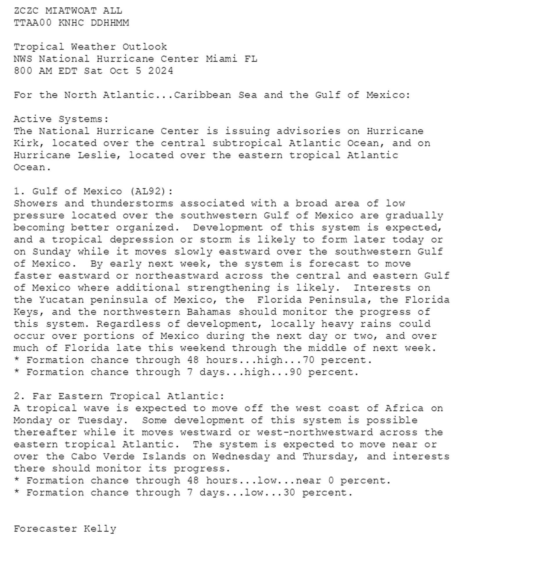
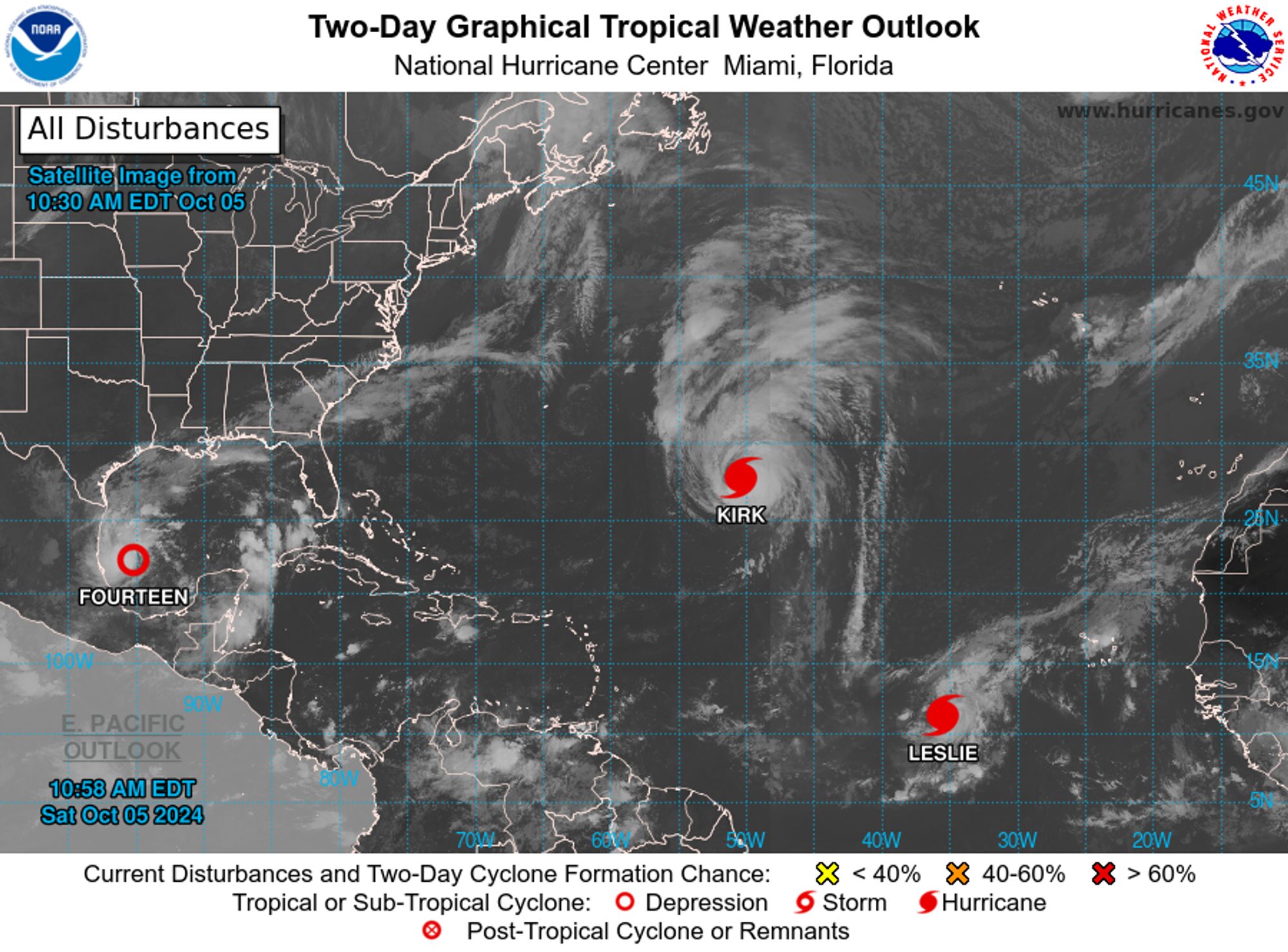
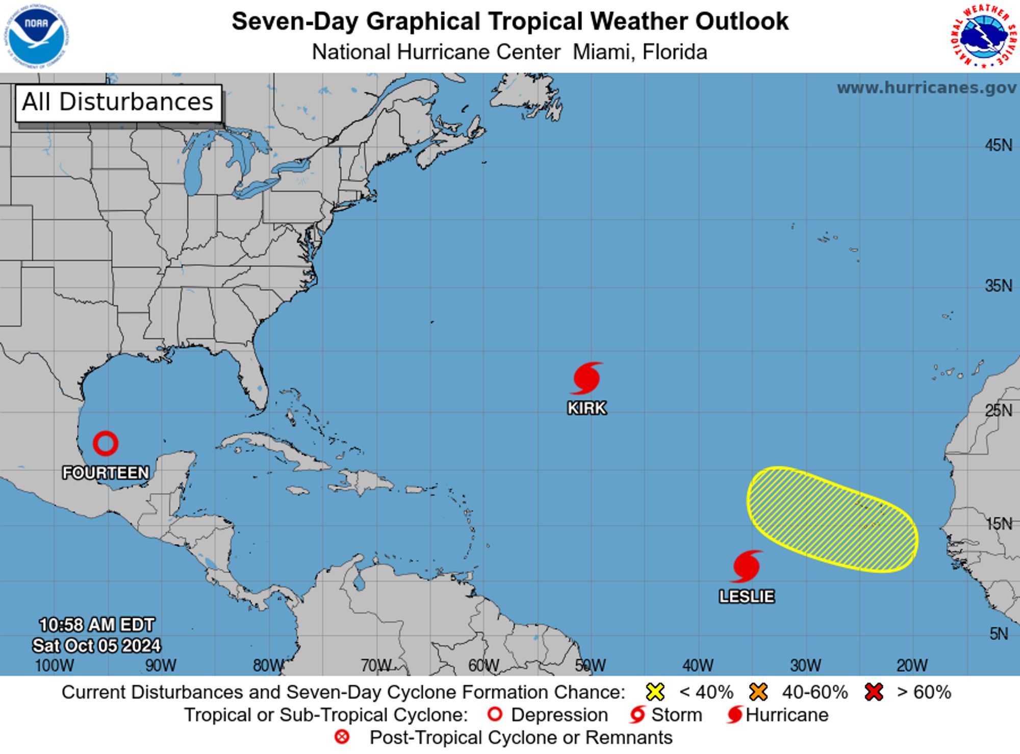
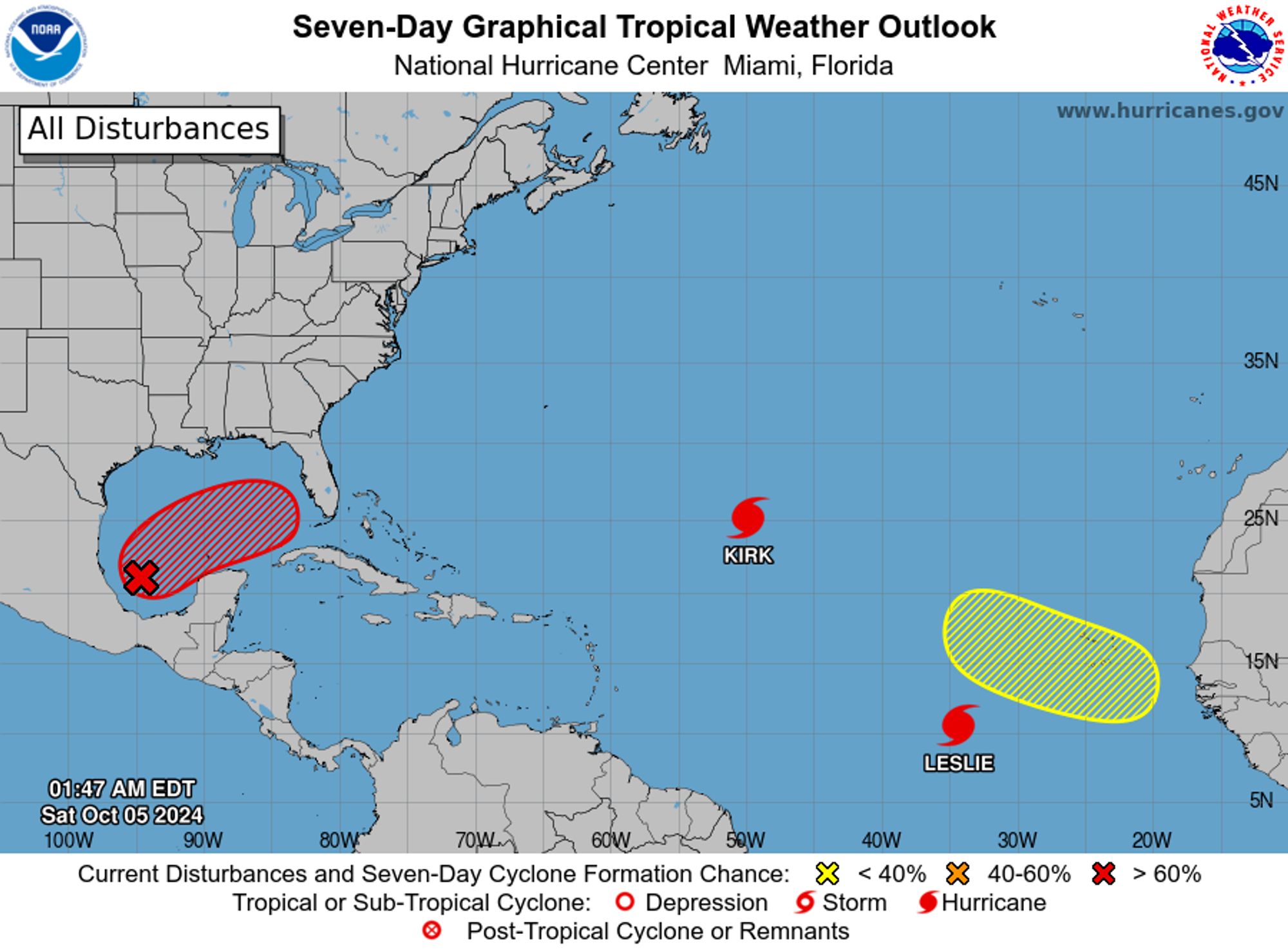
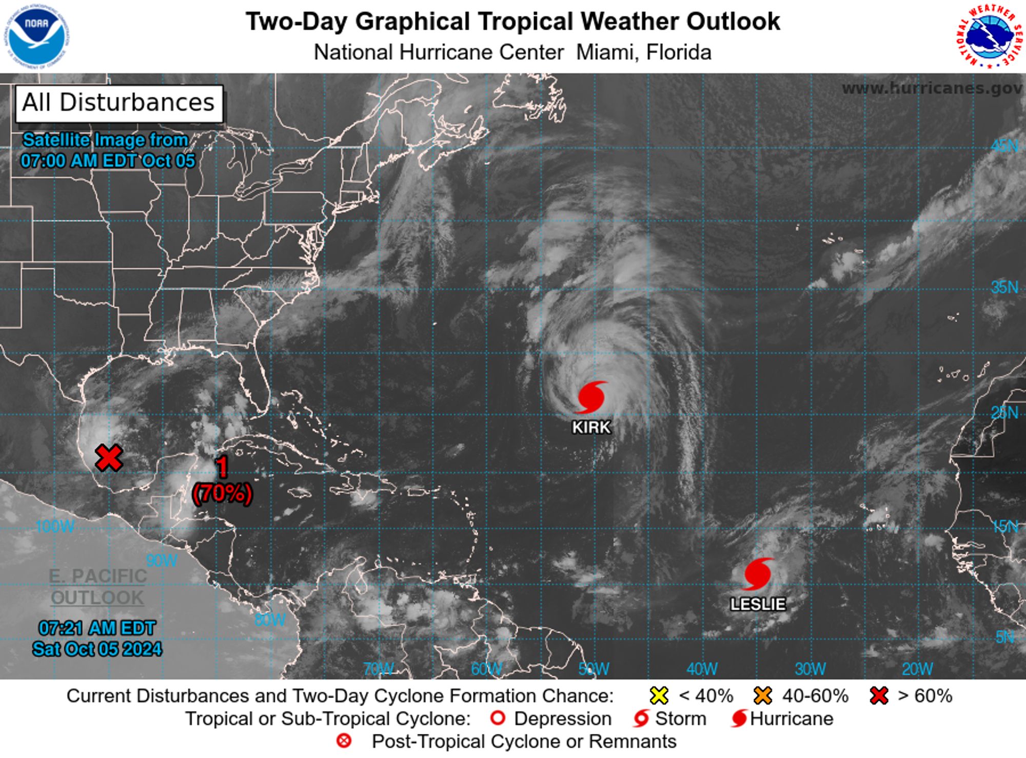
NWS National Hurricane Center Miami FL 800 AM EDT Sat Oct 5 2024 For the North Atlantic...Caribbean Sea and the Gulf of Mexico: Active Systems: The National Hurricane Center is issuing advisories on Hurricane Kirk, located over the central subtropical Atlantic Ocean, and on Hurricane Leslie, loc


yes, this is basically fast food; my experience of Mexican is mainly cooking at a truck stop in the Yucatan.
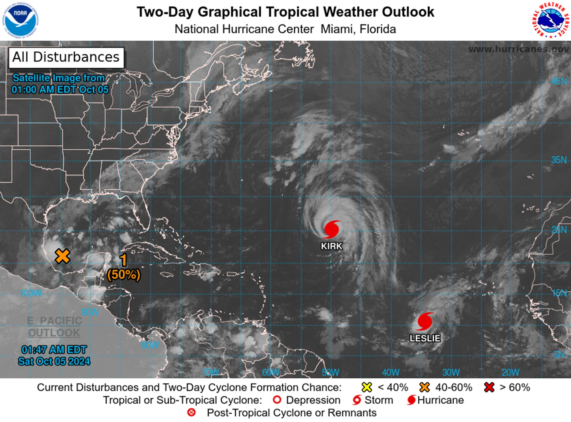
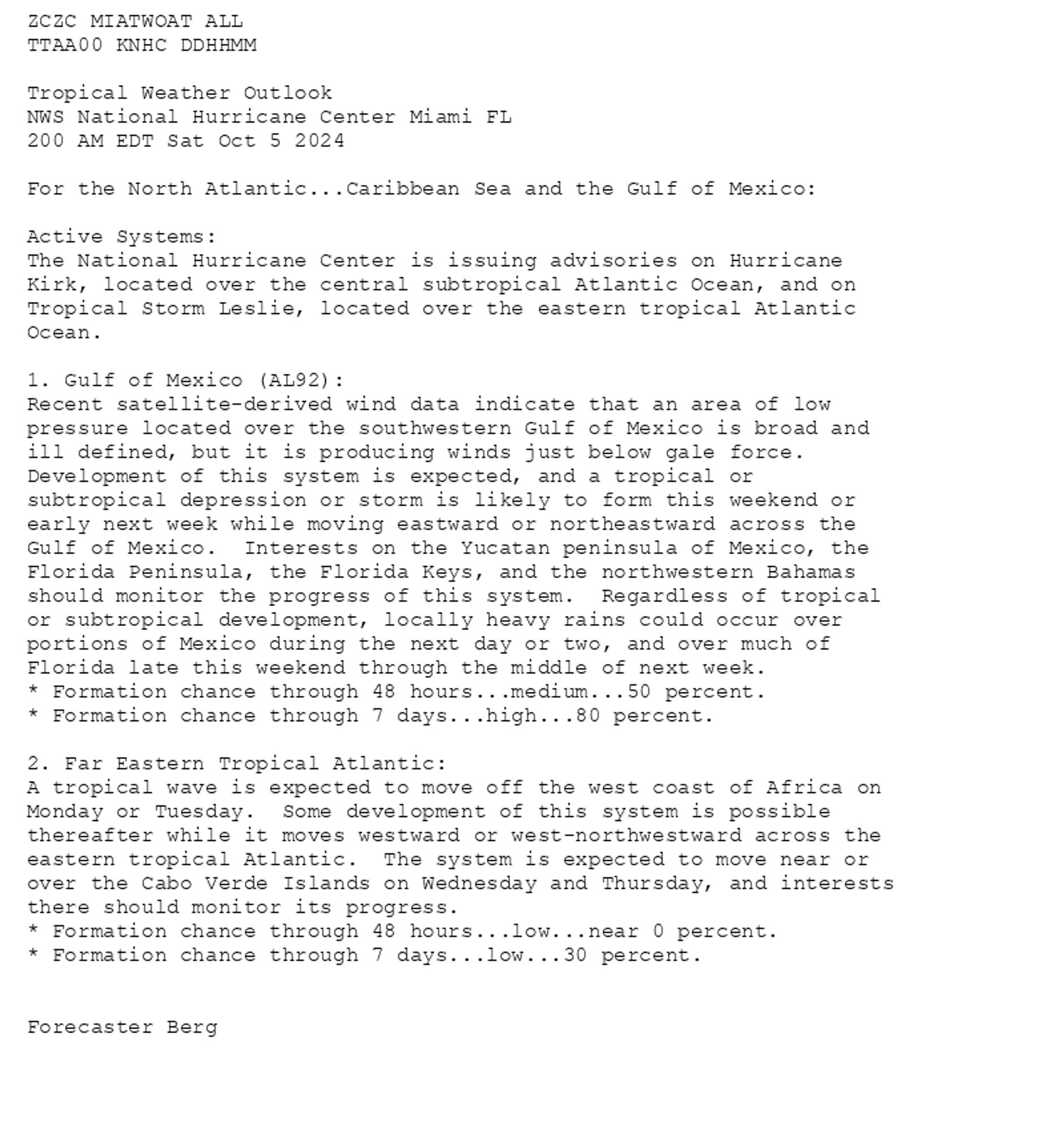
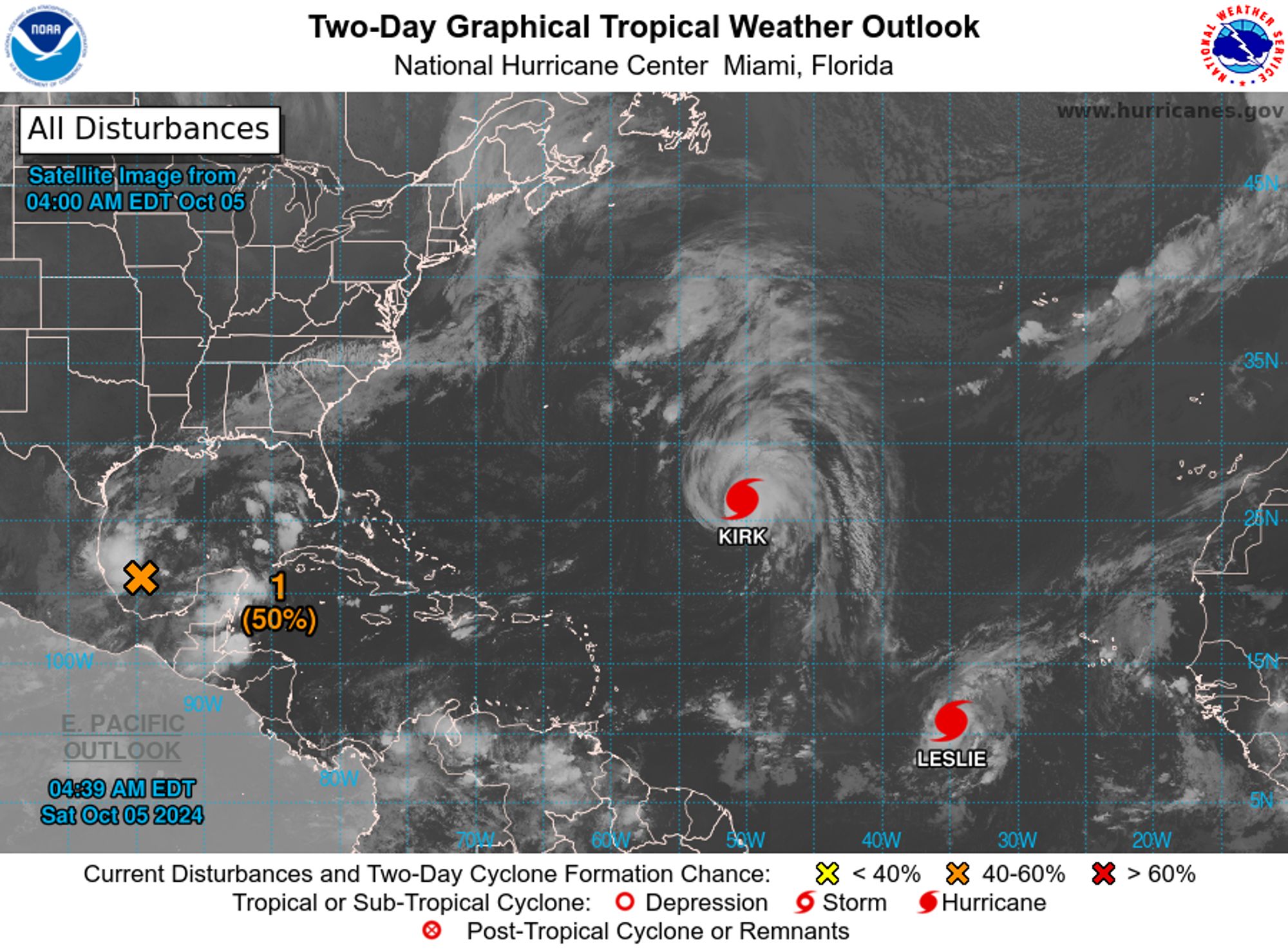
NWS National Hurricane Center Miami FL 200 AM EDT Sat Oct 5 2024 For the North Atlantic...Caribbean Sea and the Gulf of Mexico: Active Systems: The National Hurricane Center is issuing advisories on Hurricane Kirk, located over the central subtropical Atlantic Ocean, and on Tropical Storm Leslie