BLUE
Profile banner
BM
Ben MacLeod 馬志斌
@benmacleod.bsky.social
Hong Kong / Halifax, urban & transportation things (@BenMacLeod on Twitter) www.cityfile.xyz/
273 followers284 following301 posts
BMbenmacleod.bsky.social

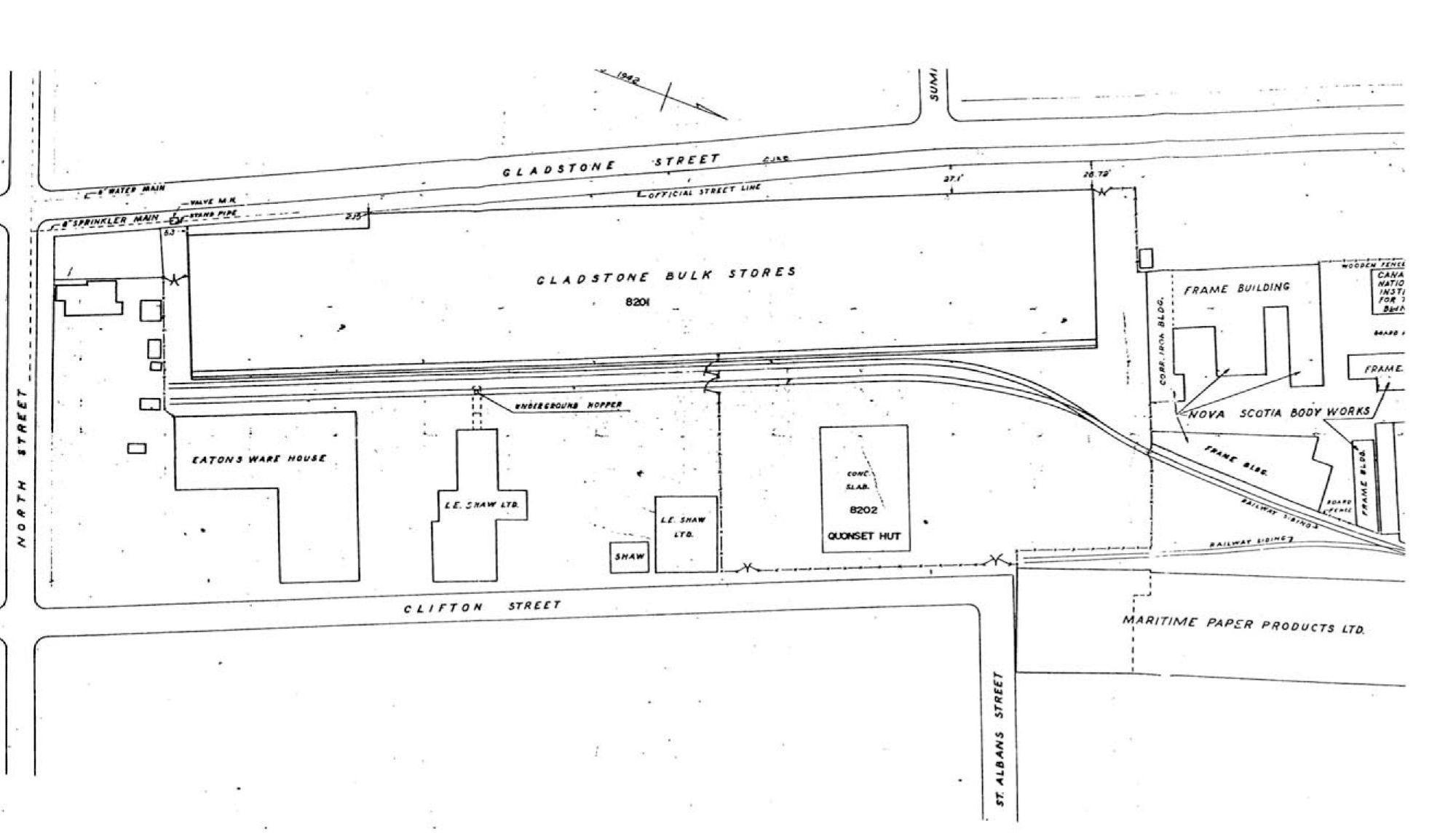
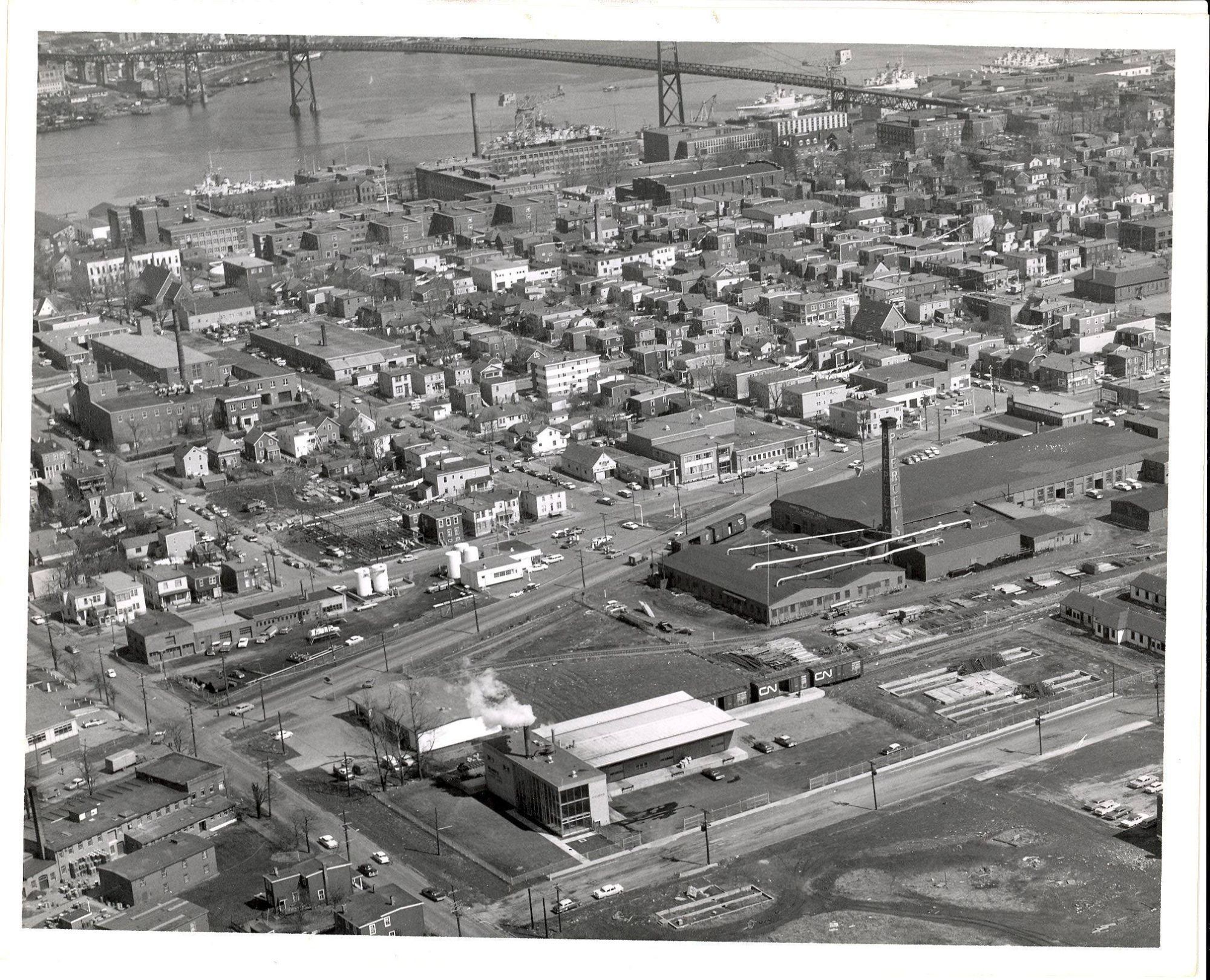
The rail line ran along Kempt which extended all the way through the block to Robie. It seems like the rail line served a bunch of industrial users and went as far south as the Gladstone Bulk Stores (a military property where Gladstone Ridge is today)

Old 1960s plan of the area around Robie Street and Kempt Road, showing Kempt running farther south than it does today. The plan also shows various railway spur lines.
Old plan of the Gladstone Bulk Stores, a long warehouse that was located on Gladstone Street in Halifax, just north of North Street. Behind the warehouse, running the length of the block, is a railway siding.
1960s aerial view of the intersection of Kempt Road and Young Street in Halifax showing various old industrial buildings and rail sidings
1

ATabolish-this.bsky.social

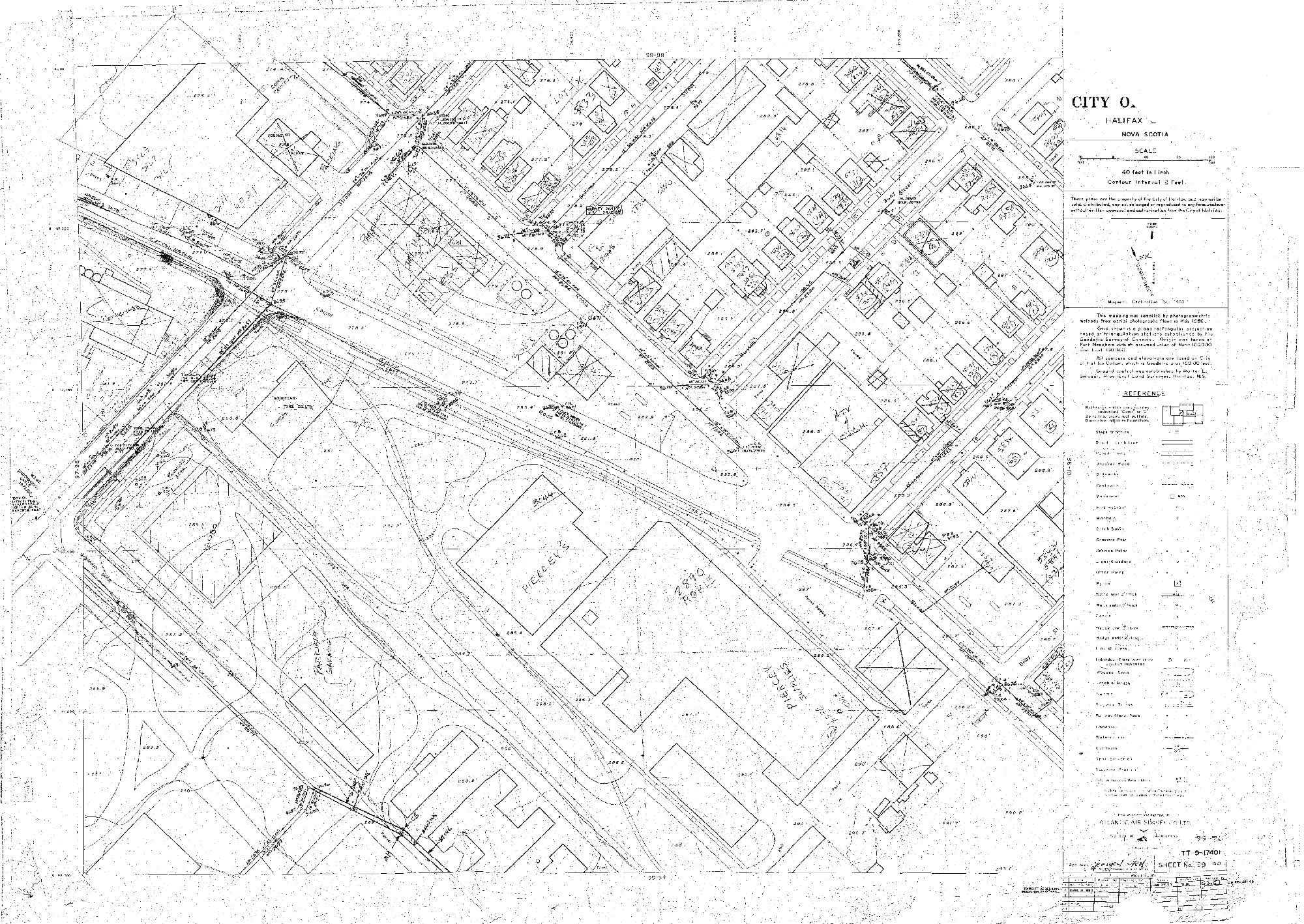
Yo that's wild, I have literally said before that Kempt looks like a rail corridor on maps and sure enough there were rails there

A reply tweet from 30 May 2023 saying "Always happy to do so. I've said before, if you showed me a Hfx map, no context & I forgot what I knew about it, & you asked where the transit-oriented high-rises were, I might point to Kempt. Parallel to arterial, pointed at downtown, next to a big space that could be a park..."
There is an image attached of a bunch of high rises and parks doodled along a map of the Kempt Rd area and "RAPID TRANSIT" scrawled along the road itself.
0
Profile banner
BM
Ben MacLeod 馬志斌
@benmacleod.bsky.social
Hong Kong / Halifax, urban & transportation things (@BenMacLeod on Twitter) www.cityfile.xyz/
273 followers284 following301 posts