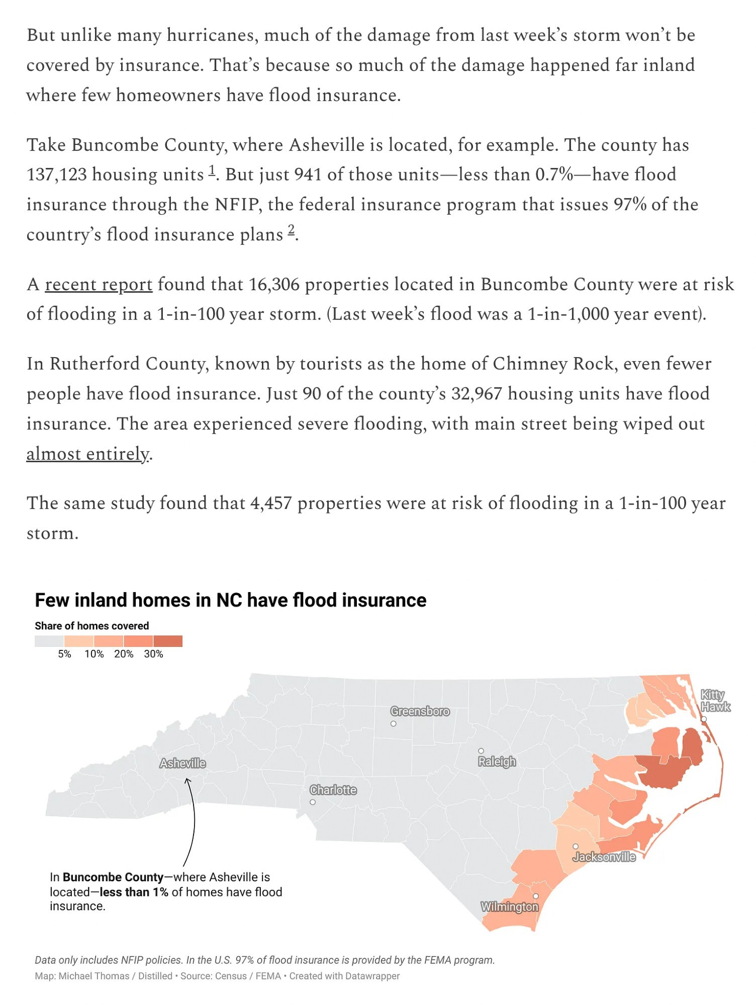
Highly recommend folks read the linked piece on the huge gaps in flood insurance coverage for most people dealing with these kinds of storm.
Note that this bill "will punish institutions that flout the law by publishing their names on a California Department of Justice website. An earlier version had proposed that schools face civil penalties for violating the law, but that provision was removed in the State Senate."
The Sep 2024 event in Southern Appalachians has had "ARkStorm-level" impacts in eastern TN & western NC. Widespread, catastrophic flooding has resulted; many lives have been lost; transport, electric, telecomm infrastructure is devastated; some towns are completely isolated. [11/n]
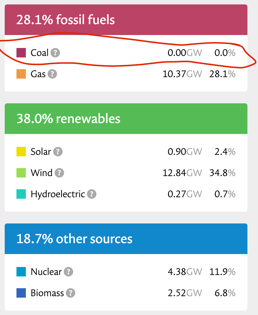
The UK has shut down its last coal-fired power station. Here's the current mix of electricity generation. www.splinter.com/coal-power-d...
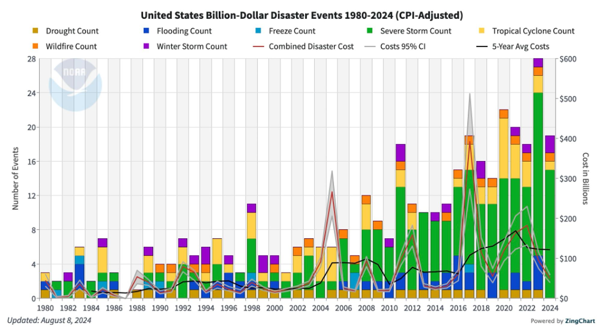
NOAA's National Centers for Environmental Information website is down, as is their database of billion-dollar weather and climate disasters. Why? Likely because NCEI is based in Asheville NC. Climate-fueled unnatural disasters spare no-one and nothing. www.ncei.noaa.gov/access/billi...
The news and images of flooding in the Southeast US, Central Europe, and Nepal are all hitting so close together in time. Meanwhile the camp I grew up going to in the mountains in San Bernardino mountains was evacuated due to a wildfire a couple of weeks back. It's a lot all at once.
You are so right!
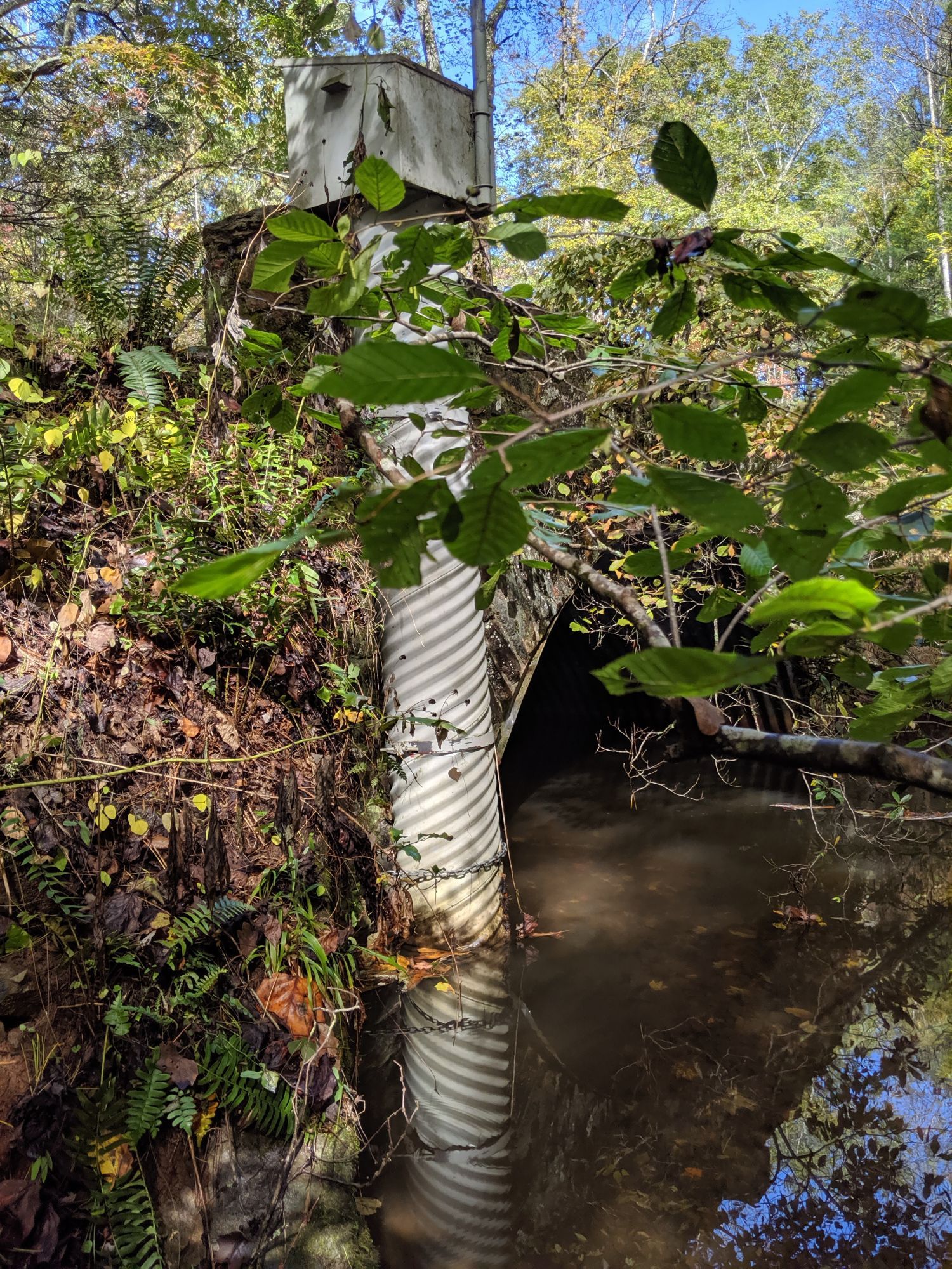
Very cool site. But I don't see the stream gauge I saw on there. I am pretty confident the photo was taken at Bent Creek, which is quite small compared to the Broad River that has gauges shown on the map. Now I wonder if the gauge I saw was in use even back in 2019. 🤔
Really wishing I could fix the #hurricane typo in my post above. 😬
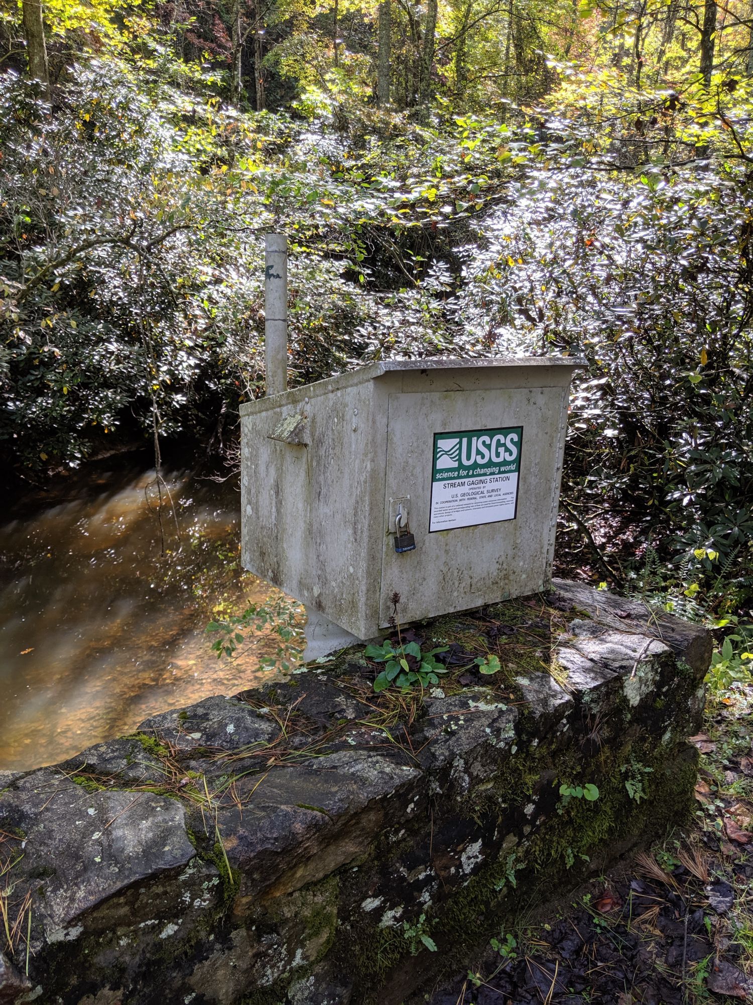
SO devastating to see all the #Hurticane#Helene#USGS#Asheville in 2019. It seems like the river may now be higher than the flood gauge. What happens to the measurements then?