HW
Hannah Weiser
@hannahwe.bsky.social
PhD student in #Geography #Geoinformatics. 3DGeo Research Group at Heidelberg University. Acquiring, simulating and analyzing 3D/4D point clouds.
13 followers9 following12 posts
📣📰 Paper alert: Classifying types of gully changes with unoccupied aircraft vehicles 3D multitemporal point clouds for training of satellite data analysis in Northwest Namibia By our former #3DGeo PhD student and #gullydoi.org/10.1002/esp....
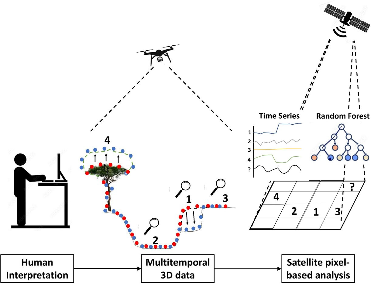
By combining the complementary benefits of UAV-based and satellite-based solutions, this work opens a line of research for the study and #classification of surface land dynamics and geomorphological feature extraction in regional extents.
HW
Hannah Weiser
@hannahwe.bsky.social
PhD student in #Geography #Geoinformatics. 3DGeo Research Group at Heidelberg University. Acquiring, simulating and analyzing 3D/4D point clouds.
13 followers9 following12 posts