
Here is the actual map of evacuation orders in Florida as of now. You can see that much of the panhandle is under no such order, and people who must leave needn't travel far. The state has arranged with Uber to provide free rides to shelters. www.floridadisaster.org/evacuation-o... 2/2
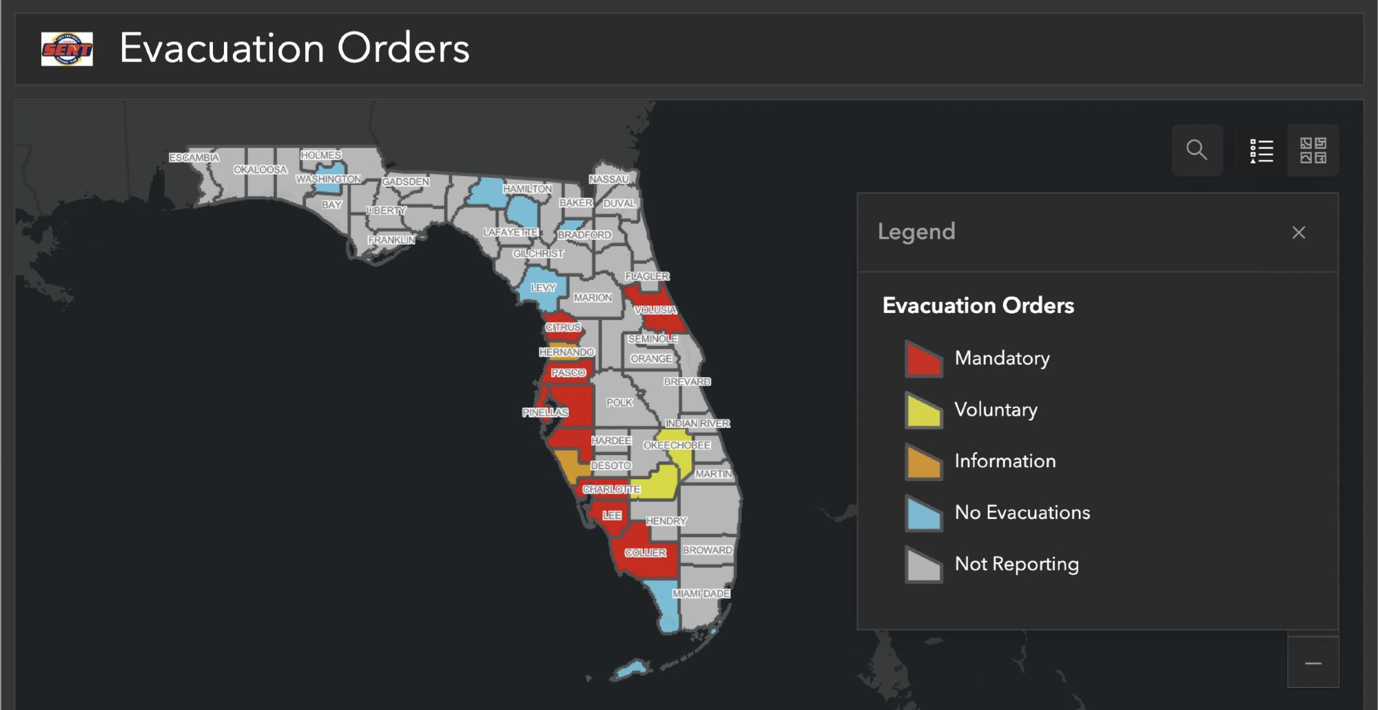
Does anybody know what’s with the orange county south of Tampa that’s not under an evacuation order.
bsky.app/profile/enki...#Desalination#Waterspout#Tornado#supercell#storm#AvroCargeoarchitektur.blogspot.com/p/waterspout...#Geoengineering#SRM#HAARP#Climate#geophysical#warfare#ClimateControl
So Uber donated a great deal to the DeSantis campaign, is the message I'm getting, here?
i'm in Volusia county and i'm curious why there's a gap between Citrus & Volusia Counties...is the hurricane taking a lunch break?
Wait I can’t tell, is Miami Dade in danger?
So, how does the mandatory order apply to/affect the meteorologists from The Weather Network who are apparently headed to the Tampa Bay area to “ride it out”? Madness.
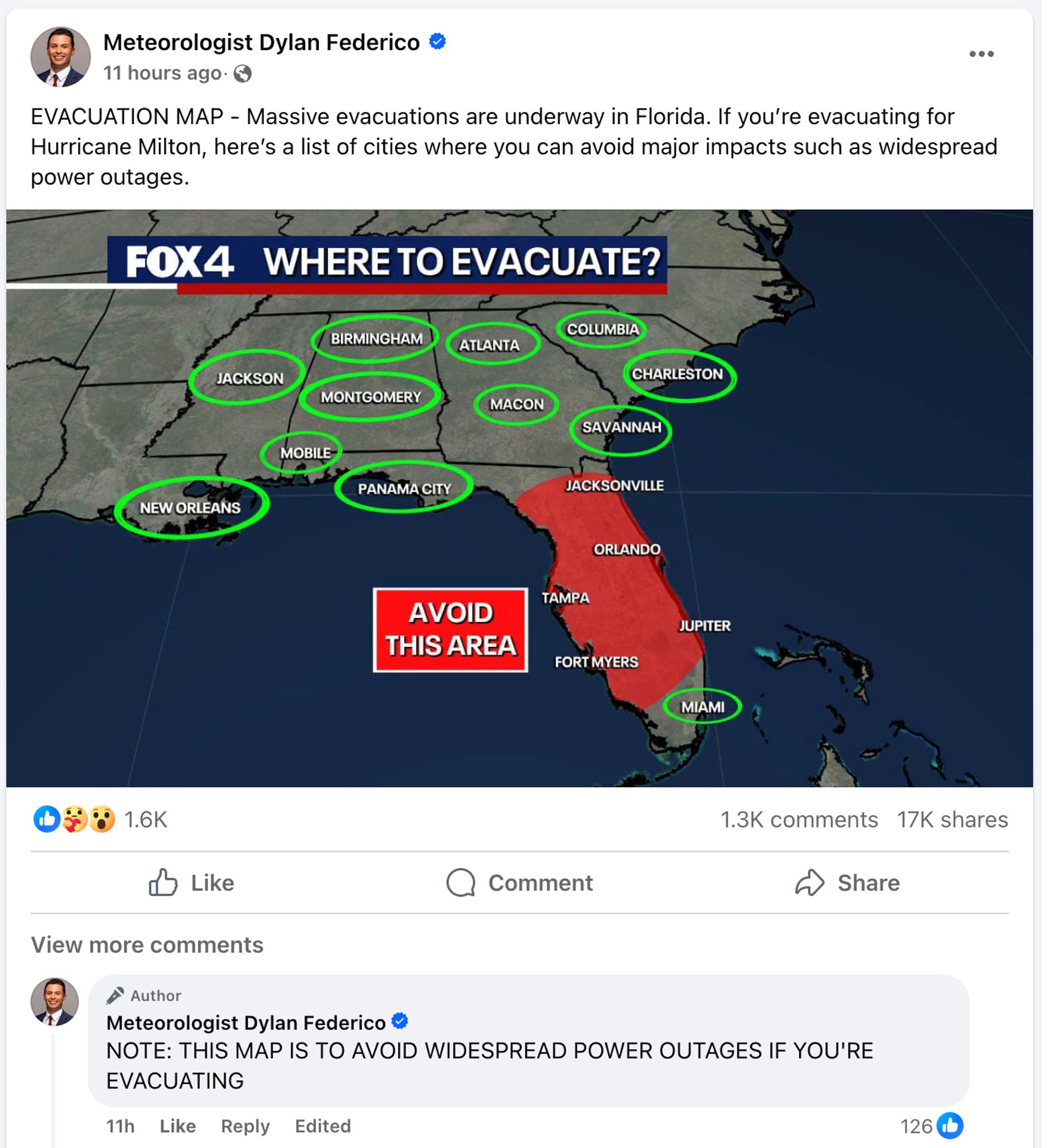
OK, looks like that misleading map was produced by a Dallas meteorologist who emphasized (after pushback) that he was only suggesting places to go if there are power outages, despite titling his graphic "WHERE TO EVACUATE?" Not great! www.facebook.com/DylanFederic...
For Hillsborough County (Tampa), it's only Zones A and B that are under mandatory evacuations. I'm not discounting the seriousness of this, just sharing local accurate info. Only the red and orange zones in this pic are under evac orders.

Thank you for posting this! I did not realize the other map didn't have an accurate source
thank you for sharing this resource!