Thank you, and yes, indeed!
@wildblueponder.bsky.social My grandfather was a WWI balloon observer; shot down but survived. Lt. Cleo Ross, his companion in the basket, was not so fortunate. This predated the creation of the USAF - my father wrote about this experience in ‘That Fateful Day’- thought you’d find this interesting.
New video - unconformity in Painted Canyon, the Mecca Hills. youtu.be/I9AECOTZdXU (3 min) ⚒️
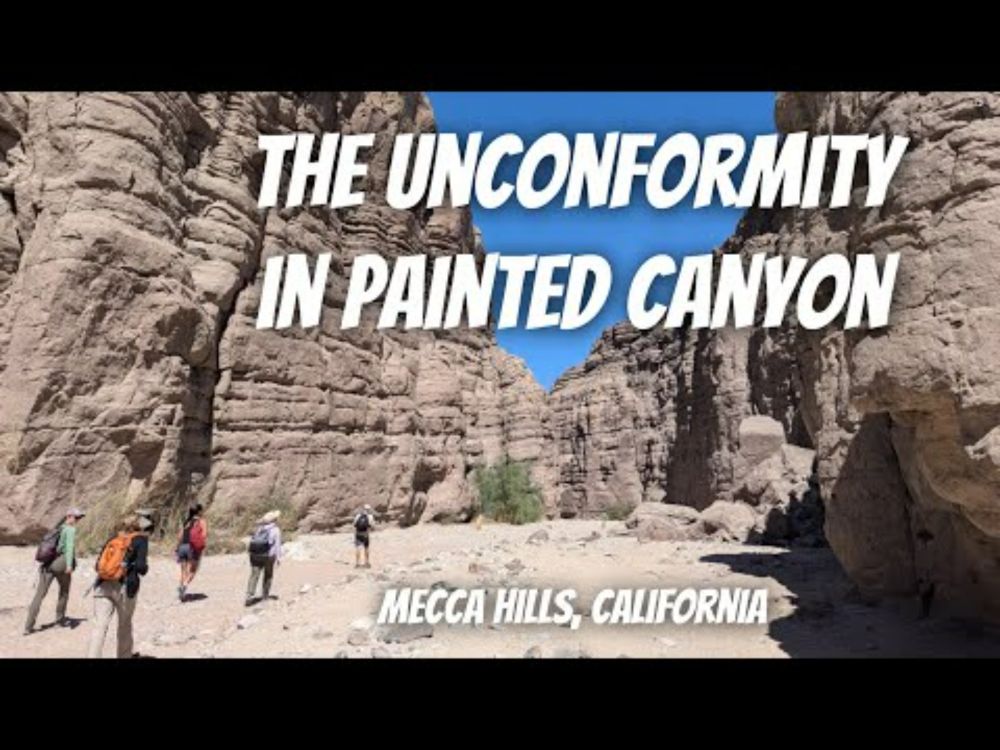
YouTube video by Callan Bentley
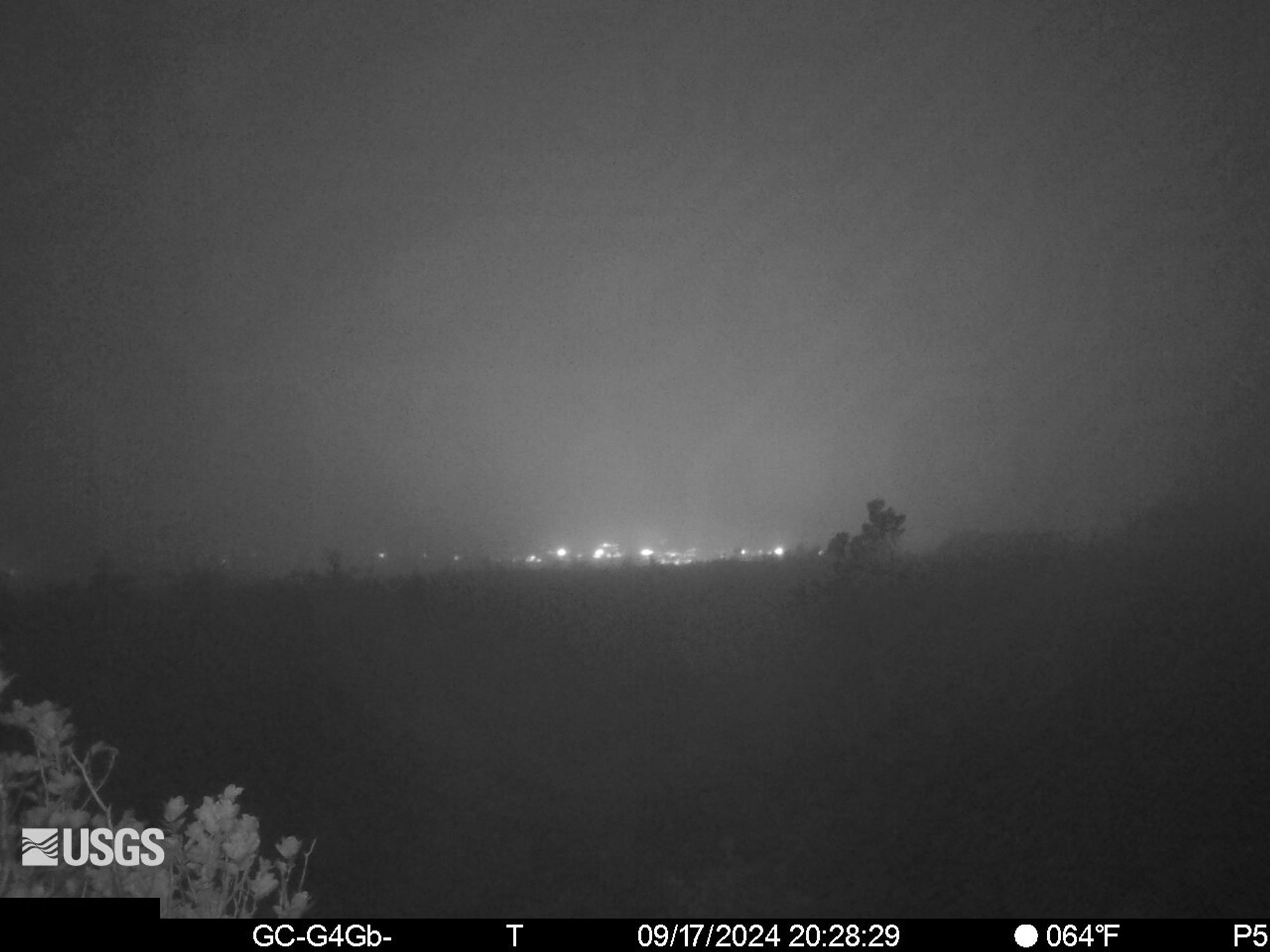
There is a new live webcam at the current eruption site on Kilauea, Napau crater! There is limited visibility at the moment, but it should clear up. ⚒️🌋 volcanoes.usgs.gov/observatorie...
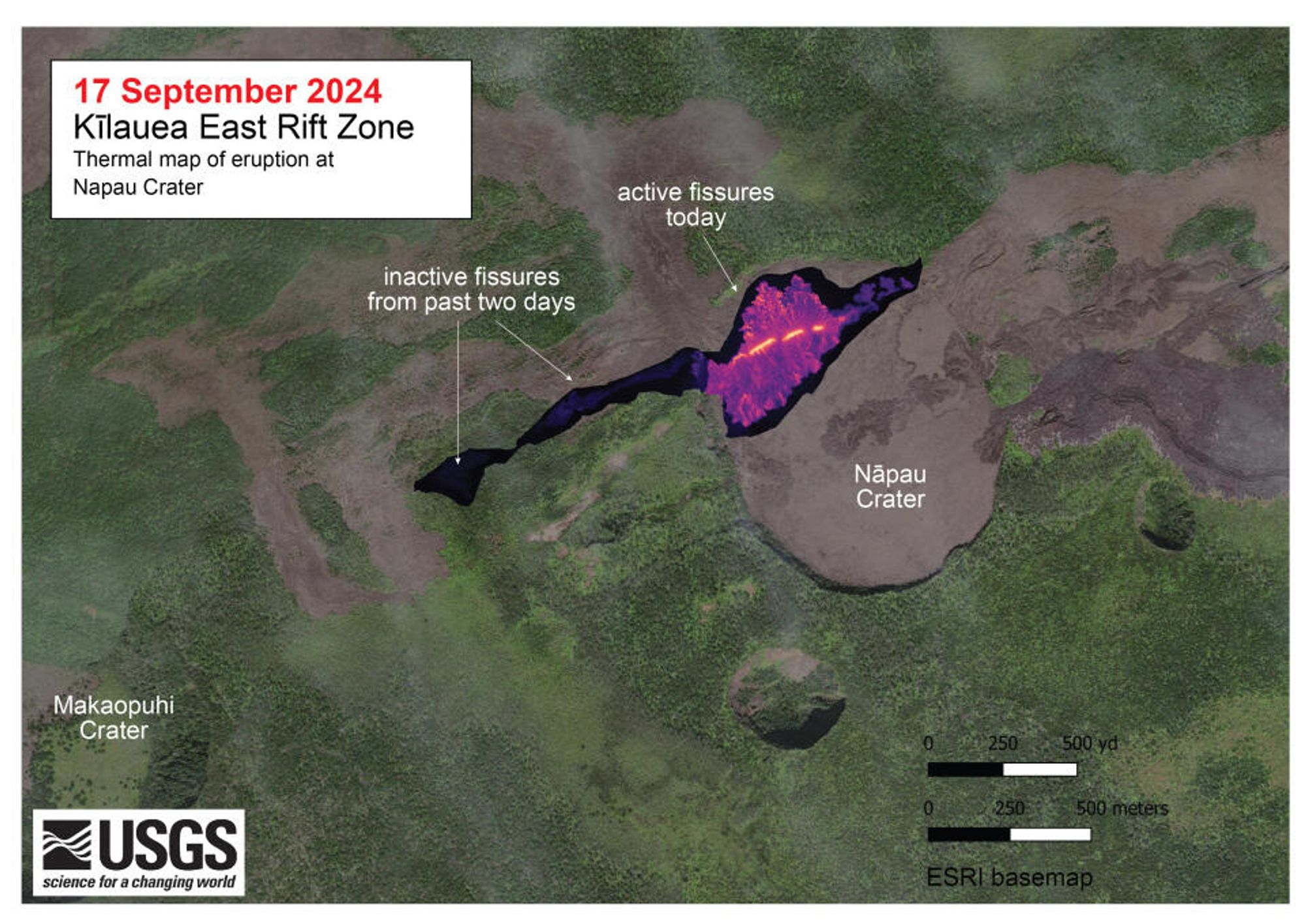
Lava returns to the east rift zone of Kīlauea 6 yrs later. Soo much has happened since (summit water lake, summit eruptions, Mauna Loa erupting 38 years after its last, upper southwest rift eruption...). It's currently spreading in Napau crater, last visited by Pele in 1968, early 1970s, and 1997.
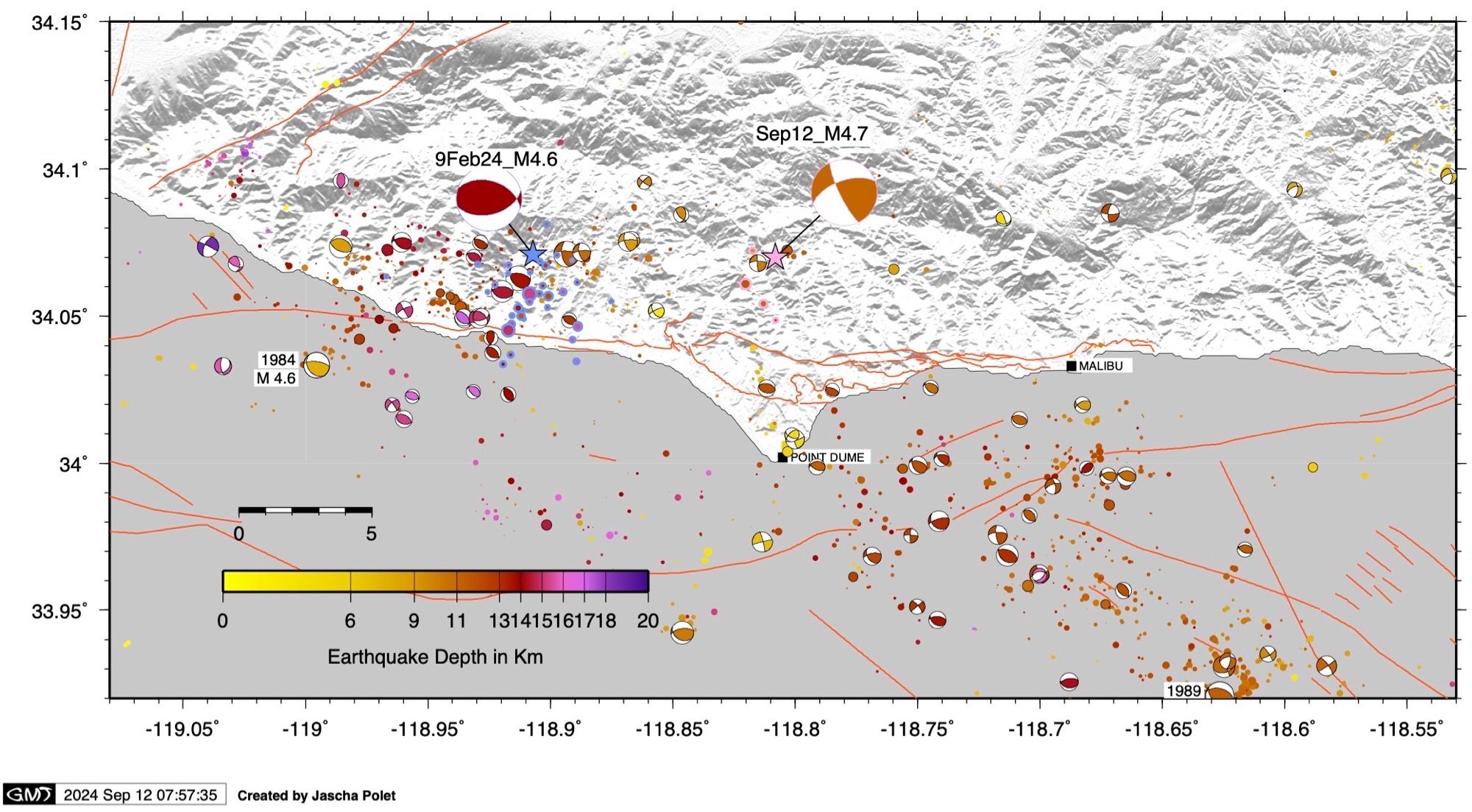
Today’s M4.7 earthquake near Malibu was located about 10 km from a M4.6 event in February. However, today’s quake was a strike slip event, whereas the earlier earthquake occurred on a reverse fault. 🧪⚒️
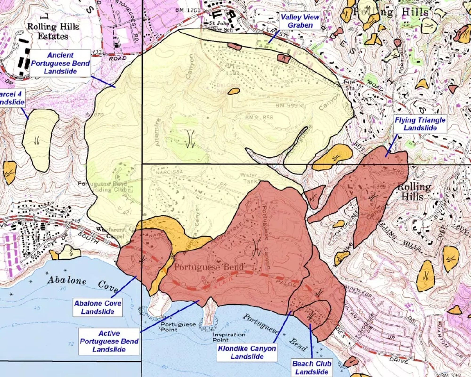
Bad news for Rancho Palos Verdes residents: “Officials confirmed a very deep and active landslide plane — previously considered dormant —during exploratory drilling this summer, a discovery that has upended emergency efforts aimed at stabilizing the area.” ⚒️🧪 www.latimes.com/california/s...
The toe of the Portuguese Bend landslide in Southern California is pushing up and creating a new beach: “The new shoreline is about 250 feet farther out to sea after parts of the seafloor moved an estimated 10 feet vertically” 🧪⚒️ www.latimes.com/california/s...
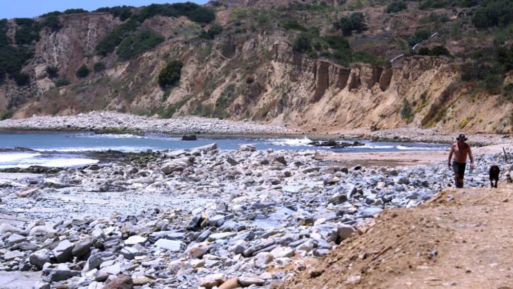
The rapidly accelerating complex of landslides in Rancho Palos Verdes has created an unforeseen outcome: a new coastline as the seafloor is pushed upward.