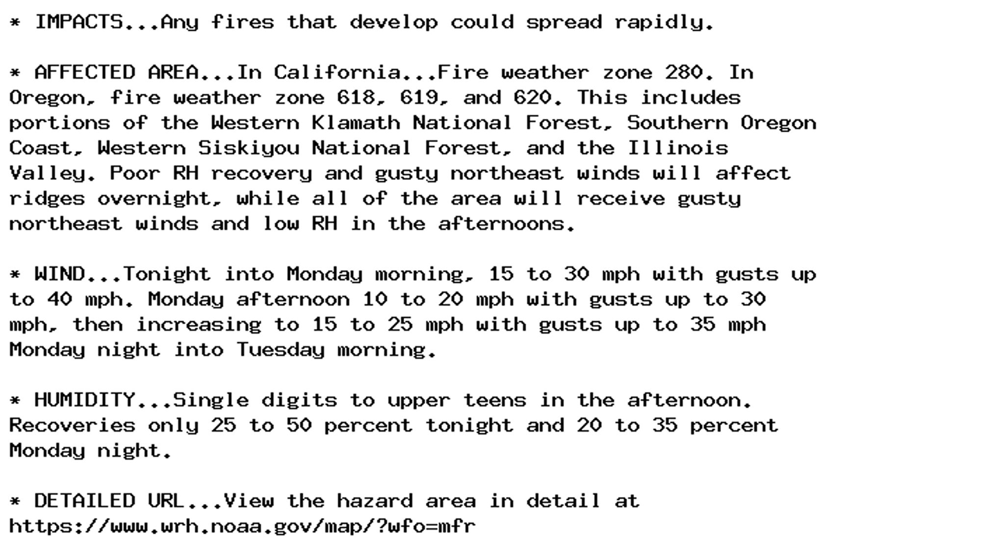
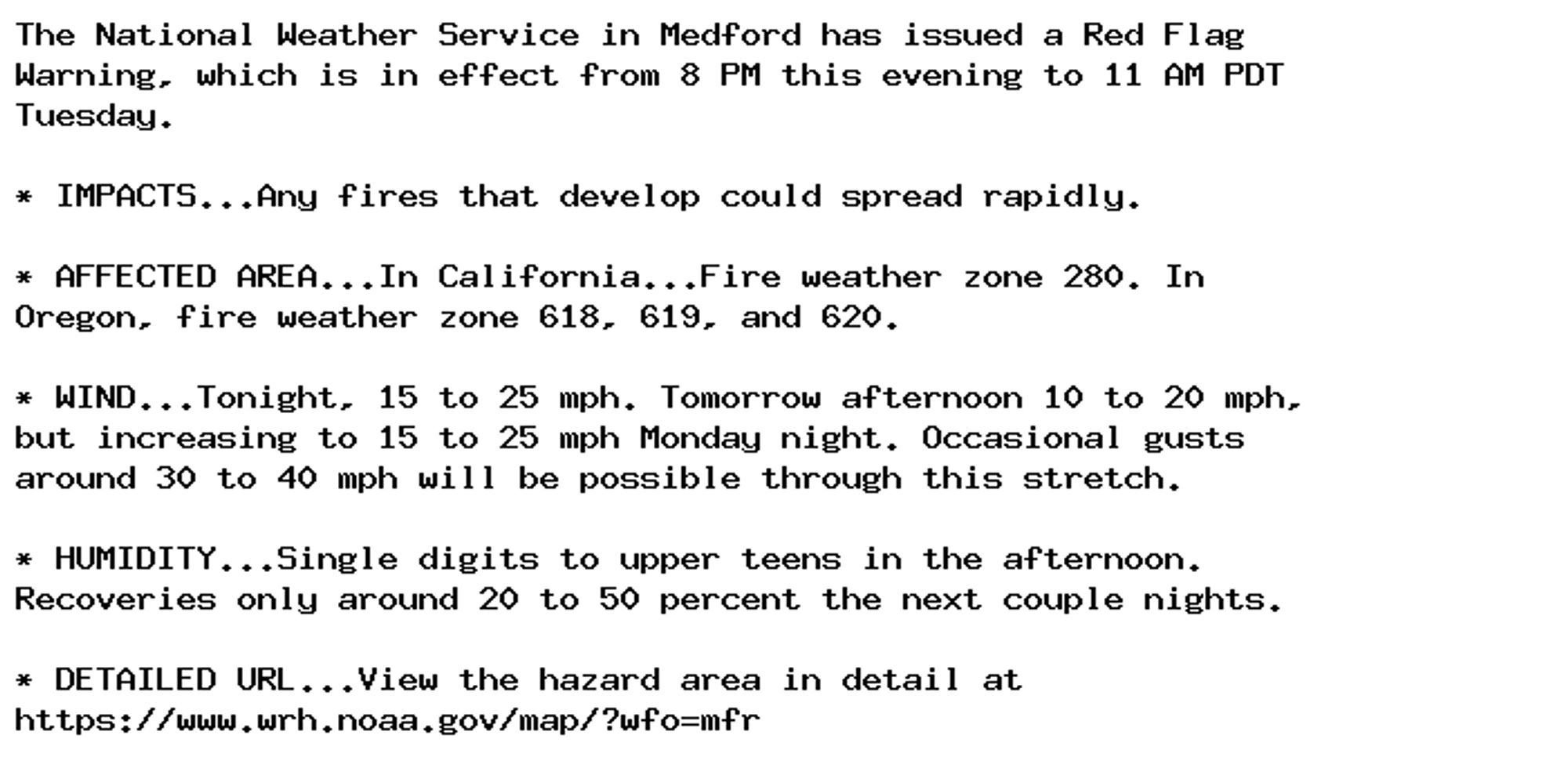
Red Flag Warning issued September 29 at 6:29PM PDT until October 1 at 11:00AM PDT by NWS Medford OR Additional Details Here.
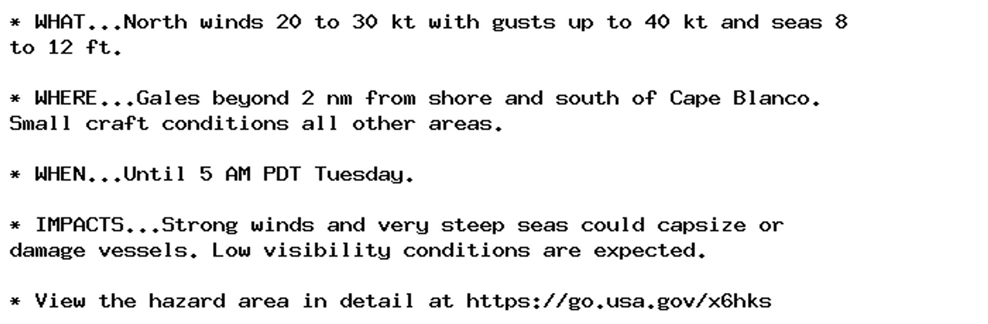
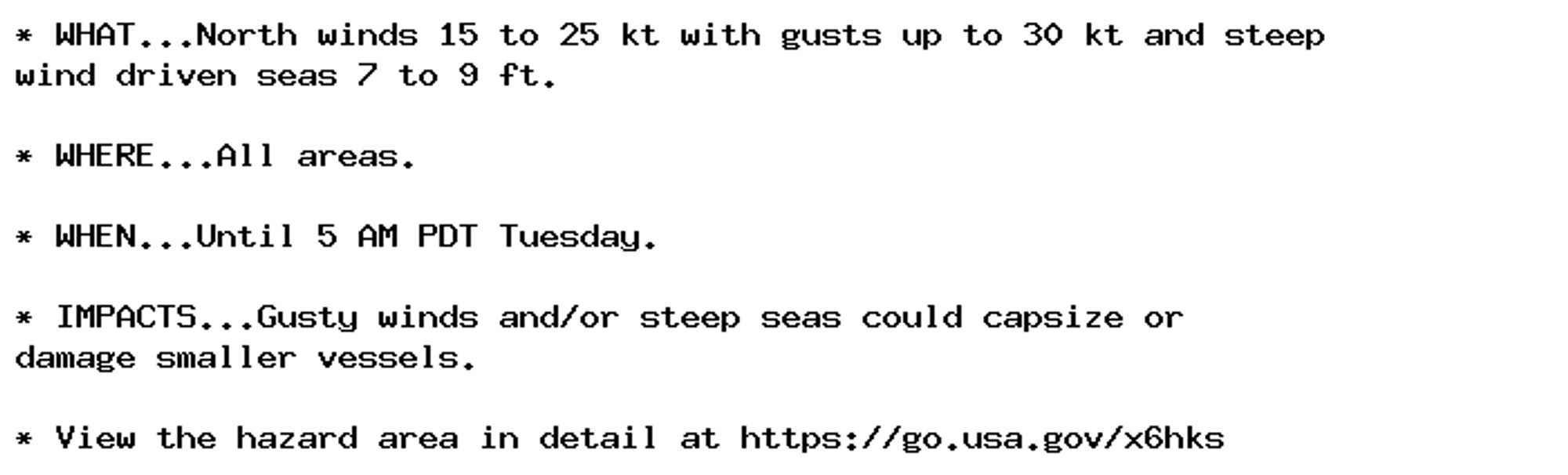
Gale Warning issued September 29 at 2:29PM PDT until October 1 at 5:00AM PDT by NWS Medford OR Additional Details Here.
Small Craft Advisory issued September 29 at 2:29PM PDT until October 1 at 5:00AM PDT by NWS Medford OR Additional Details Here.
Small Craft Advisory issued September 29 at 2:29PM PDT until October 1 at 5:00AM PDT by NWS Medford OR Additional Details Here.
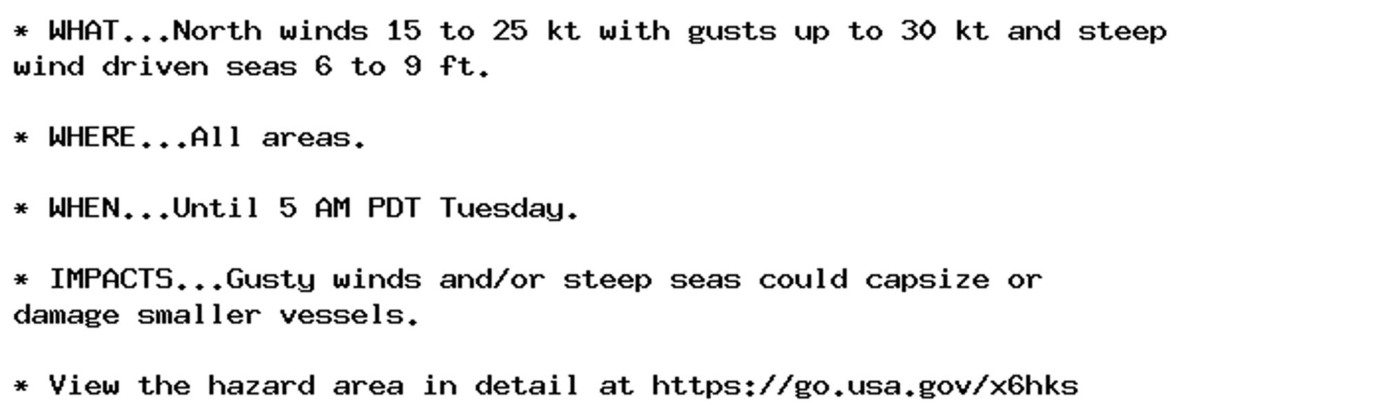
Small Craft Advisory issued September 29 at 2:29PM PDT until October 1 at 5:00AM PDT by NWS Medford OR Additional Details Here.

Red Flag Warning issued September 29 at 11:59AM PDT until October 1 at 11:00AM PDT by NWS Medford OR Additional Details Here.
Gale Warning issued September 29 at 2:02AM PDT until October 1 at 5:00AM PDT by NWS Medford OR Additional Details Here.
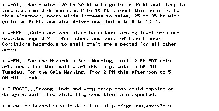
Hazardous Seas Warning issued September 29 at 2:02AM PDT until September 29 at 2:00PM PDT by NWS Medford OR Additional Details Here.
Small Craft Advisory issued September 29 at 2:02AM PDT until October 1 at 5:00AM PDT by NWS Medford OR Additional Details Here.
Small Craft Advisory issued September 29 at 2:02AM PDT until October 1 at 5:00AM PDT by NWS Medford OR Additional Details Here.