BLUE
AF
Alerts from NWS Medford OR (UNOFFICIAL)
@mfr.nws-bot.us
Unofficial bot sharing alerts from NWS Medford OR. This account is not monitored. Contact @wandrme.paxex.aero if needed.
127 followers1 following105 posts
AFmfr.nws-bot.us

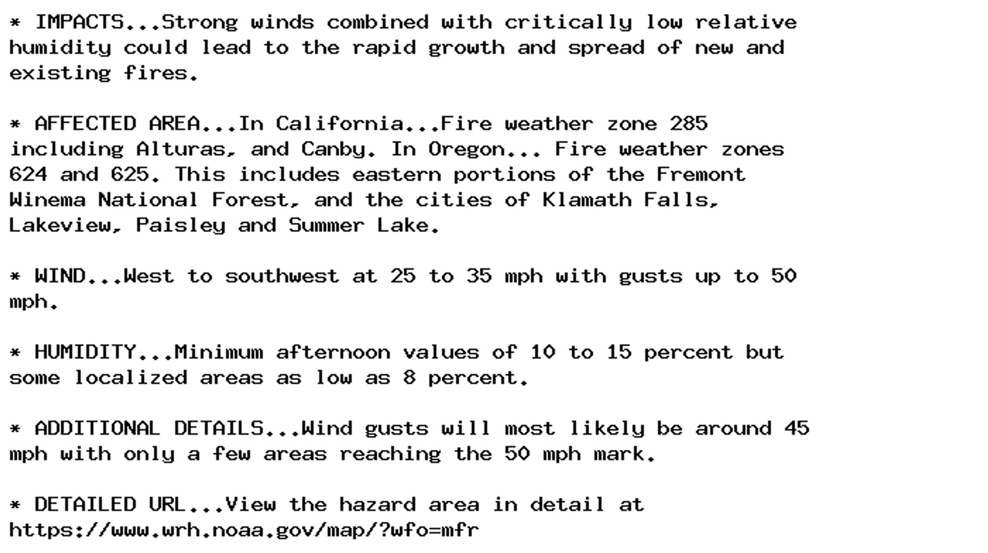
🚨 Red Flag Warning issued October 4 at 1:51PM PDT until October 4 at 8:00PM PDT by NWS Medford OR 🚨 Additional Details Here.

* IMPACTS...Strong winds combined with critically low relative
humidity could lead to the rapid growth and spread of new and
existing fires.

* AFFECTED AREA...In California...Fire weather zone 285
including Alturas, and Canby. In Oregon... Fire weather zones
624 and 625. This includes eastern portions of the Fremont
Winema National Forest, and the cities of Klamath Falls,
Lakeview, Paisley and Summer Lake.

* WIND...West to southwest at 25 to 35 mph with gusts up to 50
mph.

* HUMIDITY...Minimum afternoon values of 10 to 15 percent but
some localized areas as low as 8 percent.

* ADDITIONAL DETAILS...Wind gusts will most likely be around 45
mph with only a few areas reaching the 50 mph mark.

* DETAILED URL...View the hazard area in detail at
https://www.wrh.noaa.gov/map/?wfo=mfr
0

AF
Alerts from NWS Medford OR (UNOFFICIAL)
@mfr.nws-bot.us
Unofficial bot sharing alerts from NWS Medford OR. This account is not monitored. Contact @wandrme.paxex.aero if needed.
127 followers1 following105 posts