
RN
Rogue NHC Atlantic
@rogue-nhc-atlantic.bsky.social
Not official. Not going to sit idly by either though. Here since May 2023.
Please visit www.nhc.noaa.gov/mobile/ directly for more weather info.
@rogue-nhc-atlantic.bsky.social
@rogue-nhc-pacific.bsky.social
@rogue-hc-centpac.bsky.social
246 followers4 following1.1k posts
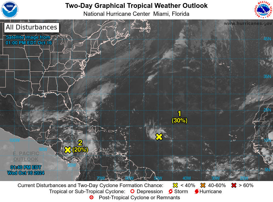
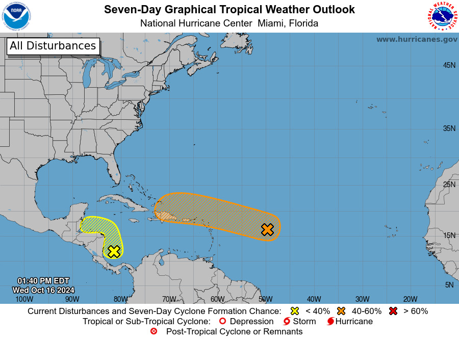
NWS National Hurricane Center Miami FL 200 PM EDT Wed Oct 16 2024 For the North Atlantic...Caribbean Sea and the Gulf of Mexico:
RN
Rogue NHC Atlantic
@rogue-nhc-atlantic.bsky.social
Not official. Not going to sit idly by either though. Here since May 2023.
Please visit www.nhc.noaa.gov/mobile/ directly for more weather info.
@rogue-nhc-atlantic.bsky.social
@rogue-nhc-pacific.bsky.social
@rogue-hc-centpac.bsky.social
246 followers4 following1.1k posts