BLUE
ST
SPC Tornado/Severe Thunderstorm Alerts (UNOFFICIAL)
@spc-storms.nws-bot.us
Unofficial bot sharing alerts from SPC Tornado/Severe Thunderstorm Watches. This account is not monitored. Contact @wandrme.paxex.aero if needed.
36 followers1 following205 posts
STspc-storms.nws-bot.us

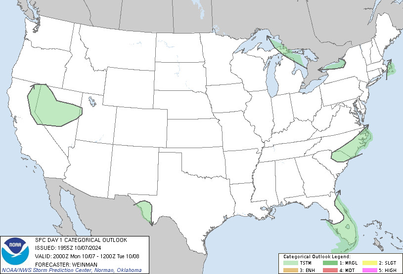
SPC Oct 7, 2024 2000 UTC Day 1 Convective Outlook ⛈️NO SEVERE THUNDERSTORM AREAS FORECAST🌪️ Additional Details Here.
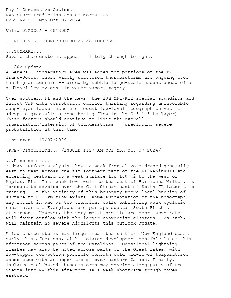
Day 1 Convective Outlook  
NWS Storm Prediction Center Norman OK
0255 PM CDT Mon Oct 07 2024

Valid 072000Z - 081200Z

...NO SEVERE THUNDERSTORM AREAS FORECAST...

...SUMMARY...
Severe thunderstorms appear unlikely through tonight.

...20Z Update...
A General Thunderstorm area was added for portions of the TX
Trans-Pecos, where widely scattered thunderstorms are ongoing over
the higher terrain -- aided by subtle large-scale ascent ahead of a
midlevel low evident in water-vapor imagery. 

Over southern FL and the Keys, the 18Z MFL/KEY special soundings and
latest VWP data corroborate earlier thinking regarding unfavorable
deep-layer lapse rates and modest low-level hodograph curvature
(despite gradually strengthening flow in the 0.5-1.5-km layer).
These factors should continue to limit the overall
organization/intensity of thunderstorms -- precluding severe
probabilities at this time.

..Weinman.. 10/07/2024

.PREV DISCUSSION... /ISSUED 1127 AM CDT Mon Oct 07 2024/

...Discussion...
Midday surface analysis shows a weak frontal zone draped generally
east to west across the far southern part of the FL Peninsula and
extending westward to a weak surface low 180 mi to the west of
Naples, FL.  This weak low, well to the east of Hurricane Milton, is
forecast to develop over the Gulf Stream east of South FL later this
evening.  In the vicinity of this boundary where local backing of
surface to 0.5 km flow exists, some augmentation of the hodograph
may result in one or two transient cells exhibiting weak cyclonic
shear over the Everglades and perhaps coastal South FL this
afternoon.  However, the very moist profile and poor lapse rates
will favor outflow with the larger convective clusters.  As such,
will maintain no severe highlights this outlook update.

A few thunderstorms may linger near the southern New England coast
early this afternoon, with isolated development possible later this
afternoon across parts of the Carolinas.  Occasional lightning
flashes may also be noted across parts of the Great Lakes, with
low-topped convection possible beneath cold mid-level temperatures
associated with an upper trough over eastern Canada. Finally,
isolated high-based thunderstorms may develop along parts of the
Sierra into NV this afternoon as a weak shortwave trough moves
eastward.
Day 1 Outlook Image
0

ST
SPC Tornado/Severe Thunderstorm Alerts (UNOFFICIAL)
@spc-storms.nws-bot.us
Unofficial bot sharing alerts from SPC Tornado/Severe Thunderstorm Watches. This account is not monitored. Contact @wandrme.paxex.aero if needed.
36 followers1 following205 posts