BLUE
ST
SPC Tornado/Severe Thunderstorm Alerts (UNOFFICIAL)
@spc-storms.nws-bot.us
Unofficial bot sharing alerts from SPC Tornado/Severe Thunderstorm Watches. This account is not monitored. Contact @wandrme.paxex.aero if needed.
22 followers1 following88 posts
STspc-storms.nws-bot.us

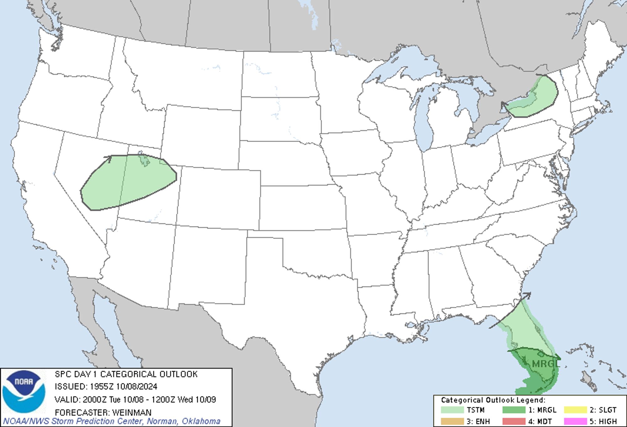
SPC Oct 8, 2024 2000 UTC Day 1 Convective Outlook ⛈️THERE IS A MARGINAL RISK OF SEVERE THUNDERSTORMS ACROSS PARTS OF WEST-CENTRAL/SOUTH FLORIDA AND THE KEYS🌪️ Additional Details Here.
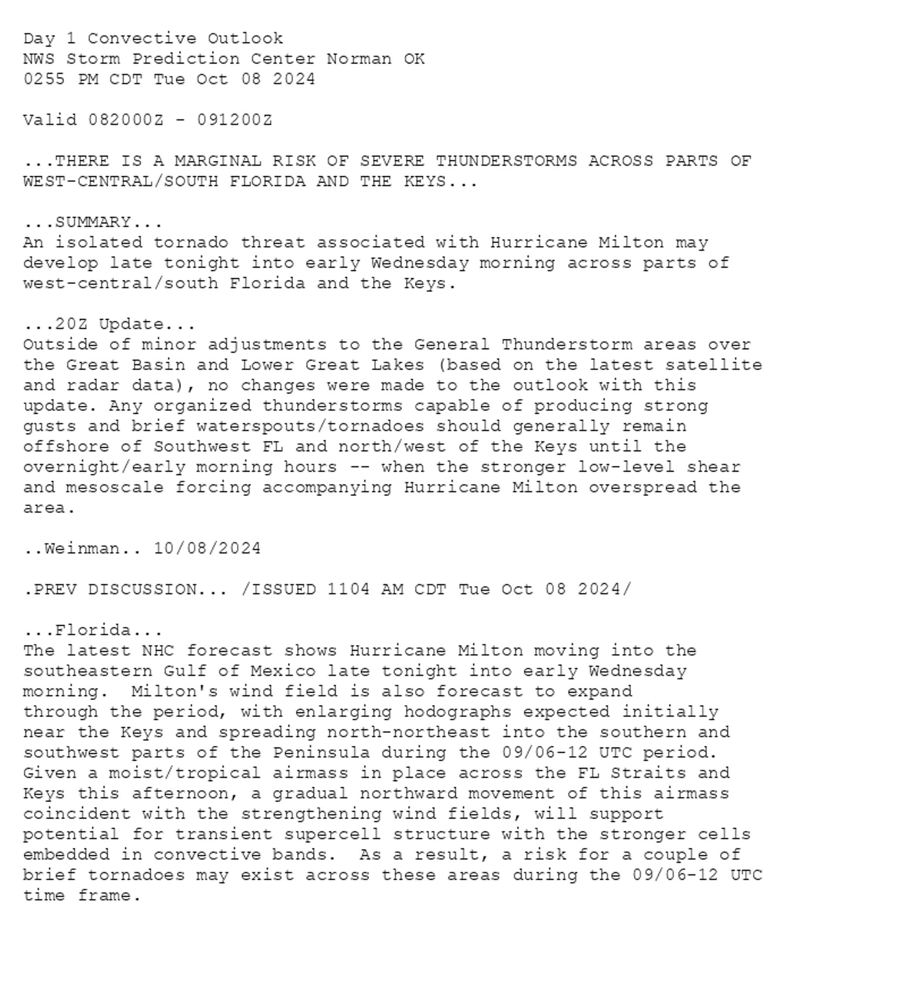
Day 1 Convective Outlook  
NWS Storm Prediction Center Norman OK
0255 PM CDT Tue Oct 08 2024

Valid 082000Z - 091200Z

...THERE IS A MARGINAL RISK OF SEVERE THUNDERSTORMS ACROSS PARTS OF
WEST-CENTRAL/SOUTH FLORIDA AND THE KEYS...

...SUMMARY...
An isolated tornado threat associated with Hurricane Milton may
develop late tonight into early Wednesday morning across parts of
west-central/south Florida and the Keys.

...20Z Update...
Outside of minor adjustments to the General Thunderstorm areas over
the Great Basin and Lower Great Lakes (based on the latest satellite
and radar data), no changes were made to the outlook with this
update. Any organized thunderstorms capable of producing strong
gusts and brief waterspouts/tornadoes should generally remain
offshore of Southwest FL and north/west of the Keys until the
overnight/early morning hours -- when the stronger low-level shear
and mesoscale forcing accompanying Hurricane Milton overspread the
area.

..Weinman.. 10/08/2024

.PREV DISCUSSION... /ISSUED 1104 AM CDT Tue Oct 08 2024/

...Florida...
The latest NHC forecast shows Hurricane Milton moving into the
southeastern Gulf of Mexico late tonight into early Wednesday
morning.  Milton's wind field is also forecast to expand
through the period, with enlarging hodographs expected initially
near the Keys and spreading north-northeast into the southern and
southwest parts of the Peninsula during the 09/06-12 UTC period. 
Given a moist/tropical airmass in place across the FL Straits and
Keys this afternoon, a gradual northward movement of this airmass
coincident with the strengthening wind fields, will support
potential for transient supercell structure with the stronger cells
embedded in convective bands.  As a result, a risk for a couple of
brief tornadoes may exist across these areas during the 09/06-12 UTC
time frame.
Day 1 Outlook Image
0

ST
SPC Tornado/Severe Thunderstorm Alerts (UNOFFICIAL)
@spc-storms.nws-bot.us
Unofficial bot sharing alerts from SPC Tornado/Severe Thunderstorm Watches. This account is not monitored. Contact @wandrme.paxex.aero if needed.
22 followers1 following88 posts