BLUE
ST
SPC Tornado/Severe Thunderstorm Alerts (UNOFFICIAL)
@spc-storms.nws-bot.us
Unofficial bot sharing alerts from SPC Tornado/Severe Thunderstorm Watches. This account is not monitored. Contact @wandrme.paxex.aero if needed.
22 followers1 following130 posts
STspc-storms.nws-bot.us

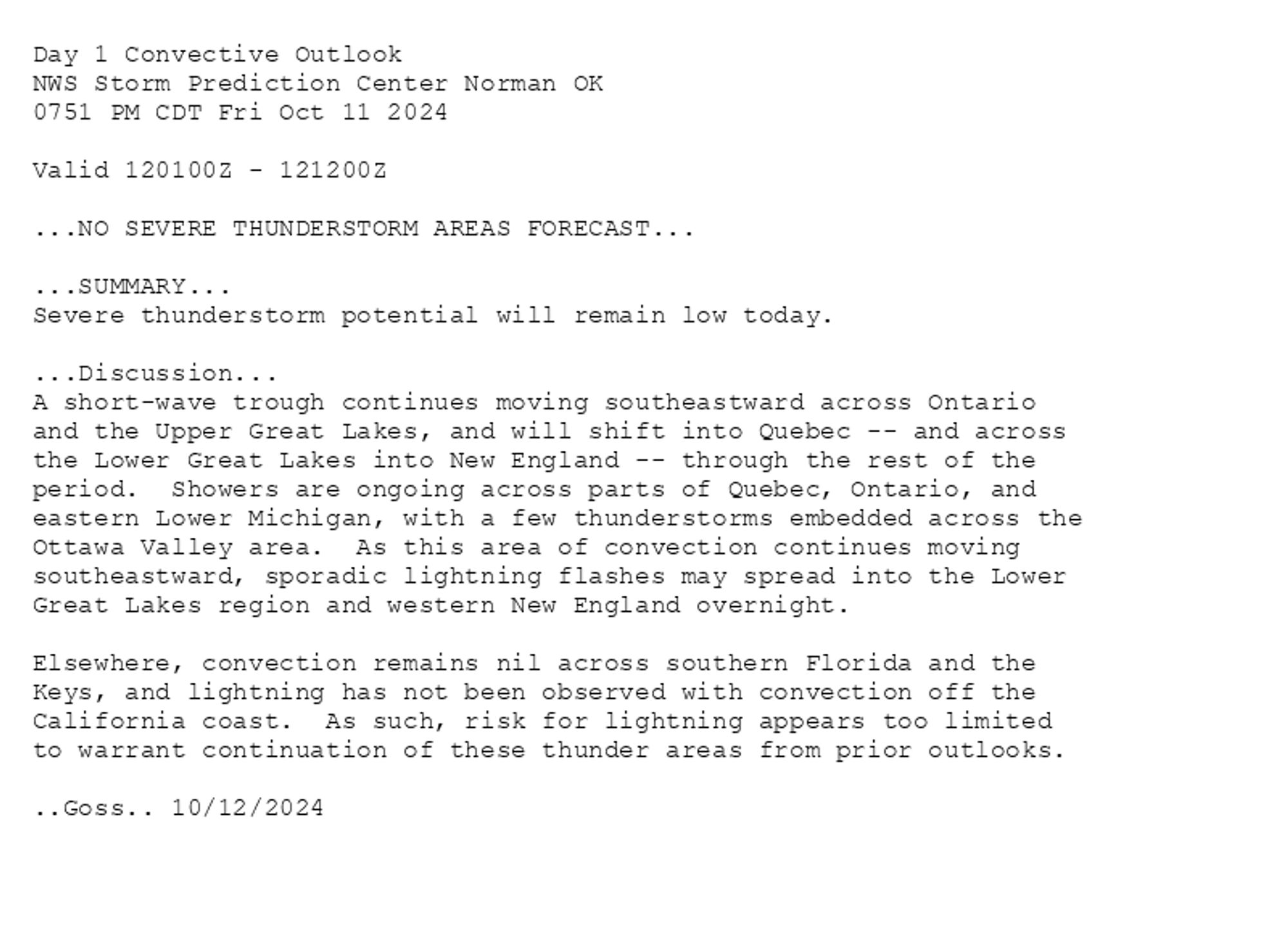
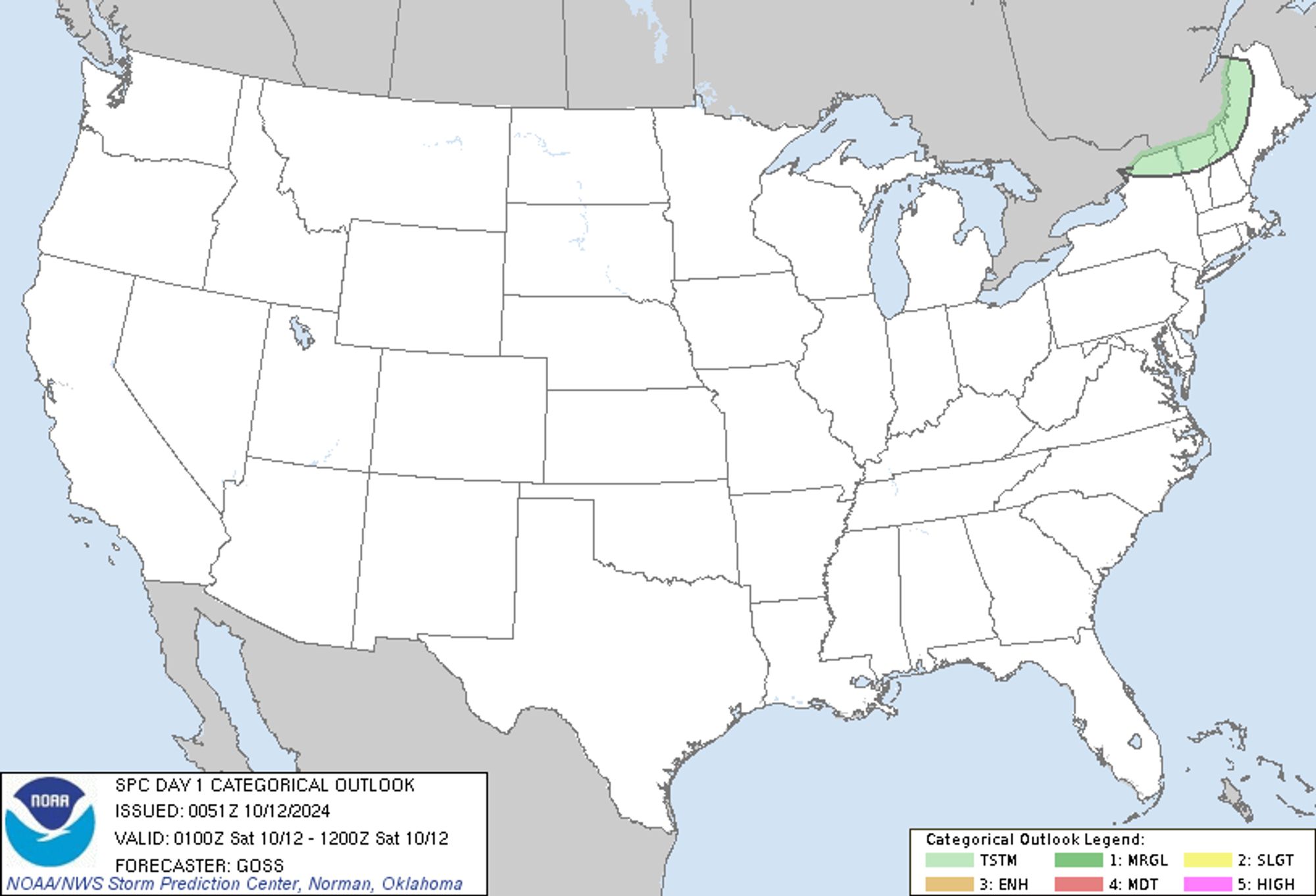
SPC Oct 12, 2024 0100 UTC Day 1 Convective Outlook ⛈️NO SEVERE THUNDERSTORM AREAS FORECAST🌪️ Additional Details Here.


Day 1 Convective Outlook  
NWS Storm Prediction Center Norman OK
0751 PM CDT Fri Oct 11 2024

Valid 120100Z - 121200Z

...NO SEVERE THUNDERSTORM AREAS FORECAST...

...SUMMARY...
Severe thunderstorm potential will remain low today.

...Discussion...
A short-wave trough continues moving southeastward across Ontario
and the Upper Great Lakes, and will shift into Quebec -- and across
the Lower Great Lakes into New England -- through the rest of the
period.  Showers are ongoing across parts of Quebec, Ontario, and
eastern Lower Michigan, with a few thunderstorms embedded across the
Ottawa Valley area.  As this area of convection continues moving
southeastward, sporadic lightning flashes may spread into the Lower
Great Lakes region and western New England overnight.

Elsewhere, convection remains nil across southern Florida and the
Keys, and lightning has not been observed with convection off the
California coast.  As such, risk for lightning appears too limited
to warrant continuation of these thunder areas from prior outlooks.

..Goss.. 10/12/2024
Day 1 Outlook Image
0

ST
SPC Tornado/Severe Thunderstorm Alerts (UNOFFICIAL)
@spc-storms.nws-bot.us
Unofficial bot sharing alerts from SPC Tornado/Severe Thunderstorm Watches. This account is not monitored. Contact @wandrme.paxex.aero if needed.
22 followers1 following130 posts