BLUE
ST
SPC Tornado/Severe Thunderstorm Alerts (UNOFFICIAL)
@spc-storms.nws-bot.us
Unofficial bot sharing alerts from SPC Tornado/Severe Thunderstorm Watches. This account is not monitored. Contact @wandrme.paxex.aero if needed.
23 followers1 following162 posts
STspc-storms.nws-bot.us

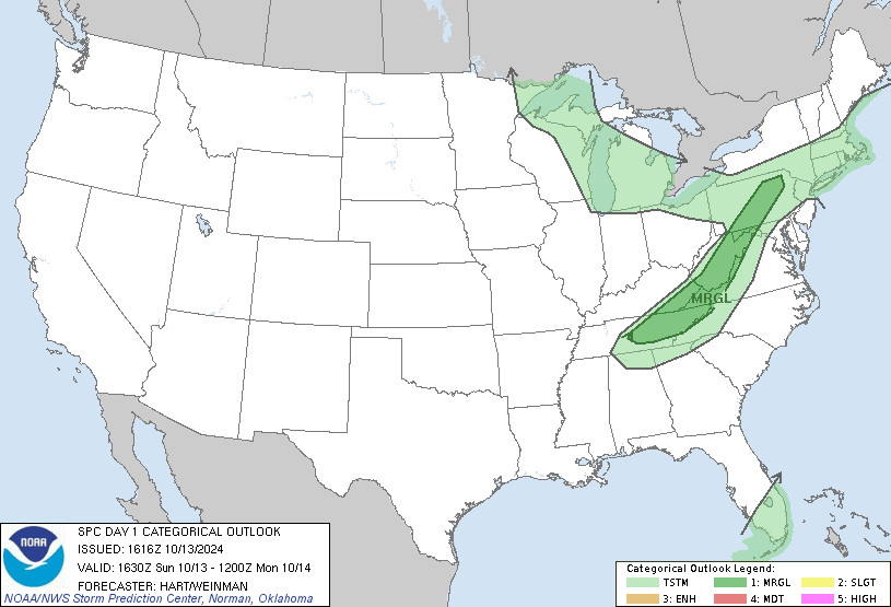
SPC Oct 13, 2024 1630 UTC Day 1 Convective Outlook ⛈️THERE IS A MARGINAL RISK OF SEVERE THUNDERSTORMS THIS AFTERNOON AND EVENING FROM THE NORTHERN APPALACHIANS INTO PARTS OF THE TENNESSEE VALLEY🌪️ Additional Details Here.
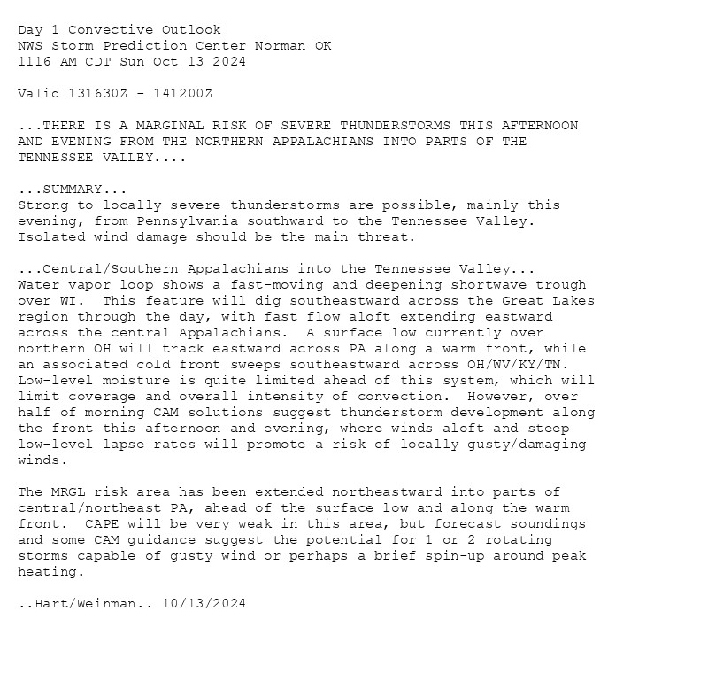
Day 1 Convective Outlook  
NWS Storm Prediction Center Norman OK
1116 AM CDT Sun Oct 13 2024

Valid 131630Z - 141200Z

...THERE IS A MARGINAL RISK OF SEVERE THUNDERSTORMS THIS AFTERNOON
AND EVENING FROM THE NORTHERN APPALACHIANS INTO PARTS OF THE
TENNESSEE VALLEY....

...SUMMARY...
Strong to locally severe thunderstorms are possible, mainly this
evening, from Pennsylvania southward to the Tennessee Valley.
Isolated wind damage should be the main threat.

...Central/Southern Appalachians into the Tennessee Valley...
Water vapor loop shows a fast-moving and deepening shortwave trough
over WI.  This feature will dig southeastward across the Great Lakes
region through the day, with fast flow aloft extending eastward
across the central Appalachians.  A surface low currently over
northern OH will track eastward across PA along a warm front, while
an associated cold front sweeps southeastward across OH/WV/KY/TN. 
Low-level moisture is quite limited ahead of this system, which will
limit coverage and overall intensity of convection.  However, over
half of morning CAM solutions suggest thunderstorm development along
the front this afternoon and evening, where winds aloft and steep
low-level lapse rates will promote a risk of locally gusty/damaging
winds.  

The MRGL risk area has been extended northeastward into parts of
central/northeast PA, ahead of the surface low and along the warm
front.  CAPE will be very weak in this area, but forecast soundings
and some CAM guidance suggest the potential for 1 or 2 rotating
storms capable of gusty wind or perhaps a brief spin-up around peak
heating.

..Hart/Weinman.. 10/13/2024
Day 1 Outlook Image
0

ST
SPC Tornado/Severe Thunderstorm Alerts (UNOFFICIAL)
@spc-storms.nws-bot.us
Unofficial bot sharing alerts from SPC Tornado/Severe Thunderstorm Watches. This account is not monitored. Contact @wandrme.paxex.aero if needed.
23 followers1 following162 posts