I've worked for a solar PV installation company for 20 years. At first, our clients were wealthy environmentalist types. We still get some of those, but a bigger portion of the pie is homeowners looking to protect against shaky grid service in our semi-rural area &/or stick it to greedy utilities.

This is a really well-produced show on climate change (effects of + solutions for). Highly recommend!
I just watched the new PBS docu-series "Weathered: Earth's Extremes," & I suggest you do too! After interacting w/production team over past few years--a period exceptional global heat & extremes--I think finished product is just right for present moment. www.pbs.org/about/ab...

PBS announces WEATHERED: EARTH'S EXTREMES, a new series hosted by Maiya May exploring extreme weather in North America.
Incredibly enough, the recent dam removals and river restorations have revived the ecosystems almost as quickly. Challenges remain but it always makes sense to take action for biodiversity. bsky.app/profile/aarn...
The Lake Ladoga salmon parr populations on the Hiitolanjoki River have doubled from last year according to on site research. The last dam was removed recently and already some large salmon have been observed upstream for the first time in one hundred years. #Biodiversity 🐟 yle.fi/a/74-2010796...
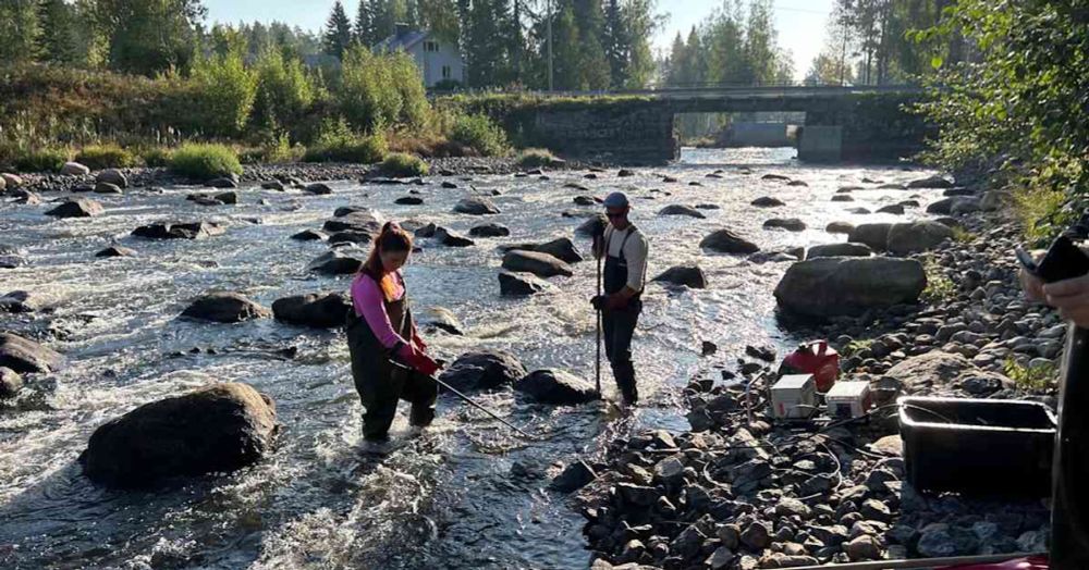
Viimeinenkin Hiitolanjoen kolmesta vesivoimapadosta purettiin lokakuussa. Isojen lohien uskotaan kutevan tänä syksynä yläjuoksulle.
Apparently today is World Mental Health Day and honestly it feels like half the world is completely unhinged & the rest of us are just hanging on trying to stay remotely functional and minimally toxic to others so I don't really know what else to say about that.
I hope they give homeowners induction stoves (if they want them) vs other electric options. The former work so much better.
I did a write up of the new California law that greenlights 30 pilot projects for "neighborhood-scale electrification" Basically, CA utilities are going to start moving whole neighborhoods off gas. People will get free retrofits and appliances. gasoutlook.com/analysis/cal...

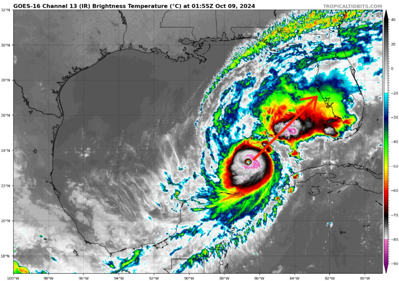
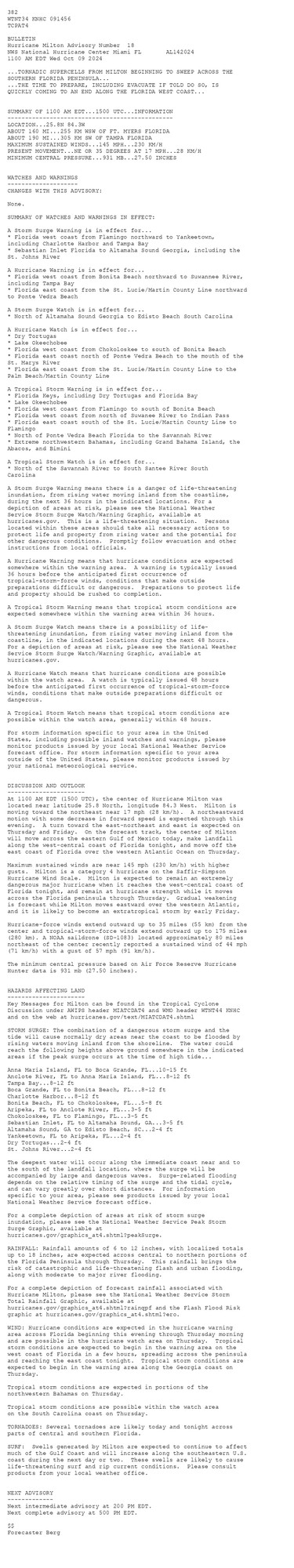
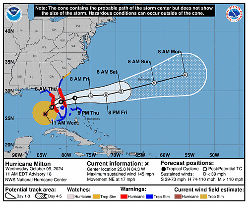
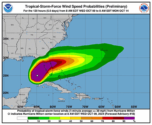
Atlantic Hurricane Milton Advisory Number 18 ...TORNADIC SUPERCELLS FROM MILTON BEGINNING TO SWEEP ACROSS THE SOUTHERN FLORIDA PENINSULA... ...THE TIME TO PREPARE, INCLUDING EVACUATE IF TOLD DO SO, IS QUICKLY COMING TO AN END ALONG THE FLORIDA WEST COAST... Additional Details Here.
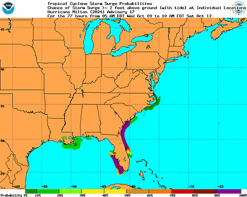
🌀 Oct 8 late night post: Major Hurricane Milton remains a very pretty circle (when seen from space). Oh, to be a satellite right now. The future of Milton remains largely the same as before, and we are expecting landfall as a large category 3 storm starting about midnight tomorrow night. 🧵