self destruction is a special kind of freedom etc
Netanyahu: "You have an opportunity to save Lebanon before it falls into the abyss of a long war that will lead to destruction and suffering like we see in Gaza." "I say to you, the people of Lebanon: Free your country from Hezbollah so that this war can end"
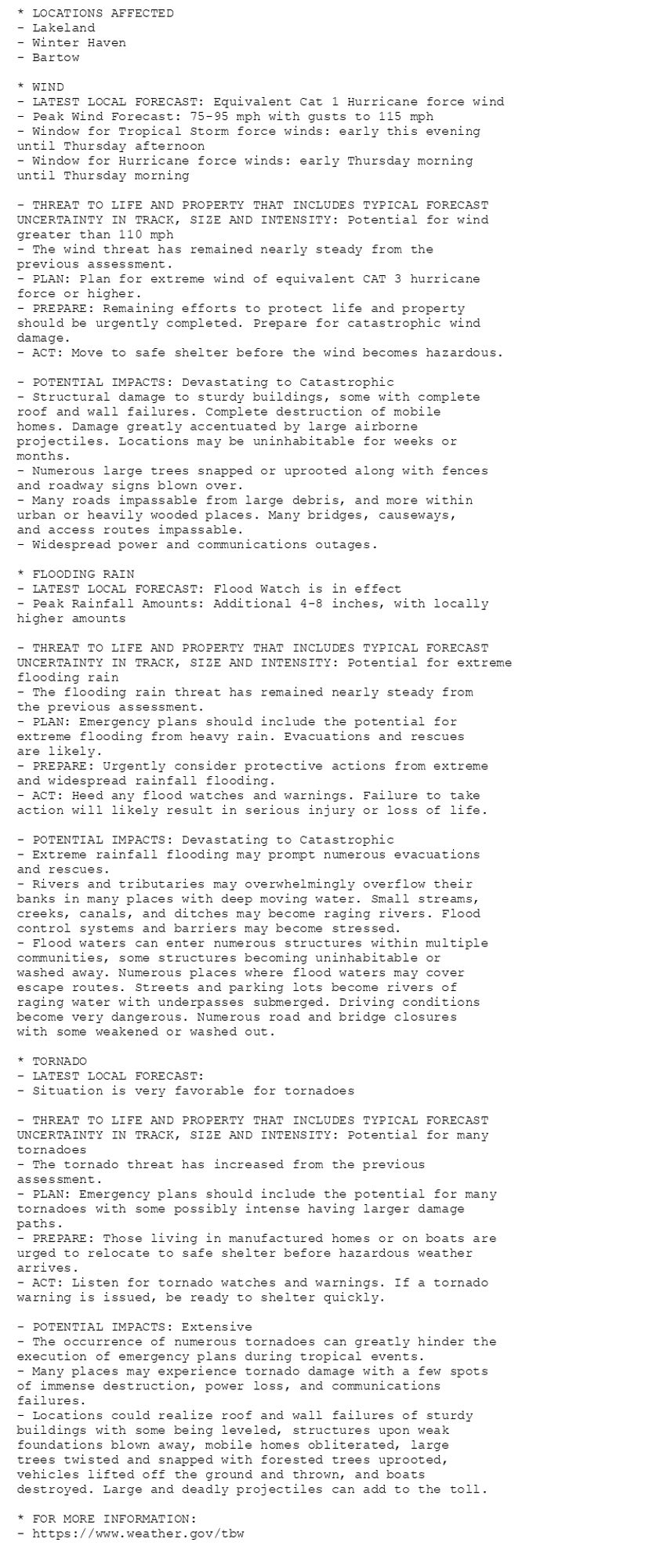
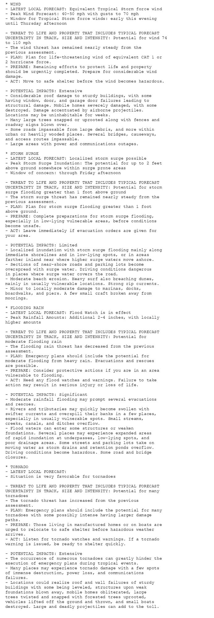
🚨🚨🚨 Hurricane Warning issued October 9 at 5:06AM EDT by NWS Tampa Bay Ruskin FL 🚨🚨🚨 Additional Details Here.(9/9)
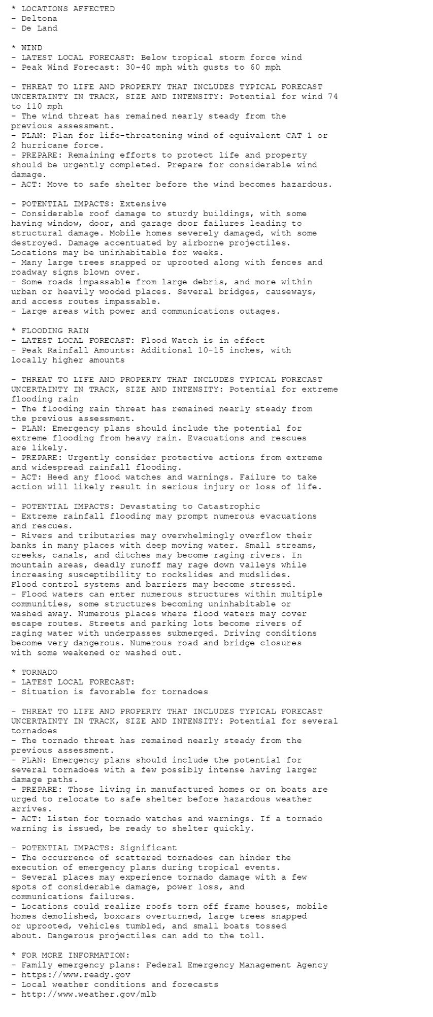
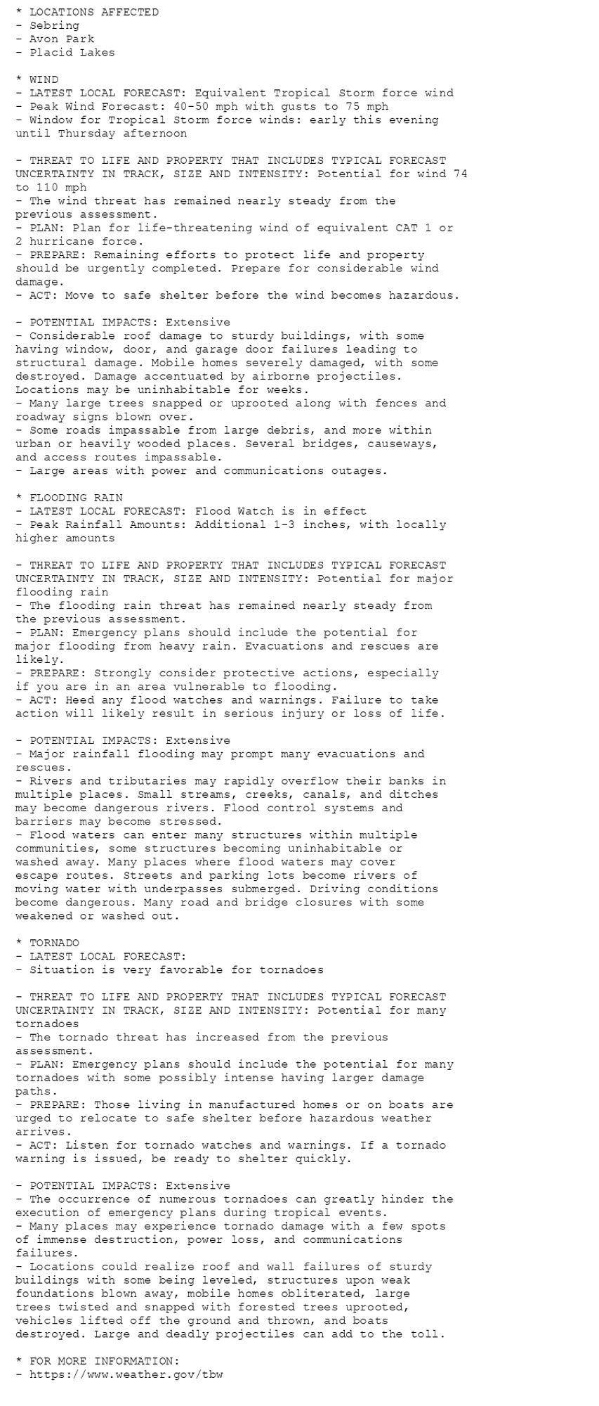
🚨🚨🚨 Hurricane Warning issued October 9 at 5:06AM EDT by NWS Tampa Bay Ruskin FL 🚨🚨🚨 Additional Details Here. (8/9)
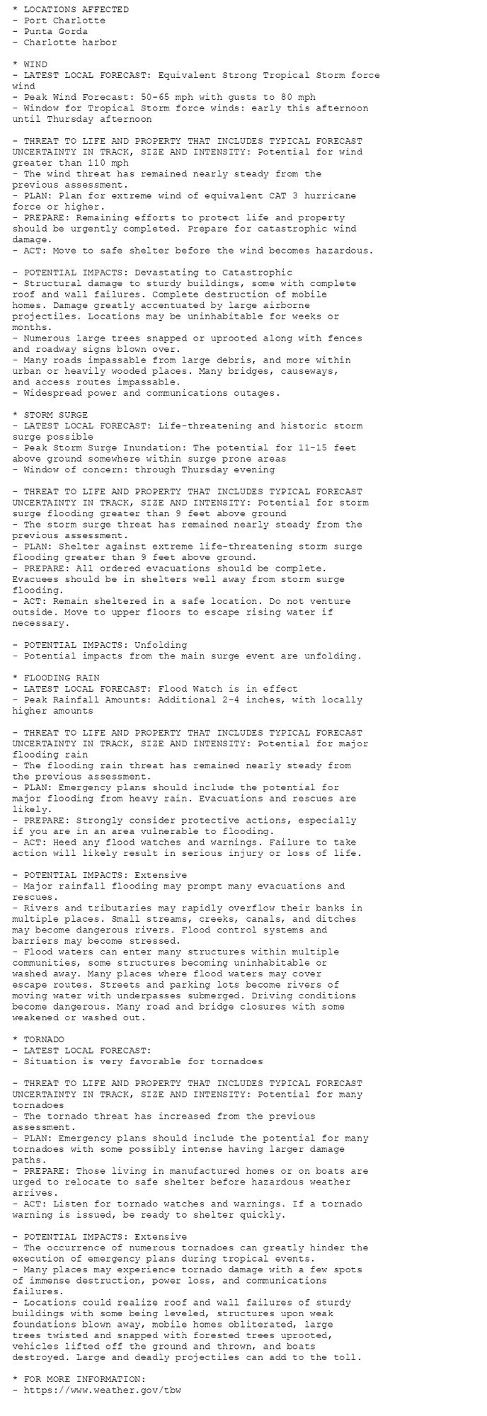
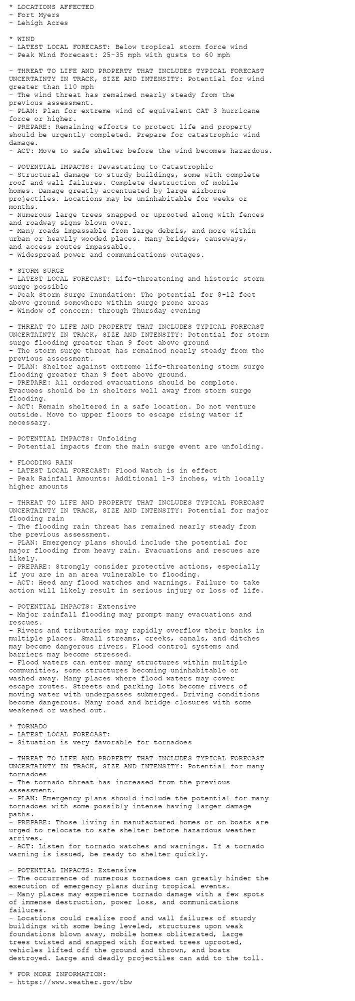
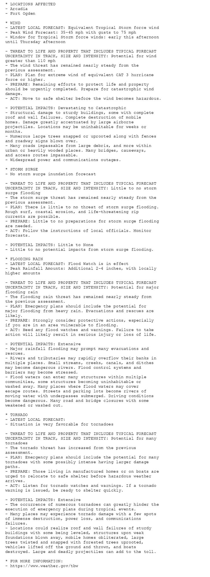
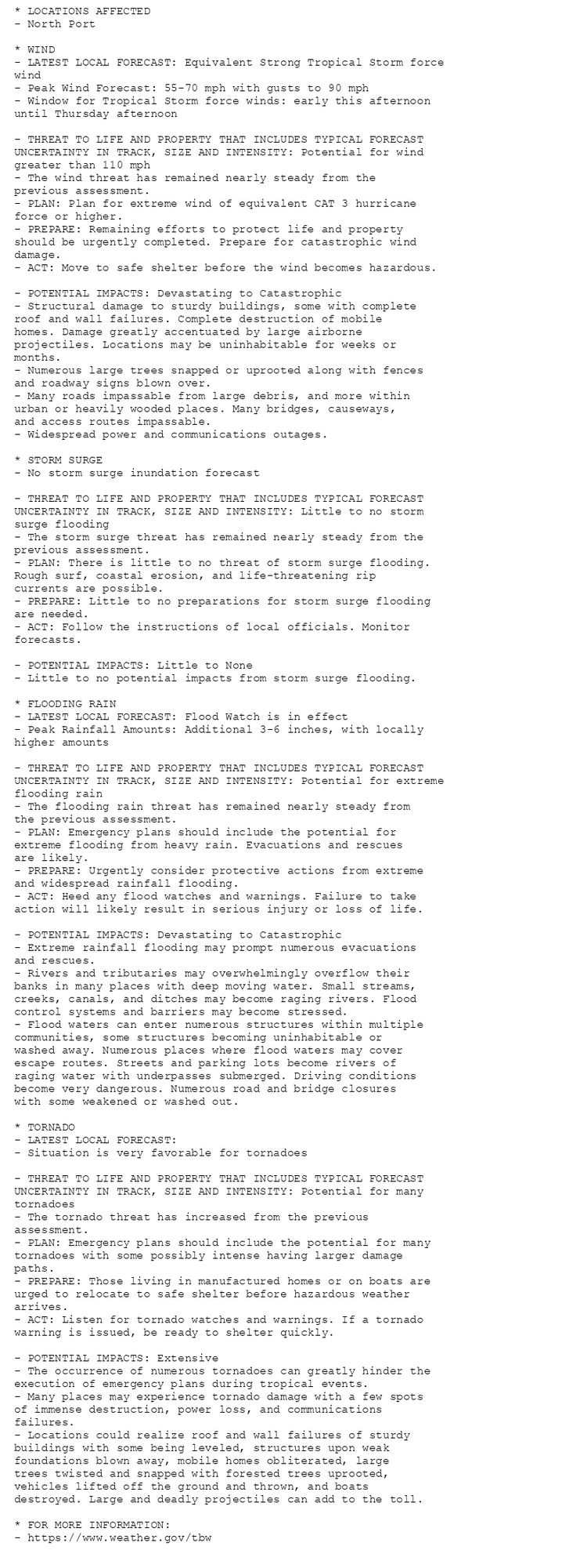
🚨🚨🚨 Hurricane Warning issued October 9 at 5:06AM EDT by NWS Tampa Bay Ruskin FL 🚨🚨🚨 Additional Details Here. (7/9)
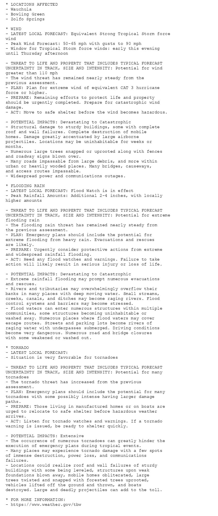
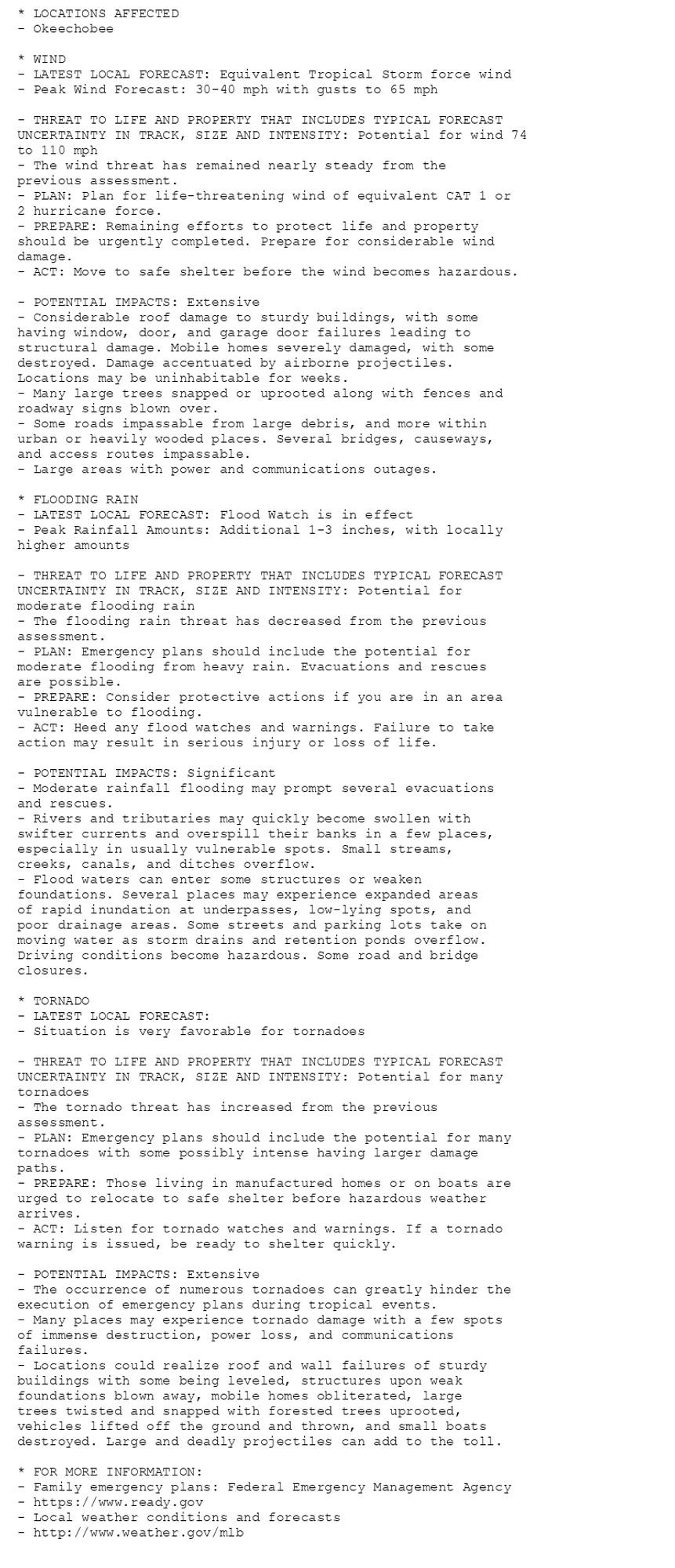
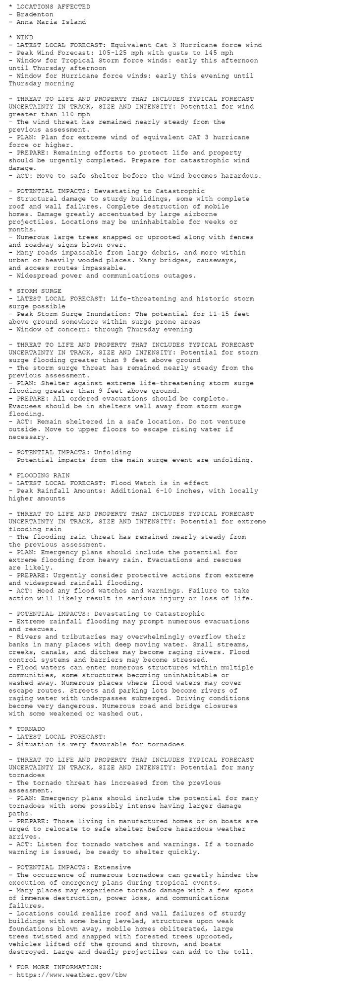
🚨🚨🚨 Hurricane Warning issued October 9 at 5:06AM EDT by NWS Tampa Bay Ruskin FL 🚨🚨🚨 Additional Details Here. (6/9)
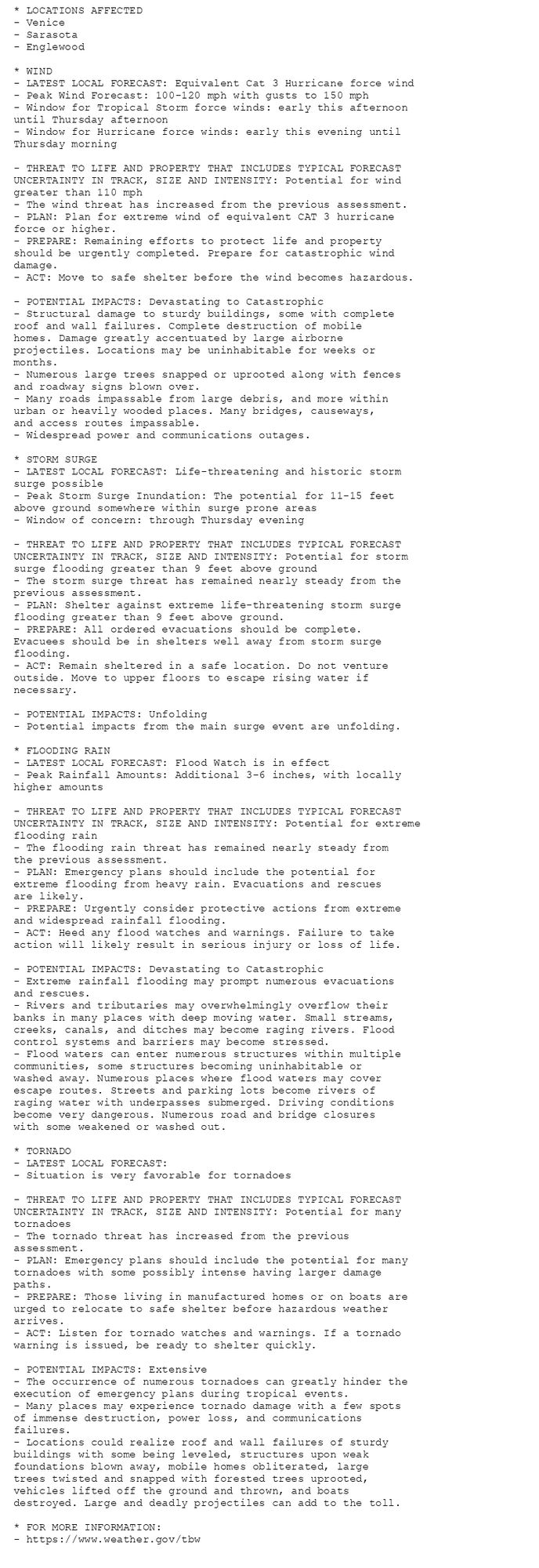
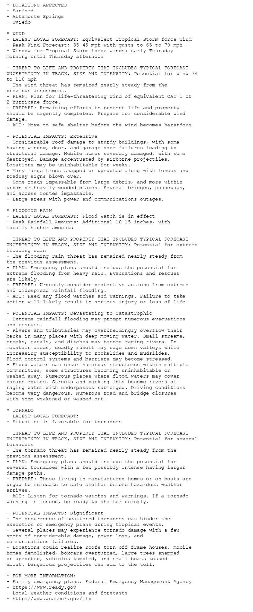
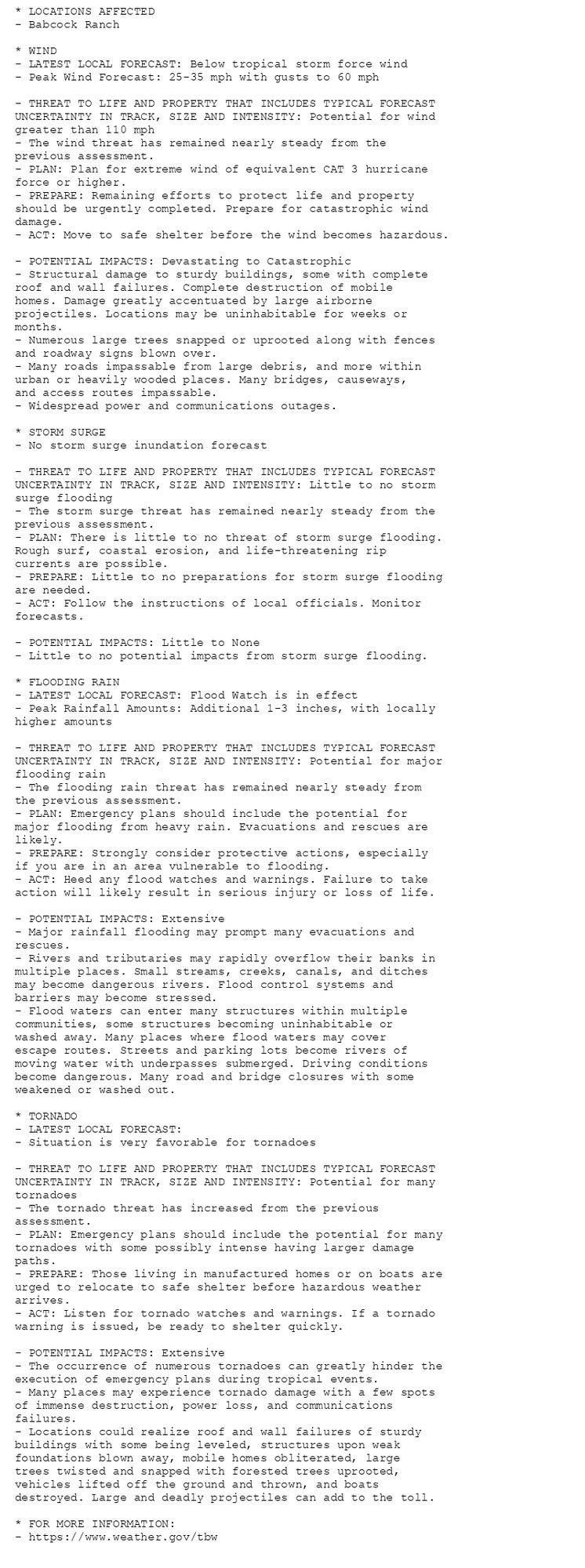
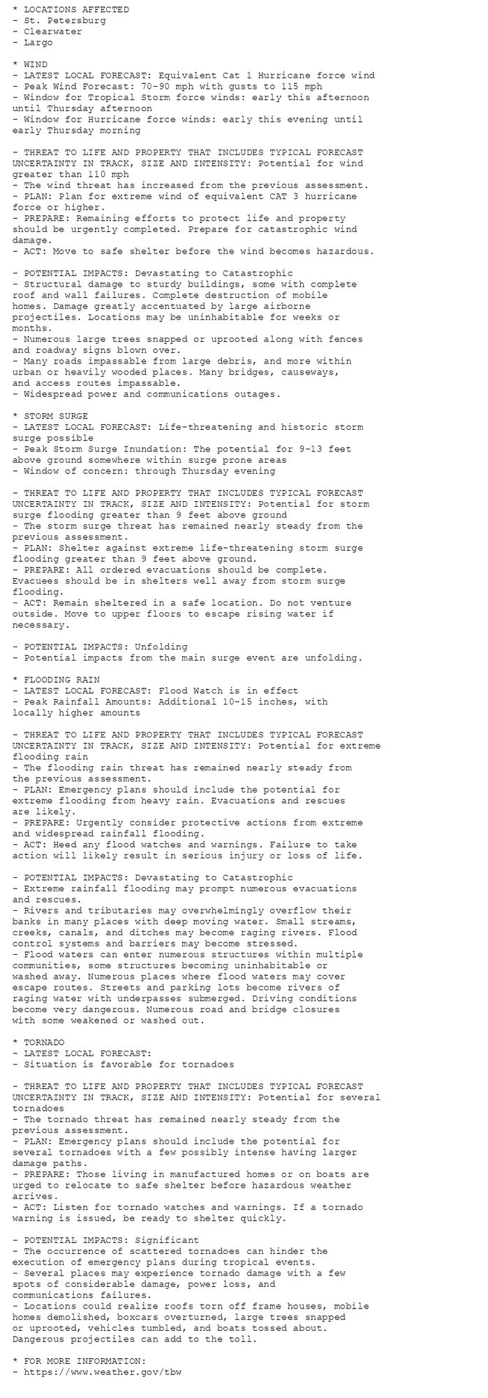
🚨🚨🚨 Hurricane Warning issued October 9 at 5:06AM EDT by NWS Tampa Bay Ruskin FL 🚨🚨🚨 Additional Details Here. (5/9)
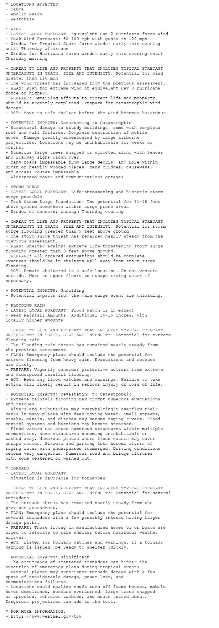
🚨🚨🚨 Hurricane Warning issued October 9 at 5:06AM EDT by NWS Tampa Bay Ruskin FL 🚨🚨🚨 Additional Details Here. (4/9)
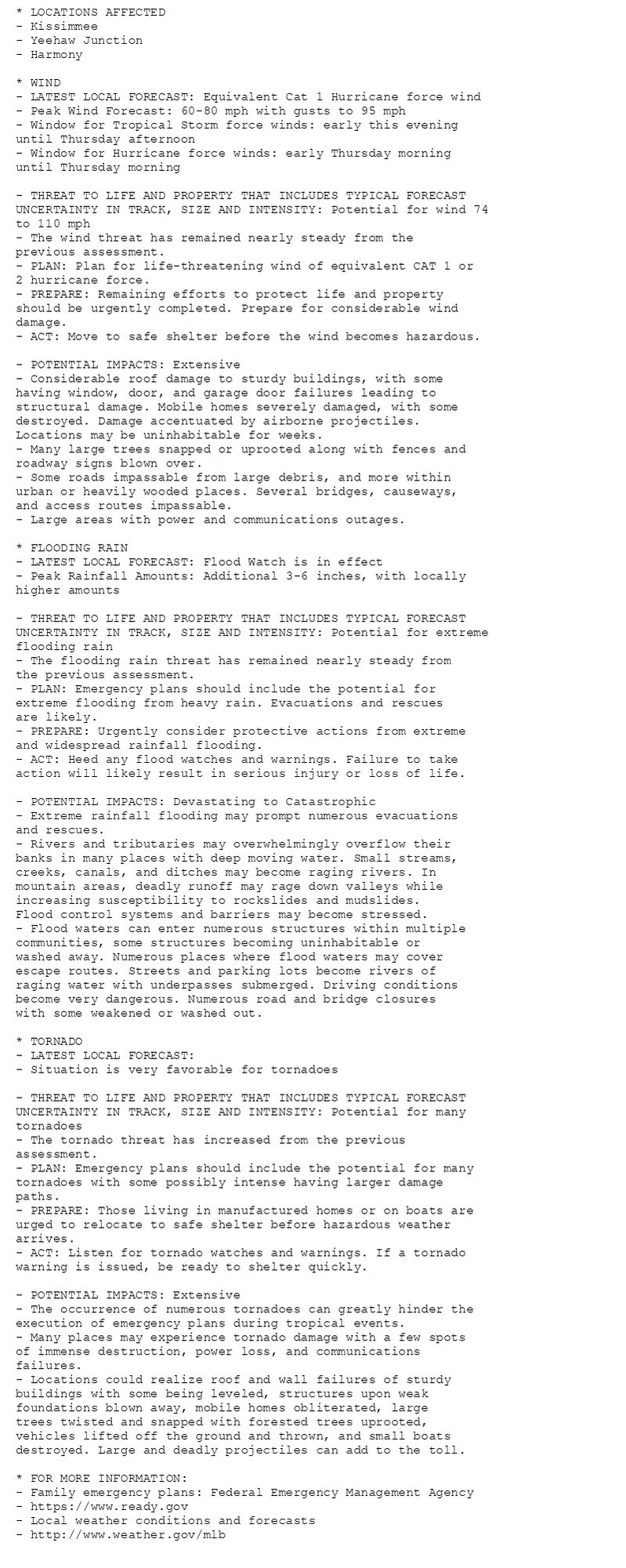
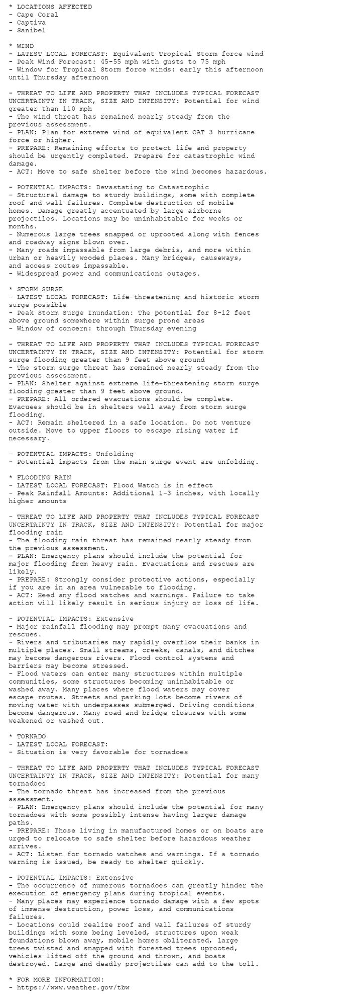
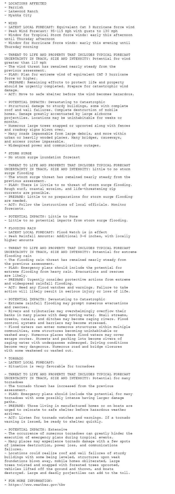
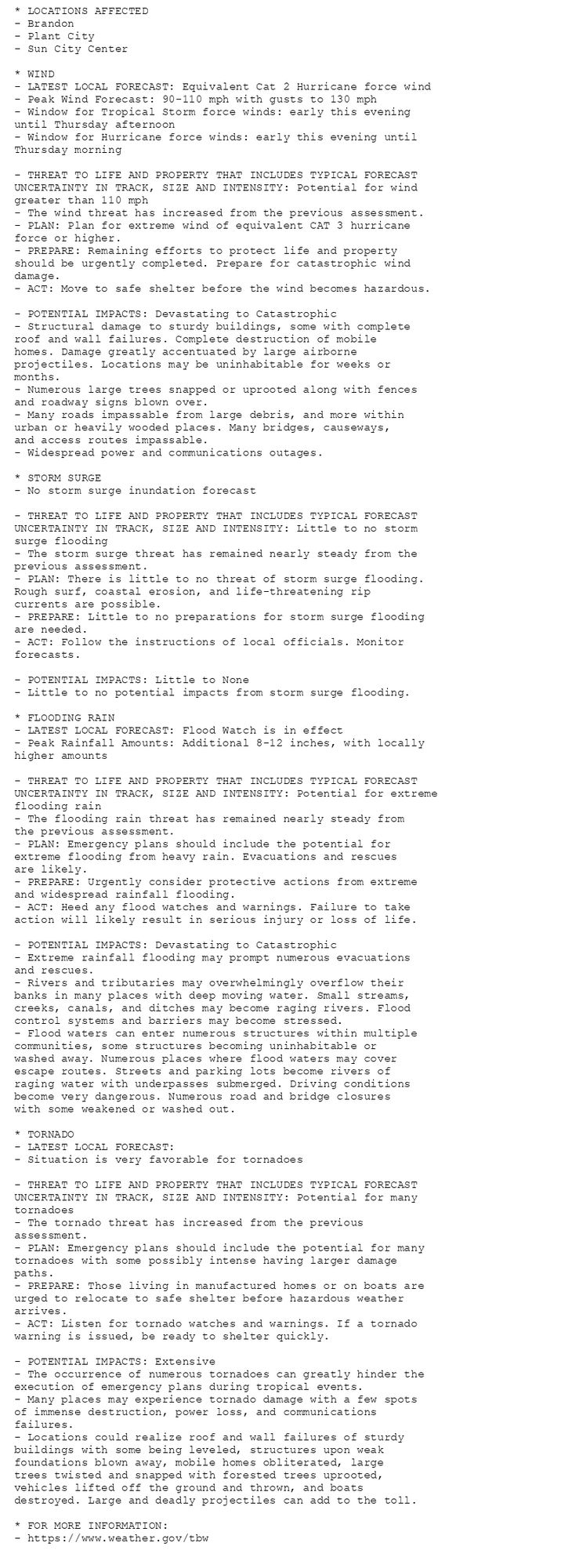
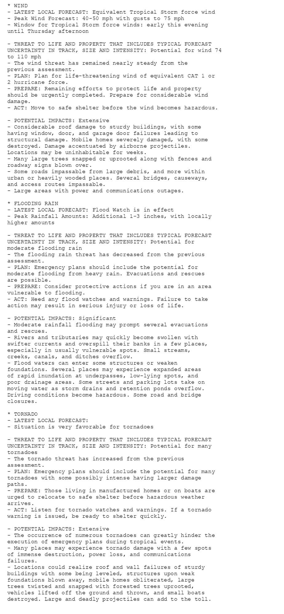
🚨🚨🚨 Hurricane Warning issued October 9 at 5:07AM EDT by NWS Melbourne FL 🚨🚨🚨 Additional Details Here. (5/7)
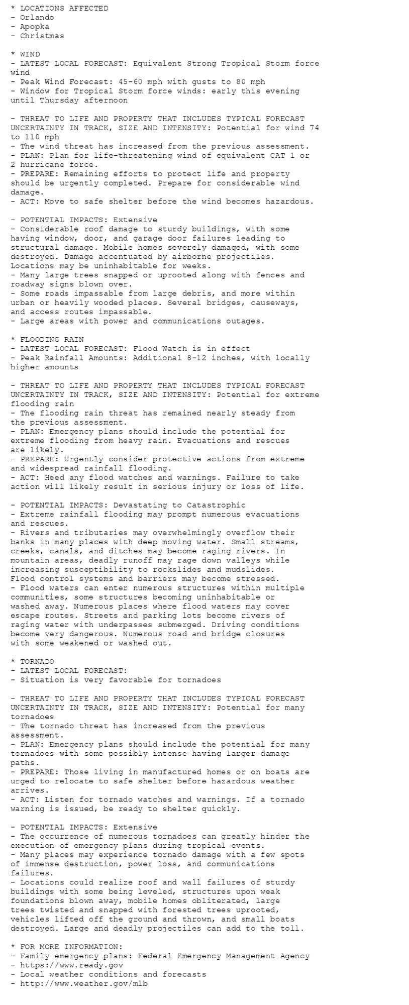
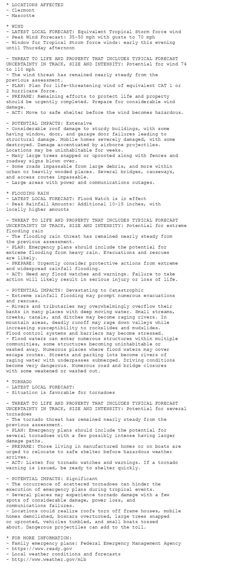
🚨🚨🚨 Hurricane Warning issued October 9 at 5:07AM EDT by NWS Melbourne FL 🚨🚨🚨 Additional Details Here. (4/7)