Bus incident reported for routes: 32. Alert: Route 32 eastbound will begin detouring at Independence Ave SW & 3rd St, resuming regular route at Independence Av SE & 1st St because of construction. Updated: 2024-10-11 08:20:30 (Eastern).
Newburyport/Rockport Line delay: Rockport Line Train 103 (7:38 am from North Station) is operating 5-15 minutes behind schedule between Salem and Rockport. Updated: 2024-10-11 08:20:27 (Eastern).
Framingham/Worcester Line track change: Please board Worcester Line Train 507 (7:30 am from South Station) on the inbound platform (Track 2) at Westborough and Grafton today. Updated: 2024-10-11 08:15:47 (Eastern).
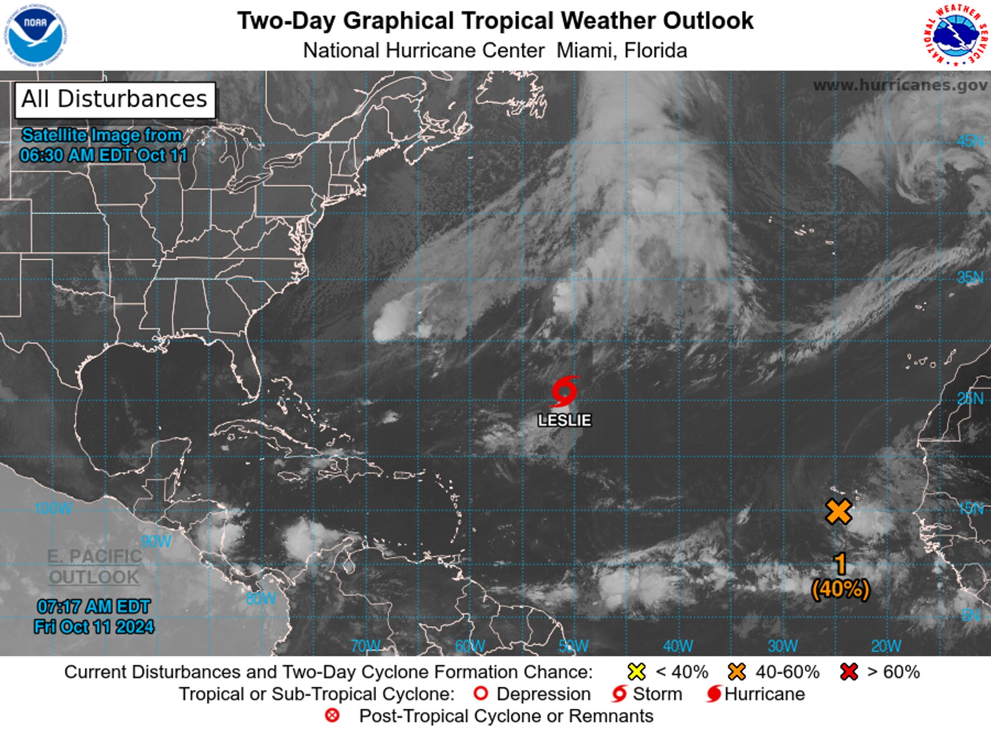
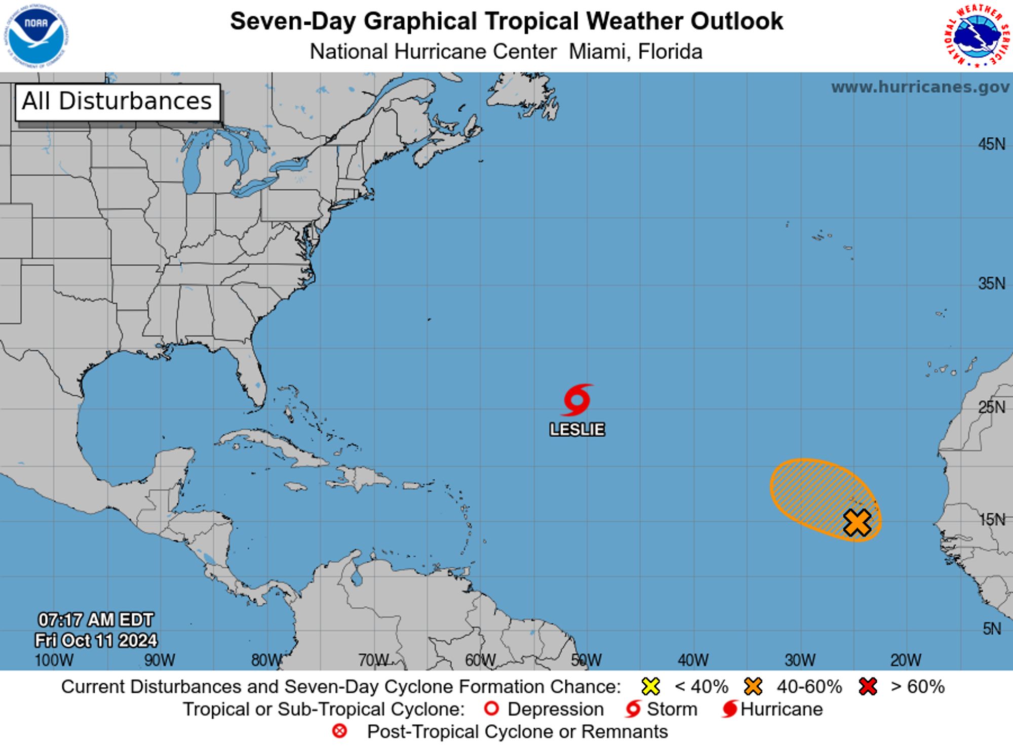
NWS National Hurricane Center Miami FL 800 AM EDT Fri Oct 11 2024 For the North Atlantic...Caribbean Sea and the Gulf of Mexico: Active Systems: The National Hurricane Center is issuing advisories on Tropical Storm Leslie, located over the central subtropical Atlantic Ocean.
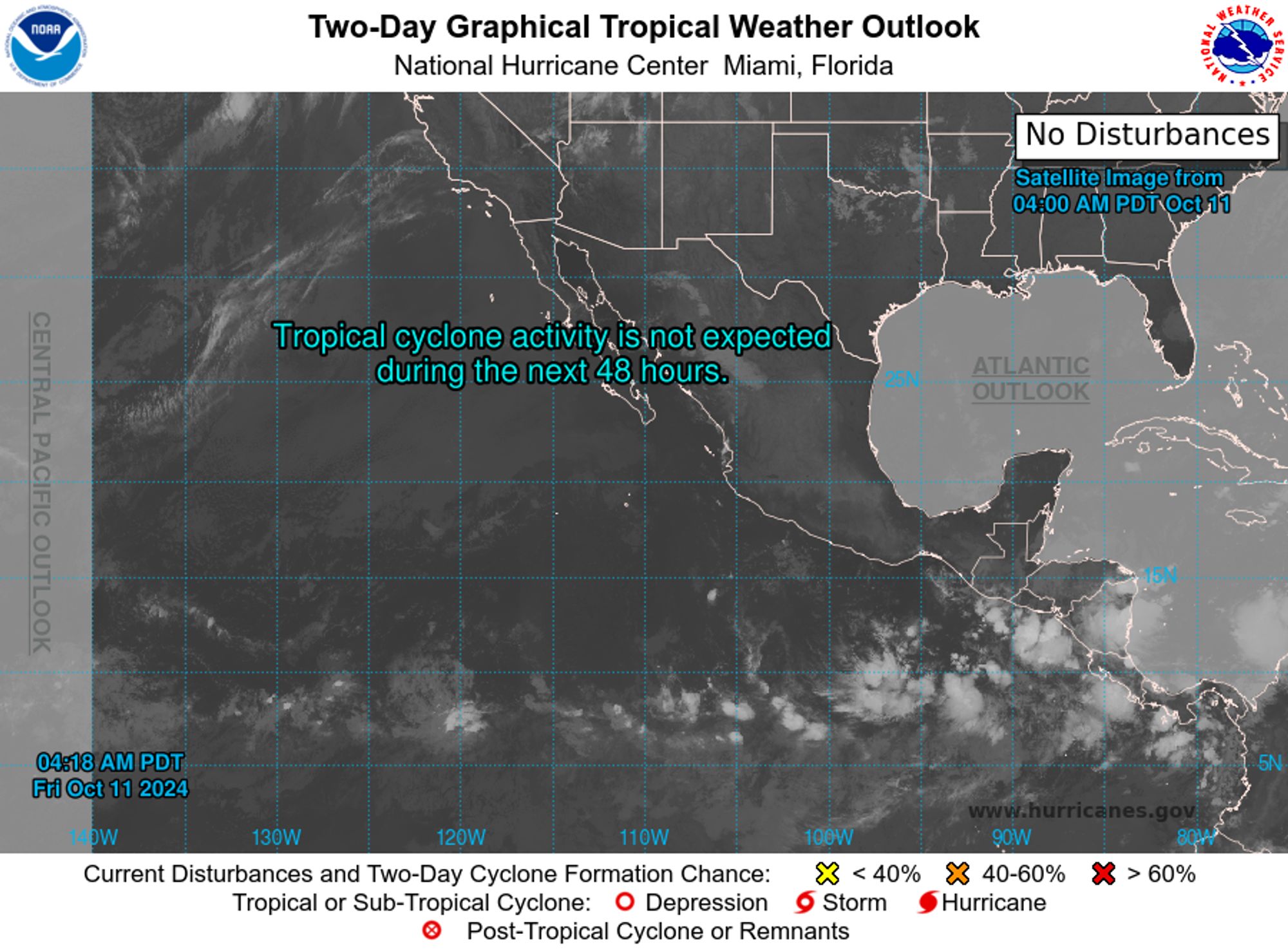
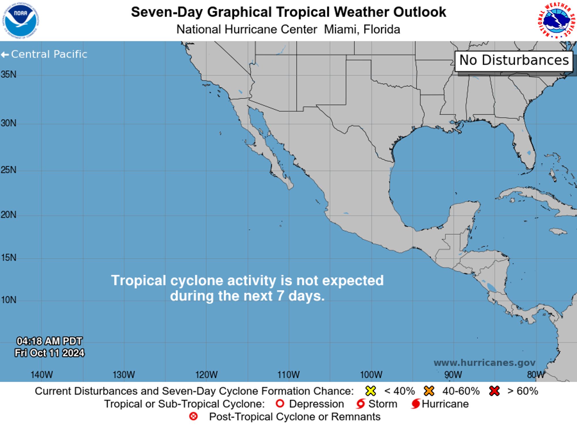
NWS National Hurricane Center Miami FL 500 AM PDT Fri Oct 11 2024 For the eastern North Pacific...east of 140 degrees west longitude: Tropical cyclone formation is not expected during the next 7 days. $$ Forecaster Hagen NNNN
Couple revives Eastern Market’s west-side counterpart as Corktown renaissance gains steam www.crainsdetroit.com/retail/weste... via Crain's Detroit Business
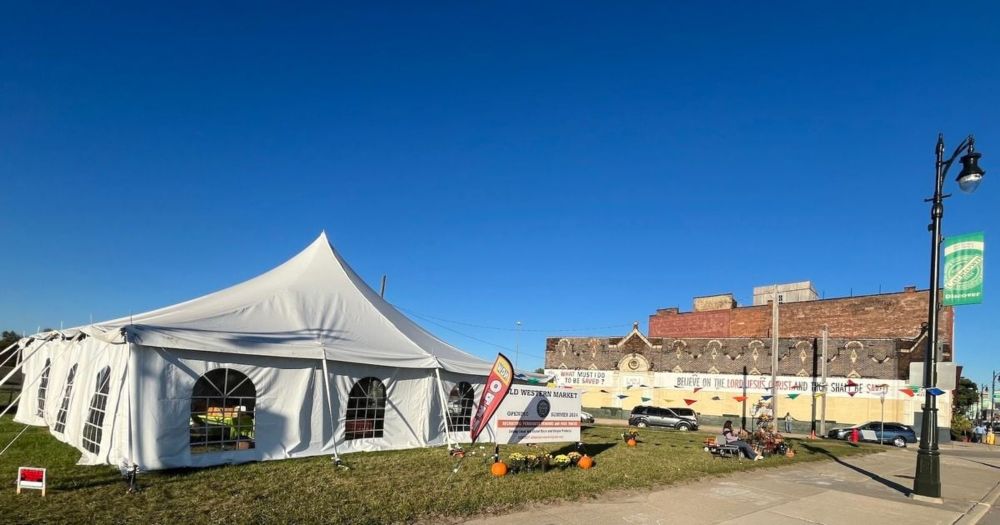
Two Corktown residents for the last five years have worked to resurrect the historic market. A grand opening for the market is set for Saturday.
For example, in most Eastern block countries, their experience of communism/fascism is as recent as 1991. For Spain, 1975. That is also why continental Europe values the European Union and its democratic values far more than UK which has never had to worry abt those things
@euronews: Public transport: What is the best and worst city in Europe? Looking at the capitals, northern and western European cities reported higher satisfaction with public transport, while southern and eastern European urban centres exhibited lower satisfaction rates. #EuropeinMotion https://t
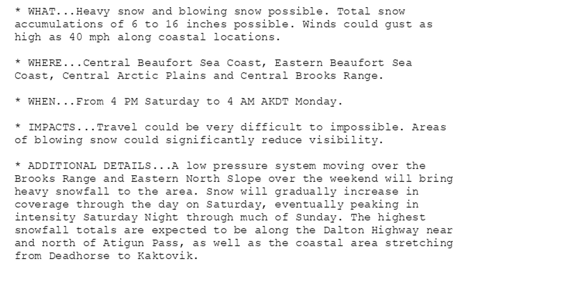
🚨 Winter Storm Warning issued October 11 at 3:55AM AKDT until October 14 at 4:00AM AKDT by NWS Fairbanks AK 🚨 Additional Details Here.
Bus incident reported for routes: C14. Alert: Expect eastbound delays on Route C14 at Naylor Road Station because of a vehicle mechanical problem. Check your bus location by visiting https://buseta.wmata.com/#C14 Updated: 2024-10-11 07:59:18 (Eastern).