🚨 High Wind Warning issued October 19 at 5:43PM MDT until October 19 at 6:00PM MDT by NWS Great Falls MT 🚨 Additional Details Here.

Em produeix tantíssima pau fer una passada ràpida per aquí i no haver d’esquivar publicacions de nazis, criptobros i incels… Quin gust, hòstia!
4. Atelier Ayesha The Atelier series combines cute outfits, a fun lower* stakes RPG setting and a banging GUST soundtrack in each game. I'm picking Ayesha here because her simple drive to just find her sistem and help others while learning Alchemy charmed me more then the previous games.


what do we call the blue sky equivalent of a tweet? a airwave due to the sky theme? gust? post? (boring option)
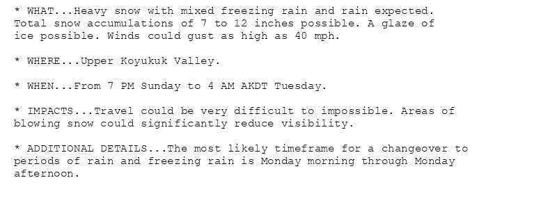
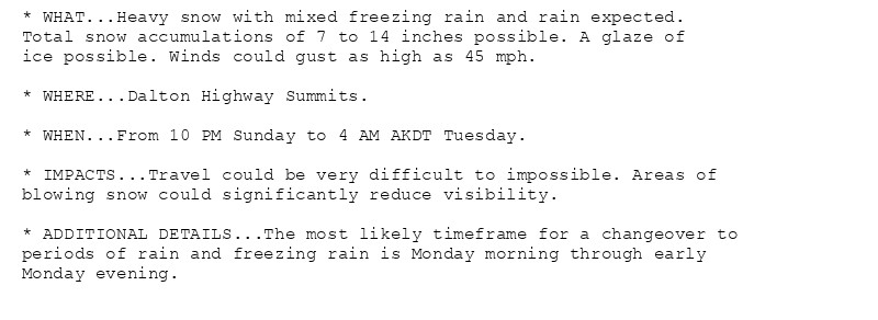
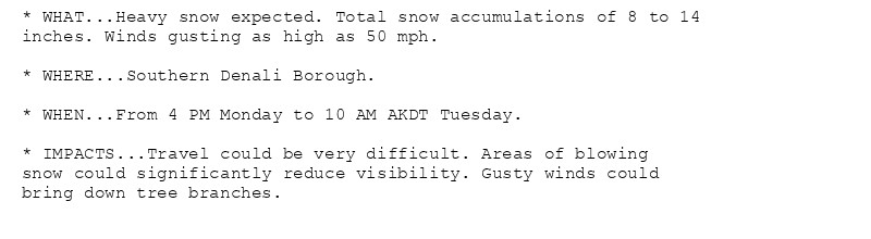
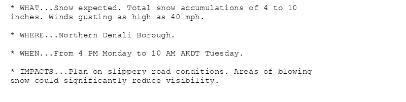
🚨 Winter Storm Warning issued October 19 at 1:07PM AKDT until October 22 at 4:00AM AKDT by NWS Fairbanks AK 🚨 Additional Details Here. (2/3)
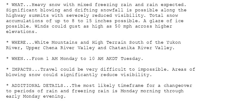
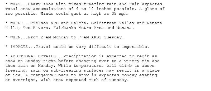
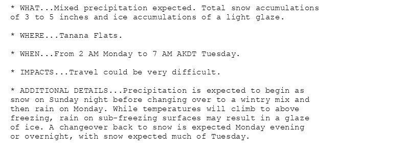
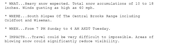
🚨 Winter Storm Warning issued October 19 at 1:07PM AKDT until October 22 at 4:00AM AKDT by NWS Fairbanks AK 🚨 Additional Details Here. (1/3)