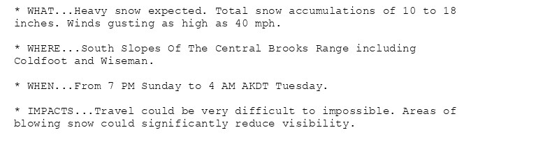
🚨 Winter Storm Warning issued October 19 at 1:07PM AKDT until October 22 at 4:00AM AKDT by NWS Fairbanks AK 🚨 Additional Details Here. (2/3)
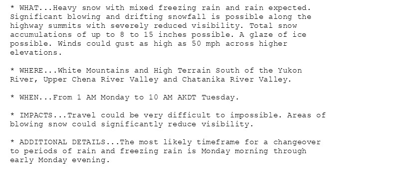
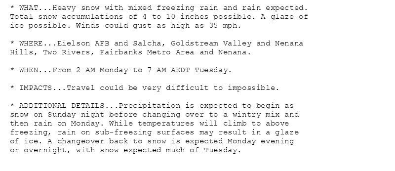
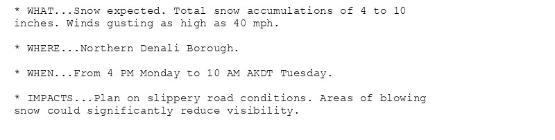
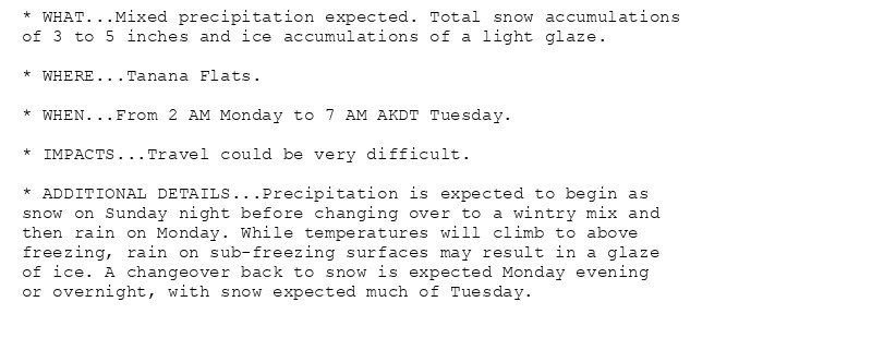
🚨 Winter Storm Warning issued October 19 at 1:07PM AKDT until October 22 at 4:00AM AKDT by NWS Fairbanks AK 🚨 Additional Details Here. (1/3)


God, I could wear a skit that short sans pantsu, buuuuuuuut I'd have a great fear. Of a slight gust of wind, dropping *anything,* short people- phew!
One strong gust of wind and he's gonna be flying around a parking lot like a receipt 😭
... That's so smart. I should find out how to do that. Thank you for a good idea ^^ Whatever happens, I trust that GUST will make another phenomenal game that will eat actual weeks of my life... and that it will have way too much DLC. 🫠