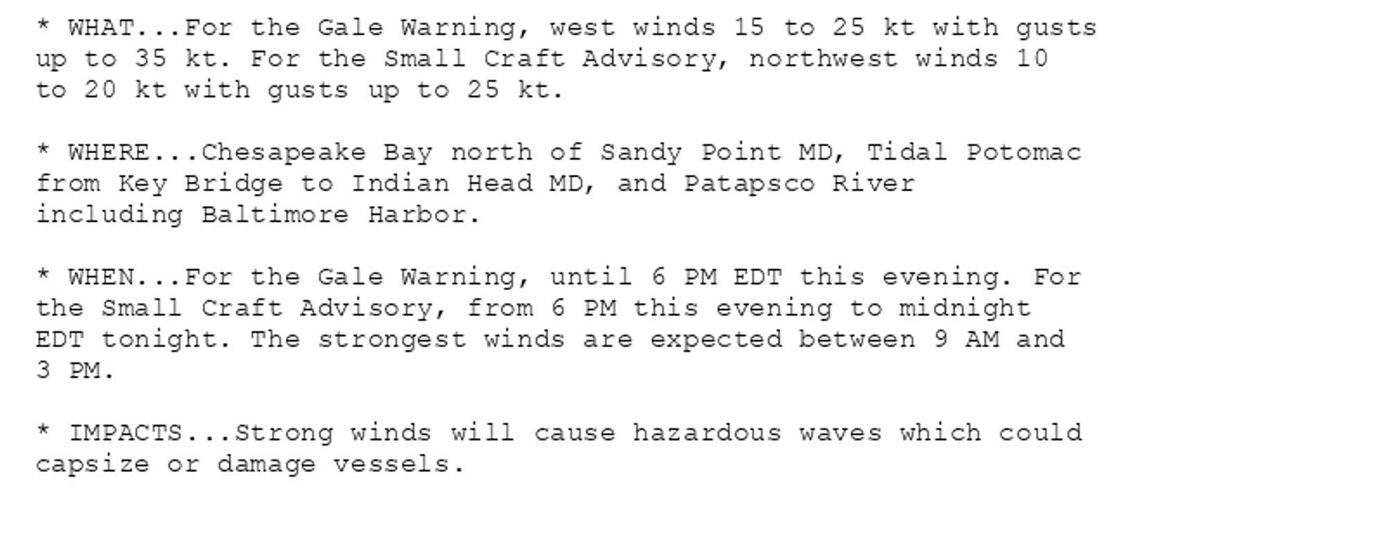
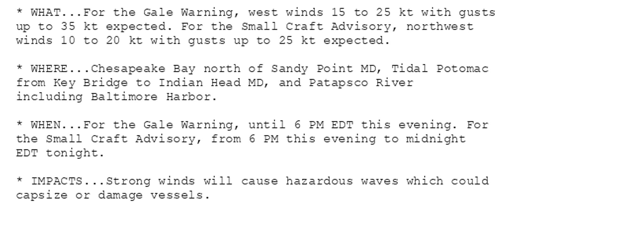
Gale Warning issued October 14 at 7:19AM EDT until October 14 at 6:00PM EDT by NWS Baltimore MD/Washington DC Additional Details Here.(1/2)
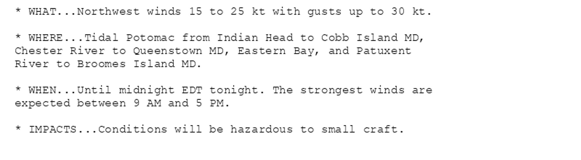
NEW WEATHER ADVISORY: Small Craft Advisory * WHAT...Northwest winds 15 to 25 kt with gusts up to 30 kt. * WHERE...Tidal Potomac from Indian Head to Cobb Island MD, Chester River to Queenstown MD, Eastern Bay, and Patuxent River to Broomes Island MD.... See more: watchedsky.social/app/alerts/...
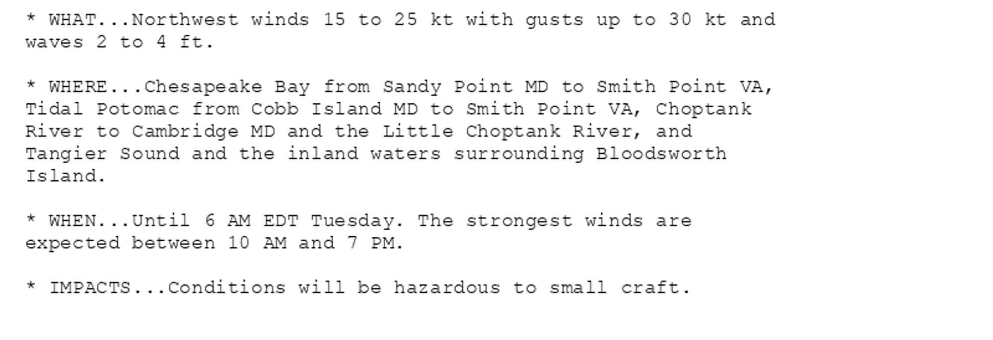
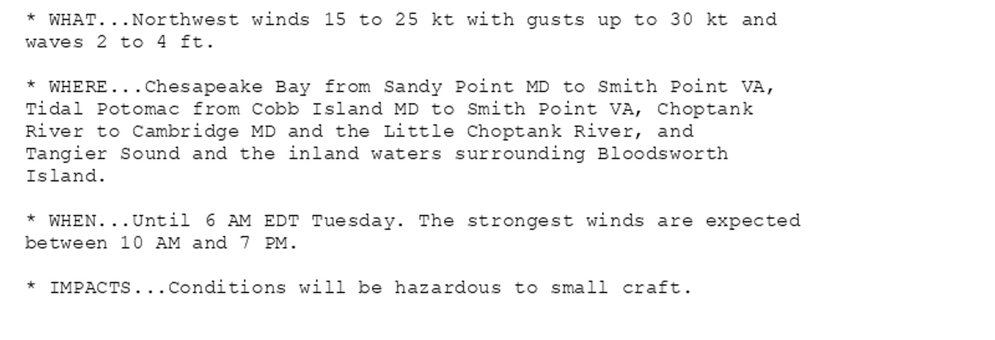
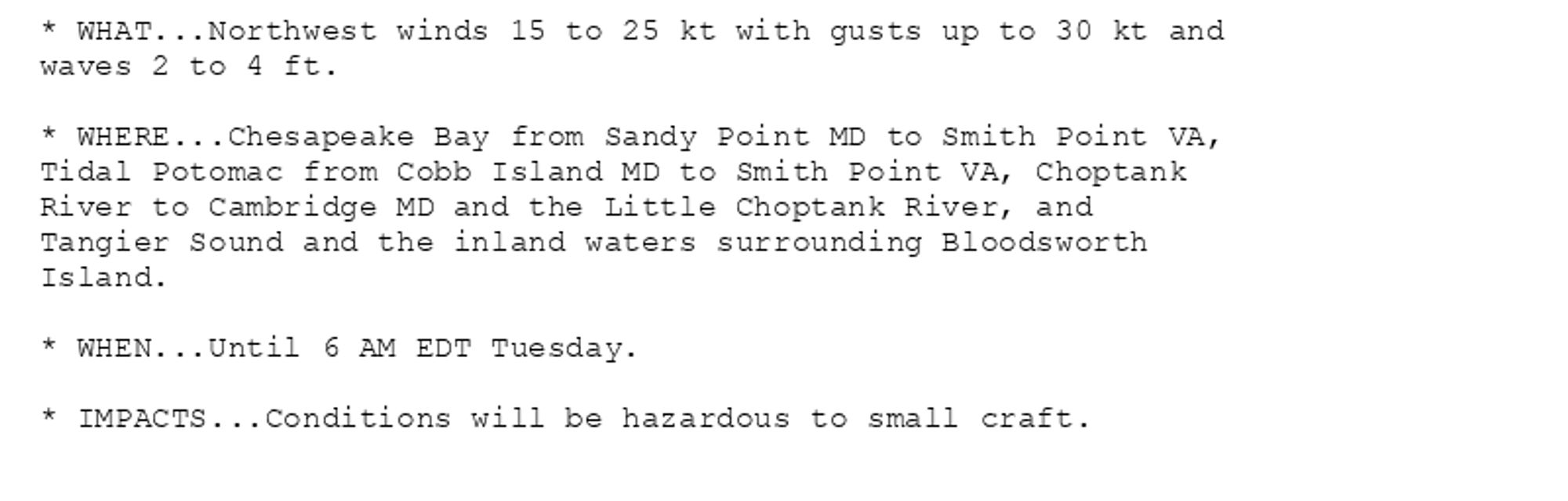
NEW WEATHER ADVISORY: Small Craft Advisory * WHAT...Northwest winds 15 to 25 kt with gusts up to 30 kt and waves 2 to 4 ft. * WHERE...Chesapeake Bay from Sandy Point MD to Smith Point VA, Tidal Potomac from Cobb Island MD to Smith Point VA, Choptank... See more: watchedsky.social/app/alerts/...
Gale Warning issued October 14 at 6:06AM EDT until October 14 at 6:00PM EDT by NWS Baltimore MD/Washington DC Additional Details Here.(1/2)
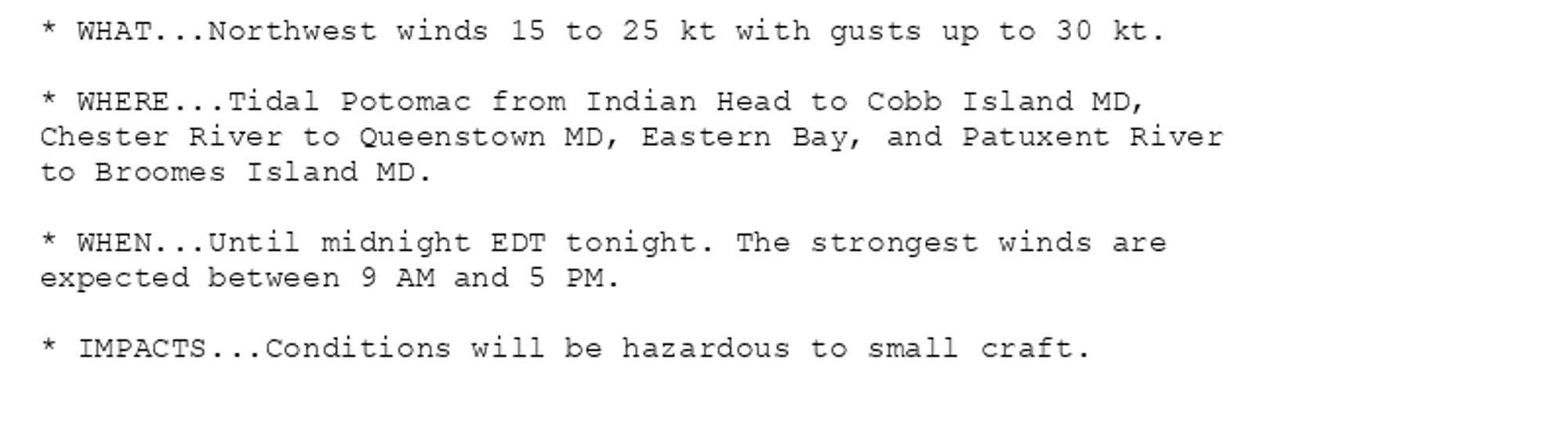
NEW WEATHER ADVISORY: Small Craft Advisory * WHAT...Northwest winds 15 to 25 kt with gusts up to 30 kt. * WHERE...Tidal Potomac from Indian Head to Cobb Island MD, Chester River to Queenstown MD, Eastern Bay, and Patuxent River to Broomes Island MD.... See more: watchedsky.social/app/alerts/...
NEW WEATHER ADVISORY: Small Craft Advisory * WHAT...Northwest winds 15 to 25 kt with gusts up to 30 kt and waves 2 to 4 ft. * WHERE...Chesapeake Bay from Sandy Point MD to Smith Point VA, Tidal Potomac from Cobb Island MD to Smith Point VA, Choptank... See more: watchedsky.social/app/alerts/...
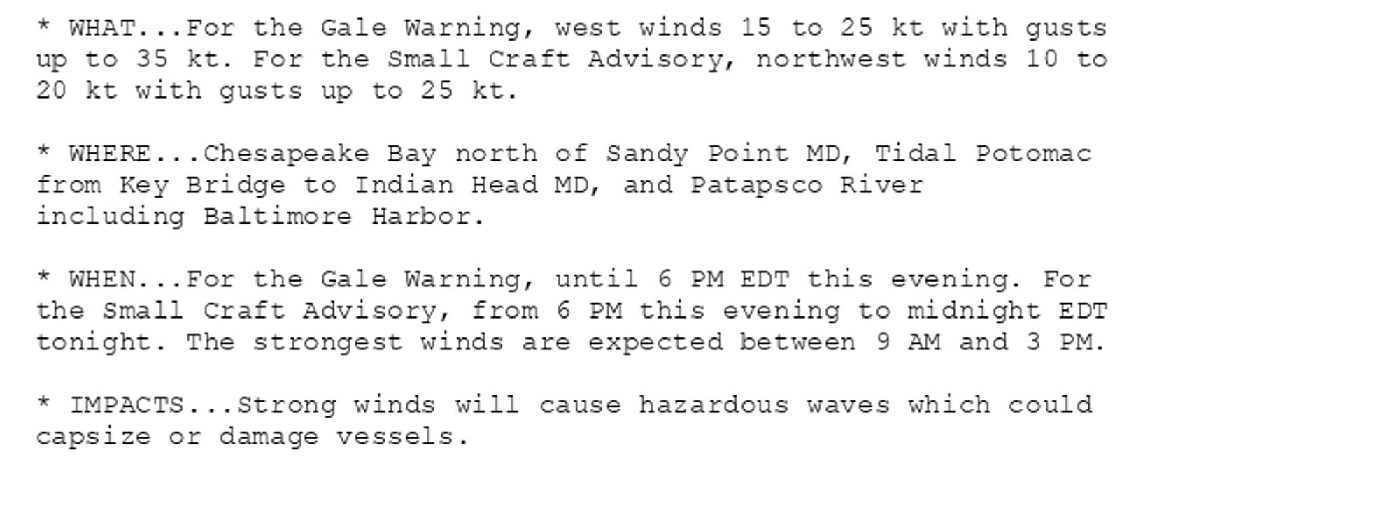
Small Craft Advisory issued October 14 at 5:35AM EDT until October 14 at 6:00AM EDT by NWS Baltimore MD/Washington DC Additional Details Here.(2/2)
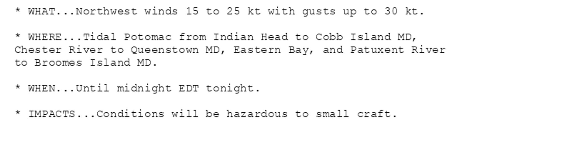
Small Craft Advisory issued October 14 at 5:35AM EDT until October 14 at 6:00AM EDT by NWS Baltimore MD/Washington DC Additional Details Here. (1/2)
NEW WEATHER ADVISORY: Small Craft Advisory * WHAT...Northwest winds 15 to 25 kt with gusts up to 30 kt. * WHERE...Tidal Potomac from Indian Head to Cobb Island MD, Chester River to Queenstown MD, Eastern Bay, and Patuxent River to Broomes Island MD.... See more: watchedsky.social/app/alerts/...
NEW WEATHER ADVISORY: Small Craft Advisory * WHAT...Northwest winds 15 to 25 kt with gusts up to 30 kt and waves 2 to 4 ft. * WHERE...Chesapeake Bay from Sandy Point MD to Smith Point VA, Tidal Potomac from Cobb Island MD to Smith Point VA, Choptank... See more: watchedsky.social/app/alerts/...