Last hurrah for the season! https://www.flakefood.com/606389/last-hurrah-for-the-season/ I was looking for Rainwater Killifish off the Potomac in VA, but still ended up catching a few Lil cuties. Some great looking Mummichogs in this location! Will need to look elsewhere next spring for the …
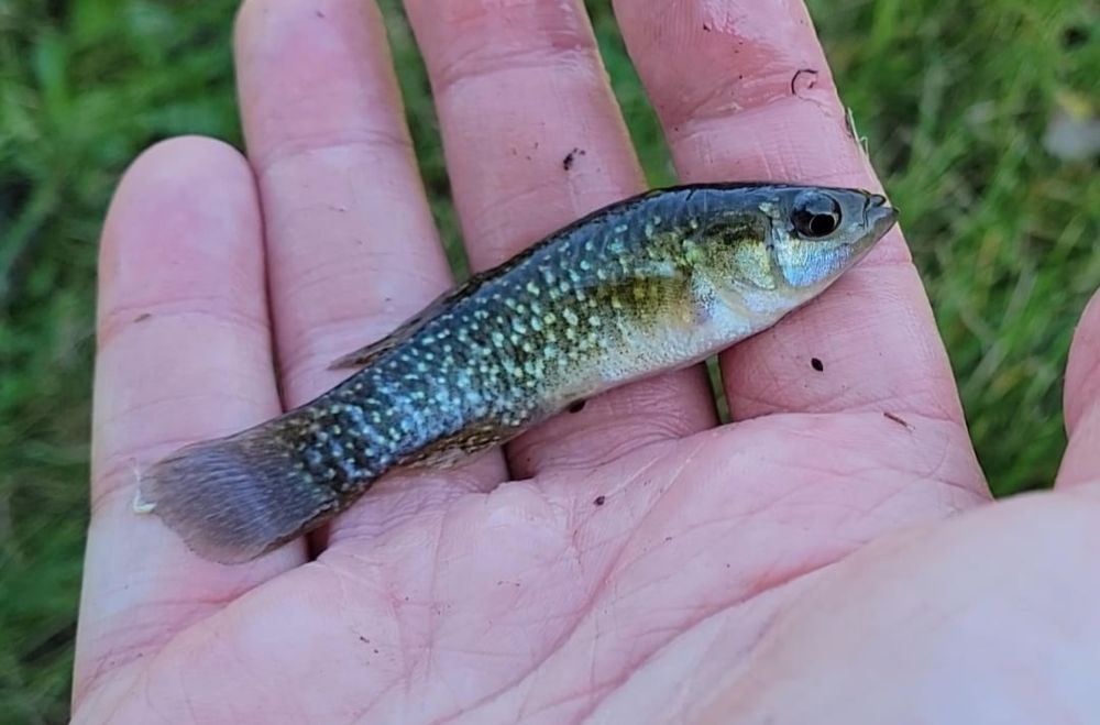
I was looking for Rainwater Killifish off the Potomac in VA, but still ended up catching a few Lil cuties. Some great looking Mummichogs in this location! Will need to look elsewhere next spring for the Rainwaters though.Posted by brambleforest
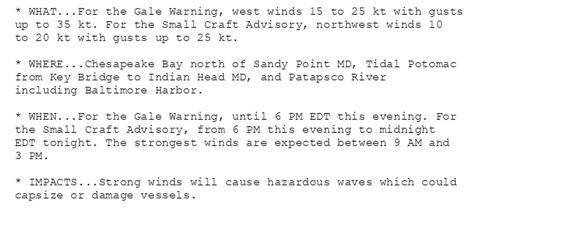
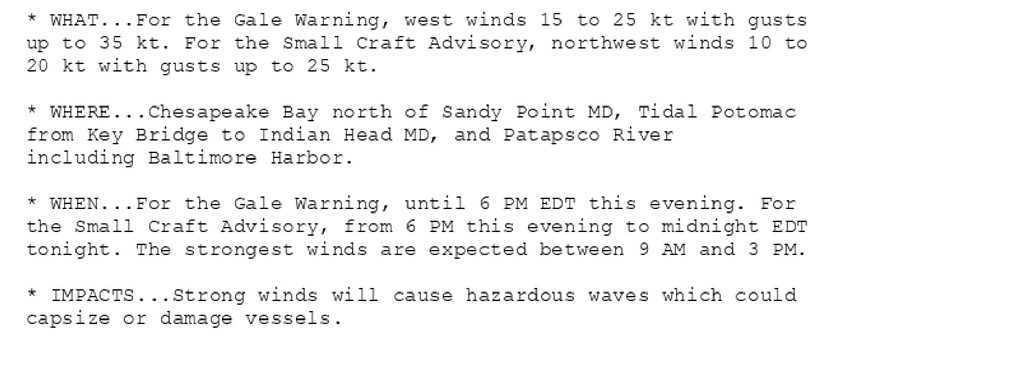
Gale Warning issued October 14 at 10:48AM EDT until October 14 at 6:00PM EDT by NWS Baltimore MD/Washington DC Additional Details Here.(2/3)
Did I forget to post Herriman yesterday? Well, take it as a loss, then. Still, in 1907, he was drawing these political cartoons for the Hearst outfit's California crusades, and here's another, with SULLIVAN heading TO WALL STREET with the WHITE HOUSE. (Anybody know what that dripping tap means?)

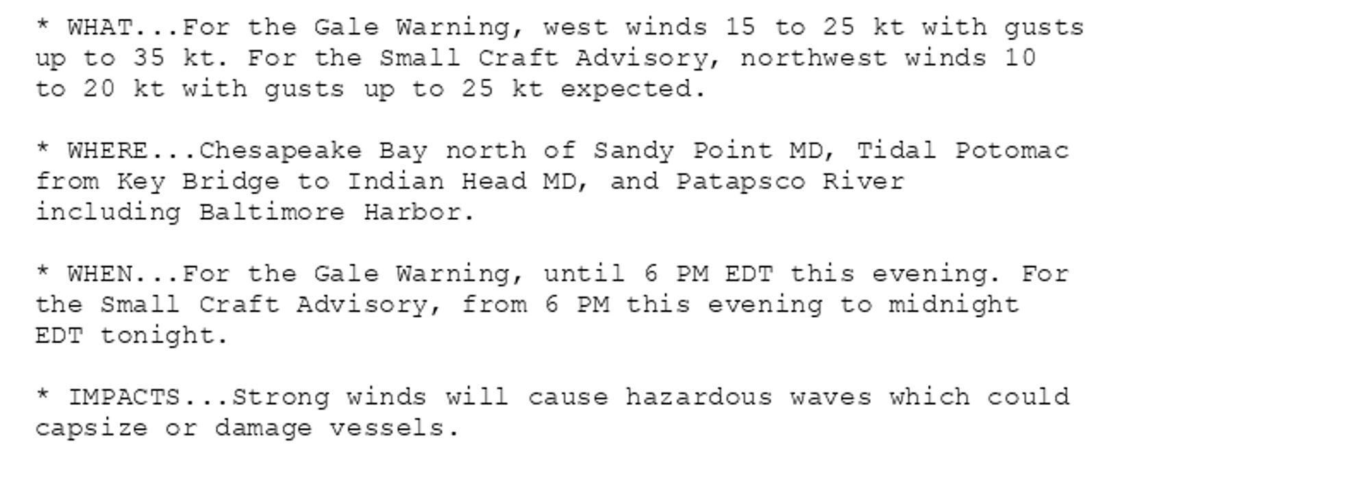
Gale Warning issued October 14 at 7:19AM EDT until October 14 at 6:00PM EDT by NWS Baltimore MD/Washington DC Additional Details Here.(1/2)
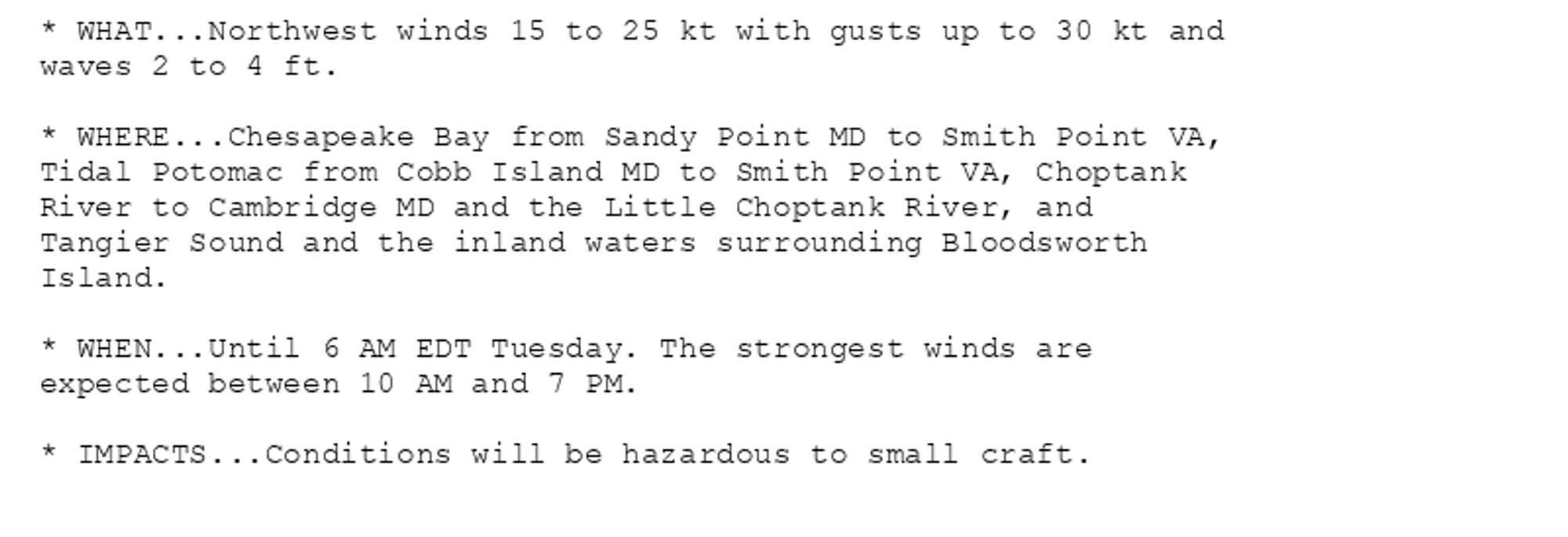
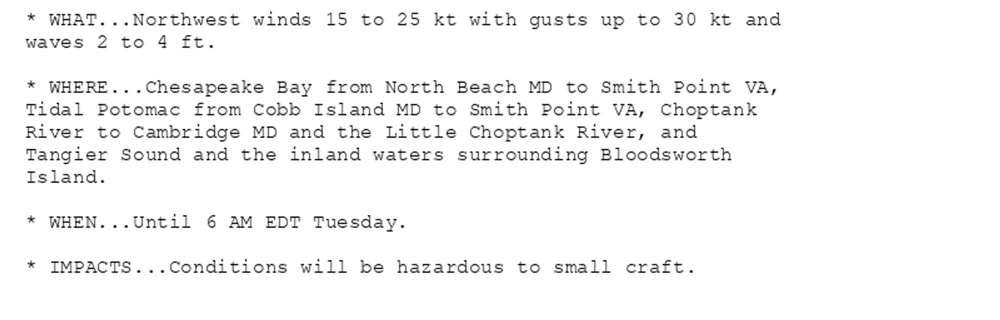
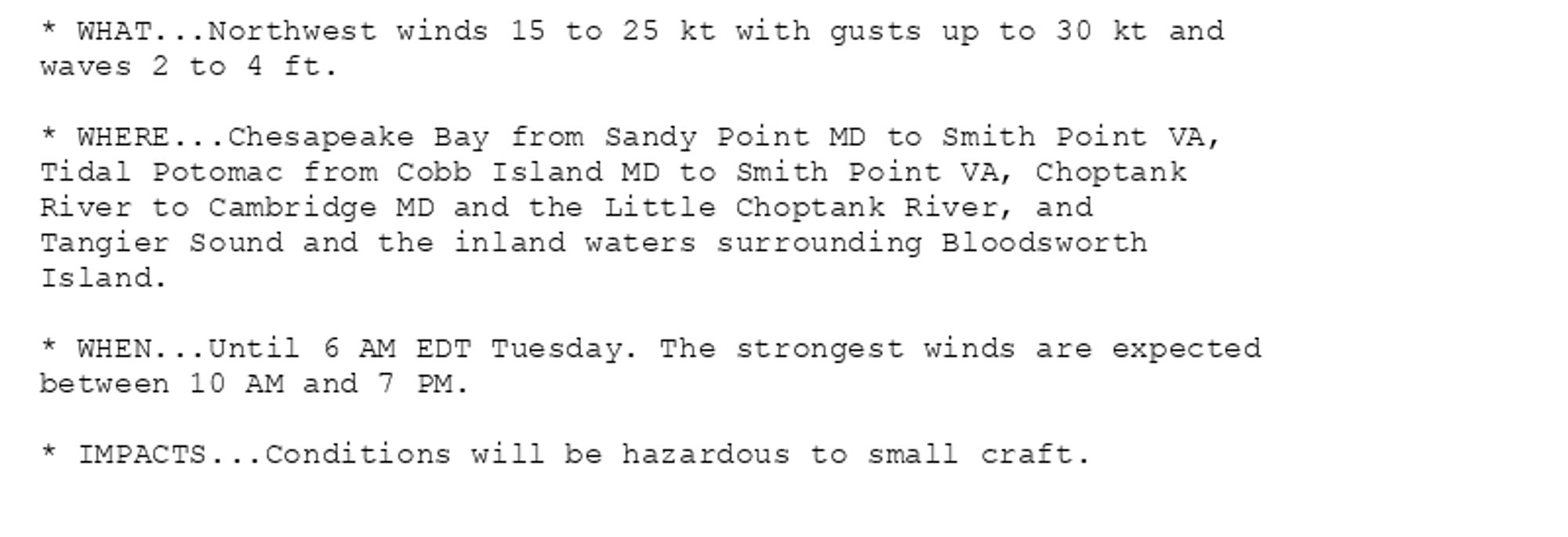
NEW WEATHER ADVISORY: Small Craft Advisory * WHAT...Northwest winds 15 to 25 kt with gusts up to 30 kt and waves 2 to 4 ft. * WHERE...Chesapeake Bay from Sandy Point MD to Smith Point VA, Tidal Potomac from Cobb Island MD to Smith Point VA, Choptank... See more: watchedsky.social/app/alerts/...
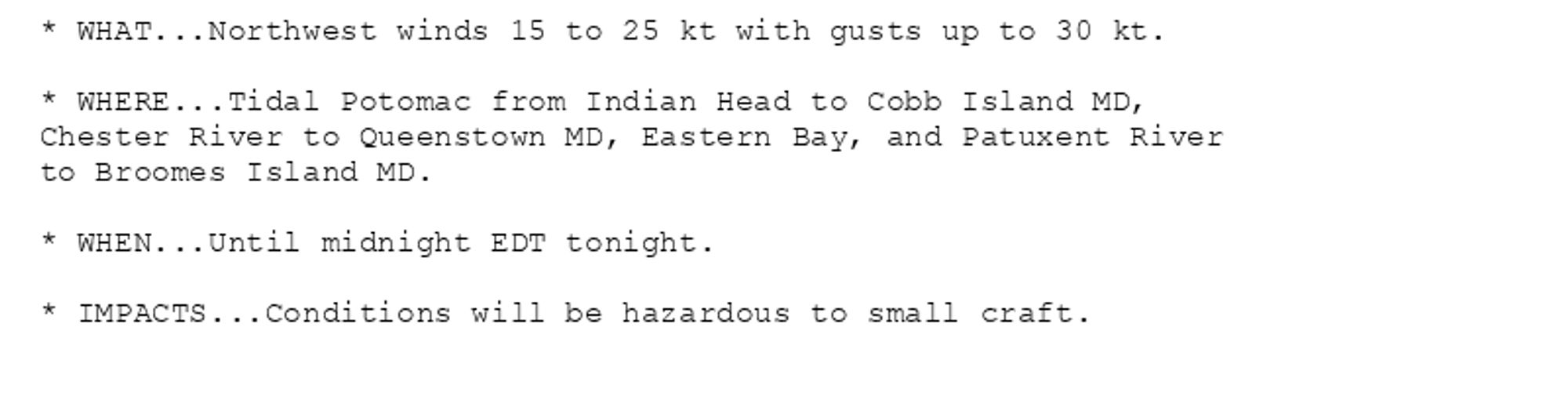
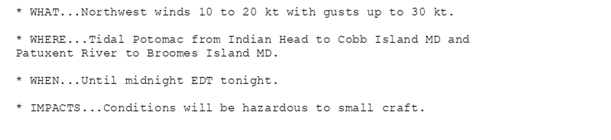
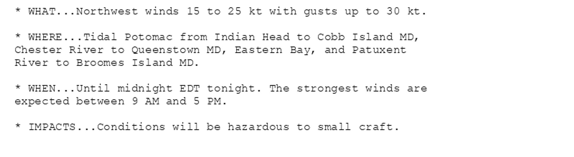
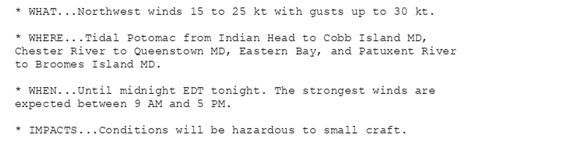
NEW WEATHER ADVISORY: Small Craft Advisory * WHAT...Northwest winds 15 to 25 kt with gusts up to 30 kt. * WHERE...Tidal Potomac from Indian Head to Cobb Island MD, Chester River to Queenstown MD, Eastern Bay, and Patuxent River to Broomes Island MD.... See more: watchedsky.social/app/alerts/...
Gale Warning issued October 14 at 6:06AM EDT until October 14 at 6:00PM EDT by NWS Baltimore MD/Washington DC Additional Details Here.(1/2)
NEW WEATHER ADVISORY: Small Craft Advisory * WHAT...Northwest winds 15 to 25 kt with gusts up to 30 kt and waves 2 to 4 ft. * WHERE...Chesapeake Bay from Sandy Point MD to Smith Point VA, Tidal Potomac from Cobb Island MD to Smith Point VA, Choptank... See more: watchedsky.social/app/alerts/...
NEW WEATHER ADVISORY: Small Craft Advisory * WHAT...Northwest winds 15 to 25 kt with gusts up to 30 kt. * WHERE...Tidal Potomac from Indian Head to Cobb Island MD, Chester River to Queenstown MD, Eastern Bay, and Patuxent River to Broomes Island MD.... See more: watchedsky.social/app/alerts/...
Small Craft Advisory issued October 14 at 5:35AM EDT until October 14 at 6:00AM EDT by NWS Baltimore MD/Washington DC Additional Details Here.(2/2)