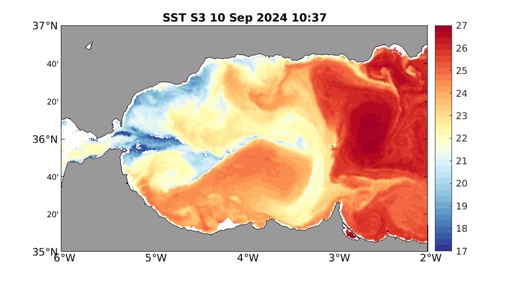
Sea surface temperature in the Alboran Sea. Dynamically there's always something interesting going on there 🌊. Cold water from the Strait of Gibraltar impacts on an anticyclonic, warm Alboran gyre. This cold water literally splashes on the gyre, spreading all along this front. #Sentinel3
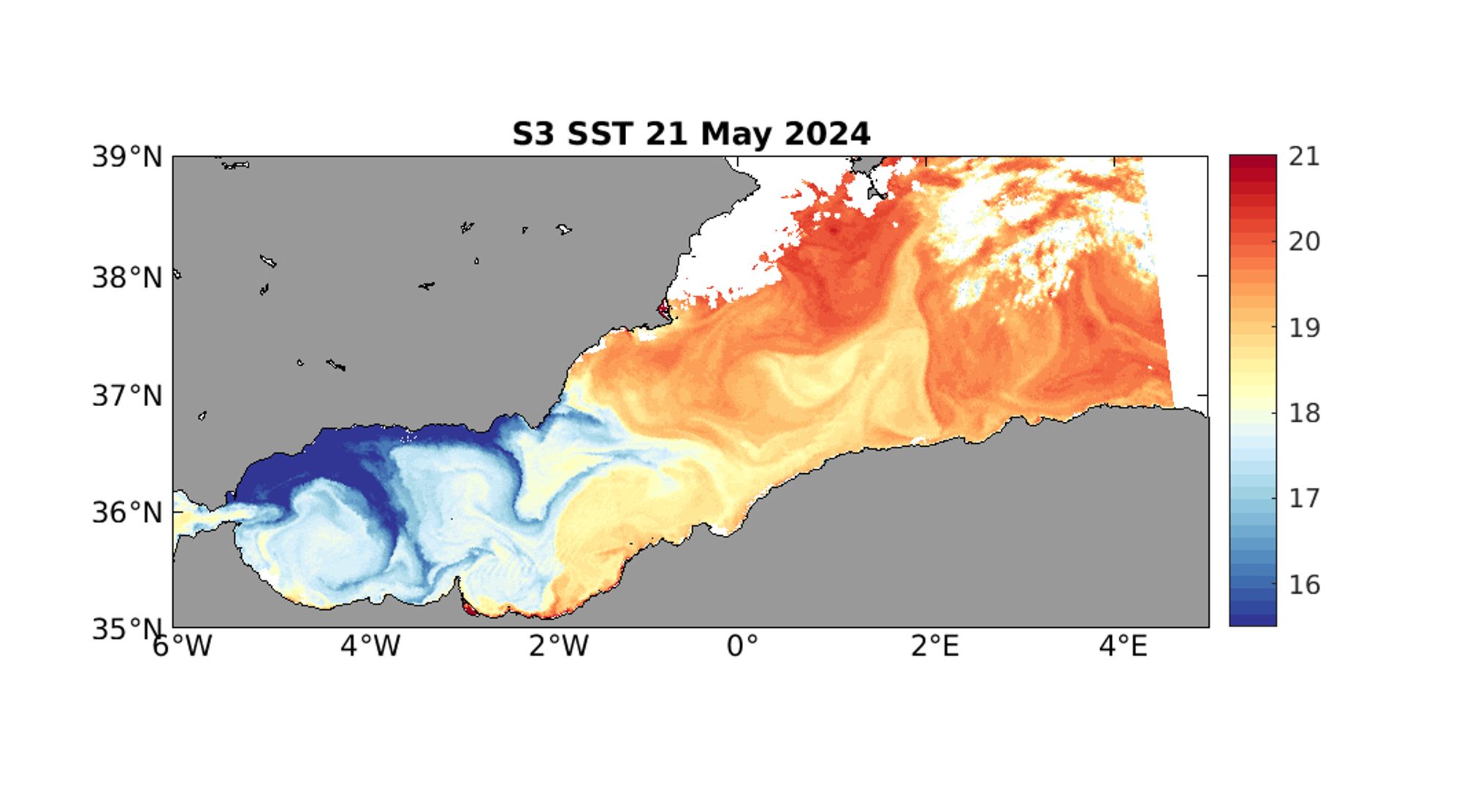
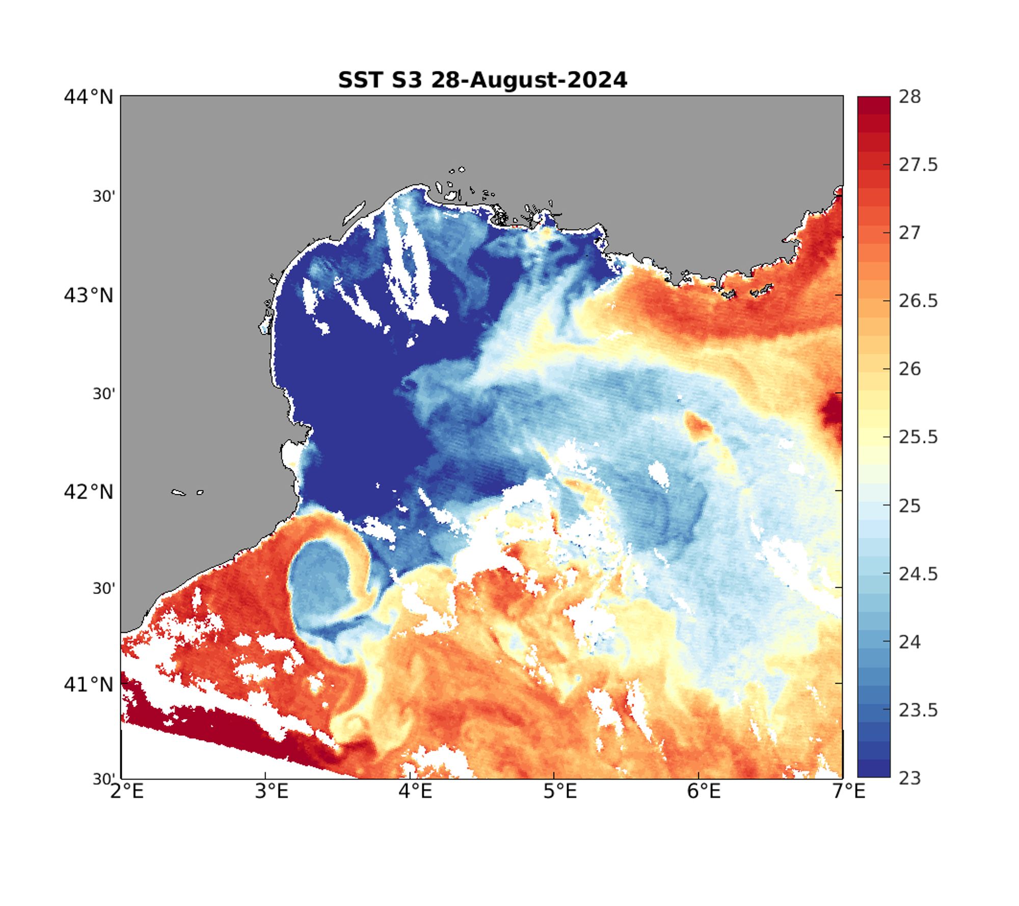
One thing I enjoy doing is just staring at sea surface temperature maps and *see* the water movement that they show. Like the great filament-eddy between the Gulf of Lion and the Balearic Sea (lower left corner) in this #Sentinel3 image. That's about 3 deg C change in just a few kilometers! 🌊
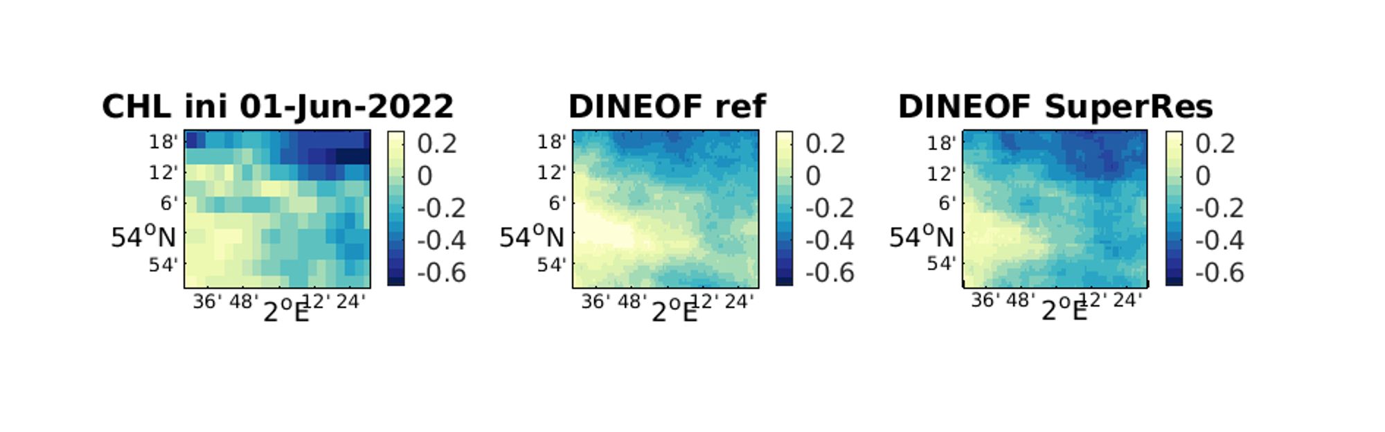
We're presenting today the results of the #MultiRes#Sentinel2#Sentinel3#DINEOFevents.marine.copernicus.eu/copernicus-m...
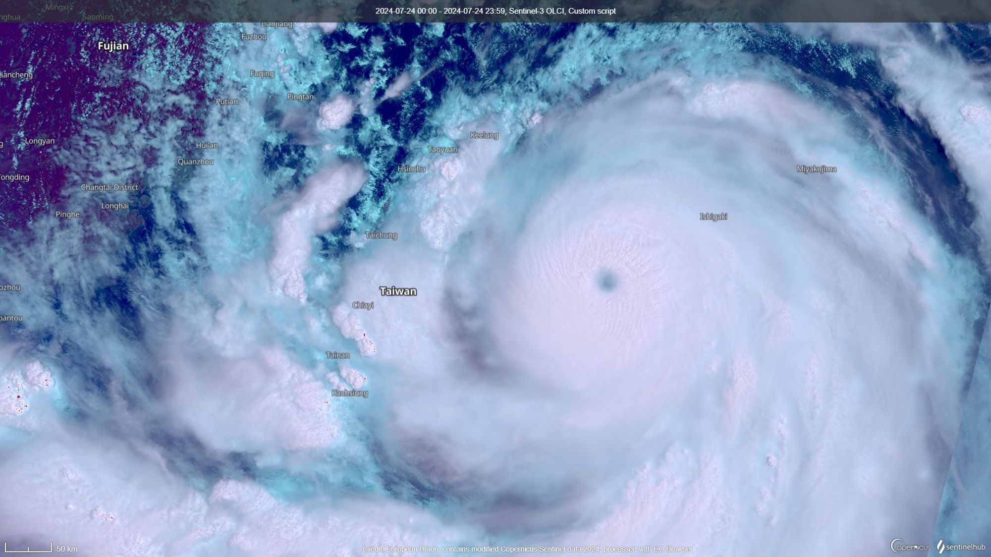
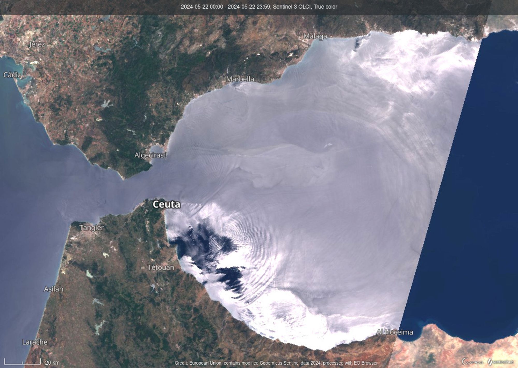
Nice image of internal waves seen in the Alboran Sea, with #Sentinel3 on 22 May 2024. Sunglint (reflection of the sun on the sea surface) allows to detect these wave trains coming out of the Strait if Gibraltar, I think there are even 2 of such wave trains! Image from the Sentinel Hub
With the Liege Colloquium literally around the corner (next Monday!), here's a relaxing activity, aimed mainly at myself 😅: looking at satellite imagery: sea surface temperature in the southwestern Mediterranean Sea. Great cold filaments in the Alboran Sea, shaped by surface currents #Sentinel3