JDPON Zelinsky will have his day
I had a dream, where Zelinsky,after another senseless pro Putin nonsense telling from shit pants Olaf Scholz,just got furious,stormed to the microfon+gave the Scholz shit-bag 2 hard punches right into his grining ugly fck face, so all his teeth were flying around. And hey ,everybody LAUGHED ABOUT🤡
Why would he present the plans to Trump? Maybe Zelinsky gave donald a version he could comprehend?
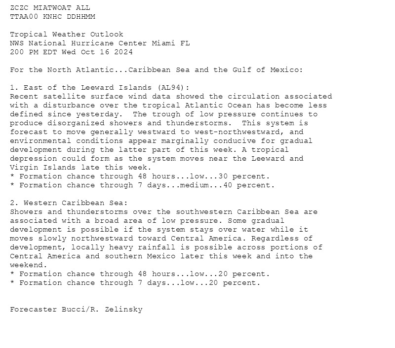
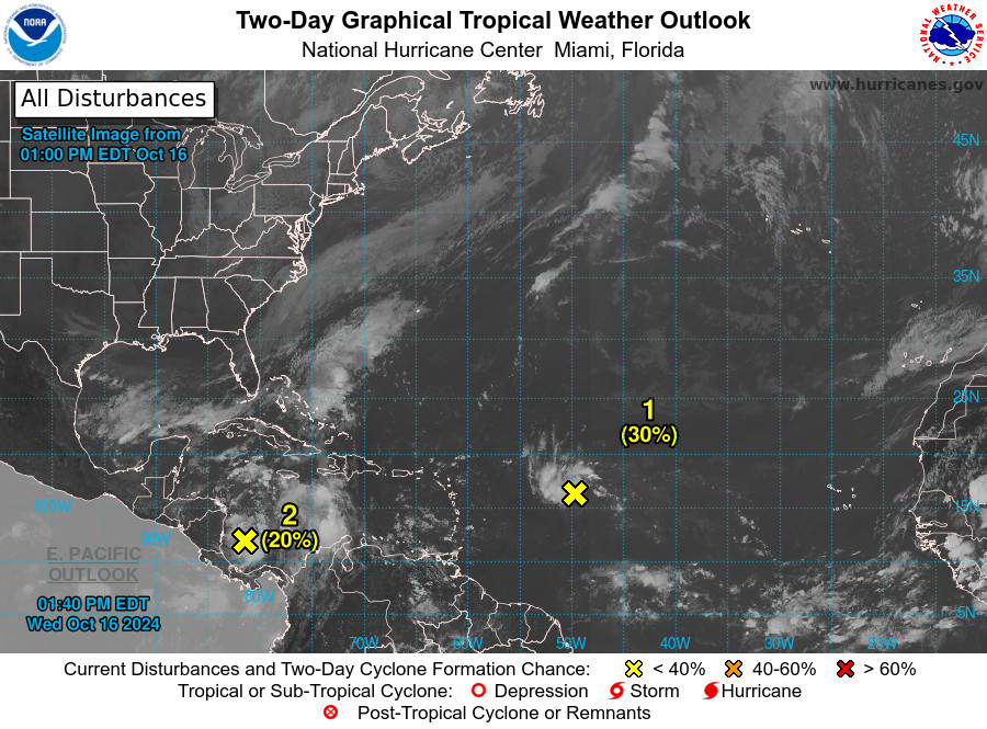
NWS National Hurricane Center Miami FL 200 PM EDT Wed Oct 16 2024 For the North Atlantic...Caribbean Sea and the Gulf of Mexico:


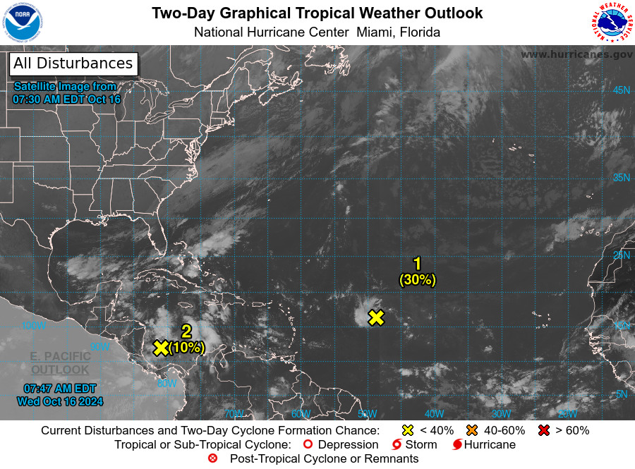
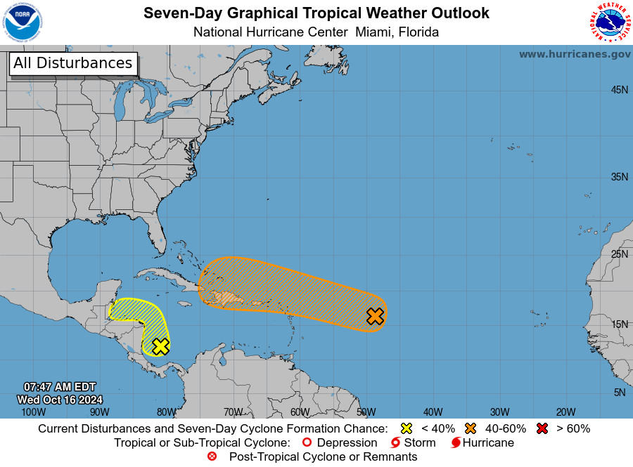
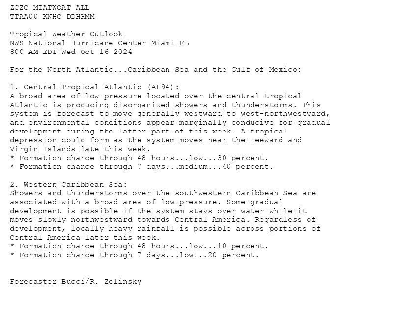
NWS National Hurricane Center Miami FL 800 AM EDT Wed Oct 16 2024 For the North Atlantic...Caribbean Sea and the Gulf of Mexico:


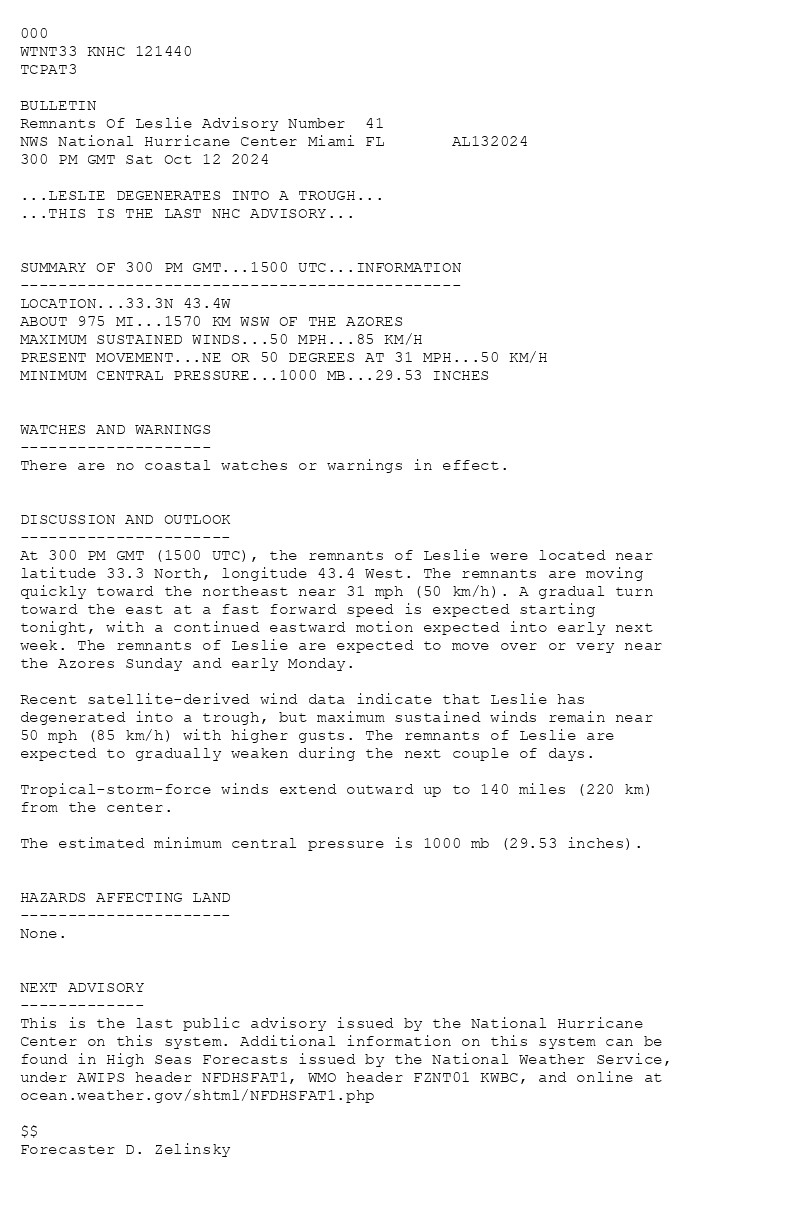
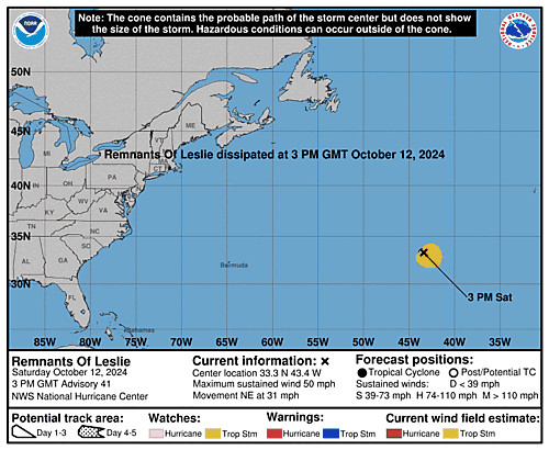
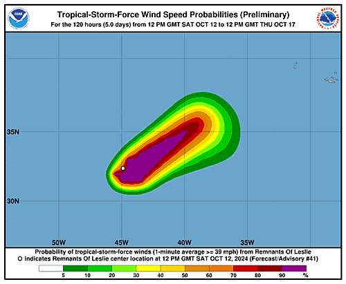
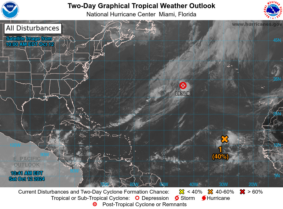
Atlantic Remnants Of Leslie Advisory Number 41 issued at Sat, 12 Oct 2024 14:40:57 +0000 ...LESLIE DEGENERATES INTO A TROUGH... ...THIS IS THE LAST NHC ADVISORY... Additional Details Here.