"If you're a glutton for punishment this could be the extraction shooter for you, but it's hard to recommend to anyone that isn't already embedded in it." 5/10 www.thesixthaxis.com/2024/10/15/h...#gaming#videogames

Extract me out of here already.
Its Alphonso TV Data Cloud services used by hundreds of Fortune 500 brands and agencies in the U.S. With video AItechnology embedded in tens of millions of smart TVs, TV chipsets, set-top boxes, and other connected devices, Alphonso understands what programming and advertising people watch on TV /
I'd like to see them supporting more 'Walking for Health' style initiatives embedded in people's local communities and helping people towards health whilst also addressing social isolation. There are alternatives to drugs...
インダストリアル品でPATAのフラッシュモジュールはありました。 jp.transcend-info.com/embedded/pro...
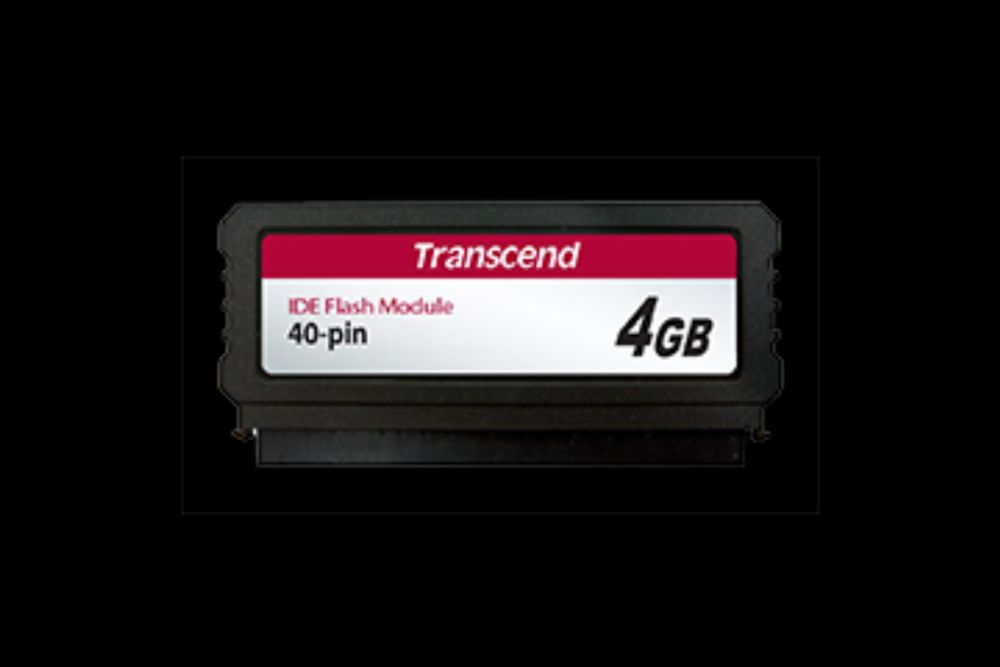
トランセンドの40ピンPATAフラッシュモジュールのPTM520は従来の3.5インチHDDの代替えとして、PATA (IDE)インターフェースで直接システムのマザーボードに設置することができます。起動ドライブとして理想的なPTM520は、既存システムベースのPCに簡単にSSDストレージテクノロジーを取り入れるソリューションです。
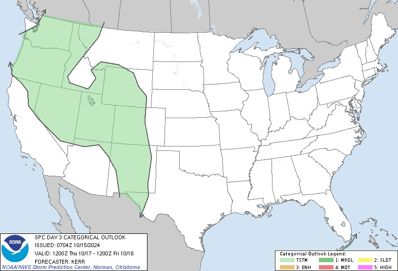
SPC Oct 15, 2024 0730 UTC Day 3 Severe Thunderstorm Outlook ⛈️NO SEVERE THUNDERSTORM AREAS FORECAST🌪️ Additional Details Here.

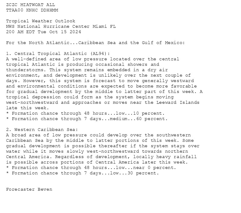
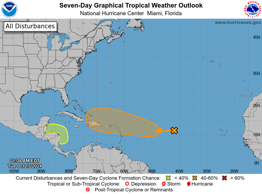
NWS National Hurricane Center Miami FL 200 AM EDT Tue Oct 15 2024 For the North Atlantic...Caribbean Sea and the Gulf of Mexico:

Mariano Cadoni, Mirko Pitzalis, Andrea Pierfrancesco Sanna Apparent horizons in cosmologically-embedded black holes https://arxiv.org/abs/2410.10459
Wie testet man Embedded Systeme, die eng mit der Hardware verbunden sind? Alex Eisenhut gibt spannende Einblicke und teilt wertvolle Tipps. Jetzt reinhören! swt.fm/pdhv

Tauche einin die Welt der Embedded-Softwareentwicklung und erfahre, warum Qualität und Standards wie MISRA wichtig sind.
This is schengen plug erasure (E), also compatible with half the other plugs on the list. I love me a plug that's large enough to have entire USB PD circuits embedded within them, and aren't an evil shape like G (great Britain foot killer) or A/B (garbage shock-you plug that also sucks to step on)