BLUE

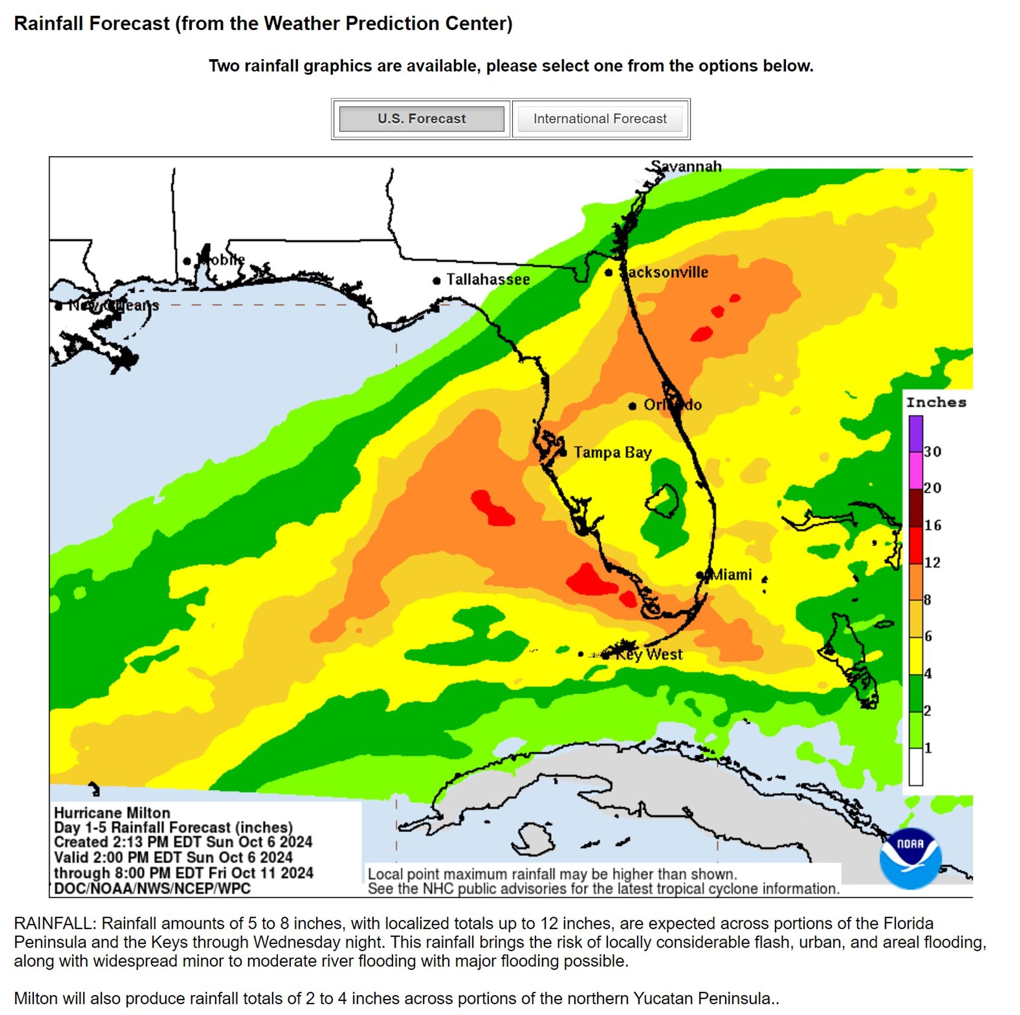
While the actual track may be considerably different from that prediction, it seems the consensus is among the models that your area will be to the north (left) of Milton's path, putting you on the side with the highest rainfall amounts.

0
STspc-storms.nws-bot.us

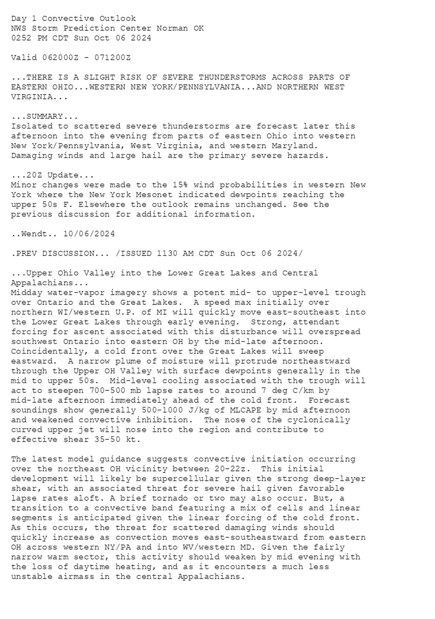
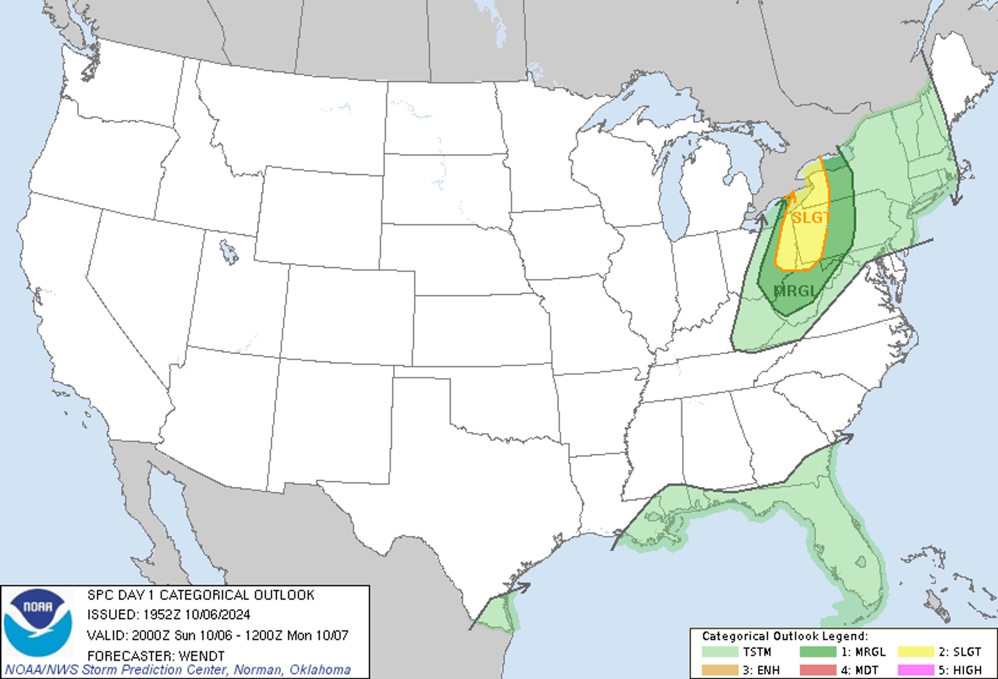
SPC Oct 6, 2024 2000 UTC Day 1 Convective Outlook ⛈️THERE IS A SLIGHT RISK OF SEVERE THUNDERSTORMS ACROSS PARTS OF EASTERN OHIO🌪️ Additional Details Here.


Day 1 Convective Outlook  
NWS Storm Prediction Center Norman OK
0252 PM CDT Sun Oct 06 2024

Valid 062000Z - 071200Z

...THERE IS A SLIGHT RISK OF SEVERE THUNDERSTORMS ACROSS PARTS OF
EASTERN OHIO...WESTERN NEW YORK/PENNSYLVANIA...AND NORTHERN WEST
VIRGINIA...

...SUMMARY...
Isolated to scattered severe thunderstorms are forecast later this
afternoon into the evening from parts of eastern Ohio into western
New York/Pennsylvania, West Virginia, and western Maryland. 
Damaging winds and large hail are the primary severe hazards.

...20Z Update...
Minor changes were made to the 15% wind probabilities in western New
York where the New York Mesonet indicated dewpoints reaching the
upper 50s F. Elsewhere the outlook remains unchanged. See the
previous discussion for additional information.

..Wendt.. 10/06/2024

.PREV DISCUSSION... /ISSUED 1130 AM CDT Sun Oct 06 2024/

...Upper Ohio Valley into the Lower Great Lakes and Central
Appalachians...
Midday water-vapor imagery shows a potent mid- to upper-level trough
over Ontario and the Great Lakes.  A speed max initially over
northern WI/western U.P. of MI will quickly move east-southeast into
the Lower Great Lakes through early evening.  Strong, attendant
forcing for ascent associated with this disturbance will overspread
southwest Ontario into eastern OH by the mid-late afternoon. 
Coincidentally, a cold front over the Great Lakes will sweep
eastward.  A narrow plume of moisture will protrude northeastward
through the Upper OH Valley with surface dewpoints generally in the
mid to upper 50s.  Mid-level cooling associated with the trough will
act to steepen 700-500 mb lapse rates to around 7 deg C/km by
mid-late afternoon immediately ahead of the cold front.  Forecast
soundings show generally 500-1000 J/kg of MLCAPE by mid afternoon
and weakened convective inhibition.  The nose of the cyclonically
curved upper jet will nose into the region and contribute to
effective shear 35-50 kt.

The latest model guidance suggests convective initiation occurring
over the northeast OH vicinity between 20-22z.  This initial
development will likely be supercellular given the strong deep-layer
shear, with an associated threat for severe hail given favorable
lapse rates aloft. A brief tornado or two may also occur. But, a
transition to a convective band featuring a mix of cells and linear
segments is anticipated given the linear forcing of the cold front.
As this occurs, the threat for scattered damaging winds should
quickly increase as convection moves east-southeastward from eastern
OH across western NY/PA and into WV/western MD. Given the fairly
narrow warm sector, this activity should weaken by mid evening with
the loss of daytime heating, and as it encounters a much less
unstable airmass in the central Appalachians.
Day 1 Outlook Image
0
TKtkovach.bsky.social

Area man wrong again

September 16, 2024 tweets from @ryanmaue

Just imagine our perception of the 2024 Atlantic hurricane season if the forecasts in May/June were calling for a tepid, quiet year instead of hyperactive gangbusters (busted) activity.  

While a few folks will care enough to investigate why the Atlantic tropics are broken, others will move on to the next shiny object.

The U Penn prediction of 27-39 named storms might be the most spectacularly wrong weather/climate forecast in recent history.  

Hopefully there will be a press release apologizing for this monstrosity.
0
SFspc-fire.nws-bot.us

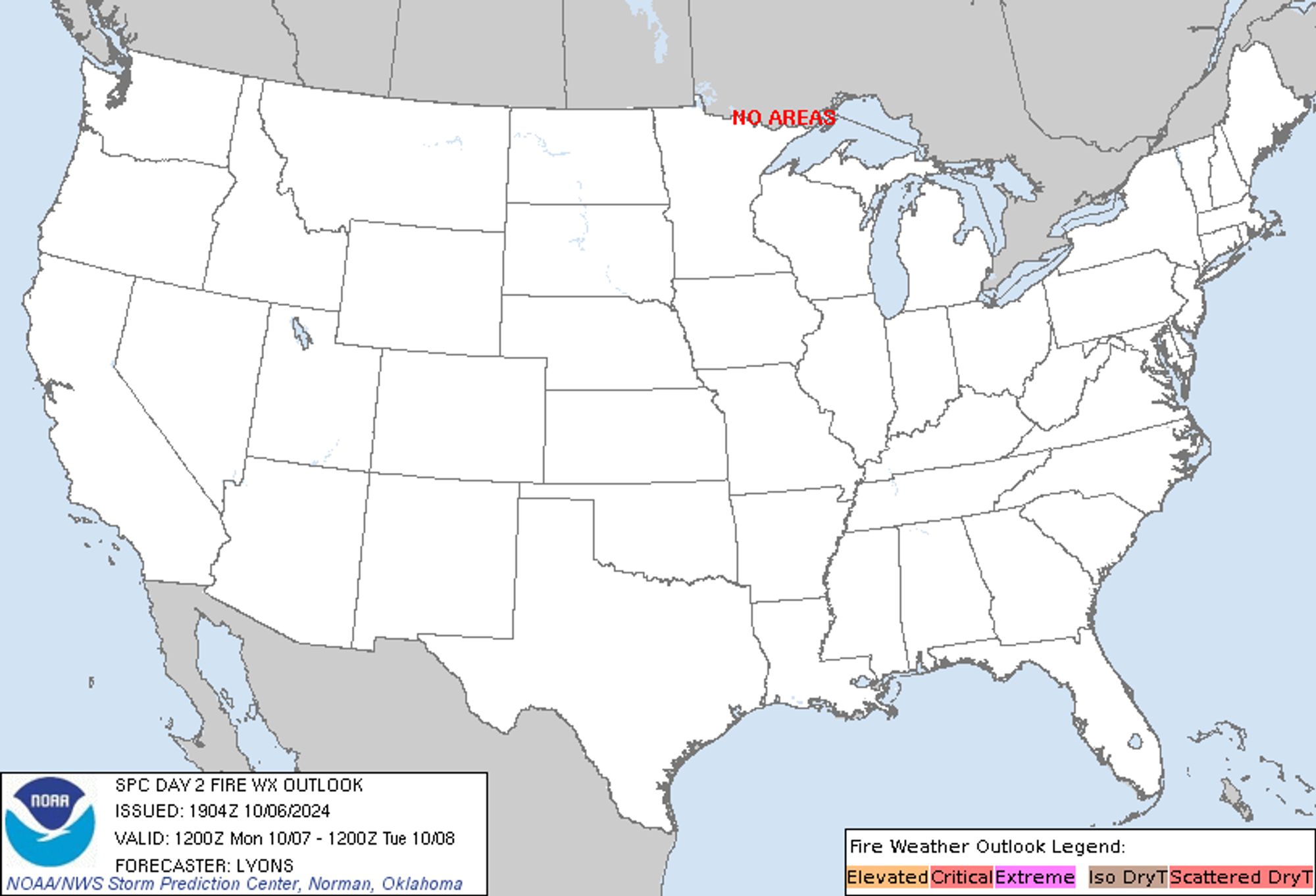
SPC Day 2 Fire Weather Outlook posted at Sun, 06 Oct 2024 19:05:29 +0000 🔥NO CRITICAL AREAS🔥 Additional Details Here.


Day 2 Fire Weather Outlook  
NWS Storm Prediction Center Norman OK
0204 PM CDT Sun Oct 06 2024

Valid 071200Z - 081200Z

...NO CRITICAL AREAS...

...19z Update...
No changes have been made to the previous outlook, see previous
discussion for more information.

..Lyons.. 10/06/2024

.PREV DISCUSSION... /ISSUED 1250 AM CDT Sun Oct 06 2024/

...Synopsis...
A large upper-level trough over the Northeast will continue to
amplify through the day, while a large upper-level ridge builds into
the northern Rockies and northern Great Plains. A mid-level
short-wave trough will sweep across parts of the Midwest into the
central Great Plains throughout the day. At the surface, warm/dry
conditions will develop across the southern/central High Plains
during the afternoon, as post-frontal return flow develops in
advance of the aforementioned short wave. This may produce locally
elevated fire-weather conditions for parts of the central High
Plains, but such conditions appear too localized to introduce an
elevated area at this time.

...Please see www.spc.noaa.gov/fire for graphic product...
Day 2 Fire Weather Outlook Image
0
STspc-storms.nws-bot.us

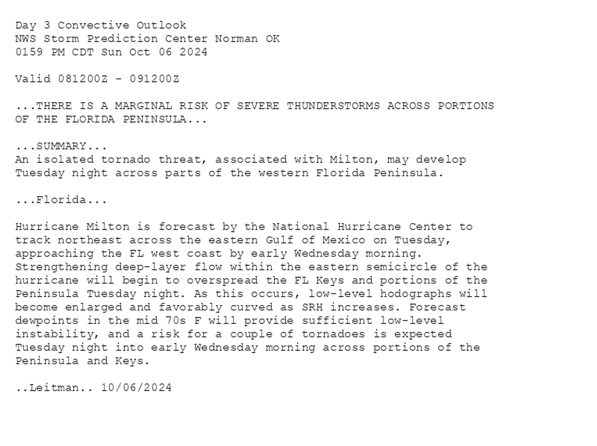
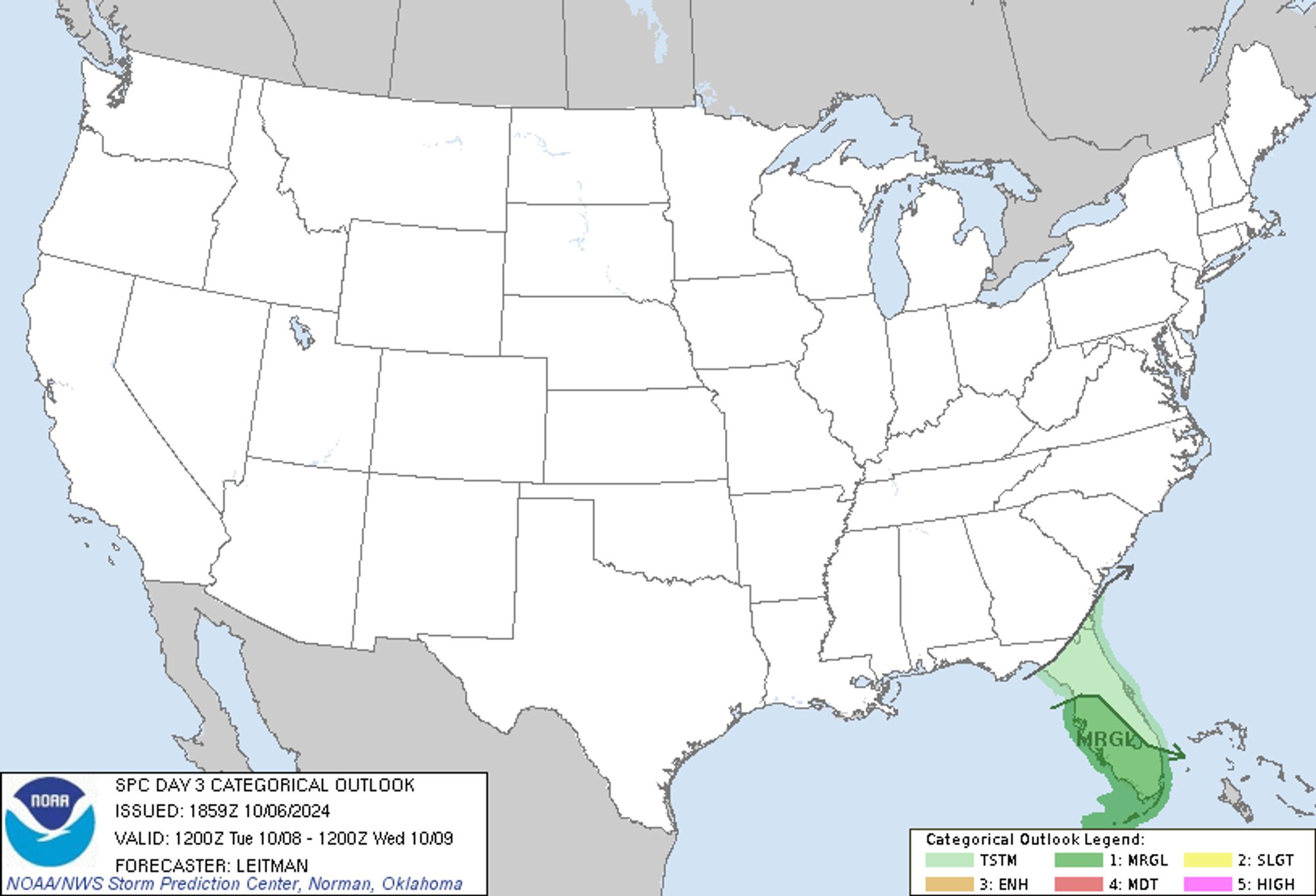
SPC Oct 6, 2024 1930 UTC Day 3 Severe Thunderstorm Outlook ⛈️THERE IS A MARGINAL RISK OF SEVERE THUNDERSTORMS ACROSS PORTIONS OF THE FLORIDA PENINSULA🌪️ Additional Details Here.


Day 3 Convective Outlook  
NWS Storm Prediction Center Norman OK
0159 PM CDT Sun Oct 06 2024

Valid 081200Z - 091200Z

...THERE IS A MARGINAL RISK OF SEVERE THUNDERSTORMS ACROSS PORTIONS
OF THE FLORIDA PENINSULA...

...SUMMARY...
An isolated tornado threat, associated with Milton, may develop
Tuesday night across parts of the western Florida Peninsula.

...Florida...

Hurricane Milton is forecast by the National Hurricane Center to
track northeast across the eastern Gulf of Mexico on Tuesday,
approaching the FL west coast by early Wednesday morning.
Strengthening deep-layer flow within the eastern semicircle of the
hurricane will begin to overspread the FL Keys and portions of the
Peninsula Tuesday night. As this occurs, low-level hodographs will
become enlarged and favorably curved as SRH increases. Forecast
dewpoints in the mid 70s F will provide sufficient low-level
instability, and a risk for a couple of tornadoes is expected
Tuesday night into early Wednesday morning across portions of the
Peninsula and Keys.

..Leitman.. 10/06/2024
Day 3 Outlook Image
0
HEheissenstat.bsky.social

Could I be wrong? Absolutely. Historians suck at prediction. But the signs are there. And the US administration, which has the capacity to rein in Israel's ambitions, has shown no inclination to do so. It may be too late.

0
Stierno158.bsky.social

Prediction: The New York Jets are going to the Super Bowl.* *They will be seated in a Section 308, Row XX

1
JBjesseberney.bsky.social

My prediction: this year's Nobel price for physics will go to... People on the Internet for their discovery that the frequency of quantum vibrations can heal all diseases and move us into the fifth dimension, just buy this copper and crystal bracelet for $89.95

0
MDmdunlavyca.bsky.social

Any prediction of how they'll make the next one unwatchable? They may have raised the bar too high.

0
OJoliver-wake.bsky.social

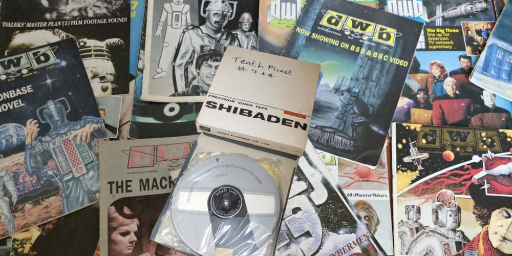
The final part of my survey of missing episodes rumours in Doctor Who fanzines is now up on my blog. Please read it here: tinyurl.com/90sRumours2. There’s an amusing (I think) bit comparing a 90s prediction of most likely returns with actual subsequent recoveries. Please share if you enjoy this.

Missing, Believed Swiped!

Missing episodes rumours in 1990s fanzines - part 2

0