Bahamas vacations are pretty inexpensive for us bc the islands are closer to us than the border with our nearest state.
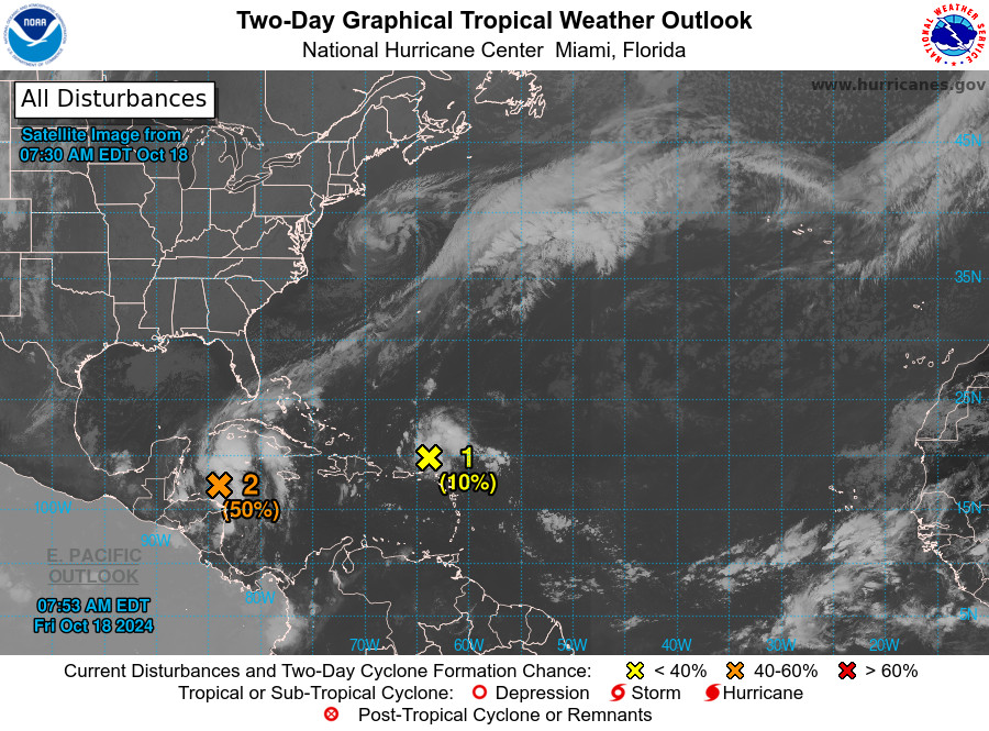
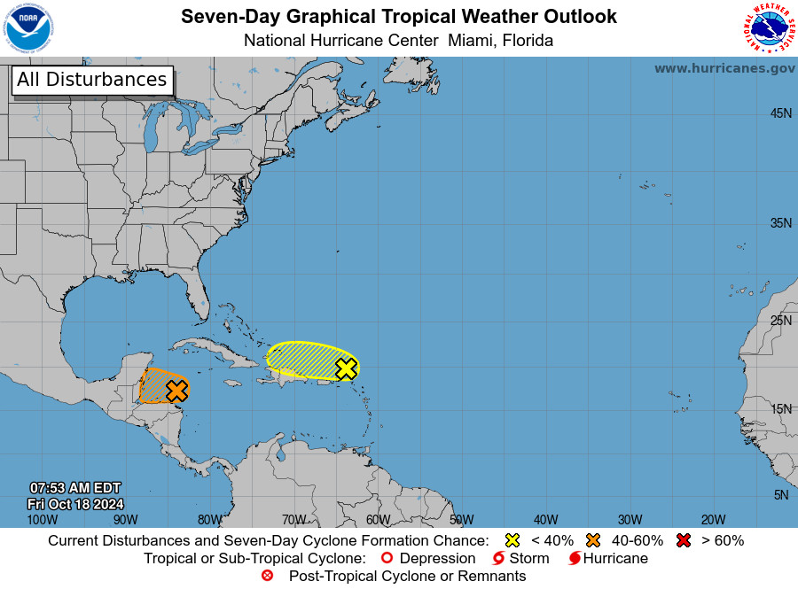
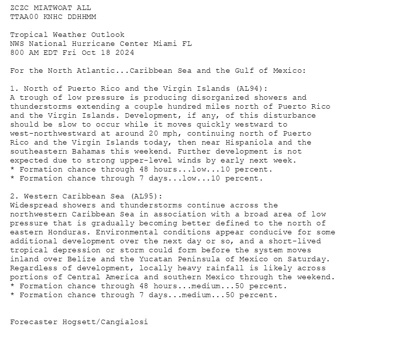
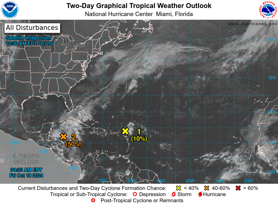
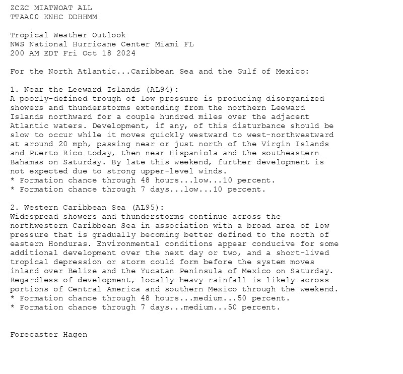
NWS National Hurricane Center Miami FL 800 AM EDT Fri Oct 18 2024 For the North Atlantic...Caribbean Sea and the Gulf of Mexico:


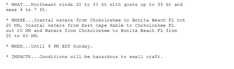
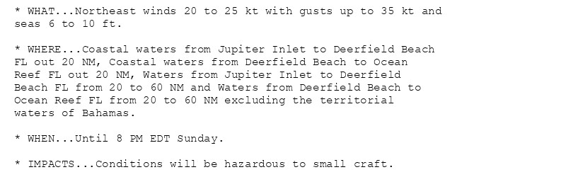
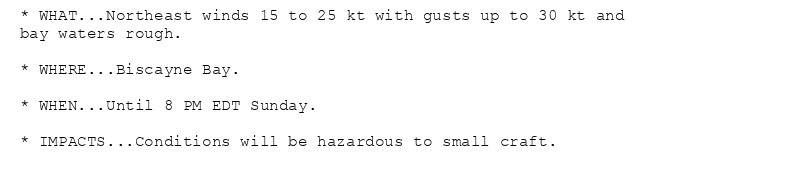
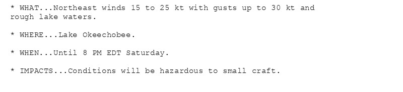
Small Craft Advisory issued October 18 at 2:03AM EDT until October 20 at 8:00PM EDT by NWS Miami FL Additional Details Here.(1/2)
NWS National Hurricane Center Miami FL 200 AM EDT Fri Oct 18 2024 For the North Atlantic...Caribbean Sea and the Gulf of Mexico:


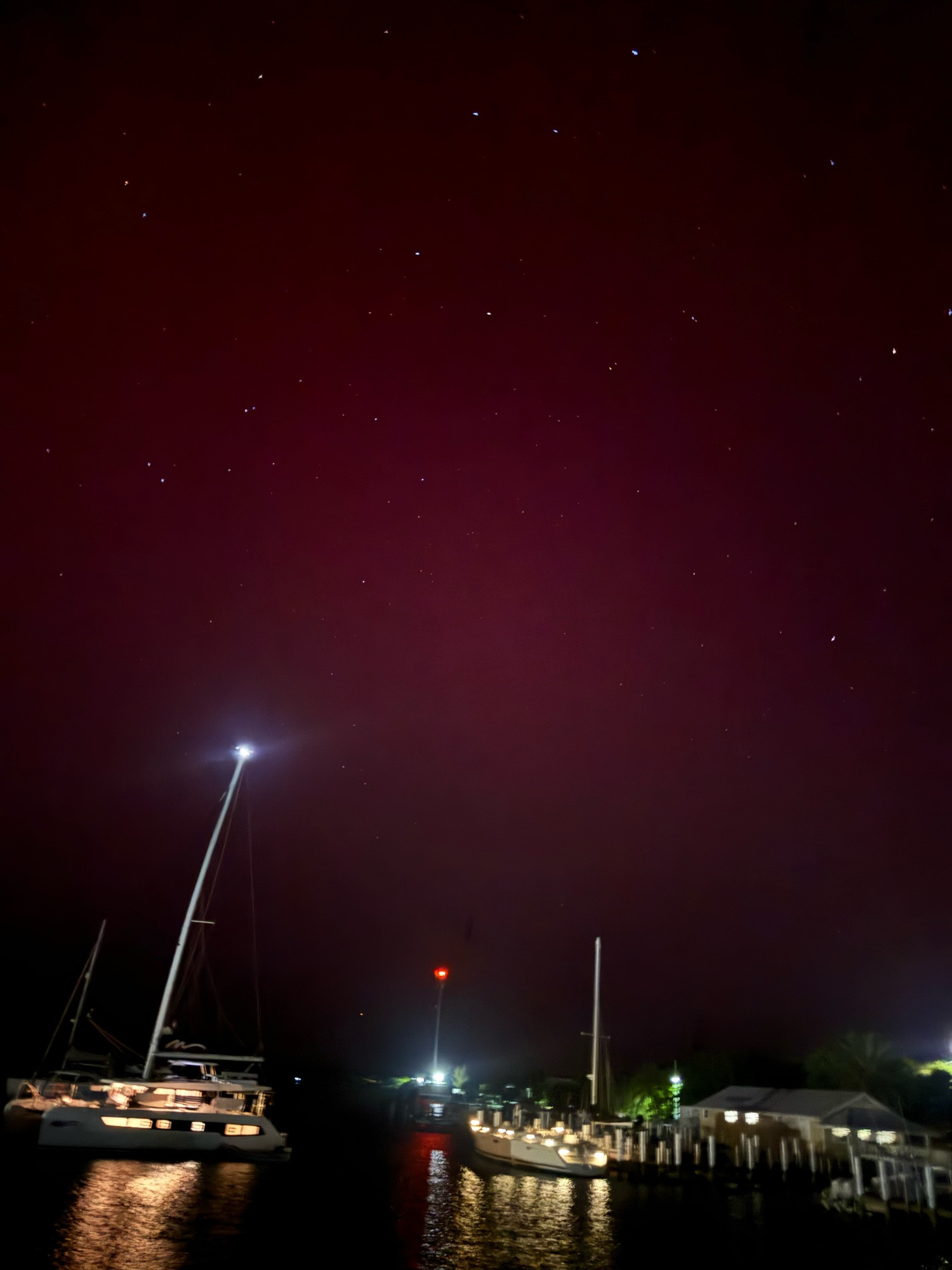
In May I saw the aurora while sailing in the Bahamas. I was surprised that would be the place I saw my first.
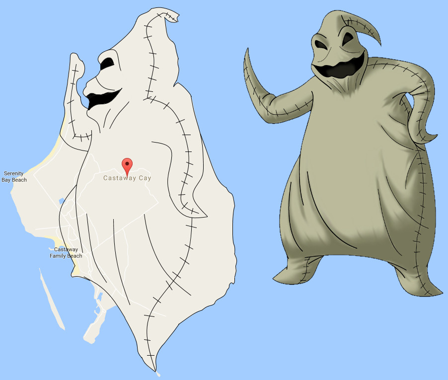
Castaway Cay, Disney's private island in the Bahamas, has a distinct resemblance to a villainous character.